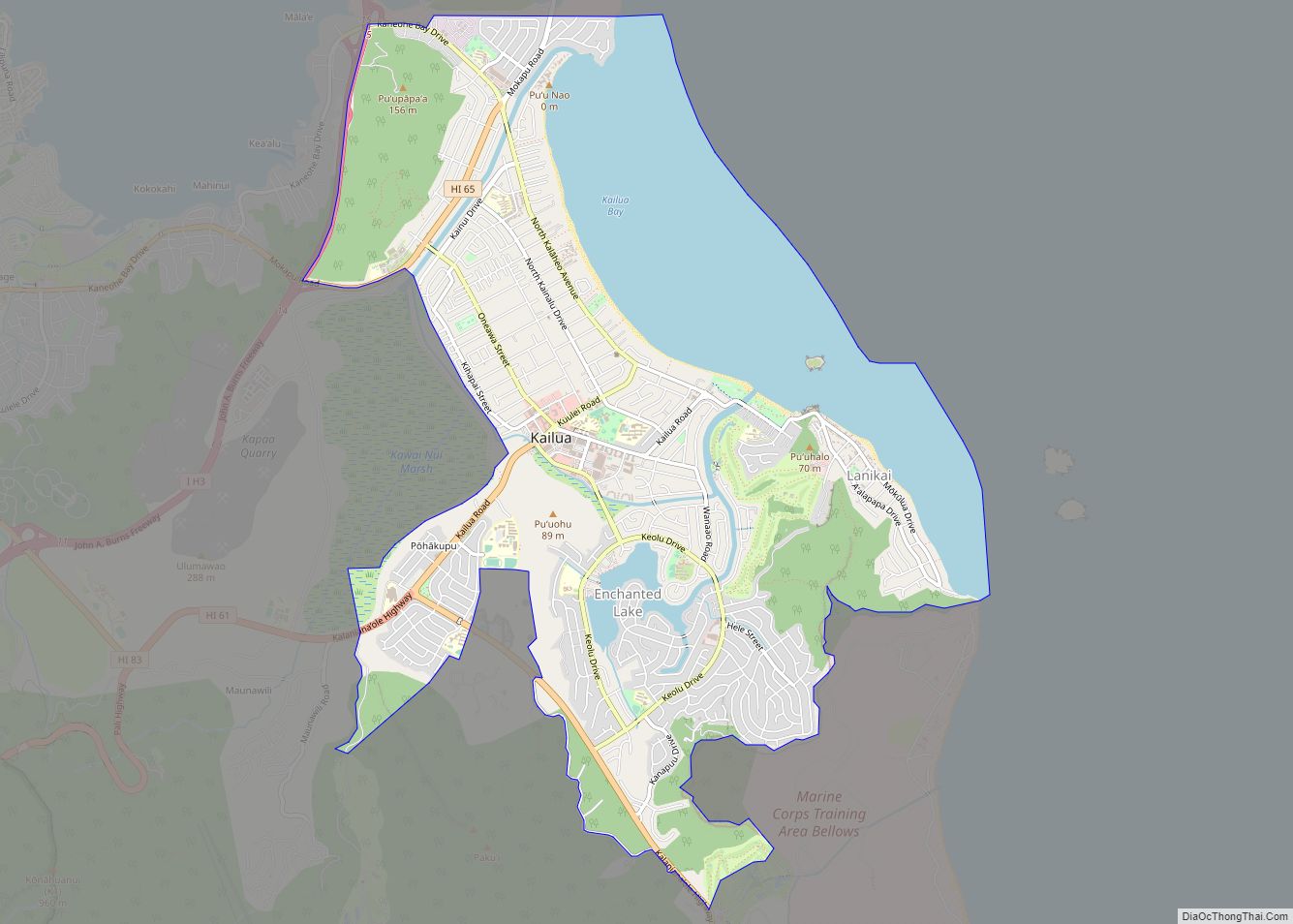
Map of East Honolulu CDP

Map of East Honolulu CDP

East Honolulu is a census-designated place (CDP) located in Honolulu County, Hawaii, United States. As of the 2020 Census, the CDP had a population of 50,922, making it the 2nd most populated CDP in Hawaii, behind Honolulu. East Honolulu CDP overview: Name: East Honolulu CDP LSAD Code: 57 LSAD Description: CDP (suffix) State: Hawaii County: … Read more

Map of Sioux City city

Map of Sioux City

Sioux City (/suː/) is a city in Woodbury and Plymouth counties in the northwestern part of the U.S. state of Iowa. The population was 85,797 in the 2020 census, making it the fourth-largest city in Iowa. The bulk of the city is in Woodbury County, of which it is the county seat, though a small … Read more

Map of Iowa City city

Map of Iowa City

Iowa City, officially the City of Iowa City, is a city in Johnson County, Iowa, United States. It is the home of the University of Iowa and county seat of Johnson County, at the center of the Iowa City Metropolitan Statistical Area. At the time of the 2020 census the population was 74,828, making it … Read more

Map of Davenport city, Iowa

Map of Davenport city, Iowa

Davenport is a city in and the county seat of Scott County, Iowa, United States. Located along the Mississippi River on the eastern border of the state, it is the largest of the Quad Cities, a metropolitan area with a population of 384,324 and a combined statistical area population of 474,019, ranking as the 147th-largest … Read more

Map of Carmel city

Map of Carmel city

Carmel /ˈkɑːrməl/ is a suburban city in Indiana, United States, immediately north of Indianapolis. With a population of 100,777, the city spans 49 square miles (130 km) across Clay Township in Hamilton County, Indiana, and is bordered by the White River to the east; the Hamilton-Boone county line to the west; 96th Street to the south … Read more

Map of Idaho Falls city

Map of Idaho Falls city

Idaho Falls is a city in and the county seat of Bonneville County, Idaho, United States. It is the state’s largest city outside the Boise metropolitan area. As of the 2020 census, the population of Idaho Falls was 64,818. In the 2010 census, the population of Idaho Falls was 56,813 (2019 estimate: 62,888), with a … Read more

Map of Caldwell city, Idaho

Map of Caldwell city, Idaho

Caldwell (locally CALL-dwel) is a city in and the county seat of Canyon County, Idaho. The population was 59,996 at the time of the 2020 United States census. Caldwell is considered part of the Boise metropolitan area. Caldwell is the location of the College of Idaho. Caldwell city overview: Name: Caldwell city LSAD Code: 25 … Read more

Map of Owensboro city

Map of Owensboro city

Owensboro is a home rule-class city in and the county seat of Daviess County, Kentucky, United States. It is the fourth-largest city in the state by population. Owensboro is located on U.S. Route 60 and Interstate 165 about 107 miles (172 km) southwest of Louisville, and is the principal city of the Owensboro metropolitan area. The … Read more

Map of Frankfort city, Kentucky

Map of Frankfort city, Kentucky

Frankfort is the capital city of the Commonwealth of Kentucky, United States, and the seat of Franklin County. It is a home rule-class city; the population was 28,602 at the 2020 census. Located along the Kentucky River, Frankfort is the principal city of the Frankfort, Kentucky Micropolitan Statistical Area, which includes all of Franklin and … Read more