South Bend is a city in and the county seat of St. Joseph County, Indiana, United States, on the St. Joseph River near its southernmost bend, from which it derives its name. At the 2020 census, the city had a total of 103,453 residents and is the fourth-largest city in Indiana. The metropolitan area had a population of 324,501 in 2020, while its combined statistical area had 812,199. The city is located just south of Indiana’s border with Michigan.
The area was settled in the early 19th century by fur traders and was established as a city in 1865. The St. Joseph River shaped South Bend’s economy through the mid-20th century. River access assisted heavy industrial development such as that of the Studebaker Corporation, the Oliver Chilled Plow Company, and other large corporations.
The population of South Bend declined after 1960, when it peaked at 132,445. This was chiefly due to migration to suburban areas as well as the demise of Studebaker and other heavy industry. Today, the largest industries in South Bend are health care, education, small business, and tourism. Remaining large corporations based in the area include Crowe, Honeywell, and AM General. The city’s economy and culture are influenced by the nearby University of Notre Dame.
The city was featured in national news coverage of former mayor Pete Buttigieg, a candidate in the 2020 Democratic Party presidential primaries and current Secretary of Transportation in the Biden administration.
| Name: | South Bend city |
|---|---|
| LSAD Code: | 25 |
| LSAD Description: | city (suffix) |
| State: | Indiana |
| County: | St. Joseph County |
| Elevation: | 692 ft (211 m) |
| Land Area: | 41.98 sq mi (108.72 km²) |
| Water Area: | 0.43 sq mi (1.10 km²) |
| Population Density: | 2,464.57/sq mi (951.58/km²) |
| Area code: | 574 |
| FIPS code: | 1871000 |
| GNISfeature ID: | 452796 |
| Website: | www.southbendin.gov |
Online Interactive Map
Click on ![]() to view map in "full screen" mode.
to view map in "full screen" mode.
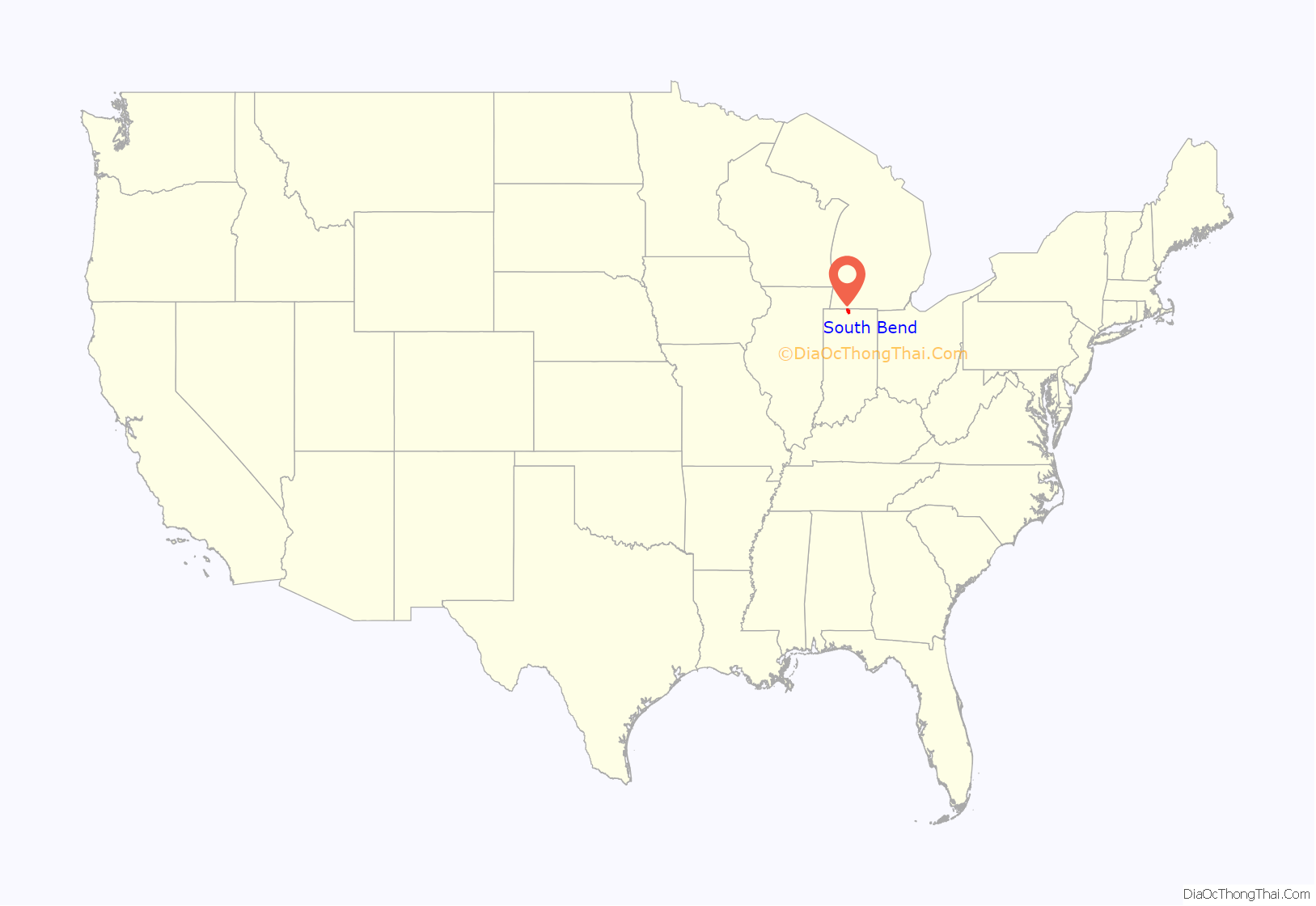
South Bend location map. Where is South Bend city?
History
Early history
The St. Joseph Valley was long occupied by Native Americans. One of the earliest known groups to occupy what would later become northern Indiana was the Miami tribe. Later, the Potawatomi moved into the region, utilizing the rich food and natural resources found along the river. The Potawatomi occupied this region of Indiana until most of them were forcibly removed in the 1840s. The South Bend area was popular because its portage was the shortest overland route from the St. Joseph River to the Kankakee River. This route was used for centuries, first by the Native Americans, then by French explorers, missionaries and traders. The French explorer René-Robert Cavelier, Sieur de La Salle, the first white European to set foot in what is now South Bend, used this portage between the St. Joseph River and the Kankakee River in December 1679.
First settlements
The first permanent white settlers of South Bend were fur traders who established trading posts in the area. In 1820, Pierre Frieschutz Navarre arrived, representing the American Fur Company (AFC) of John Jacob Astor. He settled near what is now downtown South Bend. Alexis Coquillard, another agent of the AFC, established a trading post known as the Big St. Joseph Station. In 1827, Lathrop Minor Taylor established a post for Samuel Hanna and Company, in whose records the name St. Joseph’s, Indiana was used. By 1829, the town was growing, with Coquillard and Taylor emerging as leaders. They applied for a post office. Taylor was appointed postmaster, and the post office was designated as Southold, Allen County, Indiana. The following year, the name was changed to South Bend, probably to ease confusion, as several other communities were named Southold at the time.
In 1831, South Bend was laid out as the county seat and as one of the four original townships of St. Joseph County with 128 residents. That same year, Horatio Chapin moved to the settlement, opened the first general store with imported (out of state) goods and helped established the first church and Sunday school. Around the same time, design began on what would become the town of South Bend. The town was formally established in 1835, with Chapin as the first president of the board of town trustees. In 1856, attorney Andrew Anderson, Chapin’s son-in-law, founded May Oberfell Lorber, the oldest continuous business in St. Joseph County. He compiled a complete index of South Bend’s real estate records.
In 1841, Schuyler Colfax was appointed St. Joseph County deputy auditor. Colfax purchased the South Bend Free Press and then turned it into a pro-Whig newspaper, the St. Joseph Valley Register. He was a member of the state constitutional convention of 1850, at which he opposed the barring of African American migration to Indiana. He joined the Republican Party, like many Whigs of his day, and was elected to Congress in 1855, becoming Speaker of the House in 1863 during the administration of Abraham Lincoln. In 1868, he was elected vice president under Ulysses S. Grant. Colfax returned to South Bend after his stint in Washington and is buried in City Cemetery, west of downtown.
Early business
During the late 1830s through the 1850s, much of South Bend’s development centered on the industrial complex of factories located on the two races (man-made canals along the St. Joseph River in South Bend). Several dams were created and factories were built on each side of the river. On October 4, 1851, the first steam locomotive entered South Bend. This shifted commerce from the river to the railroad. In 1852, Henry Studebaker set up Studebaker wagon shop, later becoming the world’s largest wagon builder and the only one to later succeed as an automobile manufacturer. The Singer Sewing Company and the Oliver Chilled Plow Company were among other companies that made manufacturing the driving force in the South Bend economy until the mid-20th century. Another important economic act was the dredging of the Kankakee River in 1884 to create farmland. During this time period there was a great immigration of Europeans, such as Polish, Hungarian, Irish, German, Italian, and Swedish people to South Bend because of available employment in area factories.
South Bend benefited from its location on the Michigan Road, the main north–south artery of northern Indiana in the 19th century. Another significant development occurred near South Bend in 1842, when Father Edward Sorin founded the University of Notre Dame just north of the town. It became a major factor in the area’s economy and culture.
Establishment and early history
South Bend was incorporated as a city on May 22, 1865, and its first elections were held on June 5, 1865, with William G. George elected as its first mayor The official city motto, “Peace”, refers to the fact that incorporation came in the month following the Confederate surrender that effectively ended the American Civil War.
Industrial growth was rapid after the Civil War, most notably with the Studebaker wagon factory, and the Oliver plow company. Good jobs and high wages attracted immigrants from Europe, especially Germans, Irish, and Poles. The majority were Catholic, and they achieved higher rates of social mobility than the same ethnic groups in the Northeast .
Olivet African Methodist Episcopal (AME) Church was founded in South Bend in March 1870, making it the first African American church in the city. Olivet AME is still an active African Methodist Episcopal Church, and celebrated its 145th anniversary in 2015.
A sergeant from South Bend fired the first American shells against Germany in World War I.
In 1923, the African American owner of a soda fountain received a letter signed “KKK”, threatening to kill an African American man held in the city’s jail and harm the rest of the city’s African American population. Within a few days, over a thousand African Americans fled the city.
In 1924, the Ku Klux Klan held a conference and planned a parade from its local headquarters at 230 S. Michigan St. In preparation, Klan members were posted around town to direct traffic. Notre Dame students, well aware of the anti-Catholic nature of the Klan, vigorously protested this intrusion, and before noon all of the Klansmen traffic directors had been “unmasked and unrobed.” Notre Dame students continued the fight, with several hundred gathering outside of the Klan headquarters, throwing rocks and smashing windows in protest. Local police as well as Notre Dame officials eventually managed to convince them to return to campus. It is said that even legendary football coach Knute Rockne became involved in the struggle to calm down the students.
Later business
Other industries developed in South Bend in the early 20th century, including Birdsell Manufacturing Company, the Bendix Corporation, Honeywell, AlliedSignal, South Bend Lathe Works, the O’Brien Paint Corp., the South Bend Toy Company, South Bend Range, South Bend Bait Company, and South Bend Watch Company. Workers at the Bendix Corporation staged the first sit-in strike in American history in 1936. Fast development led to the creation of electric rail transportation throughout the area, and in 1925, the South Shore interurban streetcar service was established from downtown South Bend to downtown Chicago. The South Shore line still runs daily to and from Chicago and also is a major freight carrier in the area.
On June 30, 1934, the Merchants National Bank in South Bend was the last bank to be robbed by the Dillinger gang.
Recent history
On September 29, 1929, South Bend completed its “track elevation program”. This was a railroad infrastructure project which saw the removal of Grand Trunk Western Railroad tracks from Division Street, the removal of level crossings from Chapin to Miami streets, the creation of a modern freight layout, and the construction of Union Station. This project had been seventeen years in the making, and had been the subject of the Indiana Supreme Court case Vandalia Railroad v. South Bend, which was subsequently affirmed by the Supreme Court of the United States.
In 1949, legendary percussionist Lionel Hampton was informed that his concert at South Bend’s Palais du Royale would be a blacks-only event; he threatened to call for a boycott of the venue, and the affair proceeded as an integrated evening, which newspapers said led to all attendees breaking out in “paroxysms of ecstasy.”
By 1950, more than half of all employment was in the manufacturing sector. Due to economic difficulties, Studebaker closed its automotive manufacturing plants in South Bend in December 1963. A general decline in manufacturing soon followed as industry was restructured nationwide. By 2000, manufacturing was only 16 percent of the local economy. Due to the severe loss of jobs, the city’s population decreased by nearly 30,000 during that period.
In 1984, South Bend community leaders began seeking a minor-league baseball team for the city. A stadium was constructed in 1986 and a 10-year player-development contract was signed with the Chicago White Sox. The team would be known as the South Bend White Sox. In 1994, the team’s name was changed to the South Bend Silver Hawks, and then to The South Bend Cubs in 2015. They are a Class A minor league affiliate of the Chicago Cubs in the Midwest League.
In 2015, the City of South Bend celebrated its 150th birthday. The yearlong festival culminated with the ceremonial illumination of the first River Lights along the St. Joseph River. Mayor Pete Buttigieg welcomed the coming of the next 150 years of South Bend’s heritage accompanied by five previous South Bend mayors: Steve Luecke, Joe Kernan, Roger Parent, Peter Nemeth and Jerry Miller.
In 2015, the city’s population increased by 286, the largest one-year growth in over twenty years. The former Studebaker plant has been developed as the Ignition Park center to attract new businesses, especially in the tech industry. South Bend has also seen new development, particularly in the tech field, a decline in unemployment, and a renewal of the downtown area under Buttigieg’s tenure, which has been described as a revival and South Bend as a ‘turnaround city’. South Bend also was in the national spotlight during the 2019-20 Democratic presidential campaign of former mayor Pete Buttigieg.
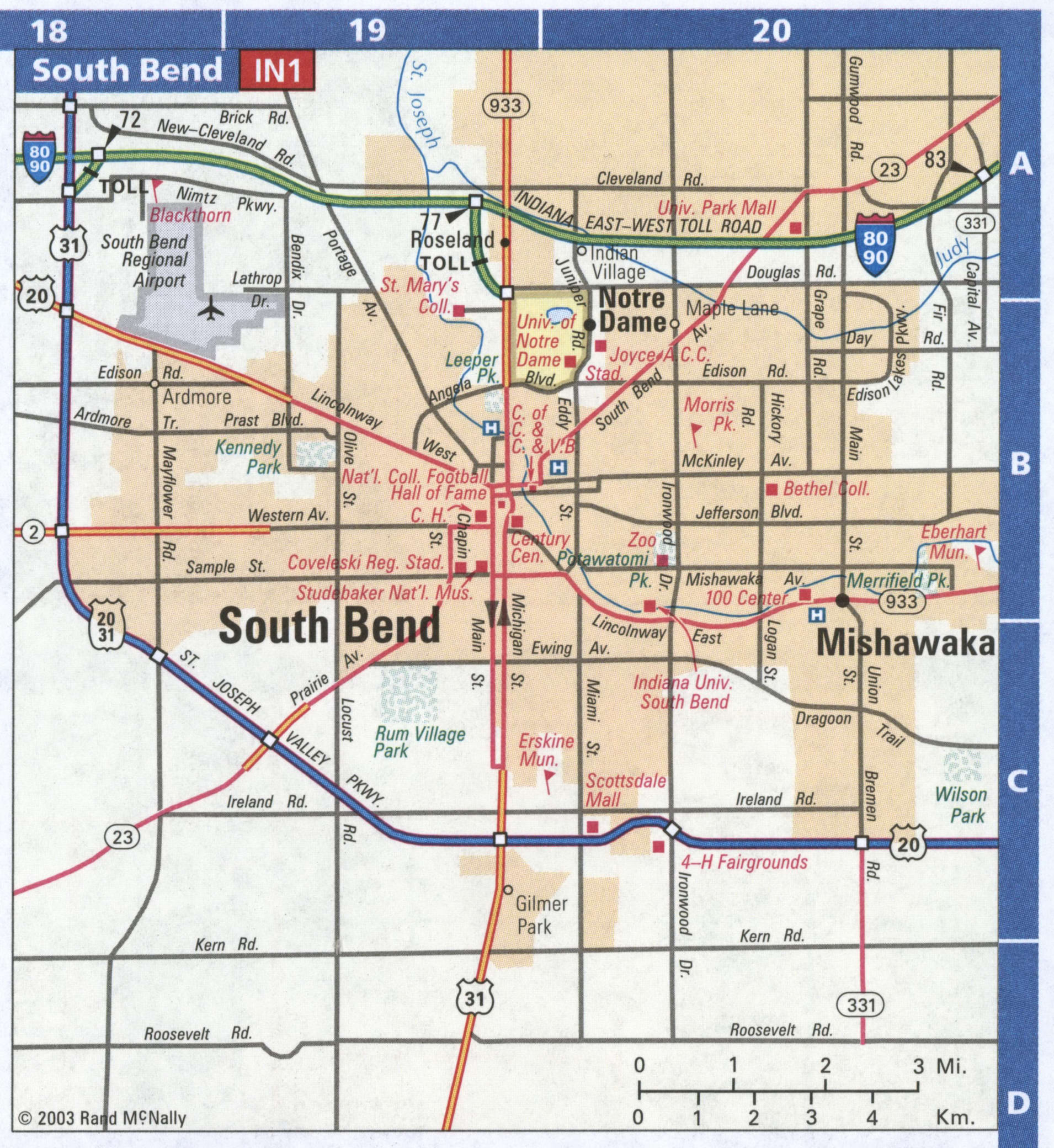
South Bend Road Map
South Bend city Satellite Map
Geography
South Bend is located 5 mi (8.0 km) from the Michigan border and approximately equidistant from Illinois and Ohio. The city is 93 mi (150 km) from Chicago. The shore of Lake Michigan is 20 mi (32 km) away.
According to the 2010 census, South Bend has a total area of 41.877 square miles (108.46 km), of which 41.46 square miles (107.38 km) (or 99%) is land and 0.417 square miles (1.08 km) (or 1%) is water.
Cityscape
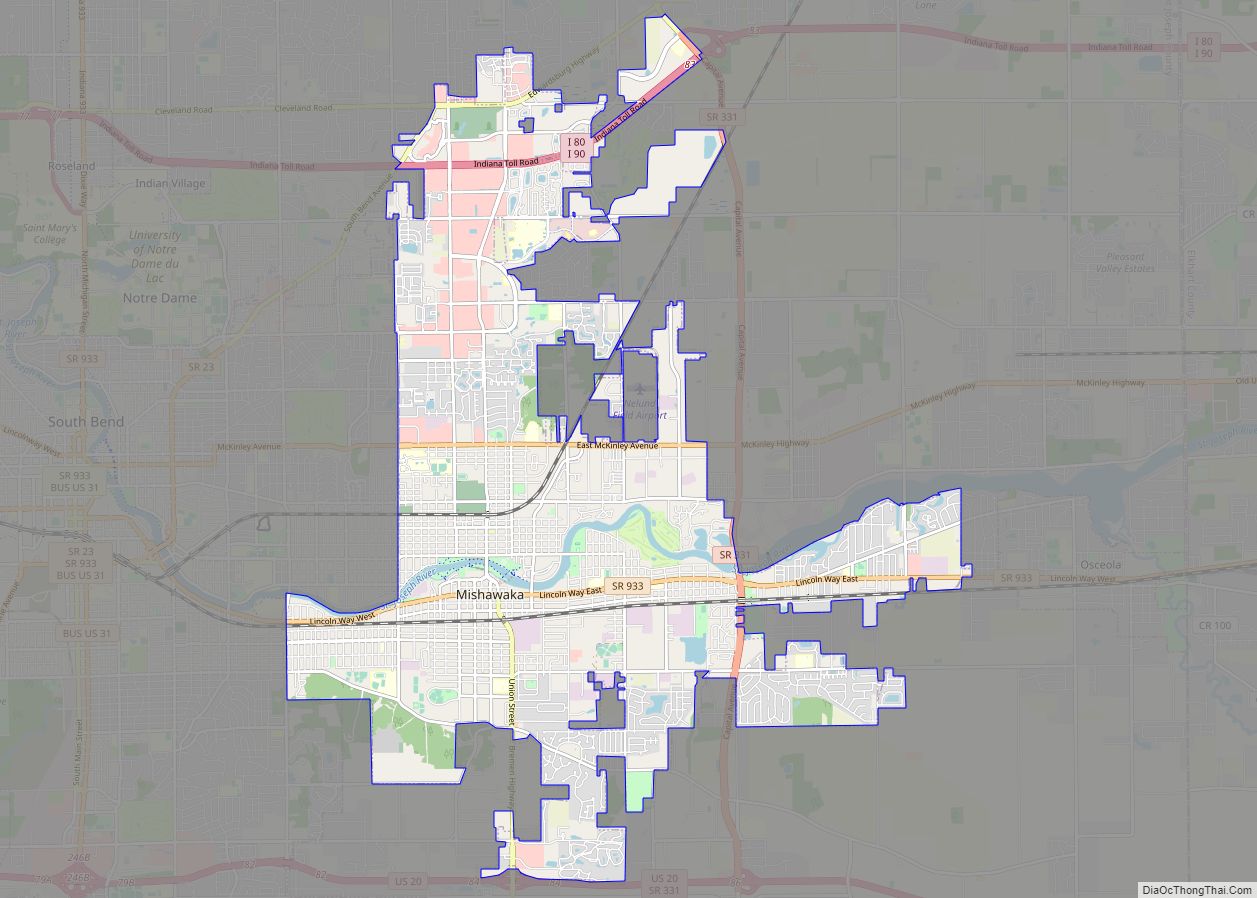
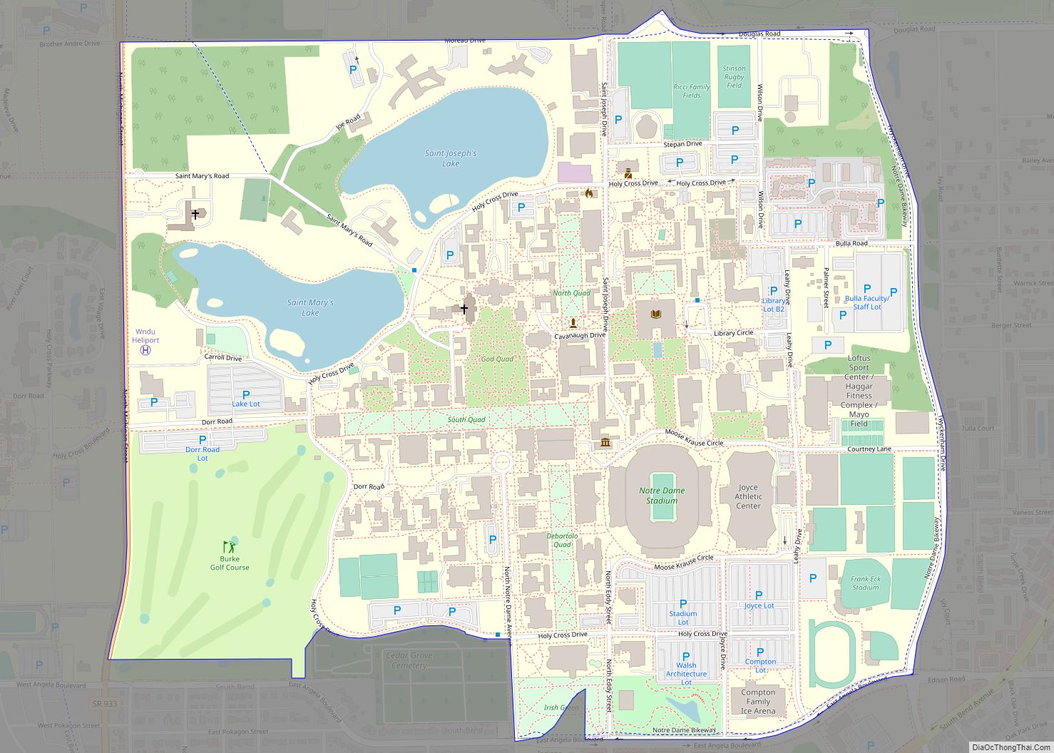
The St. Joseph River flows from the east end of the city turning north near the city center, giving South Bend its name at the bend in the river. South Bend is located on the north–south continental divide, and the river flows northwest into Lake Michigan. The downtown area is located in the north-central part of the city along the St. Joseph River. Notre Dame, Indiana, is directly adjacent to the north. The city extends further north on the west side, mainly with manufacturing and distribution facilities near the South Bend International Airport. Mishawaka, Indiana, is adjacent to South Bend’s east side.
Neighborhoods
Notable neighborhoods in the city include:
- Far Northwest, Near Northwest, and Keller Park are located off of Portage Avenue. along the riverfront.
- Northeast South Bend is between the River and SR 23 north of East LaSalle Avenue.
- River Park is located north and south of Mishawaka Avenue. It has been the subject of several redevelopment projects intended to revitalize the area.
- The Wayne Street neighborhood between Washington Street and Sunnymede Avenue along Jefferson Boulevard was designated a historic district in 1987.
- Rum Village is in Southwest South Bend north of West Ewing Avenue and west of South Main Street.
- The Eddy Street Commons is a mixed-use complex along North Eddy Street across Angela Boulevard from Notre Dame.
- Leeper Park is south of the River and northwest of the Memorial Hospital main campus.
Climate
South Bend has a humid continental climate, with a Köppen climate classification of Dfa. Lake Michigan exerts a great influence on the climate of South Bend, including lake effect snow in winter and a tendency to moderate temperatures year round. June, July and August are the warmest months, with average temperatures above 69 °F (21 °C). Normally, 42 days with thunderstorms occur each year. The snowiest month is usually January, with snowfall normally recorded from October through April. On average, South Bend receives 64.5 inches (164 cm) of snow per year. Spring and fall can be mild and overcast, but also severely stormy at times with 293 partly cloudy to cloudy days each year.
See also
Map of Indiana State and its subdivision:- Adams
- Allen
- Bartholomew
- Benton
- Blackford
- Boone
- Brown
- Carroll
- Cass
- Clark
- Clay
- Clinton
- Crawford
- Daviess
- De Kalb
- Dearborn
- Decatur
- Delaware
- Dubois
- Elkhart
- Fayette
- Floyd
- Fountain
- Franklin
- Fulton
- Gibson
- Grant
- Greene
- Hamilton
- Hancock
- Harrison
- Hendricks
- Henry
- Howard
- Huntington
- Jackson
- Jasper
- Jay
- Jefferson
- Jennings
- Johnson
- Knox
- Kosciusko
- LaGrange
- Lake
- Lake Michigan
- LaPorte
- Lawrence
- Madison
- Marion
- Marshall
- Martin
- Miami
- Monroe
- Montgomery
- Morgan
- Newton
- Noble
- Ohio
- Orange
- Owen
- Parke
- Perry
- Pike
- Porter
- Posey
- Pulaski
- Putnam
- Randolph
- Ripley
- Rush
- Saint Joseph
- Scott
- Shelby
- Spencer
- Starke
- Steuben
- Sullivan
- Switzerland
- Tippecanoe
- Tipton
- Union
- Vanderburgh
- Vermillion
- Vigo
- Wabash
- Warren
- Warrick
- Washington
- Wayne
- Wells
- White
- Whitley
- Alabama
- Alaska
- Arizona
- Arkansas
- California
- Colorado
- Connecticut
- Delaware
- District of Columbia
- Florida
- Georgia
- Hawaii
- Idaho
- Illinois
- Indiana
- Iowa
- Kansas
- Kentucky
- Louisiana
- Maine
- Maryland
- Massachusetts
- Michigan
- Minnesota
- Mississippi
- Missouri
- Montana
- Nebraska
- Nevada
- New Hampshire
- New Jersey
- New Mexico
- New York
- North Carolina
- North Dakota
- Ohio
- Oklahoma
- Oregon
- Pennsylvania
- Rhode Island
- South Carolina
- South Dakota
- Tennessee
- Texas
- Utah
- Vermont
- Virginia
- Washington
- West Virginia
- Wisconsin
- Wyoming
