Lake Charles (French: Lac Charles) is the fifth-largest incorporated city in the U.S. state of Louisiana, and the parish seat of Calcasieu Parish, located on Lake Charles, Prien Lake, and the Calcasieu River. Founded in 1861 in Calcasieu Parish, it is a major industrial, cultural, and educational center in the southwest region of the state. As of the 2020 U.S. census, Lake Charles’s population was 84,872.
The city and metropolitan area of Lake Charles is considered a regionally significant center of petrochemical refining, gambling, tourism, and education, being home to McNeese State University and Sowela Technical Community College. Because of the lakes and waterways throughout the city, metropolitan Lake Charles is often called the Lake Area.
| Name: | Lake Charles city |
|---|---|
| LSAD Code: | 25 |
| LSAD Description: | city (suffix) |
| State: | Louisiana |
| County: | Calcasieu Parish |
| Founded: | March 7, 1861; 162 years ago (1861-03-07) as Charleston |
| Elevation: | 15 ft (5 m) |
| Land Area: | 45.73 sq mi (118.44 km²) |
| Water Area: | 2.87 sq mi (7.43 km²) |
| Population Density: | 1,855.98/sq mi (716.59/km²) |
| FIPS code: | 2241155 |
| Website: | www.cityoflakecharles.com |
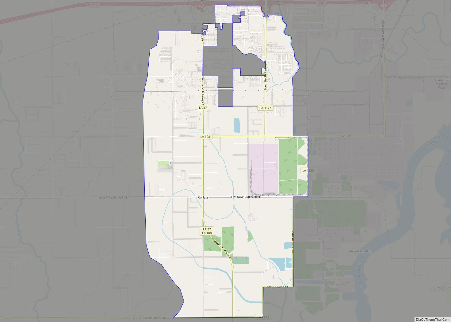
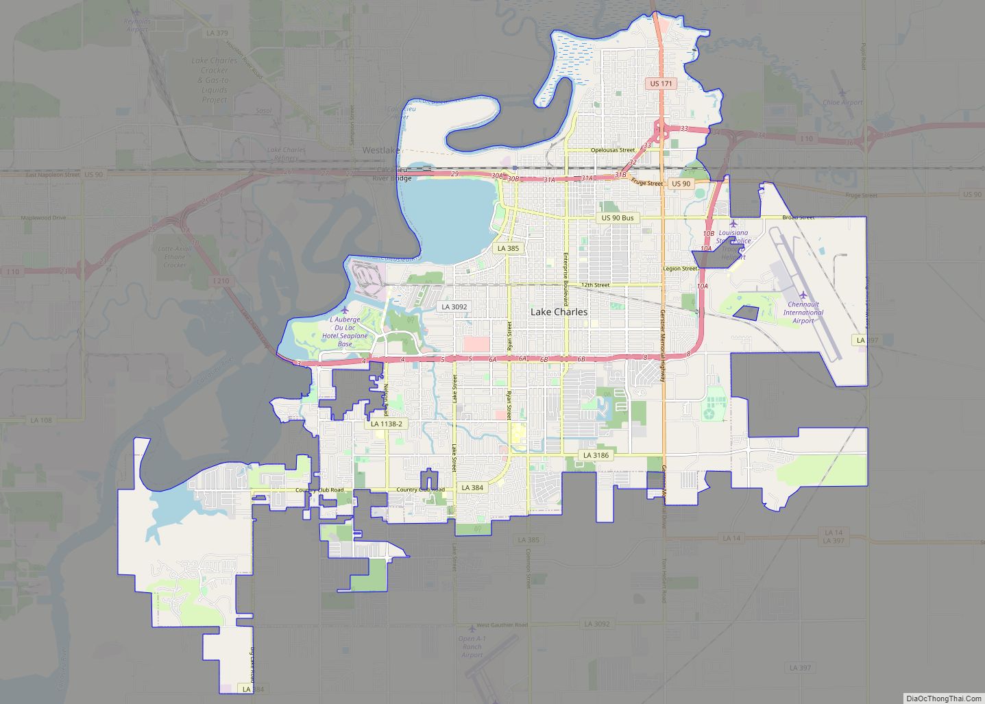
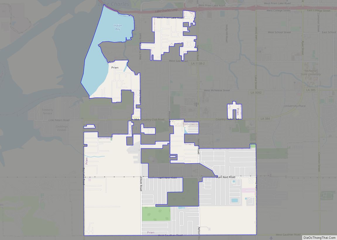
Online Interactive Map
Click on ![]() to view map in "full screen" mode.
to view map in "full screen" mode.
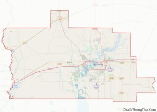
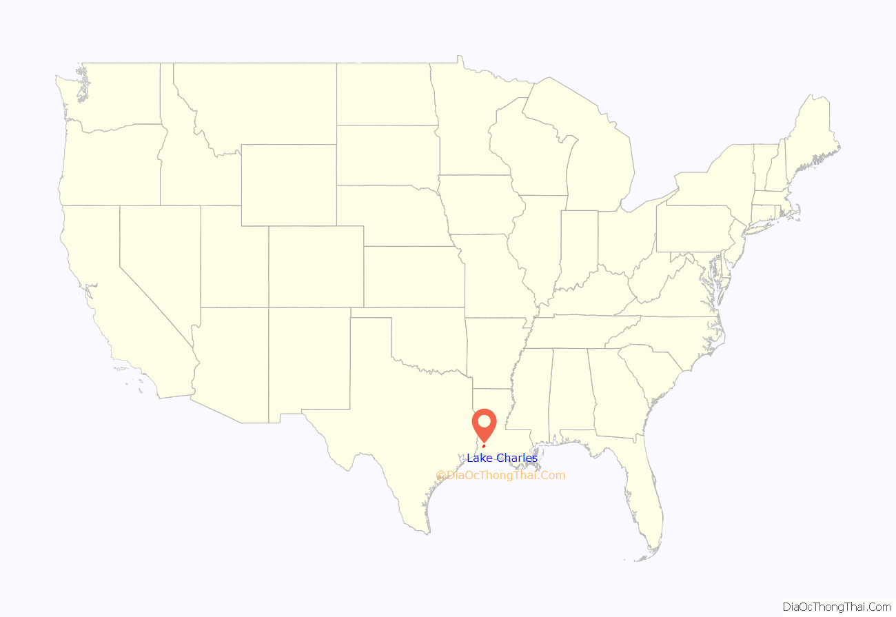
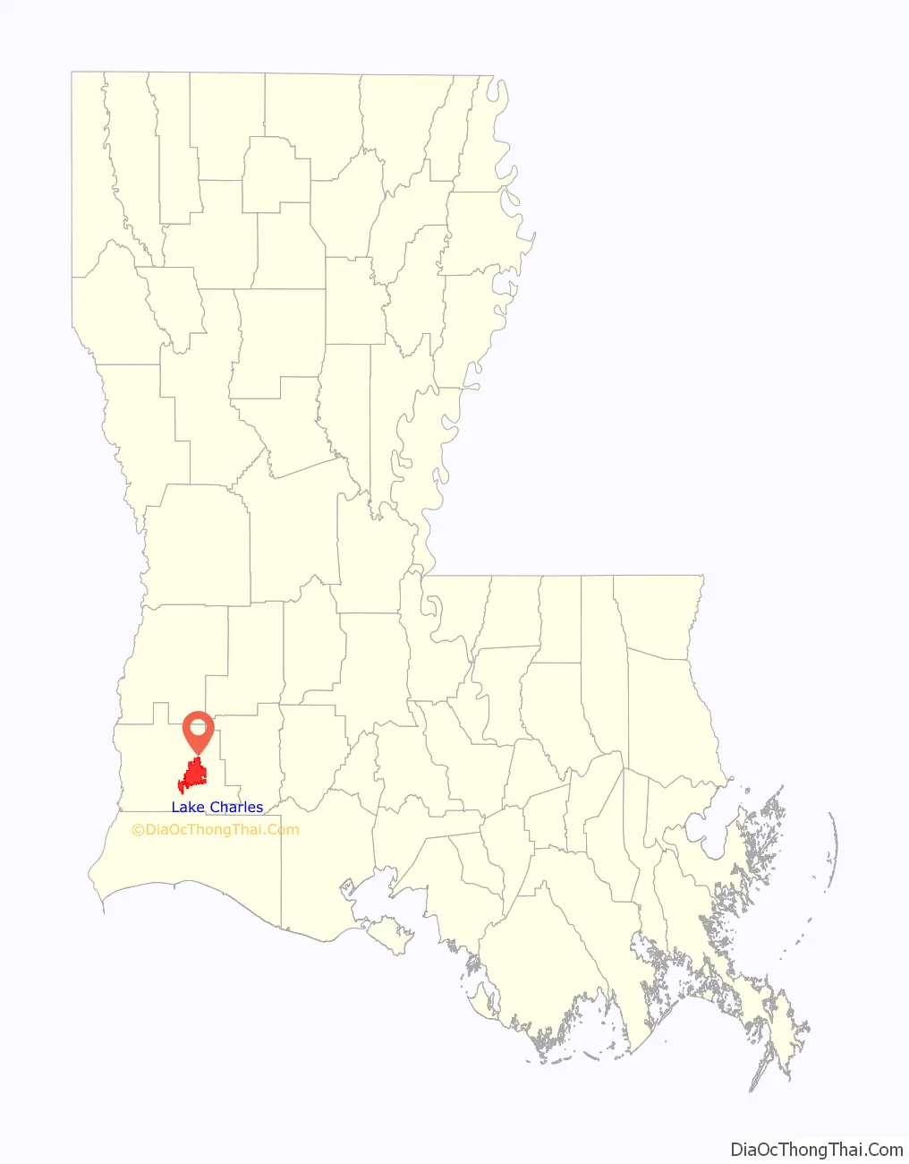
Lake Charles location map. Where is Lake Charles city?
History
On March 7, 1861, Lake Charles was incorporated as the town of Charleston, Louisiana.
Lake Charles was founded by merchant and tradesman Marco Eliche (or Marco de Élitxe) as an outpost. He was a Sephardic Jewish trader of either Basque-Spanish or Venetian-Italian origins. He had arrived in Louisiana after hitchhiking and was invited onto a Spanish vessel due to his determination and loyalty to volunteer and work freely for the Spanish Empire. Long before incorporation and even before the Louisiana Purchase, other names for Lake Charles were Porte du Lafitte (Port of Jean Lafitte) or Rivière Lafitte (River Lafitte/Lafitte’s River), among many other names now lost. Eliche had also founded other outposts and towns in Louisiana prior, most notably Marksville, which is named after him. There are also urban tales he had planned to name the settlement Nouveau Cadix (New Cádiz)”, after the city in Spain, but this is uncertain.
The town was first incorporated in 1857 as Charleston, after an early settler, Charles Sallier. Ten years later, on March 16, 1867, Charleston was reincorporated as the City of Lake Charles. The Great Fire of April 1910 devastated much of the city.
Lake Charles soon rebuilt, grew and expanded in the twentieth century. The Charleston Hotel was completed in 1929, during the administration of Mayor Henry J. Geary. During and after World War II, Lake Charles experienced industrial growth with the arrival of petrochemical refineries. The city grew to a high of some 75,000 people in the early 1980s, but with local economic recession, the population declined and stagnated. In 1985, the city was identified as a potential Strategic Homeport to support Navy Secretary John Lehman’s desire for a 600-ship Navy. Support ships were to be operated from the new Naval Station Lake Charles; but with the tailing-off of the Cold War, the 1988 Base Realignment and Closure Commission recommended it be closed. By 1991, the incomplete base was dropped from the program and shuttered.
In 2005, the city was heavily damaged by Hurricane Rita. In 2020, it was battered by two hurricanes, Category 4 Hurricane Laura on August 26–27, and Hurricane Delta on October 9, 2020.
The southern portion of the city was damaged by an EF2 tornado on October 27, 2021.
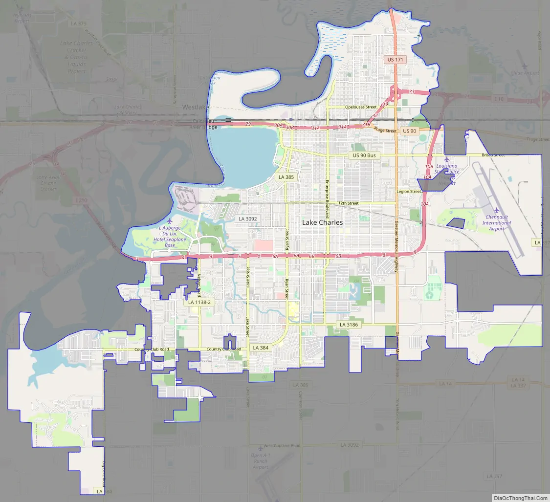
Lake Charles Road Map
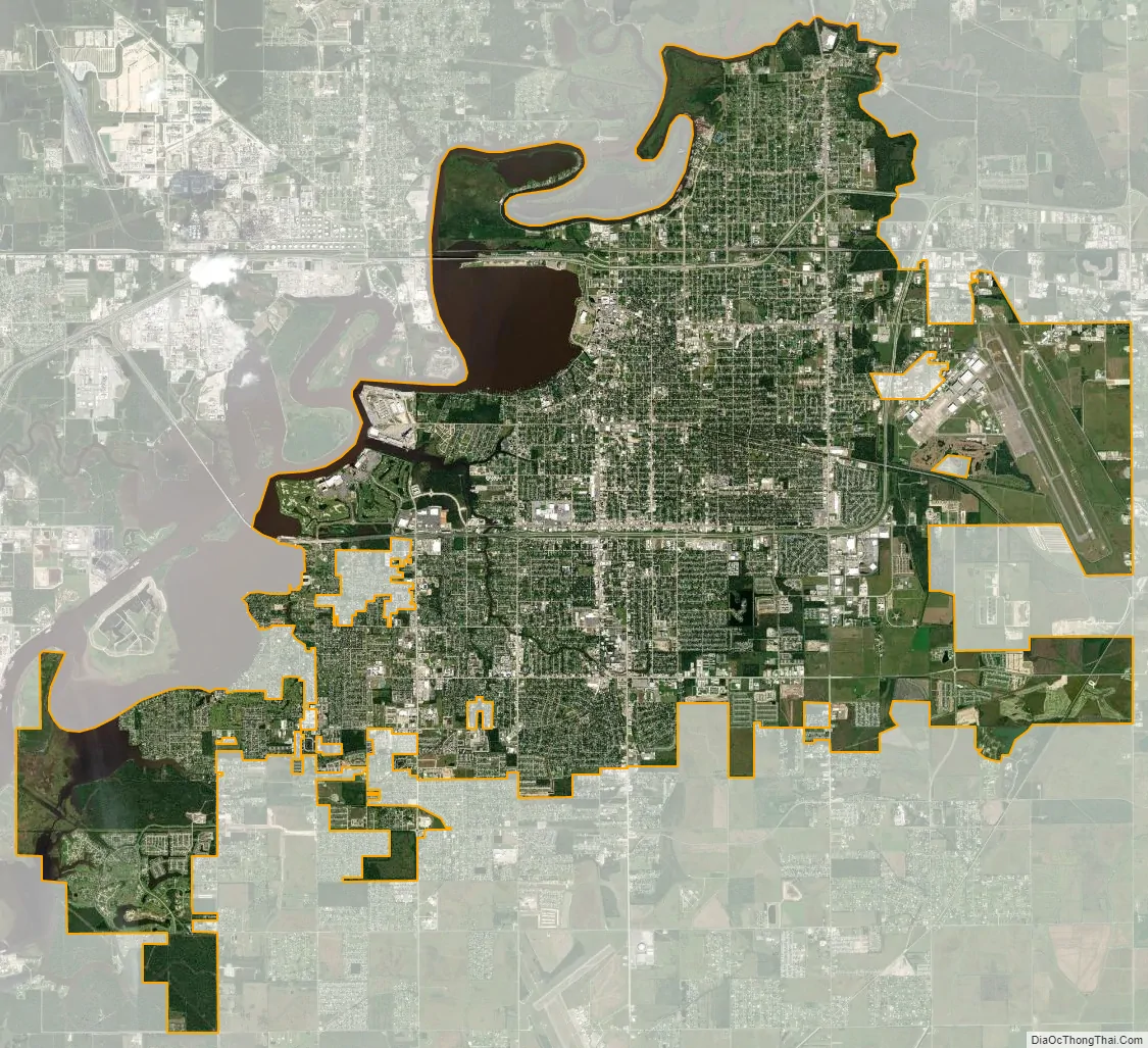
Lake Charles city Satellite Map
Geography
Lake Charles, located on a level plain about 30 miles (48 km) from the Gulf of Mexico, has an elevation of approximately 13 feet (4.0 m) above sea level, and is located on the banks of the Calcasieu River in southwestern Louisiana. It borders both Lake Charles and Prien Lake. Contraband Bayou, Henderson Bayou, and English Bayou flow through the city. Oak trees and pine trees dot the landscape; the lumber industry was once the main economic engine of the area. The Calcasieu Ship Channel, which allows large ocean-going vessels to sail up from the Gulf, also borders the city.
According to the United States Census Bureau, the city has a total area of 44.8 square miles (116.0 km), of which 42.0 square miles (108.9 km) is land and 2.7 square miles (7.1 km), or 6.12%, is water.
Climate
Lake Charles is tied with Port Arthur, Texas, and Astoria, Oregon, as the most humid city in the contiguous United States, and the second-most humid measured location behind unincorporated Quillayute, Washington. The average relative humidity in Lake Charles is 90% in the morning, and 72% in the afternoon. Average annual precipitation is also high among U.S. cities, at 57.49 inches (1,460 mm) per year.
Hurricanes
Hurricane Laura devastated the city in 2020. The National Weather Service called the storm surge “unsurvivable” with one-minute sustained wind speeds of 150 mph (240 km/h). Numerous trees were blown down. The Lake Charles Regional Airport saw a gust of 128 miles per hour (206 km/h) as well as multiple hangars destroyed. Another gust in the city reached 137 miles per hour (220 km/h). Many windows were blown out of Capital One Tower downtown. A communications tower collapsed onto the KPLC studio building (which had been evacuated) and part of a sky bridge was blown out. The radar at the NWS Lake Charles forecast office (whose staff evacuated, with the office’s operations transferred to the Brownsville, Texas office) was destroyed around the time of landfall, with its dome and much of its internal equipment sheared from the radar tower’s base. A few weeks later, Hurricane Delta also hit Lake Charles.
See also
Map of Louisiana State and its subdivision:- Acadia
- Allen
- Ascension
- Assumption
- Avoyelles
- Beauregard
- Bienville
- Bossier
- Caddo
- Calcasieu
- Caldwell
- Cameron
- Catahoula
- Claiborne
- Concordia
- De Soto
- East Baton Rouge
- East Carroll
- East Feliciana
- Evangeline
- Franklin
- Grant
- Iberia
- Iberville
- Jackson
- Jefferson
- Jefferson Davis
- La Salle
- Lafayette
- Lafourche
- Lincoln
- Livingston
- Madison
- Morehouse
- Natchitoches
- Orleans
- Ouachita
- Plaquemines
- Pointe Coupee
- Rapides
- Red River
- Richland
- Sabine
- Saint Bernard
- Saint Charles
- Saint Helena
- Saint James
- Saint John the Baptist
- Saint Landry
- Saint Martin
- Saint Mary
- Saint Tammany
- Tangipahoa
- Tensas
- Terrebonne
- Union
- Vermilion
- Vernon
- Washington
- Webster
- West Baton Rouge
- West Carroll
- West Feliciana
- Winn
- Alabama
- Alaska
- Arizona
- Arkansas
- California
- Colorado
- Connecticut
- Delaware
- District of Columbia
- Florida
- Georgia
- Hawaii
- Idaho
- Illinois
- Indiana
- Iowa
- Kansas
- Kentucky
- Louisiana
- Maine
- Maryland
- Massachusetts
- Michigan
- Minnesota
- Mississippi
- Missouri
- Montana
- Nebraska
- Nevada
- New Hampshire
- New Jersey
- New Mexico
- New York
- North Carolina
- North Dakota
- Ohio
- Oklahoma
- Oregon
- Pennsylvania
- Rhode Island
- South Carolina
- South Dakota
- Tennessee
- Texas
- Utah
- Vermont
- Virginia
- Washington
- West Virginia
- Wisconsin
- Wyoming