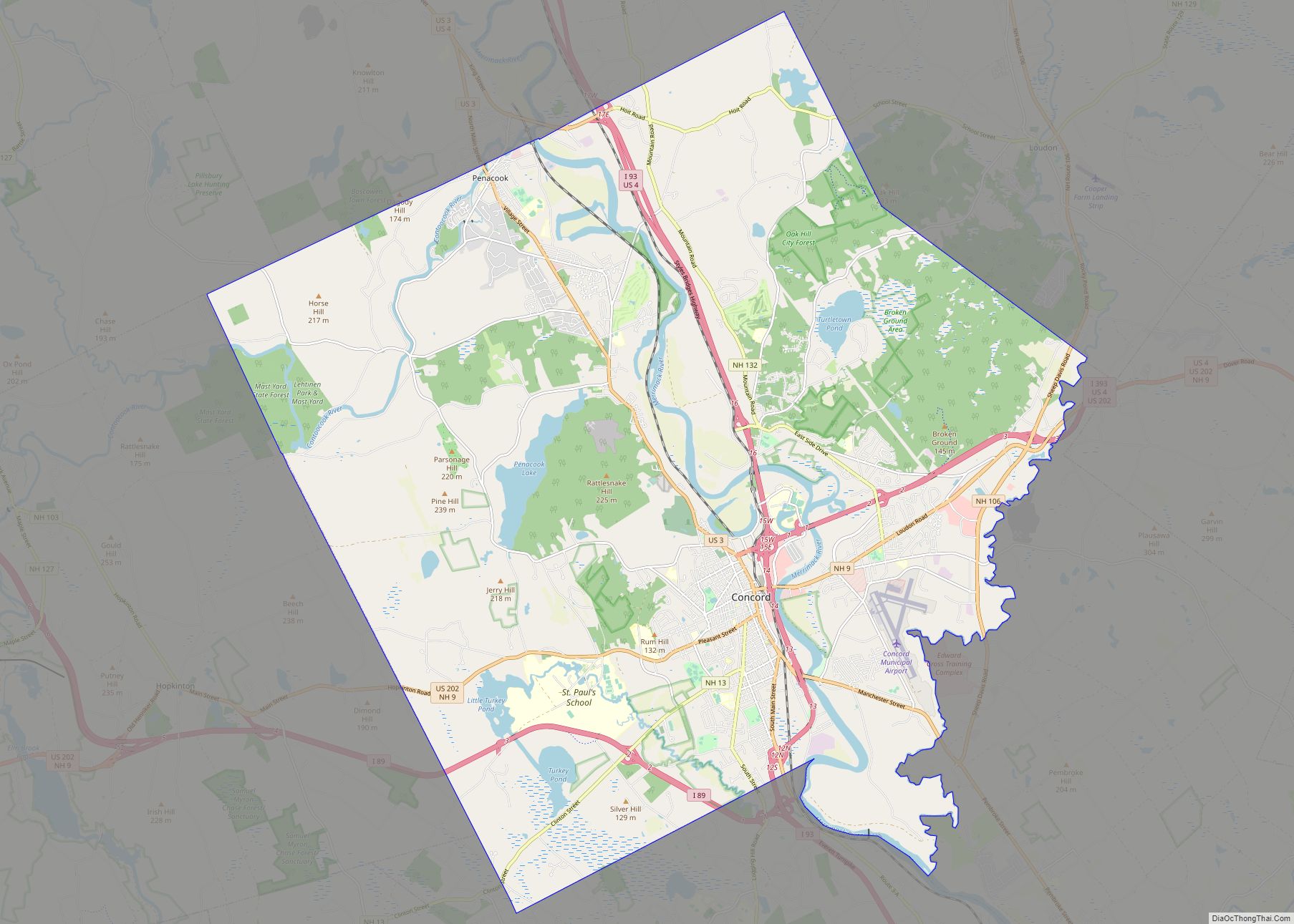
Map of Kearney city, Nebraska

Map of Kearney city, Nebraska

Kearney (/ˈkɑːrni/ KARR-nee) is the county seat of Buffalo County, Nebraska, United States. The population was 33,790 in the 2020 census. It is home to the University of Nebraska at Kearney. The westward push of the railroad as the Civil War ended gave new birth to the community. Kearney city overview: Name: Kearney city LSAD … Read more

Map of Cape May city

Map of Cape May city

Cape May (sometimes Cape May City) is a city located at the southern tip of Cape May Peninsula in Cape May County in the U.S. state of New Jersey. Located where the Delaware Bay meets the Atlantic Ocean, it is one of the country’s oldest vacation resort destinations. The city, and all of Cape May … Read more

Map of Atlantic City city

Map of Atlantic City, New Jersey

Atlantic City overview: Name: Atlantic City LSAD Code: 25 LSAD Description: city (suffix) State: New Jersey County: Atlantic County Incorporated: May 1, 1854 Elevation: 7 ft (2 m) Land Area: 10.76 sq mi (27.87 km²) Water Area: 6.45 sq mi (16.72 km²)  37.50% Population Density: 3,577.8/sq mi (1,381.4/km²) Area code: 609 FIPS code: 3402080 GNISfeature ID: 0885142 Website: www.cityofatlanticcity.org Online Interactive Map Atlantic City … Read more

Map of Paradise CDP, Nevada

Map of Paradise CDP, Nevada

Paradise is an unincorporated town and census-designated place (CDP) in Clark County, Nevada, United States, adjacent to the city of Las Vegas. It was formed on December 8, 1950. Its population was 191,238 at the 2020 census, making it the fifth-most-populous CDP in the United States; if it were an incorporated city, it would be … Read more

Map of Santa Fe city

Map of Santa Fe city, New Mexico

Santa Fe (/ˌsæntə ˈfeɪ, ˈsæntə feɪ/ SAN-tə FAY, -⁠ fay; Spanish: [santaˈfe], Spanish for ‘Holy Faith’; Tewa: Oghá P’o’oge, Tewa for ‘white shell water place’; Northern Tiwa: Hulp’ó’ona; Navajo: Yootó, Navajo for ‘bead + water place’) is the capital of the U.S. state of New Mexico. The name “Santa Fe” means ‘Holy Faith’ in Spanish, and … Read more

Map of Sandusky city, Ohio

Map of Sandusky city, Ohio

Sandusky (/sænˈdʌski/ san-DUSS-kee) is a city in and the county seat of Erie County, Ohio, United States. Situated along the shores of Lake Erie in the northern part of the state, Sandusky is located roughly midway between Toledo (45 miles (72 km) west) and Cleveland (50 miles (80 km) east). According to 2020 census, the city had … Read more