Sandusky (/sænˈdʌski/ san-DUSS-kee) is a city in and the county seat of Erie County, Ohio, United States. Situated along the shores of Lake Erie in the northern part of the state, Sandusky is located roughly midway between Toledo (45 miles (72 km) west) and Cleveland (50 miles (80 km) east). According to 2020 census, the city had a population of 25,095, and the Sandusky micropolitan area had 75,622 residents.
Sandusky is home to the Cedar Fair Entertainment Company, which owns large amounts of property in Sandusky. These properties include Cedar Point, Cedar Fair’s flagship park and one of the most popular amusement parks in the world, as well as Cedar Point Shores, adjacent to Cedar Point itself. In 2011, Sandusky was ranked No. 1 by Forbes as the “Best Place to Live Cheaply” in the United States due to its high median family income of $64,000 compared to its relatively low cost of living. The National Arbor Day Foundation has designated Sandusky as a Tree City USA.
| Name: | Sandusky city |
|---|---|
| LSAD Code: | 25 |
| LSAD Description: | city (suffix) |
| State: | Ohio |
| County: | Erie County |
| Founded: | 1818 |
| Elevation: | 597 ft (182 m) |
| Land Area: | 9.63 sq mi (24.96 km²) |
| Water Area: | 12.19 sq mi (31.58 km²) |
| Population Density: | 2,604.57/sq mi (1,005.58/km²) |
| Area code: | 419/567 |
| FIPS code: | 3970380 |
| GNISfeature ID: | 1076832 |
| Website: | www.ci.sandusky.oh.us |
Online Interactive Map
Click on ![]() to view map in "full screen" mode.
to view map in "full screen" mode.
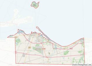
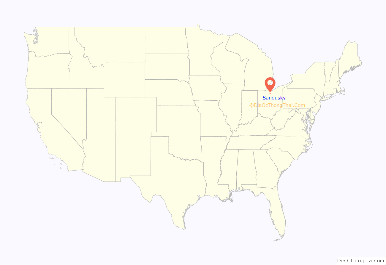
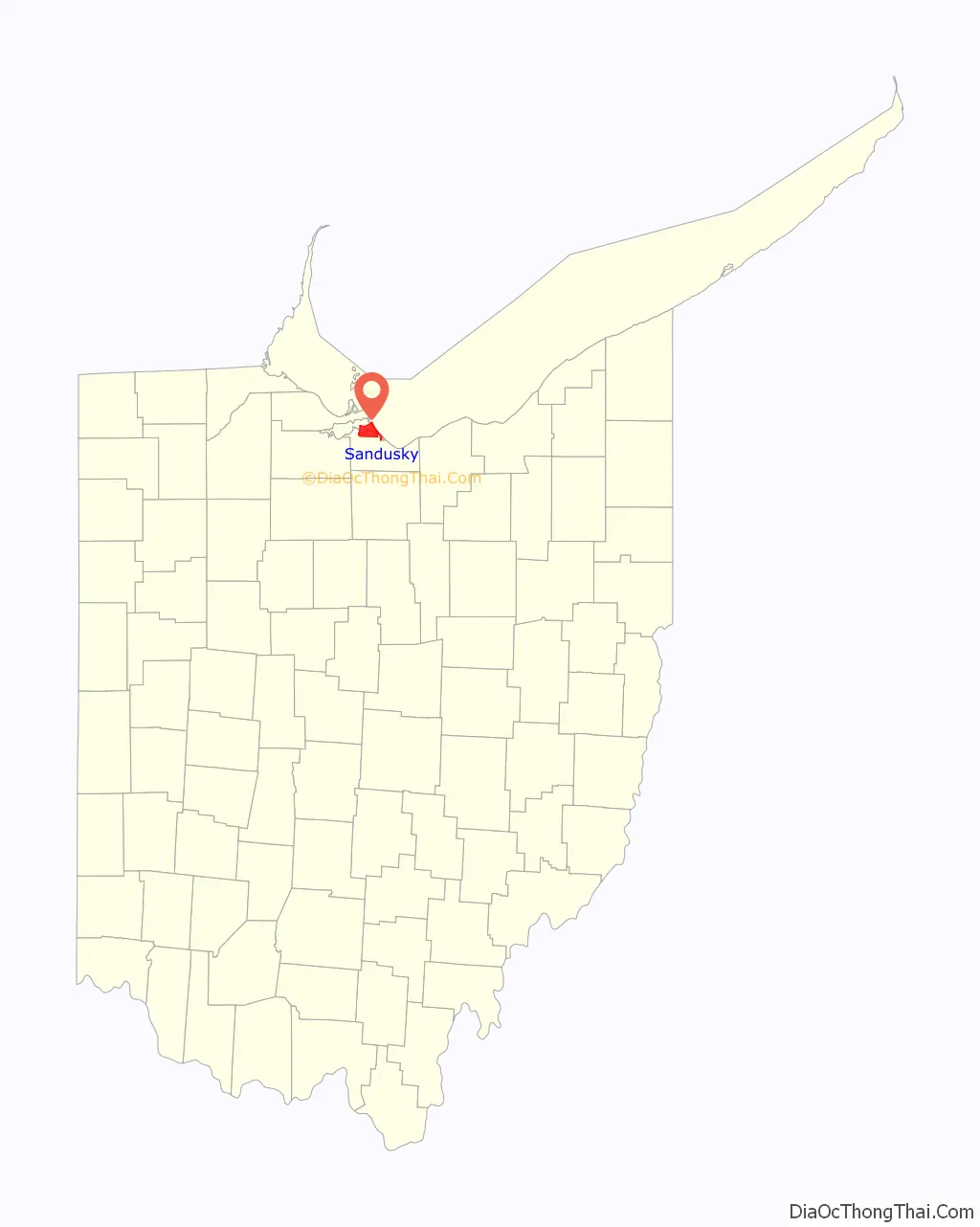
Sandusky location map. Where is Sandusky city?
History
This area was a center of trading and fortifications since the 18th century: the English, French, and Americans had trading posts and forts built on both the north and south sides of Sandusky Bay. George Croghan was one of the more prominent men who operated in this area in the 18th-century. A federal fur trade factory was established in 1808 but was lost at the beginning of the War of 1812.
Development by European Americans of the city of Sandusky, starting in 1818, on the southeast shore of Sandusky Bay, followed settlement of the war of 1812. Part of the city quickly enveloped the site of an earlier small village named Portland (established about 1816). Sandusky was incorporated as a city in 1824. Eventually the city of Sandusky encompassed most of the entire township that had been called Portland. Some of the city was built on land formerly occupied by a Native American man named Ogontz, and therefore the city is said to have been built on “Ogontz’ place”.
Sandusky’s rise in the 19th century was heavily influenced by its location at the head of Sandusky Bay. This made it a key point both for the movement of goods and for the movement of people. The mild climate caused by its proximity to Lake Erie also caused it to become the center of Ohio’s wine industry. The presence of limestone was also key to its development. It was also a key location for ice harvesting in the 19th century. Lumber transport, stone quarrying and, in the early 20th century, manufacturing have all been key in the city’s history.
Prior to the abolition of slavery in the United States, Sandusky was a major stop for refugee slaves on the Underground Railroad, as some would travel across Lake Erie to reach freedom in Canada. Although Ohio was a free state, they felt at risk from slavecatchers because of bonuses offered under the Fugitive Slave Act of 1850. As depicted in Harriet Beecher Stowe’s novel Uncle Tom’s Cabin (1855), many refugee slaves seeking to get to Canada made their way to Sandusky, where they boarded boats crossing Lake Erie to the port of Amherstburg in Ontario.
Sandusky’s original plat was designed by surveyor Hector Kilbourne according to a modified grid plan, known today as the Kilbourne Plat. Kilbourne later became the first Worshipful Master of the first Sandusky Masonic Lodge, known as Science Lodge #50, still in operation on Wayne Street. His design featured a street grid with avenues cutting diagonally to create patterns reminiscent of the symbols of Freemasonry.
On September 17, 1835, Sandusky was the site of groundbreaking for the Mad River and Lake Erie Railroad, which brought change to the town. Industrial areas developed near the railroad and goods were transported through the port. The coal docks located west of downtown still use a portion of the original MR&LE right-of-way. In 1838 Erie County, Ohio was formed by the state legislature and Sandusky was designated the county seat. This led to the foundation of a court house and Sandusky becoming a regional government center. In 1846 Sandusky had a population of approximately 3,000 people. At that point Sandusky had two railroads and was also a main focus of lake traffic. The town then consisted of many stores, two printing offices, two machine shops, two banks, six churches, one high school, and several iron furnaces.
Since the late 20th century, Battery Park Marina was developed on the original site of the MR&LE Railroad after restructuring of the industry reduced traffic on the line. The tracks that ran through downtown Sandusky have since been removed. Most of the downtown industrial area is also being redeveloped for other purposes, including mainly marina dockage.
The English author Charles Dickens visited the city in 1842, and briefly wrote of it in his subsequent travelogue, American Notes. Said Dickens, who rode the newly constructed MR&LE railroad from Tiffin:
By 1880 Sandusky had risen to a population of 16,000. There were then 20 churches and three newspapers in the community. The city boasted 29 businesses with at least 10 employees. Products being products included lime, railroad locomotives and cars, carriages, wheels, crayons, chalk, beer, paper, baskets, and tools. By 1886 Sandusky was the center of wood wheel manufacture in the United States. It was also the location of the Ohio State Fish hatchery and the Ohio Soldiers and Sailor’s Home.
The city developed as a center of paper-making. With a mill in the industrial area near the lake, the Hinde & Dauch Paper Company was the largest employer in the city in the early 1900s.
As the 20th century progressed, the economy of Sandusky came to focus mainly on tourism and fishing.
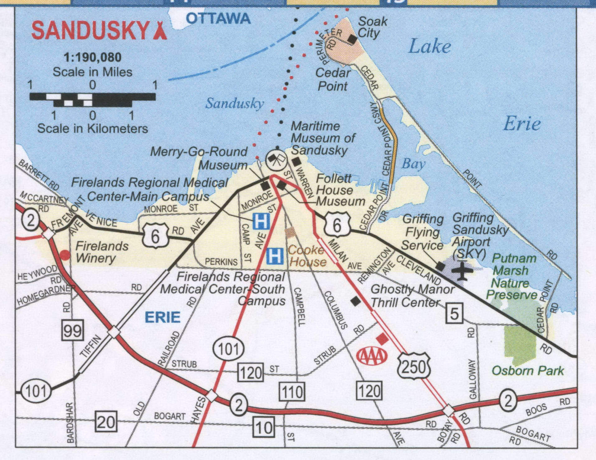
Sandusky Road Map
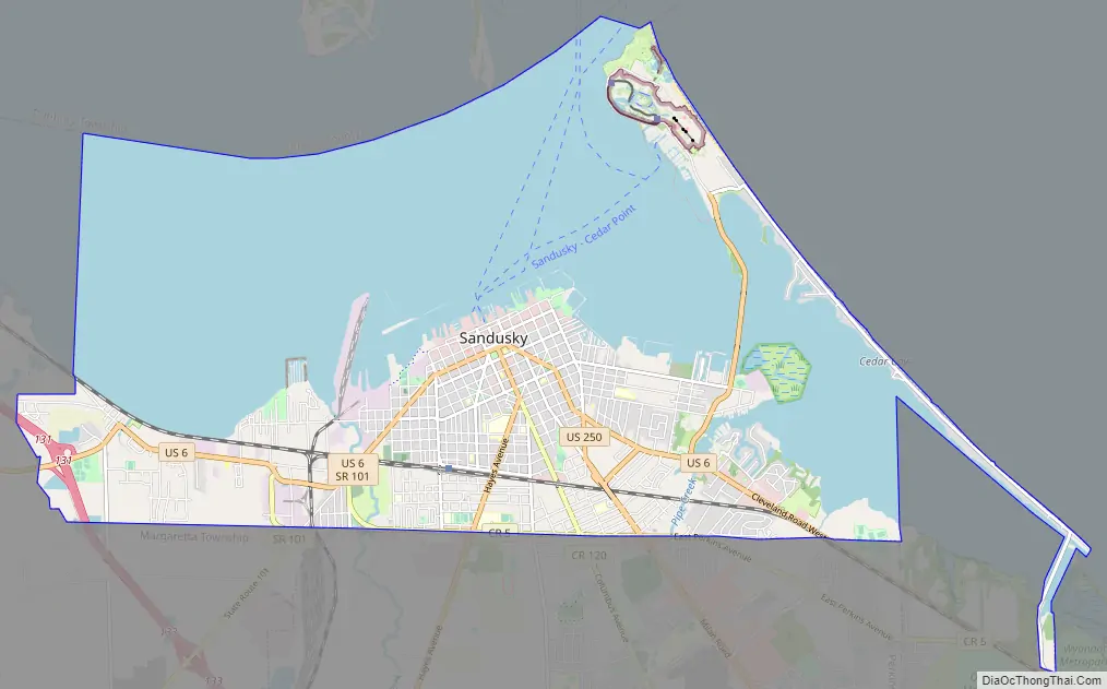
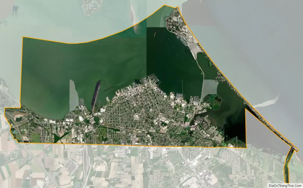
Sandusky city Satellite Map
Geography
Geography
Sandusky is located at 41°26′48″N 82°42′33″W / 41.44667°N 82.70917°W / 41.44667; -82.70917 (41.446741, −82.709092).
According to the United States Census Bureau, the city has a total area of 21.91 square miles (56.75 km), of which 9.73 square miles (25.20 km) is land and 12.18 square miles (31.55 km) is water.
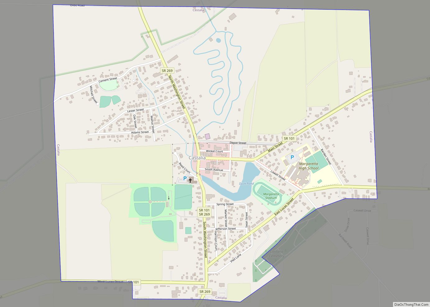
Sandusky occupies the defunct township Portland and borders the following townships:
- Margaretta Township – west and south
- Perkins Township – south
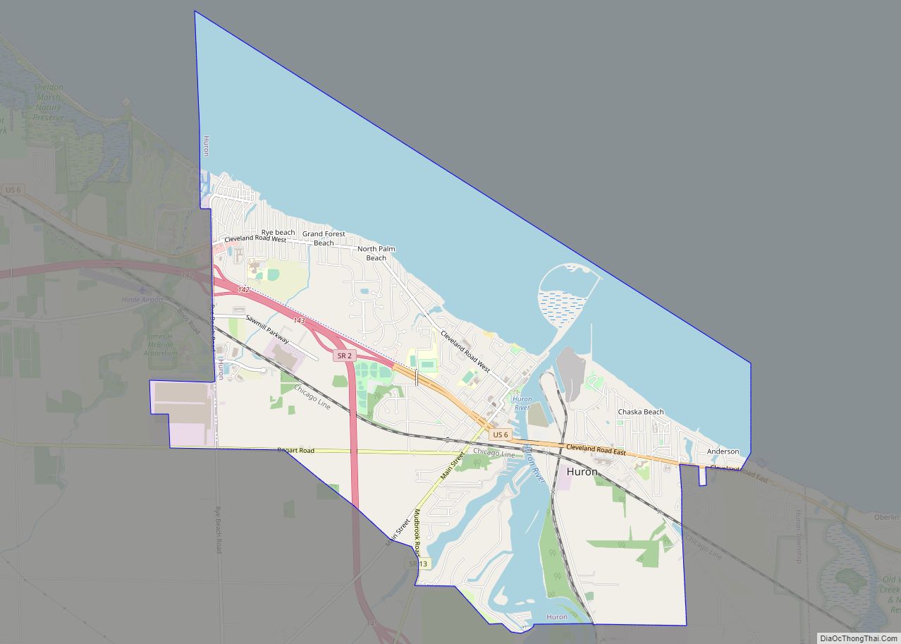
- Huron Township – east
Climate
Sandusky has a humid continental climate (Köppen climate classification Dfa), typical of the Midwestern United States, with warm summers and cold winters. Winters tend to be cold, with an average January high temperature of 32 °F (0 °C), and an average January low temperature of 19 °F (−7 °C), with considerable variation in temperatures. Sandusky averages 23.3 inches (59 cm) of snow per winter. Summers tend to be warm with an average July high temperature of 82 °F (28 °C), and an average July low temperature of 66 °F (19 °C). Summer weather is more stable, generally humid with thunderstorms. Fall usually is the driest season with many clear warm days and cool nights.
The highest recorded temperature in Sandusky of 105 °F (41 °C) was set on July 14, 1936, and the lowest recorded temperature of −20 °F (−29 °C) was set on January 19, 1994.
Local areas
Historically, the Wyandot used the term andoske to refer to the river, the bay, and the general area where the city of “Sandusky” later developed. This practice was also used by French and English settlers in the area. Often in historical documents, the word “Sandusky” is used without clarification as to which specific site or location is being referred to. Historical references to “Sandusky” might mean any one of the following locations, depending also on the date of the reference.
List of locations, with approximate dates of usage:
- Sandusky/Sandusky City – about 1817* to present, village/city on southeast side of Sandusky Bay (*-any “Sandusky” reference dated prior to 1817 would not refer to this village, as it was not officially established by this name until 1818).
- Sandusky Bay – 1700 to present; early variants were “(Lac d’)Otsanderket”, “(Lac d’)Otsandoske”, “Lake Sandoskė”.
- Sandusky River – 1740s to present.
- Fort Sandusky – various locations: c. 1745, an English trading post on the northern side of the bay. c.1754, a French fort (“Fort Janundat”) was built on the southern side of the bay. Later in the French and Indian War, the British built Fort Sandusky on the southeastern side of Sandusky Bay. From about 1812/1813, this referred to a fort (later called “Fort Stephenson”) on the Sandusky River, near present-day Fremont, Ohio.
- Lower Sandusky – 1760s to 1849, area or village at the site of what is now the city of Fremont.
- Upper Sandusky – 1760s? to present, area or village at the falls, which later developed as the current city of Upper Sandusky. Upper Sandusky is south of Sandusky and upriver of it. While a common first impression is that “Upper” implies “north of”, here “Upper” refers to “upstream”, as in upstream of Lake Erie by means of the Sandusky River.
- Upper Sandusky Old Town – 1760s? to ?, a historic Wyandot (Huron) tribe village, about 12 miles (19 km) north of where the city of Upper Sandusky developed.
See also
Map of Ohio State and its subdivision:- Adams
- Allen
- Ashland
- Ashtabula
- Athens
- Auglaize
- Belmont
- Brown
- Butler
- Carroll
- Champaign
- Clark
- Clermont
- Clinton
- Columbiana
- Coshocton
- Crawford
- Cuyahoga
- Darke
- Defiance
- Delaware
- Erie
- Fairfield
- Fayette
- Franklin
- Fulton
- Gallia
- Geauga
- Greene
- Guernsey
- Hamilton
- Hancock
- Hardin
- Harrison
- Henry
- Highland
- Hocking
- Holmes
- Huron
- Jackson
- Jefferson
- Knox
- Lake
- Lake Erie
- Lawrence
- Licking
- Logan
- Lorain
- Lucas
- Madison
- Mahoning
- Marion
- Medina
- Meigs
- Mercer
- Miami
- Monroe
- Montgomery
- Morgan
- Morrow
- Muskingum
- Noble
- Ottawa
- Paulding
- Perry
- Pickaway
- Pike
- Portage
- Preble
- Putnam
- Richland
- Ross
- Sandusky
- Scioto
- Seneca
- Shelby
- Stark
- Summit
- Trumbull
- Tuscarawas
- Union
- Van Wert
- Vinton
- Warren
- Washington
- Wayne
- Williams
- Wood
- Wyandot
- Alabama
- Alaska
- Arizona
- Arkansas
- California
- Colorado
- Connecticut
- Delaware
- District of Columbia
- Florida
- Georgia
- Hawaii
- Idaho
- Illinois
- Indiana
- Iowa
- Kansas
- Kentucky
- Louisiana
- Maine
- Maryland
- Massachusetts
- Michigan
- Minnesota
- Mississippi
- Missouri
- Montana
- Nebraska
- Nevada
- New Hampshire
- New Jersey
- New Mexico
- New York
- North Carolina
- North Dakota
- Ohio
- Oklahoma
- Oregon
- Pennsylvania
- Rhode Island
- South Carolina
- South Dakota
- Tennessee
- Texas
- Utah
- Vermont
- Virginia
- Washington
- West Virginia
- Wisconsin
- Wyoming