Kearney (/ˈkɑːrni/ KARR-nee) is the county seat of Buffalo County, Nebraska, United States. The population was 33,790 in the 2020 census. It is home to the University of Nebraska at Kearney. The westward push of the railroad as the Civil War ended gave new birth to the community.
| Name: | Kearney city |
|---|---|
| LSAD Code: | 25 |
| LSAD Description: | city (suffix) |
| State: | Nebraska |
| County: | Buffalo County |
| Elevation: | 2,152 ft (656 m) |
| Total Area: | 15.15 sq mi (39.25 km²) |
| Land Area: | 14.88 sq mi (38.53 km²) |
| Water Area: | 0.28 sq mi (0.72 km²) |
| Total Population: | 33,790 |
| Population Density: | 2,271.29/sq mi (876.95/km²) |
| ZIP code: | 68845, 68847, 68848 (P.O. Box), 68849 UNK |
| Area code: | 308 |
| FIPS code: | 3125055 |
| GNISfeature ID: | 0830442 |
| Website: | www.cityofkearney.org |
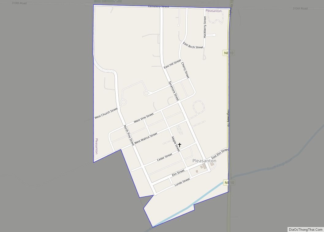
Online Interactive Map
Click on ![]() to view map in "full screen" mode.
to view map in "full screen" mode.
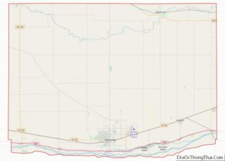
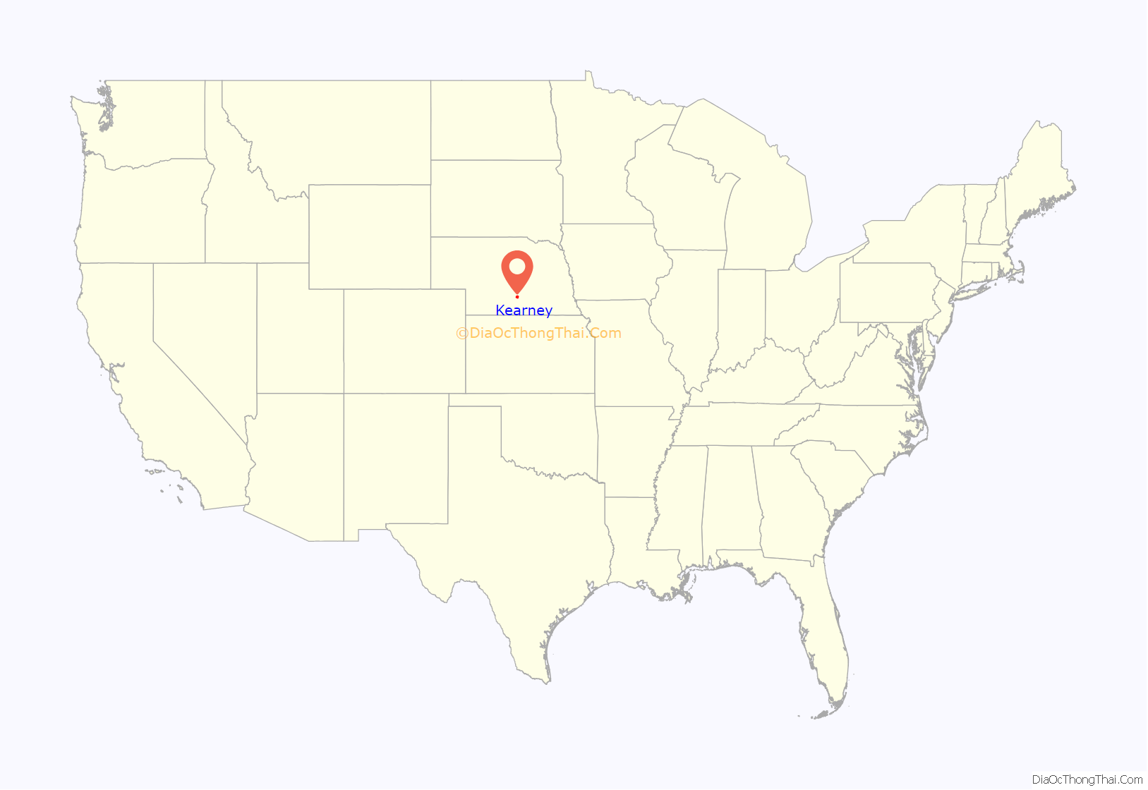
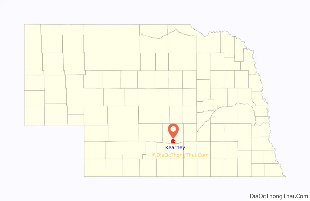
Kearney location map. Where is Kearney city?
History
In the late 1840s, American settlers traveling westward arrived in significant numbers along the Mormon Trail and Overland Trails. This marked the beginning of Kearney’s role as a crossroads on major east-west transportation arteries. In 1848, to safeguard westward migrants traveling through the region, the US Army established a military fort several miles southeast of the present city. Named after famed frontier military officer Stephen W. Kearny, Fort Kearny would become the namesake of the present city and serve as a comfort station for gold prospectors, Pony Express riders, and Union Pacific Railroad workers until 1871.
The first permanent settlement in the area was called Dobytown, located 2 miles (3.2 km) southeast of the present-day Kearney. The “e” in Kearney was added by mistake sometime afterwards by postmen who consistently misspelled the town name; eventually the spelling became nomenclature. The region expanded in 1866 with the arrival of the Union Pacific Railroad. The fixing of a junction point with the Burlington & Missouri River Railroad in 1871 anticipated the establishment of a townsite in the summer of that year. The city of Kearney was incorporated on December 3, 1873, the townsite being fixed a mille north of the Platte River. In 1874, Kearney was chosen to be the seat of Buffalo County, experiencing great population, economic, and infrastructural expansion in subsequent years that transformed the nascent city into the local business, education, and transportation center it remains to this day. This boom would be sustained through the next twenty-years, fueled by a post-Civil War period of frenzied economic expansion and wealth generation (Gilded Age) that was transforming the whole nation. Enterprising investors poured into the burgeoning community from the East and elsewhere, hoping to enrich themselves through ambitious speculative development schemes that, more often than not, turned out to be ill-conceived and economically unsustainable. An irrigation canal, electric street railway, and a five-story opera house were some of the projects to ultimately make it off the drawing board. These flush times would grind to a sudden halt as a result of the agricultural depression and economic crisis of the early 1890s.
In 1912, a Catholic Diocese was centered here. This status was removed in 1917, with the creation of other dioceses. In 1997, the city began to be used as a titular see by the Catholic Church.
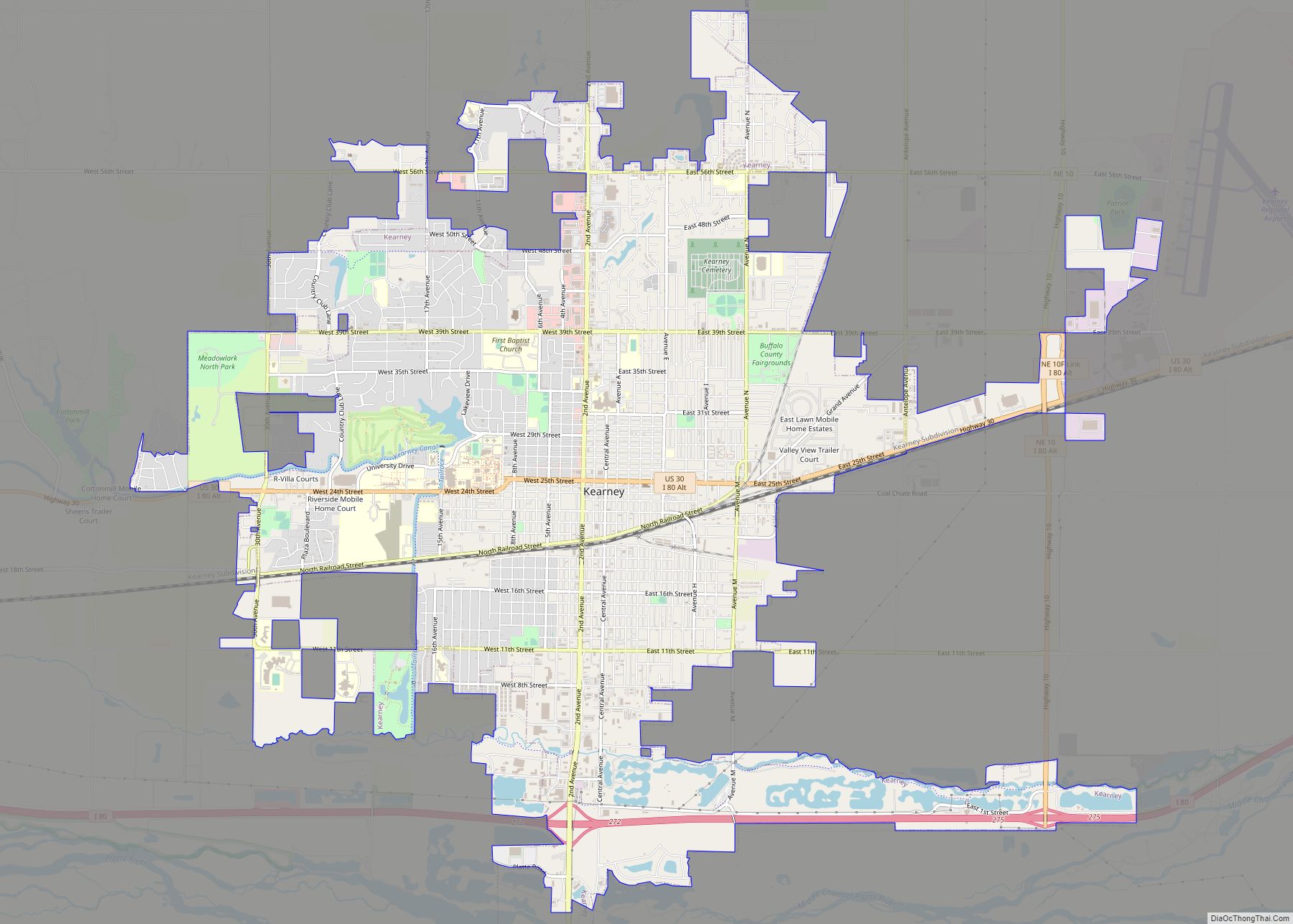
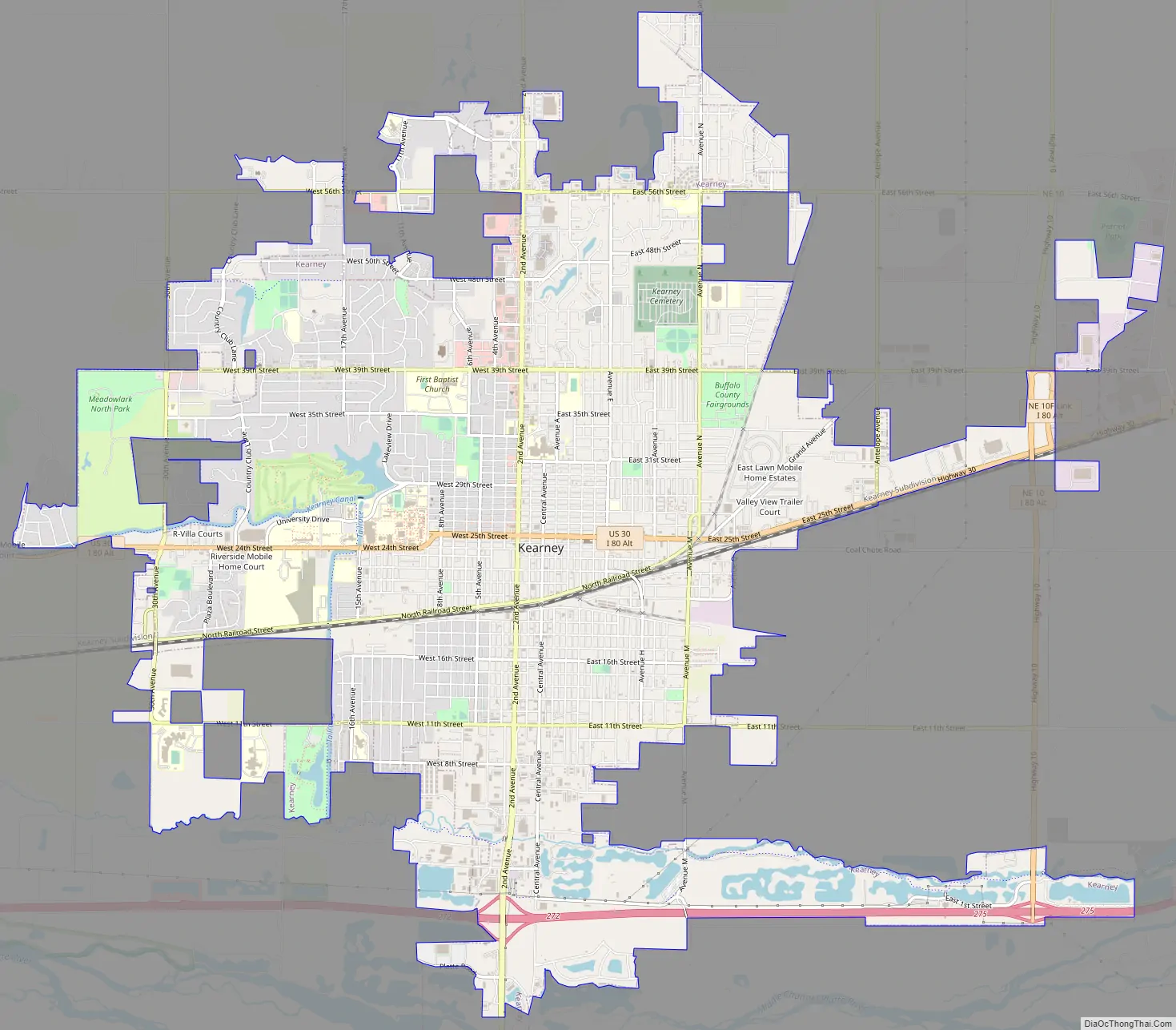
Kearney Road Map
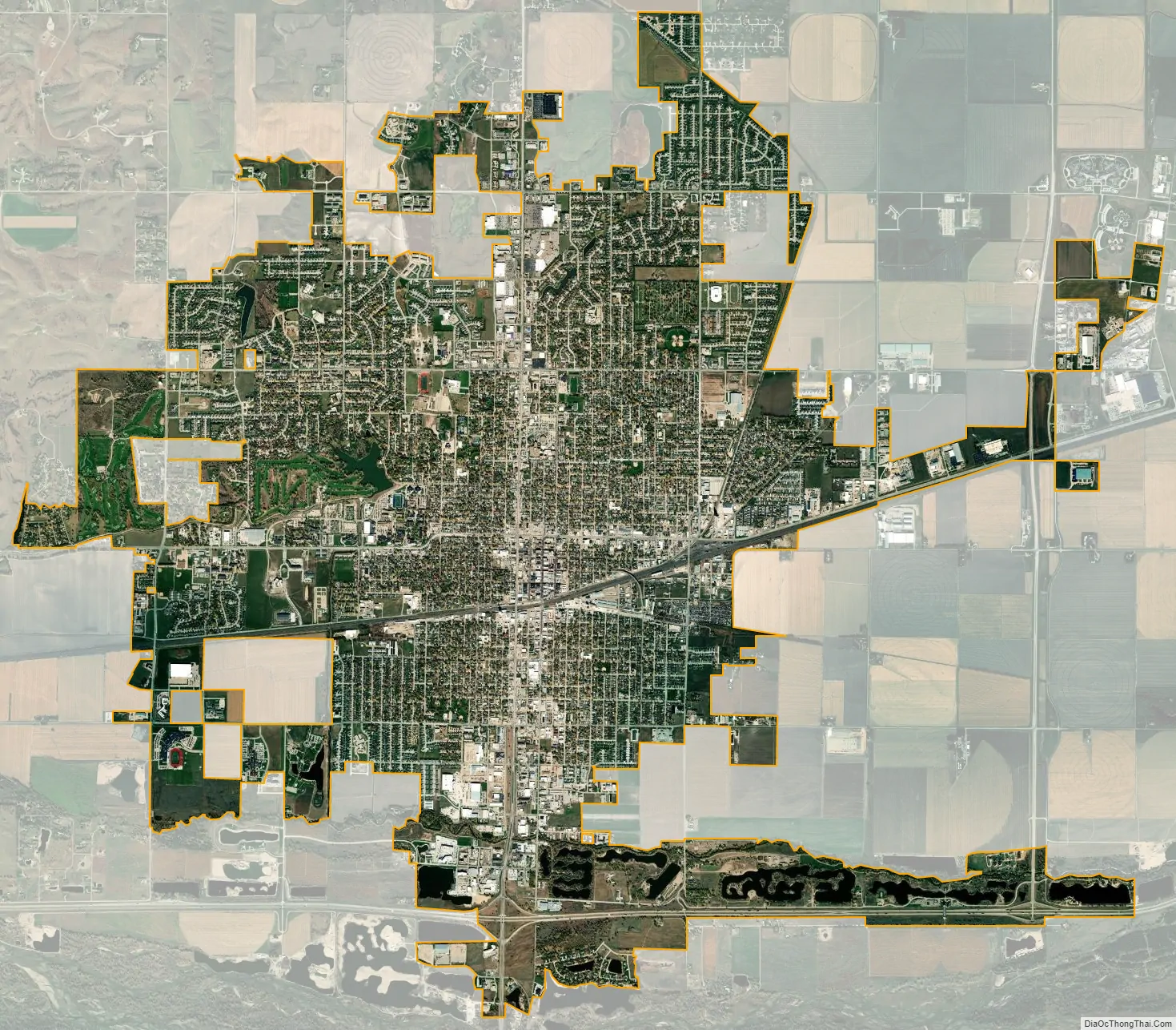
Kearney city Satellite Map
Geography
Kearney is located at 40°42′3″N 99°4′52″W / 40.70083°N 99.08111°W / 40.70083; -99.08111 (40.700731, -99.081150) on I-80 with access to the major markets of Omaha–Lincoln, Denver, Kansas City, Des Moines, Wichita and Cheyenne, Kearney is at the center of a seven-state region and 20 million people.
According to the United States Census Bureau, the city has a total area of 13.00 square miles (33.67 km), of which 12.77 square miles (33.07 km) is land and 0.23 square miles (0.60 km) is water.
Climate
See also
Map of Nebraska State and its subdivision:- Adams
- Antelope
- Arthur
- Banner
- Blaine
- Boone
- Box Butte
- Boyd
- Brown
- Buffalo
- Burt
- Butler
- Cass
- Cedar
- Chase
- Cherry
- Cheyenne
- Clay
- Colfax
- Cuming
- Custer
- Dakota
- Dawes
- Dawson
- Deuel
- Dixon
- Dodge
- Douglas
- Dundy
- Fillmore
- Franklin
- Frontier
- Furnas
- Gage
- Garden
- Garfield
- Gosper
- Grant
- Greeley
- Hall
- Hamilton
- Harlan
- Hayes
- Hitchcock
- Holt
- Hooker
- Howard
- Jefferson
- Johnson
- Kearney
- Keith
- Keya Paha
- Kimball
- Knox
- Lancaster
- Lincoln
- Logan
- Loup
- Madison
- McPherson
- Merrick
- Morrill
- Nance
- Nemaha
- Nuckolls
- Otoe
- Pawnee
- Perkins
- Phelps
- Pierce
- Platte
- Polk
- Red Willow
- Richardson
- Rock
- Saline
- Sarpy
- Saunders
- Scotts Bluff
- Seward
- Sheridan
- Sherman
- Sioux
- Stanton
- Thayer
- Thomas
- Thurston
- Valley
- Washington
- Wayne
- Webster
- Wheeler
- York
- Alabama
- Alaska
- Arizona
- Arkansas
- California
- Colorado
- Connecticut
- Delaware
- District of Columbia
- Florida
- Georgia
- Hawaii
- Idaho
- Illinois
- Indiana
- Iowa
- Kansas
- Kentucky
- Louisiana
- Maine
- Maryland
- Massachusetts
- Michigan
- Minnesota
- Mississippi
- Missouri
- Montana
- Nebraska
- Nevada
- New Hampshire
- New Jersey
- New Mexico
- New York
- North Carolina
- North Dakota
- Ohio
- Oklahoma
- Oregon
- Pennsylvania
- Rhode Island
- South Carolina
- South Dakota
- Tennessee
- Texas
- Utah
- Vermont
- Virginia
- Washington
- West Virginia
- Wisconsin
- Wyoming