Ashe County is a county located in the United States state of North Carolina. As of the 2020 census, the population was 26,577. Its county seat is Jefferson.
| Name: | Ashe County |
|---|---|
| FIPS code: | 37-009 |
| State: | North Carolina |
| Founded: | 1799 |
| Named for: | Samuel Ashe |
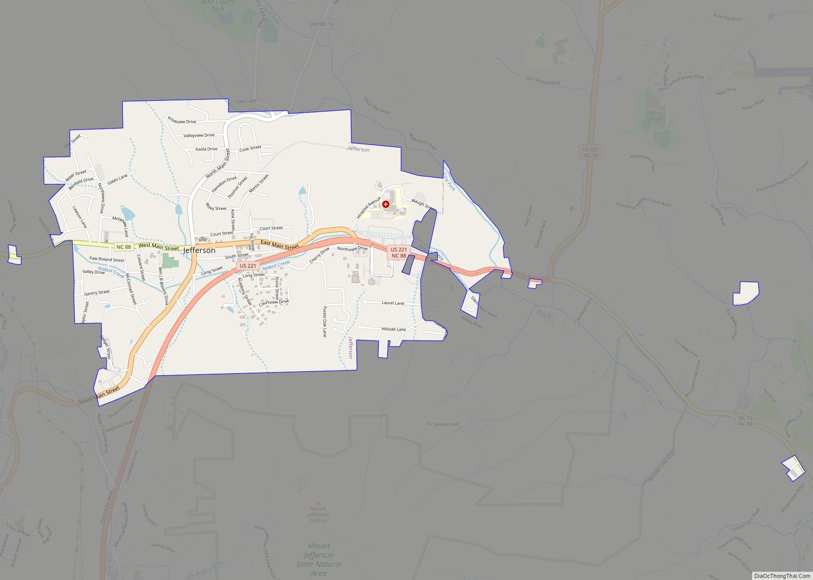
| Seat: | Jefferson |
| Largest town: | Jefferson |
| Total Area: | 429 sq mi (1,110 km²) |
| Land Area: | 426 sq mi (1,100 km²) |
| Total Population: | 26,711 |
| Population Density: | 62.7/sq mi (24.2/km²) |
| Time zone: | UTC−5 (Eastern) |
| Summer Time Zone (DST): | UTC−4 (EDT) |
| Website: | www.ashecountygov.com |
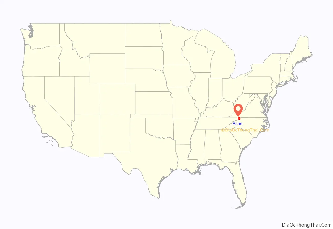
Ashe County location map. Where is Ashe County?
History
Historical evidence shows that Ashe County was inhabited by Native Americans, which included the Cherokee, Creek, and Shawnee tribes. Pieces of broken pottery, arrowheads, and other Native American artifacts have been found, indicating their presence. Most of these artifacts have been found in the Old Fields area of Ashe County.
The earliest Europeans to explore Ashe County were Bishop August Gottlieb Spangenberg – head of the Moravian Church in America – and his associates, Timothy Horsefield, Joseph Mueller, Henry Antes, Johan Merck, and Herman Loesch. Bishop Spangenberg wrote about his journey in Ashe in a diary that has been preserved by the Moravian church. He was given 100,000 acres (400 km) in Virginia as a place for his fellow Moravians to settle. The only one of Spangenberg’s group to return and permanently settle in Ashe County was Herman Loesch. Other early settlers were David Helton, William Walling, William McLain and Daniel Boone, the famous pioneer. With the exception of Boone, these men and their families all settled in Ashe in 1771.
During the Revolutionary War one skirmish was fought in Ashe County, the Battle of Big Glades. The battle was fought in July 1780 between a force of Americans, led by Captain Robert Love, and a force of 150 British Loyalists on their way to Charlotte to join Lord Cornwallis, the British commander in the Southern colonies. The Americans won the skirmish.
In the 1780s, Ashe County was a part of the self-declared “State of Franklin”, within the boundaries of its Washington County. The “State of Franklin” marked the beginnings of the State of Tennessee. The North Carolina legislature created Ashe County in late 1799 with an area of 977 square miles (2,530 km). Many family surnames noted in the 1800 Ashe County Census, Blevins, Hart, Bare, Barker, Stamper, Miller, Burkett, Gambill, Baldwin, and Ballou as a sample, are still present today. Ashe County was named in honor of Samuel Ashe, a Revolutionary patriot, a superior court judge, and the Governor of North Carolina from 1795 to 1798.
From 1807 to 1913, the county went through numerous boundary changes. In 1849, to form Watauga County, the southwestern part of Ashe County was combined with parts of Caldwell County, Wilkes County, and Yancey County. Ten years later in 1859, the eastern part of the remainder of Ashe County became Alleghany County.
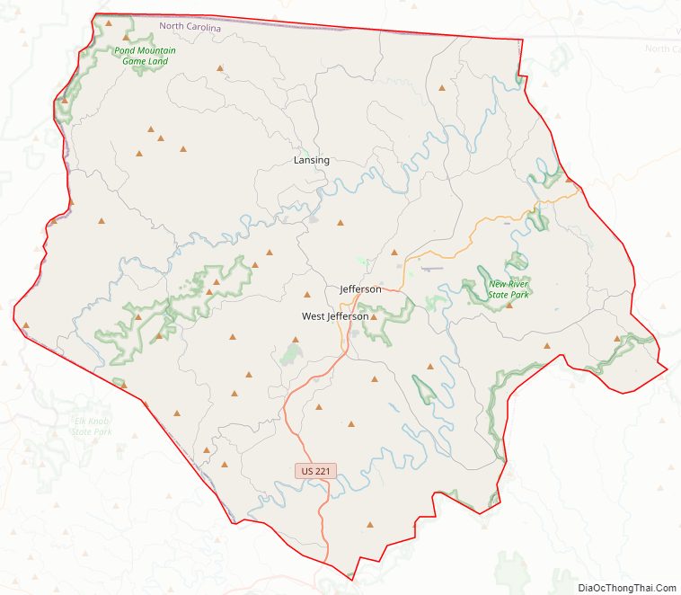
Ashe County Road Map
Geography
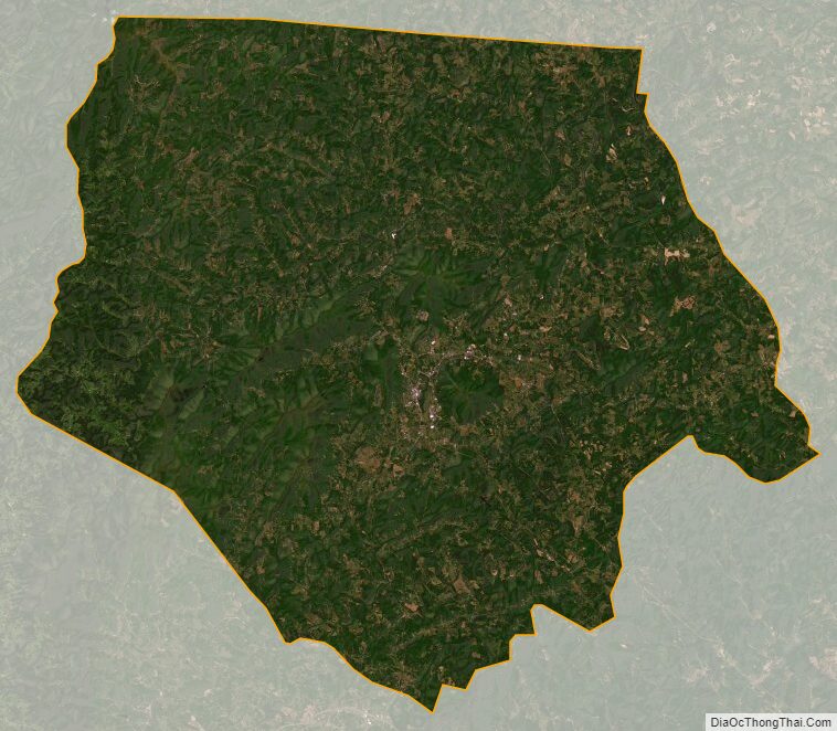
According to the U.S. Census Bureau, the county has a total area of 429 square miles (1,110 km), of which 426 square miles (1,100 km) is land and 3.1 square miles (8.0 km) (0.7%) is water.
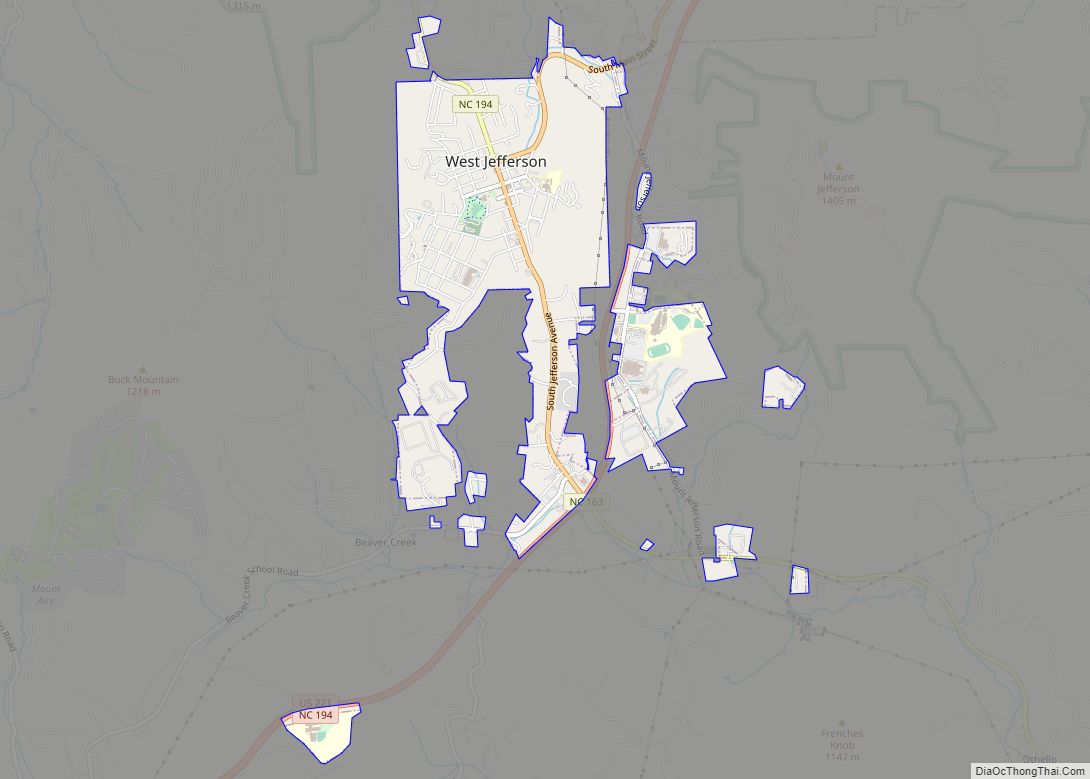
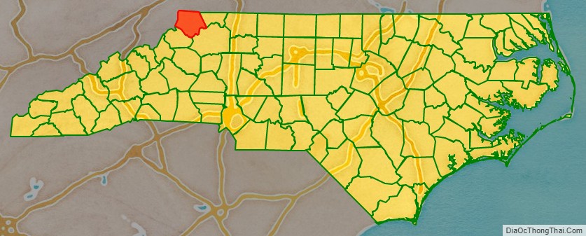
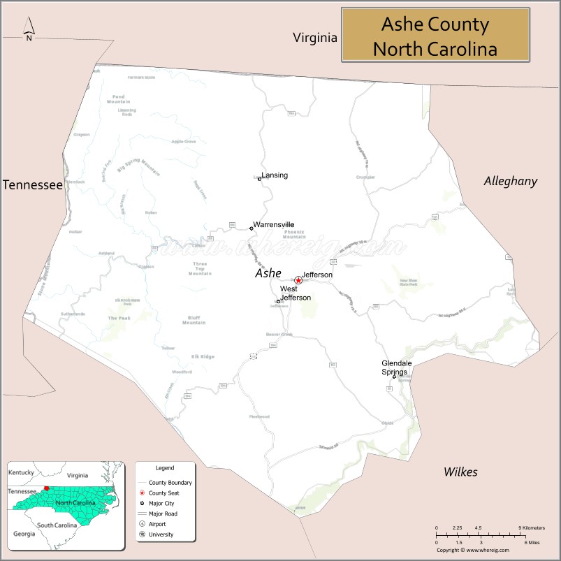
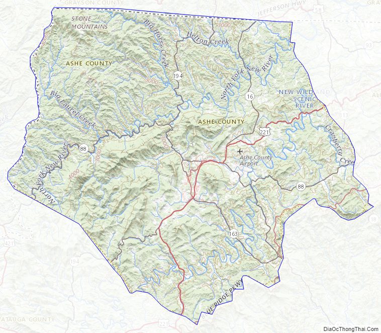
Ashe County is located in extreme northwestern North Carolina. The county is bordered by two states: Virginia on the north; and Tennessee to the west. The county is located entirely within the Appalachian Mountains region of North Carolina. Most of the county is located atop a rolling plateau that ranges from 2,500 feet (760 m) to 3,000 feet (910 m) above sea level. On the county’s southeastern border the land drops sharply to about 1,500 feet (460 m) in neighboring Wilkes County, North Carolina. Numerous mountains and hills dot the plateau. In total, five mountains in the county rise to over 5,000 feet. A prominent landmark is Mount Jefferson, which is a State Natural Area and rises to 4,665 feet (1,422 m), and towers more than 1,600 feet (490 m) above the towns of Jefferson and West Jefferson.
The county’s main river is the New River, one of the oldest rivers in the world, and one of the few major rivers in the southeastern United States to flow primarily north instead of south, east, or west. 34 creeks and streams flow into the New River in Ashe County. In 1998 the river was designated an “American Heritage River” by President Bill Clinton, and it is famed for its beautiful rural scenery, clear water, fly fishing, and kayaking and canoeing.
Isolated by mountainous terrain from the remainder of North Carolina to the east, Ashe County was described in the 19th and early 20th centuries as one of the Lost Provinces of North Carolina.
Ashe County generally is known for its mountain scenery, and the tourism industry is an important mainstay of the county’s economy. The Blue Ridge Parkway runs along the county’s southeastern border. Ashe County has historically consisted of rural farmland, with numerous cattle and poultry farms. However, cattle farming in recent decades has given way to the industry of raising Christmas trees. Many cattle farmers have switched to growing Christmas trees, and in 1997, 2007, 2008, and 2012, an Ashe County Christmas tree was selected as the official White House Christmas Tree by the National Christmas Tree Association. The tree was put on display in the Blue Room (White House). As of 2014 Ashe County grows more Christmas trees than any other county in the Eastern United States.
Climate
Ashe County, North Carolina has a considerably different climate than most of the Southeastern United States. Summers typically average around 80 °F or 26.7 °C. Temperatures rarely exceed 90 °F or 32.2 °C, but on rare occasions can reach the mid-90s as they did in 2012 – the most recent that 90+ was observed. 100 °F (37.8 °C)+ has never been observed. Summer nights are cool, and temperatures often dip to near 60 °F or 15.6 °C even in July. In winter there is snow, averaging about 30 inches or 0.76 metres for the towns of Jefferson and West Jefferson during the past thirty years. Considerably more snow falls on the peaks and the western slopes of the Appalachian Mountains. During the 2009–2010 snow season Jefferson received some 60 inches or 1.52 metres of snow. Snow has been observed as early as around October 1 and as late as around May 1. Ashe County is also a very windy location especially in winter when several times per year the Jefferson Airport sees the wind gusting 60 to 85 miles per hour (97 to 137 km/h; 52 to 74 kn). In addition it does get very cold in Ashe County. In January 2014 the low temperature dipped below 0 °F or −17.8 °C several times, the coldest being −8 °F (−22.2 °C) on January 30–31. Single digit temperatures, often just above zero Fahrenheit, are observed most winter seasons on occasion. The average winter high is in the 40s with an average low near 20 °F or −6.7 °C. Ashe County often feels more like the northeastern United States when wind chill factors are also observed.
National protected areas
- Blue Ridge Parkway (part)
- Cherokee National Forest (part)
State and local protected areas
- Mount Jefferson State Natural Area
- New River State Park (part)
- Phoenix Lake, Ashe County Park
- Pond Mountain Game Lands
- Thurmond Chatham Wildlife Management Area (part)
- West Jefferson Municipal Park
Major water bodies
- Big Horse Creek
- Brush Creek
- Cranberry Creek
- Helton Creek
- Hoskin Fork
- Grassy Creek (Elkin Creek tributary)
- Little Horse Creek
- Little Phoenix Creek
- Long Hope Creek
- Mill Creek
- New River (Kanawha River tributary)
- North Fork New River
- Obids Creek
- Roundabout Creek
- South Fork New River
Adjacent counties
- Grayson County, Virginia – north
- Alleghany County – east
- Wilkes County – southeast
- Watauga County – southwest
- Johnson County, Tennessee – west
Major highways
- US 221
- US 221 Bus.
- NC 16
- NC 88
- NC 163
- NC 194
Major infrastructure
- Ashe County Airport
Ashe County Topographic Map
Ashe County Satellite Map
Ashe County Outline Map