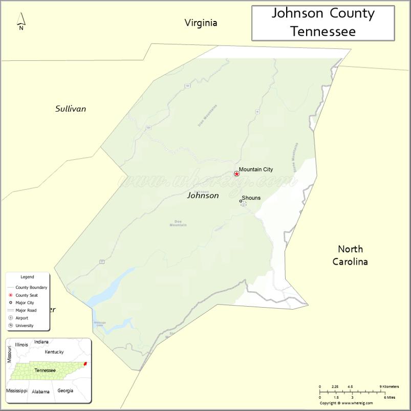
Johnson County is a county located in the U.S. state of Tennessee. As of the 2020 census, the population was 17,948. Its county seat is Mountain City. It is the state’s northeasternmost county, sharing borders with Virginia and North Carolina.
| Name: | Johnson County |
|---|---|
| FIPS code: | 47-091 |
| State: | Tennessee |
| Founded: | 1836 |
| Named for: | Thomas Johnson, early settler |
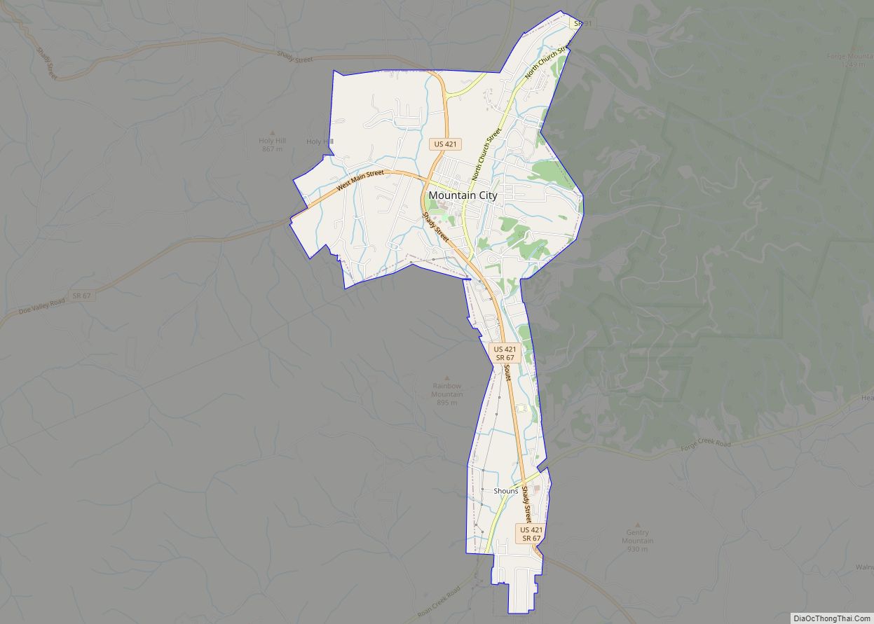
| Seat: | Mountain City |
| Largest town: | Mountain City |
| Total Area: | 303 sq mi (780 km²) |
| Land Area: | 298 sq mi (770 km²) |
| Total Population: | 17,948 |
| Population Density: | 61/sq mi (24/km²) |
| Time zone: | UTC−5 (Eastern) |
| Summer Time Zone (DST): | UTC−4 (EDT) |
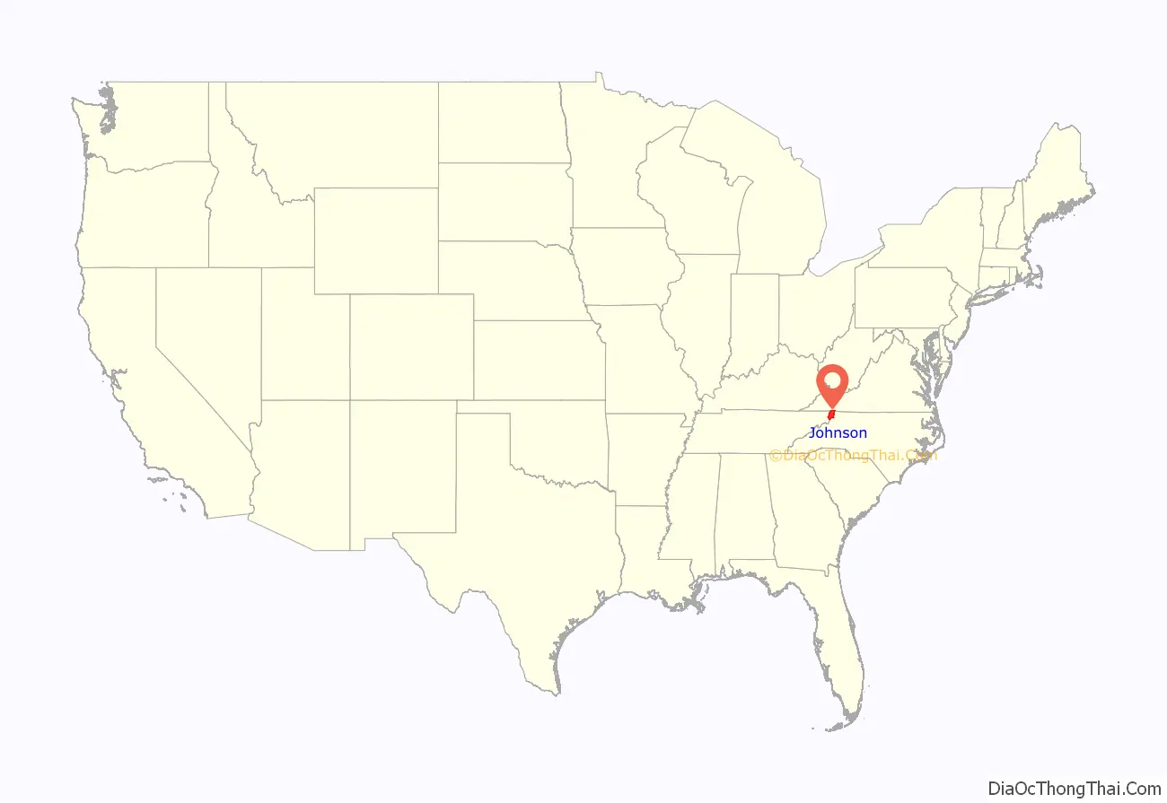
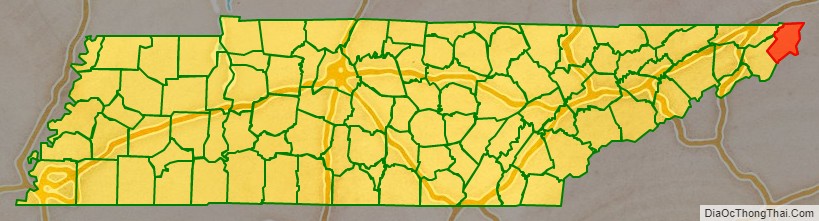
Johnson County location map. Where is Johnson County?
History
Johnson County was created in 1836 from parts of Carter County. This followed several years of bickering over the location of Carter County’s seat, with residents of what is now Johnson County arguing that travel to Elizabethton was too lengthy and difficult. When their petition to move the seat to a more central location was rejected, they petitioned the state legislature for the creation of a new county. The new county was named after Thomas Johnson, an early settler. The county seat was initially named “Taylorsville” in honor of Colonel James P. Taylor (it was changed to “Mountain City” in the 1880s).
Most Johnson Countians supported the Union during the Civil War. The county’s residents rejected secession by a margin of 788 to 111 in Tennessee’s secession referendum on June 8, 1861. The county sent a sizable delegation to the Greeneville session of the pro-Union East Tennessee Convention in June 1861.
Due in large part to the county’s remoteness, the railroads did not reach Johnson until the early 20th century. The arrival of the railroads during this period aided the development of the timber and manganese mining industries.
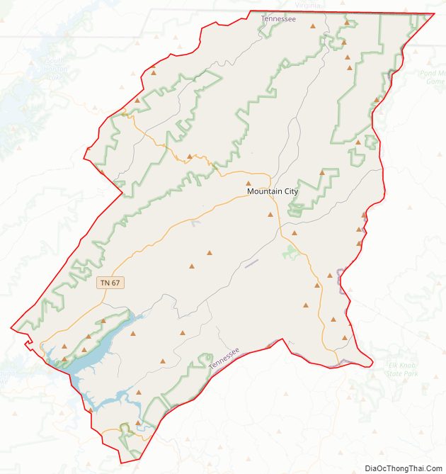
Johnson County Road Map
Geography
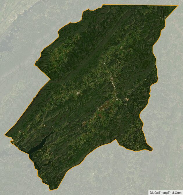
According to the U.S. Census Bureau, the county has a total area of 303 square miles (780 km), of which 298 square miles (770 km) is land and 4.2 square miles (11 km) (1.4%) is water.
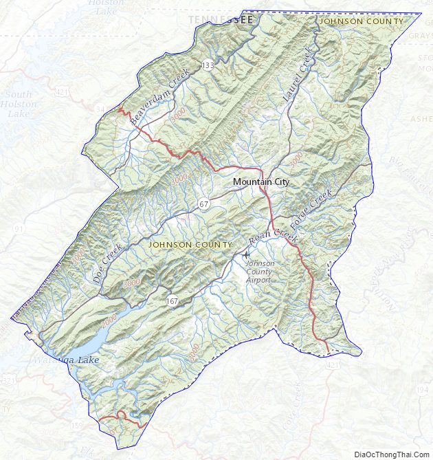
Situated entirely within the Blue Ridge Mountains, Johnson County is relatively rugged and hilly. The county’s boundary with Sullivan County to the northwest is defined as the ridgeline of Holston Mountain, while the Iron Mountains provide the county’s boundary with Carter County to the southwest. Snake Mountain, at 5,574 feet (1,699 m), is the county’s highest point.
High elevation
In terms of average elevation, Johnson County is one of the highest counties (if not the highest) in Tennessee. The county is home to the two highest communities in the state: Trade, at 3,133 feet (955 m), and Shady Valley, at 2,785 feet (849 m). Mountain City is the highest incorporated city in Tennessee, at 2,418 feet (737 m). The highest place in Johnson County is Snake Mountain’s lower peak, (near the North Carolina state line), at 5,518 feet (1,682 m). The lowest point in the county is Watauga Lake, at an elevation of 1,959 feet (597 m).
Lakes
- Watauga Lake
Adjacent counties
- Washington County, Virginia (north)
- Grayson County, Virginia (northeast)
- Ashe County, North Carolina (east)
- Watauga County, North Carolina (southeast)
- Avery County, North Carolina (south)
- Carter County (southwest)
- Sullivan County (west)
National protected areas
- Appalachian Trail (part)
- Cherokee National Forest (part)
Johnson County Topographic Map
Johnson County Satellite Map
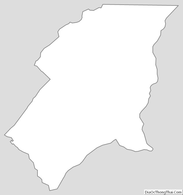
Johnson County Outline Map