| Name: | Charlotte city |
|---|---|
| LSAD Code: | 25 |
| LSAD Description: | city (suffix) |
| State: | North Carolina |
| County: | Mecklenburg County |
| Incorporated: | December 3, 1768 |
| Elevation: | 761 ft (232 m) |
| Land Area: | 310.02 sq mi (802.94 km²) |
| Water Area: | 1.98 sq mi (5.14 km²) |
| Population Density: | 2,821.06/sq mi (1,089.22/km²) |
| ZIP code: | 282XX 28201-28237, 28240-28247, 28250, 28253-28256, 28258, 28260-28262, 28265-28266, 28269-28275, 28277-28278, 28280-28290, 28296-28297, 28299 |
| FIPS code: | 3712000 |
| Website: | charlottenc.gov |
Are you ready to explore the Queen City? Let’s dive in!
Download Free Maps of Charlotte, North Carolina
If you need a map of Charlotte, North Carolina to plan your trip, you’ve come to the right place. Here, we have several maps of the city to help you explore and find your way around.
The city of Charlotte is located in the Piedmont Triad region of North Carolina. It is the largest city in the state with a population of over 850,000. The city has a plethora of attractions and things to do, making it a perfect fit for families. From the Motor Speedway and NASCAR Hall of Fame to amusement parks like Carowinds, Charlotte offers something for everyone.
We have several maps of the city available for you to download and take with you on your journey. These maps provide a detailed overview of the city, including roads, landmarks, and points of interest. So, let’s take a look at the maps of Charlotte, North Carolina.
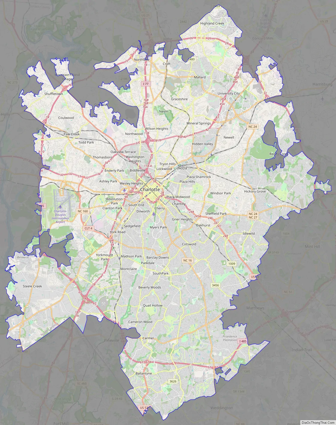
Online Interactive Map
Click on ![]() to view map in "full screen" mode.
to view map in "full screen" mode.
If you live in Charlotte or are just visiting, you know how important it is to be able to navigate the city and get around. This interactive Charlotte map will help you get around Charlotte, NC. No matter where you are in the city, you can find information about places of interest, transportation, and parking that are available in the city.
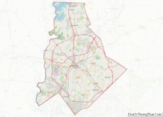
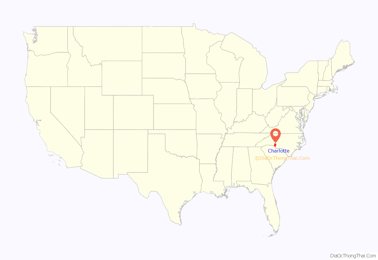
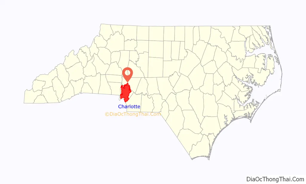
Charlotte location map. Where is Charlotte city?
History
Early history through American Revolution
The Catawba Native Americans were the first known historic tribe to settle Mecklenburg County (in the Charlotte area) and were first recorded around 1567 in Spanish records. By 1759 half the Catawba tribe had died from smallpox, which was endemic among European colonists because the Catawba had not acquired immunity to the new disease. At the time of their largest population, Catawba people numbered 10,000, but by 1826 their total population had dropped to 110.
The city of Charlotte was developed first by a wave of migration of Scots-Irish Presbyterians, or Ulster-Scot settlers from Northern Ireland, who dominated the culture of the Southern Piedmont Region. They made up the principal founding population in the backcountry. German immigrants also settled in the area before the American Revolutionary War, but in much smaller numbers. They still contributed greatly to the early foundations of the region.
Mecklenburg County was initially part of Bath County (1696 to 1729) of the New Hanover Precinct, which became New Hanover County in 1729. The western portion of New Hanover split into Bladen County in 1734, and its western portion split into Anson County in 1750. Mecklenburg County was formed from Anson County in 1762. Further apportionment was made in 1792, after the American Revolutionary War, with Cabarrus County formed from Mecklenburg.
In 1842, Union County formed from Mecklenburg’s southeastern portion and a western portion of Anson County. These areas were all part of one of the original six judicial/military districts of North Carolina known as the Salisbury District.
The area that is now Charlotte was first settled by European colonists around 1755 when Thomas Spratt and his family settled near what is now the Elizabeth neighborhood. Thomas Polk (great-uncle of U.S. President James K. Polk), who later married Thomas Spratt’s daughter, built his house by the intersection of two Native American trading paths between the Yadkin and Catawba rivers. One path ran north–south and was part of the Great Wagon Road; the second path ran east–west along what is now Trade Street.
Nicknamed the “Queen City”, like its county a few years earlier, Charlotte was named in honor of German princess Charlotte of Mecklenburg-Strelitz, who had become the queen consort of Great Britain and Ireland in 1761, seven years before the town’s incorporation. A second nickname derives from the American Revolutionary War, when British commander General Charles Cornwallis, 1st Marquess Cornwallis occupied the city but was driven out by hostile residents. He wrote that Charlotte was “a hornet’s nest of rebellion”, leading to the nickname “The Hornet’s Nest”.
Within decades of Polk’s settling, the area grew to become the Town of Charlotte, incorporated in 1768. Though chartered as Charlotte, the name appears as a form of “Charlottesburgh” on many maps until around 1800. A form of “Charlottetown” also appears on maps of British origin depicting General Cornwallis’ route of invasion. The crossroads in Piedmont became the heart of Uptown Charlotte. In 1770, surveyors marked the streets in a grid pattern for future development. The east–west trading path became Trade Street, and the Great Wagon Road became Tryon Street, in honor of William Tryon, a royal governor of colonial North Carolina. The intersection of Trade and Tryon—commonly known today as “Trade & Tryon”, or simply “The Square”—is more properly called “Independence Square”.
While surveying the boundary between the Carolinas in 1772, William Moultrie stopped in Charlotte, whose five or six houses were “very ordinary built of logs”.
Local leaders came together in 1775 and signed the Mecklenburg Resolves, more popularly known as the Mecklenburg Declaration of Independence. While not a true declaration of independence from British rule, it is among the first such declarations that eventually led to the American Revolution. May 20, the traditional date of the signing of the declaration, is celebrated annually in Charlotte as “MecDec”, with musket and cannon fire by reenactors in Independence Square. North Carolina’s state flag and state seal also bear the date.
Late 18th century through 19th century
Charlotte is traditionally considered the home of Southern Presbyterianism, but in the 19th century, numerous churches, including Presbyterian, Baptist, Methodist, Episcopal, Lutheran, and Roman Catholic formed, eventually giving Charlotte the nickname, “The City of Churches”.
In 1799, in nearby Cabarrus County, 12-year-old Conrad Reed found a 17- pound rock, which his family used as a doorstop. Three years later, a jeweler determined it was nearly solid gold, paying the family a paltry $3.50. The first documented gold find in the United States of any consequence set off the nation’s first gold rush. Many veins of gold were found in the area throughout the 19th and early 20th centuries, leading to the 1837 founding of the Charlotte Mint. North Carolina was the chief producer of gold in the United States, until the Sierra Nevada find in 1848, although the volume mined in the Charlotte area was dwarfed by subsequent rushes.
Some groups still pan for gold occasionally in local streams and creeks. The Reed Gold Mine operated until 1912. The Charlotte Mint was active until 1861, when Confederate forces seized it at the outbreak of the Civil War. The mint was not reopened at the war’s end, but the building, albeit in a different location, now houses the Mint Museum of Art.
The city’s first boom came after the Civil War, as Charlotte became a cotton processing center and railroad hub. By the 1880s, Charlotte sat astride the Southern Railway mainline from Atlanta to Washington, D.C. Farmers from miles around would bring cotton to the railroad platform in Uptown. Local promotors began building textile factories, starting with the 1881 Charlotte Cotton Mill that still stands at Graham and 5th streets.
Charlotte’s city population at the 1890 census grew to 11,557.
Early 20th century to present
In 1910, Charlotte surpassed Wilmington to become North Carolina’s largest city with 34,014 residents.
The population grew again during World War I, when the U.S. government established Camp Greene, north of present-day Wilkinson Boulevard. The camp supported 40,000 soldiers, with many troops and suppliers staying after the war, launching urbanization that eventually overtook older cities along the Piedmont Crescent. In the 1920 census, Charlotte fell to being the state’s second largest city, Winston-Salem with 48,395 people, had two thousand more people than Charlotte. Charlotte would pass Winston-Salem in population by the 1930 census, and has remained North Carolina’s largest city since.
Until 1958, the Seaboard Air Line Railroad operated a daily passenger train from its own station (which had opened in 1896) to Wilmington.
The city’s modern-day banking industry achieved prominence in the 1970s and 1980s, largely under the leadership of financier Hugh McColl. McColl transformed North Carolina National Bank (NCNB) into a formidable national bank that through aggressive acquisitions eventually merged with BankAmerica to become Bank of America. First Union, later Wachovia in 2001, experienced similar growth before it was acquired by San Francisco-based Wells Fargo in 2008. Measured by control of assets, Charlotte became the second largest banking headquarters in the United States after New York City.
On September 22, 1989, the city was hit by Hurricane Hugo. With sustained winds of 69 mph (111 km/h) and gusts of 87 mph (140 km/h), Hugo caused massive property damage, destroyed 80,000 trees, and knocked out electrical power to most of the population. Residents were without power for weeks, schools were closed for a week or more, and the cleanup took months. The city was caught unprepared; Charlotte is 200 miles (320 km) inland, and residents from coastal areas in both Carolinas often wait out hurricanes in Charlotte.
In December 2002, Charlotte and much of central North Carolina were hit by an ice storm that resulted in more than 1.3 million people losing power. During an abnormally cold December, many were without power for weeks. Many of the city’s Bradford pear trees split apart under the weight of the ice.
In August 2015 and September 2016, the city experienced several days of protests related to the police shootings of Jonathan Ferrell and Keith Scott.
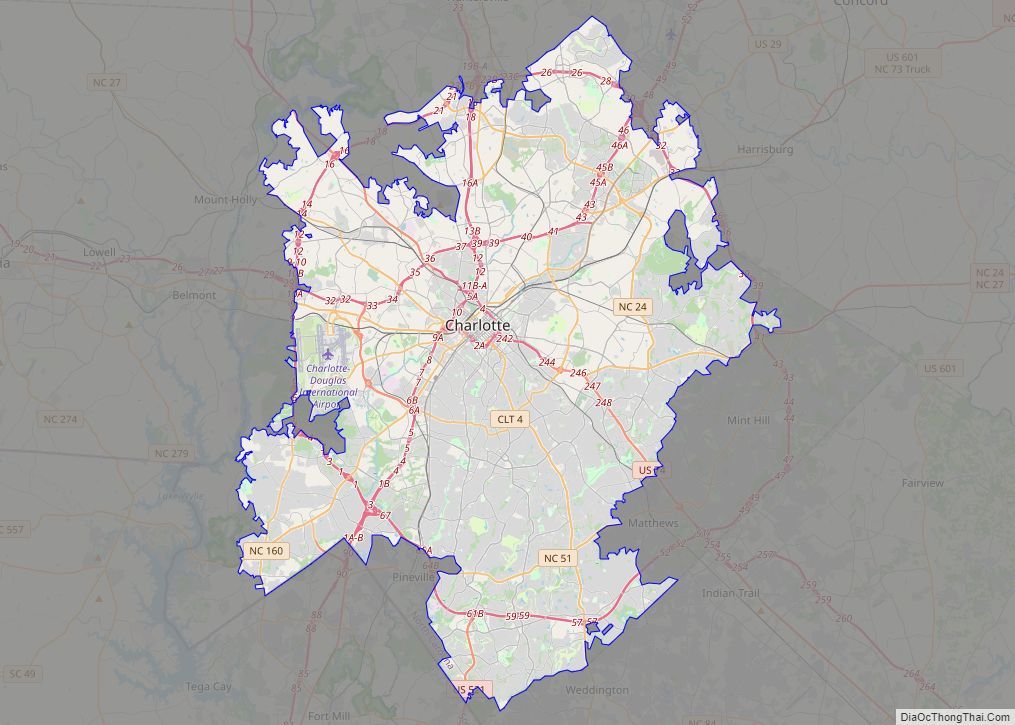
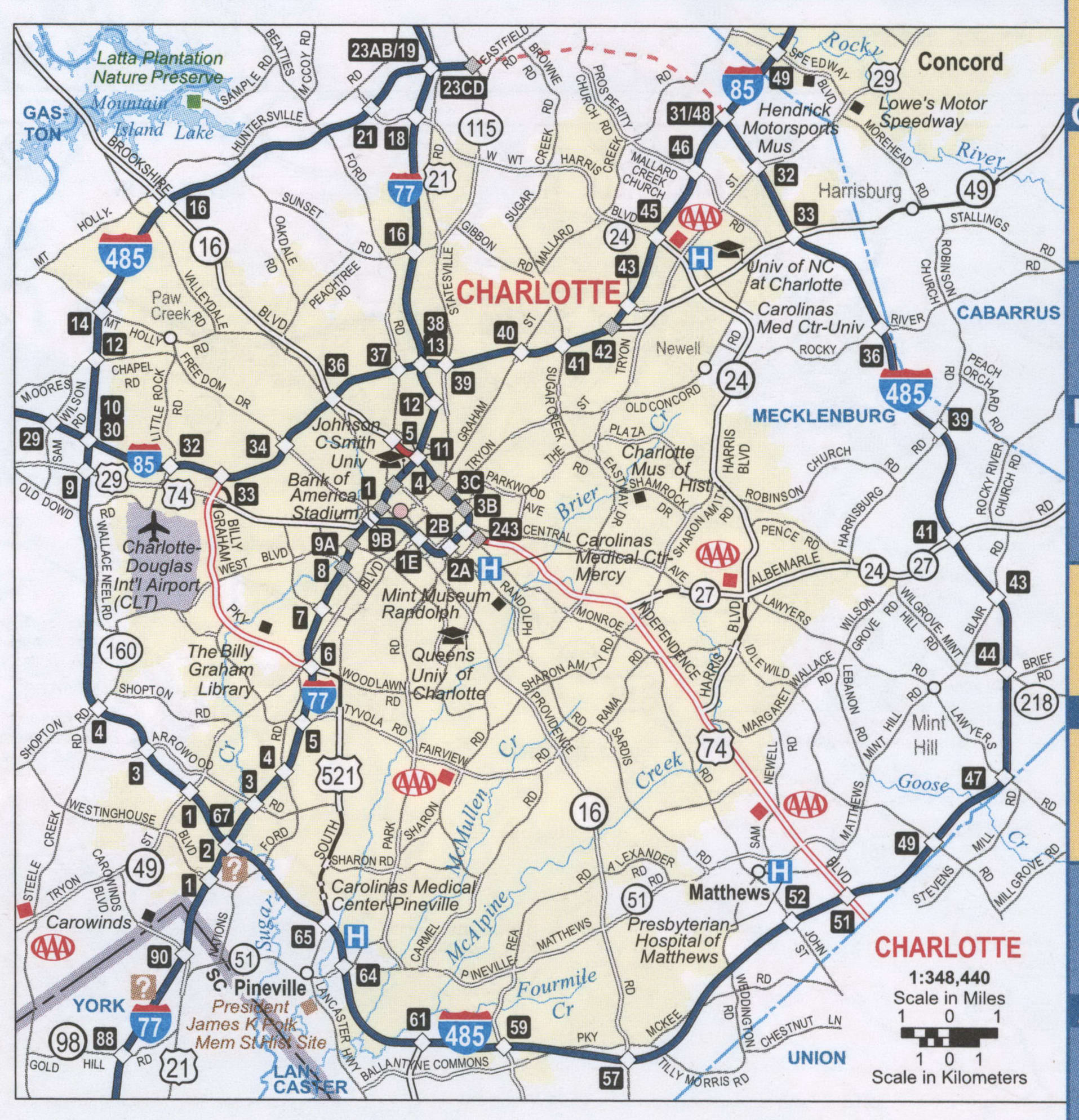
Charlotte Road Map
A map of Charlotte is a great tool for exploring, locating places, and understanding where you are. Whether you’re new in town or a local, we all love to explore places on a map, and Charlotte has much to explore! It includes interstates such as I-277, I-485, I-495, I-77, and I-85, as well as US highways such as 16, 21, 24, 27, 29, 49, 51, 74, 115, 160, 277, 485, 495, 521, 1004, 1126, 1128, 1138, 1143, 1784, 2019, 2108, 2110, Independence Expy, and Lancaster Hwy. Additionally, the map includes parkways/expressways like Billy Graham Pky, Independence Expy, and Josh Birmingham Pky, as well as major roads like 3rd St, 4th St, 5th St, 7th St, Albemarle Rd, Arrowood Rd, Bellhaven Blvd, Brevard St, Brookshire Blvd, Brown Grier Rd, Caldwell St, Church St, Clanton Rd, Clarkson St, College St, Dalton Ave, Dixie Rd, East Blvd, Freedom Dr, Graham St, Independence Blvd, Johnston Rd, Mcdowell St, Mint St, Morehead St, Mount Holly Rd, Nations Ford Rd, Oakdale Rd, Old Statesville Rd, Peachtree Rd, Pineville Matthews Rd, Providence Rd, Rozzelles Ferry Rd, South Blvd, Statesville Rd, Steele Creek Rd, Sunset Rd, Trade St, Tryon St, University City Blvd, Walnut Ave, West Blvd, Westinghouse Blvd, Wilgrove Mint Hill Rd, Wilkinson Blvd, Woodlawn Rd, Wt Harris Blvd, and York Rd. So you’ll never get lost!
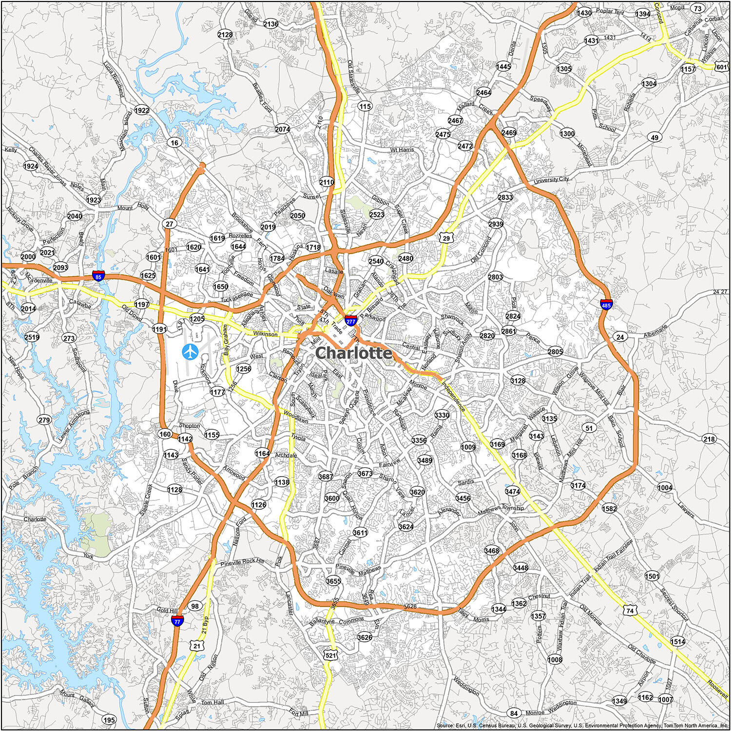
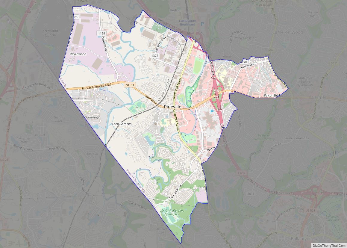
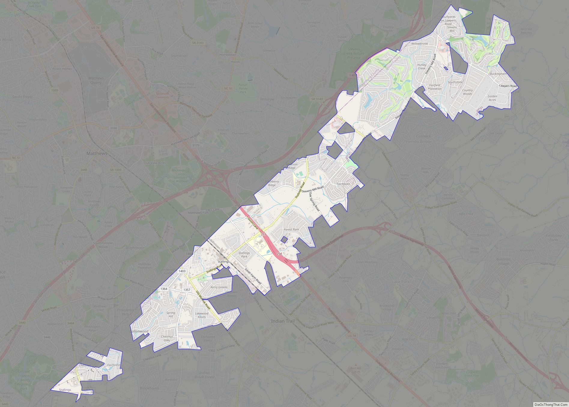
Are you looking for an up-to-date map of the Charlotte area? Look no further! Our printable map of the Charlotte area shows all the parks, towns, and neighborhoods around Charlotte, North Carolina. Whether you’re a local looking to rediscover the area or a visitor looking to explore, this map is the perfect resource. Here are the cities, towns, villages, and census-designated places in the Charlotte area:
- Cities: Belmont, Charlotte, Concord, Gastonia, Kannapolis, Lowell, Monroe, Mount Holly, Rock Hill, Tega Cay
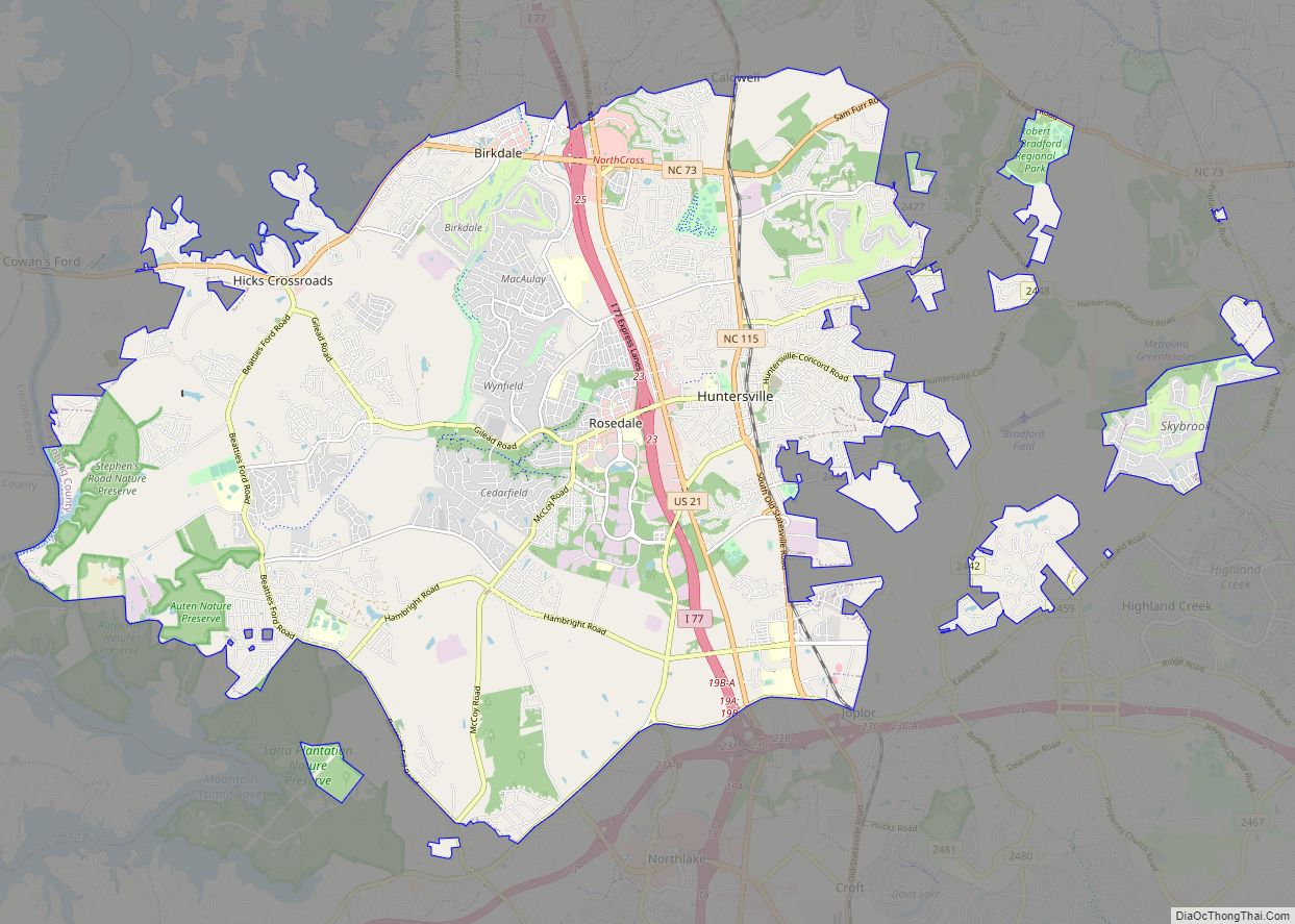
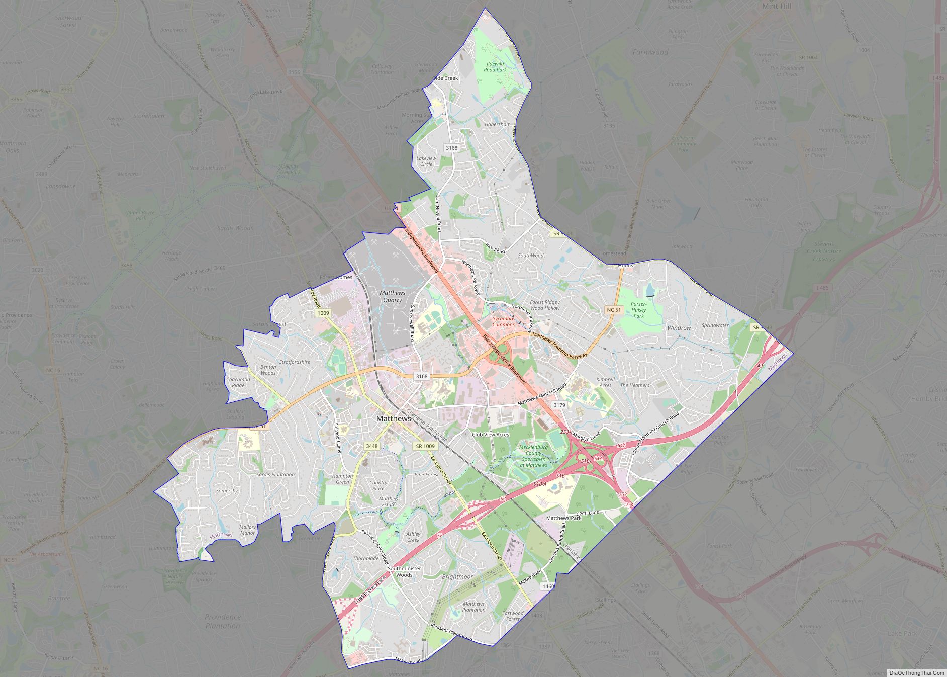
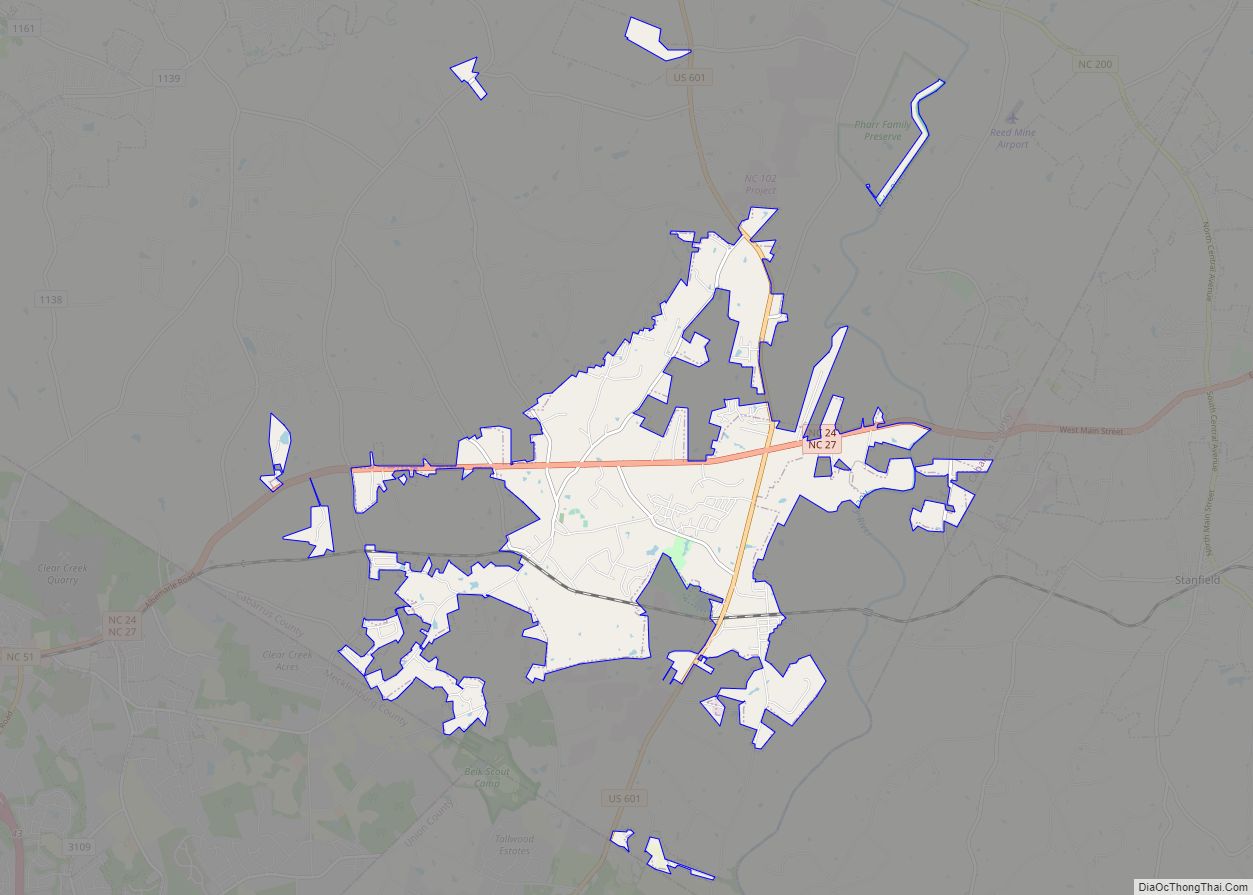
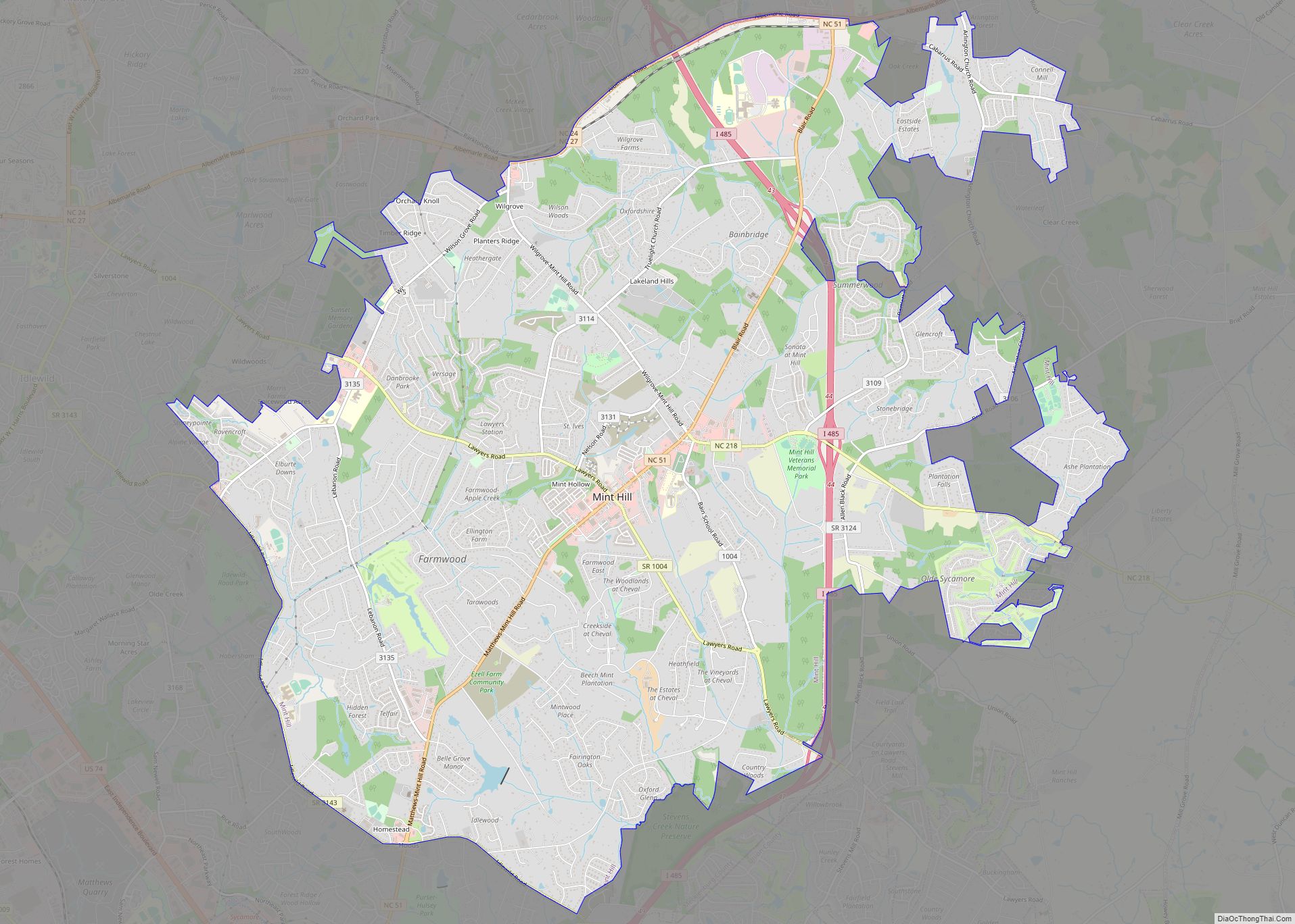
- Towns: Cramerton, Fairview, Fort Mill, Harrisburg, Hemby Bridge, Huntersville, Indian Trail, Matthews, McAdenville, Midland, Mint Hill, Pineville, Stallings, Stanley, Unionville, Weddington
- Villages: Lake Park, Marvin, Wesley Chapel
- Census-designated place (CDP): India Hook, Lake Wylie, Lowesville, Newport, Riverview
If you’re looking to rediscover the Charlotte area, our printable map is the perfect resource. Explore everything the area has to offer with one convenient map.
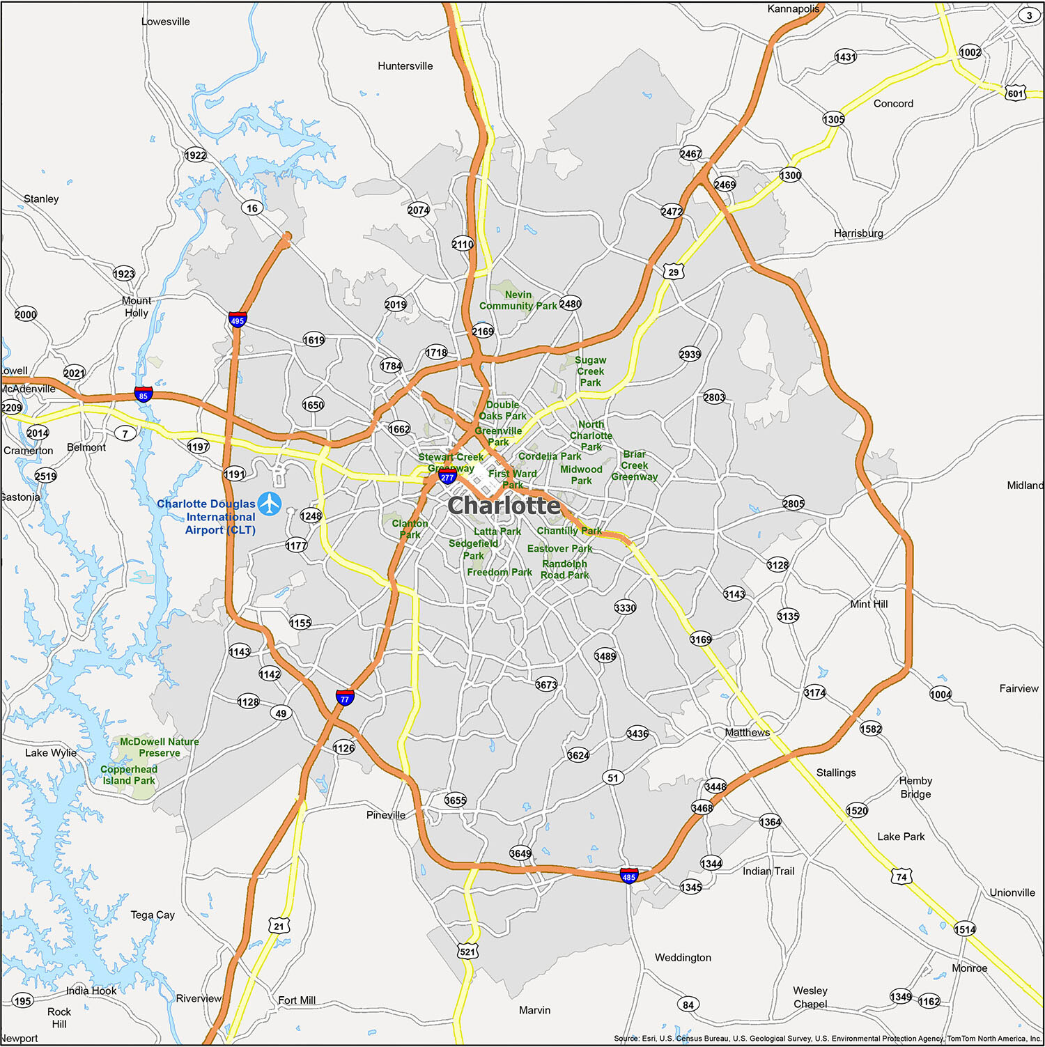
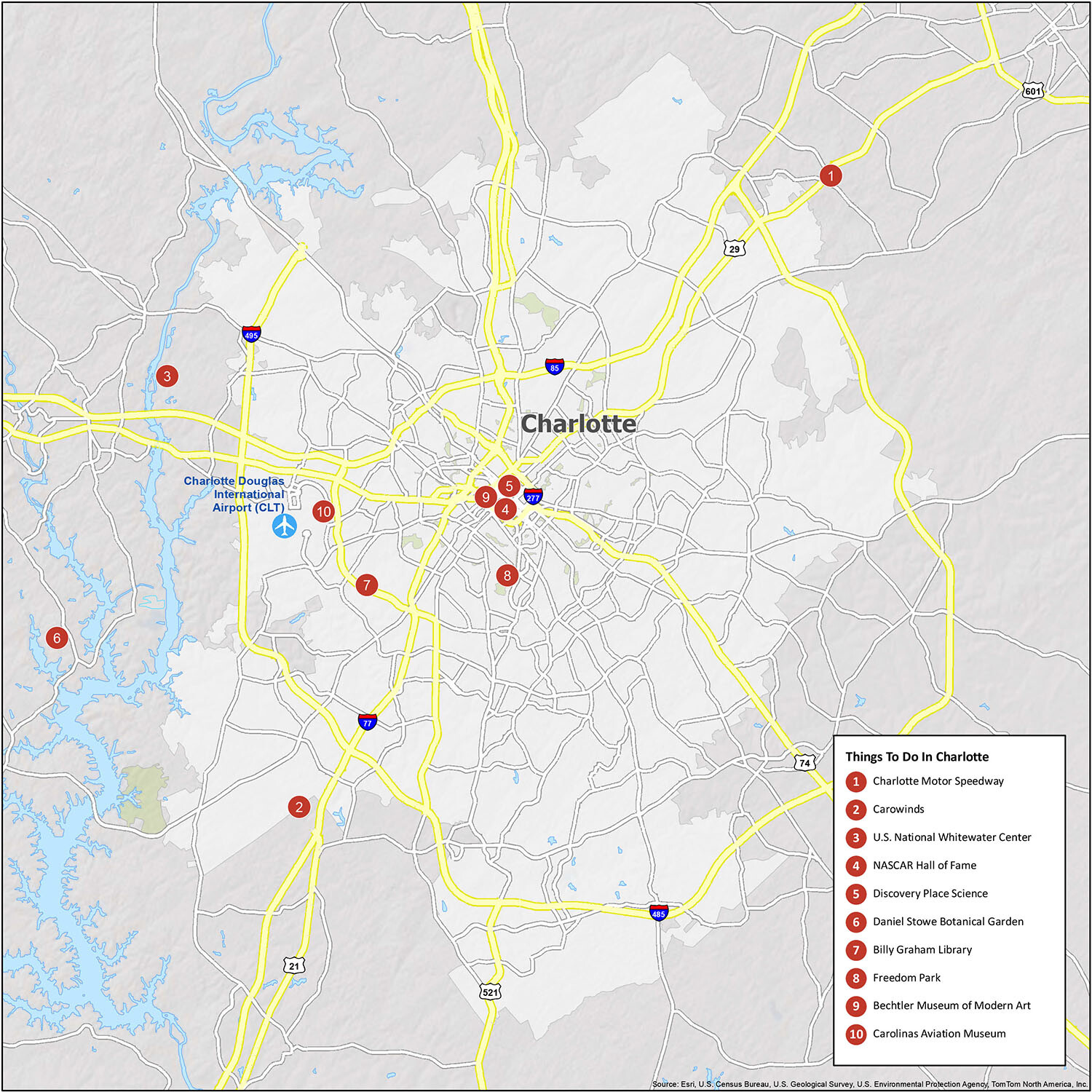
10 things to do in Charlotte city
If you’re looking to explore the city of Charlotte, NC, then this map is a great way to start. It gives you an overview of the city and its attractions, including some of the best places to visit. From Charlotte Motor Speedway and the NASCAR Hall of Fame to Carowinds, the U.S. National Whitewater Center, and Discovery Place Science, there’s something for everyone. Plus, the Daniel Stowe Botanical Garden, Billy Graham Library, Freedom Park, Bechtler Museum of Modern Art, and Carolinas Aviation Museum all make for interesting visits.
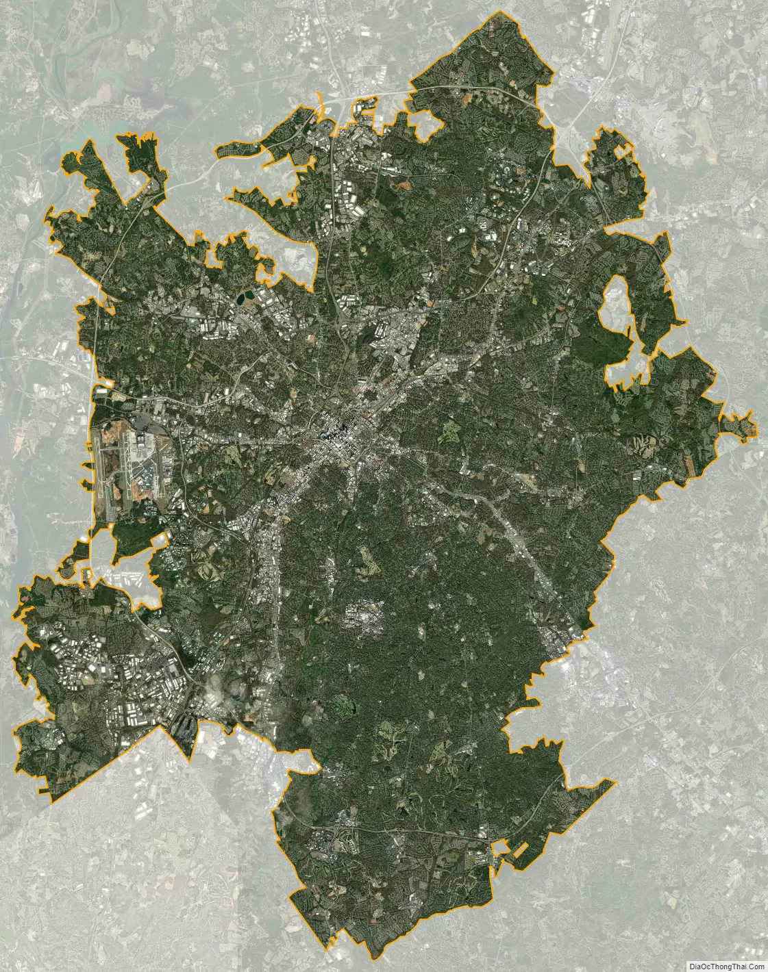
Charlotte city Satellite Map
Geography
According to the United States Census Bureau, the city has a total area of 308.6 square miles (799 km), of which 306.6 square miles (794 km) is land and 2.0 square miles (5.2 km) is water. Charlotte is the twenty-sixth-most expansive city in the United States and lies at an elevation of 751 feet (229 m). Charlotte constitutes most of Mecklenburg County in the Carolina Piedmont. Uptown Charlotte sits atop a long rise between two creeks, Sugar Creek and Irwin Creek, and was built on the gunnies of the St. Catherine’s and Rudisill gold mines. Charlotte is 25 miles (40 km) southwest of Concord, 26 miles (42 km) northeast of Rock Hill, South Carolina, 83 miles (134 km) southwest of Greensboro, 135 miles (217 km) west of Fayetteville, and 165 miles (266 km) southwest of Raleigh, the state capitol.
Though the Catawba River and its lakes lie several miles west, there are no significant bodies of water or other geological features near the city center. Consequently, development has neither been constrained nor helped by waterways or ports that have contributed to many cities of similar size. The lack of these obstructions has contributed to Charlotte’s growth as a highway, rail, and air transportation hub.
Neighborhoods
Charlotte has 199 neighborhoods radiating in all directions from Uptown. Biddleville, the primary historic center of Charlotte’s African American community, is west of Uptown, starting at the Johnson C. Smith University campus and extending to the airport. East of The Plaza and north of Central Avenue, Plaza-Midwood is known for its international population, including Eastern Europeans, Greeks, Middle-Easterners, and Hispanics. North Tryon and the Sugar Creek area include several Asian American communities. NoDa (North Davidson), north of Uptown, is an emerging center for arts and entertainment. Myers Park, Dilworth, and Eastover are home to some of Charlotte’s most affluent, oldest and largest houses, on tree-lined boulevards, with Freedom Park nearby.
The SouthPark area offers shopping, dining, and multifamily housing. Far South Boulevard is home to a large Hispanic community. Many students, researchers, and affiliated professionals live near UNC Charlotte in the northeast area known as University City.
The large area known as Southeast Charlotte is home to many golf communities, luxury developments, churches, the Jewish community center, and private schools. As undeveloped land within Mecklenburg has become scarce, many of these communities have expanded into Weddington and Waxhaw in Union County. Ballantyne, in the south of Charlotte, and nearly every area on the I‑485 perimeter, has experienced rapid growth over the past ten years. The Steele Creek neighborhood which is primarily in Mecklenburg county is located within minutes near Uptown Charlotte.
Since the 1980s in particular, Uptown Charlotte has undergone massive construction of buildings, housing Bank of America, Wells Fargo, Hearst Corporation, and Duke Energy, several hotels, and multiple condominium developments.
Parks and green space
The 120‑acre Park Road Park is a prominent landmark near the SouthPark area. Park Road Park features eight basketball courts, two horseshoe pits, six baseball fields, five picnic shelters, volleyball courts, playgrounds, trails, tennis courts, and an eleven-acre lake. The Charlotte-Mecklenburg Parks & Recreation Department operates 36 tennis facilities and the 12 lighted tennis courts at the park. In September 2013, the 5.4 acre Romare Bearden Park opened to the public.
The urban section of Little Sugar Creek Greenway was completed in 2012. Inspired in part by the San Antonio River Walk, and integral to Charlotte’s extensive urban park system, it is “a huge milestone” according to Gwen Cook, greenway planner for Mecklenburg County Park and Recreation. However, the Little Sugar Creek Greenway bears no relation to the San Antonio River Walk. The Little Sugar Creek Greenway is prone to flooding during thunderstorms and periods of heavy rain. Creation of Little Sugar Creek Greenway cost $43 million and was controversial because it required the forced acquisition of several established local businesses.
The city of Charlotte and Mecklenburg County began purchasing flood-prone homes in the 1990s. Voluntary buyouts of 700 households have created around 200 acres of open land that can flood safely, thereby saving an estimated $28 million in flood damage and emergency rescues.
McAlpine Creek Park and integrated McAlpine Creek Greenway constructed in 1978 was the first greenway built in the western piedmont of North Carolina.
Climate
Like much of the Piedmont region of the southeastern United States, Charlotte has a humid subtropical climate (Köppen Cfa), with four distinct seasons; the city itself is part of USDA hardiness zone 8a, transitioning to 7b in the suburbs in all directions except the south. The following narrative reflects 1991-2020 climate data. Winters are short and fairly mild, with a normal January daily mean temperature of 42.1 °F (5.6 °C). On occasion the temperature can fall below 20 °F (−6.7 °C) but Charlotte also enjoys multiple warm winter days in excess of 65 °F (18.3 °C). On average, there are 59 nights per year that drop to or below freezing, and only 1.5 days that fail to rise above freezing. Precipitation is evenly distributed through the year; only August stands out as a slightly wetter month, averaging 4.35 inches of rainfall. Summers are hot and humid, with a normal July daily mean temperature of 80.1 °F (26.7 °C). Hot and humid days can arrive as early as May and last through the end of September. There is an average of 44 days per year with highs at or above 90 °F (32 °C). Official record temperatures range from 104 °F (40 °C) recorded six times, most recently from June 29 to July 1, 2012, down to −5 °F (−21 °C) recorded on January 21, 1985, the most recent of three occasions. The record cold daily maximum is 14 °F (−10 °C) on February 12 and 13, 1899, and the record warm daily minimum is 82 °F (28 °C) on August 13, 1881. The average window for freezing temperatures is November 5 through March 30, allowing a growing season of 220 days.
Charlotte is directly in the path of subtropical moisture from the Gulf of Mexico as it heads up the eastern seaboard, thus the city receives ample precipitation throughout the year but also many clear, sunny days; precipitation is generally less frequent in autumn than in spring. On average, Charlotte receives 43.60 inches (1,110 mm) of precipitation annually, evenly distributed throughout the year. Annual precipitation has historically ranged from 26.23 in (666 mm) in 2001 to 68.44 in (1,738 mm) in 1884. There is an average of 3.5 inches (8.9 cm) of snow, mainly in January and February and rarely December or March, with more frequent ice storms and sleet mixed in with rain; seasonal snowfall has historically ranged from trace amounts in 2011–12 to 22.6 in (57 cm) in 1959–60. Snow and ice storms can have a major impact on the area, as they often pull tree limbs down onto power lines and make driving hazardous. Snow has been recorded a small number of times in April, most recently, April 2, 2019.
As of 2020, the Charlotte metropolitan area as a whole is noted for having one of the worst weather radar gaps among any major U.S. East Coast city, with little to no coverage in a roughly quadrilateral area spanning Concord, Salisbury and much of Statesville. As the nearest NWS-owned NEXRAD is located in Greer, South Carolina, more than 80 mi (130 km) to the west-southwest of Charlotte, this deficit is particularly problematic during severe thunderstorm or tornado episodes. The current lowest angle of the radar, based in Greer, is quite far above the surface over Charlotte, so the velocities measurement for detecting rotations cannot be below mid-level in potential tornado-forming storms and thus cannot indicate whether said rotation extends closer to the ground (below 5,000 ft (1,500 m)).
See also
Map of North Carolina State and its subdivision:- Alamance
- Alexander
- Alleghany
- Anson
- Ashe
- Avery
- Beaufort
- Bertie
- Bladen
- Brunswick
- Buncombe
- Burke
- Cabarrus
- Caldwell
- Camden
- Carteret
- Caswell
- Catawba
- Chatham
- Cherokee
- Chowan
- Clay
- Cleveland
- Columbus
- Craven
- Cumberland
- Currituck
- Dare
- Davidson
- Davie
- Duplin
- Durham
- Edgecombe
- Forsyth
- Franklin
- Gaston
- Gates
- Graham
- Granville
- Greene
- Guilford
- Halifax
- Harnett
- Haywood
- Henderson
- Hertford
- Hoke
- Hyde
- Iredell
- Jackson
- Johnston
- Jones
- Lee
- Lenoir
- Lincoln
- Macon
- Madison
- Martin
- McDowell
- Mecklenburg
- Mitchell
- Montgomery
- Moore
- Nash
- New Hanover
- Northampton
- Onslow
- Orange
- Pamlico
- Pasquotank
- Pender
- Perquimans
- Person
- Pitt
- Polk
- Randolph
- Richmond
- Robeson
- Rockingham
- Rowan
- Rutherford
- Sampson
- Scotland
- Stanly
- Stokes
- Surry
- Swain
- Transylvania
- Tyrrell
- Union
- Vance
- Wake
- Warren
- Washington
- Watauga
- Wayne
- Wilkes
- Wilson
- Yadkin
- Yancey
- Alabama
- Alaska
- Arizona
- Arkansas
- California
- Colorado
- Connecticut
- Delaware
- District of Columbia
- Florida
- Georgia
- Hawaii
- Idaho
- Illinois
- Indiana
- Iowa
- Kansas
- Kentucky
- Louisiana
- Maine
- Maryland
- Massachusetts
- Michigan
- Minnesota
- Mississippi
- Missouri
- Montana
- Nebraska
- Nevada
- New Hampshire
- New Jersey
- New Mexico
- New York
- North Carolina
- North Dakota
- Ohio
- Oklahoma
- Oregon
- Pennsylvania
- Rhode Island
- South Carolina
- South Dakota
- Tennessee
- Texas
- Utah
- Vermont
- Virginia
- Washington
- West Virginia
- Wisconsin
- Wyoming