Jefferson is a town in and the county seat of Ashe County, North Carolina, United States. The population was 1,611 at the 2010 census.
| Name: | Jefferson town |
|---|---|
| LSAD Code: | 43 |
| LSAD Description: | town (suffix) |
| State: | North Carolina |
| County: | Ashe County |
| Founded: | as Jeffersonton 1799 as Jefferson 1799 |
| Elevation: | 2,920 ft (890 m) |
| Total Area: | 2.12 sq mi (5.48 km²) |
| Land Area: | 2.11 sq mi (5.47 km²) |
| Water Area: | 0.00 sq mi (0.01 km²) |
| Total Population: | 1,622 |
| Population Density: | 767.63/sq mi (296.33/km²) |
| ZIP code: | 28640 |
| Area code: | 336 |
| FIPS code: | 3734440 |
| GNISfeature ID: | 1020939 |
| Website: | www.townofjefferson.org |
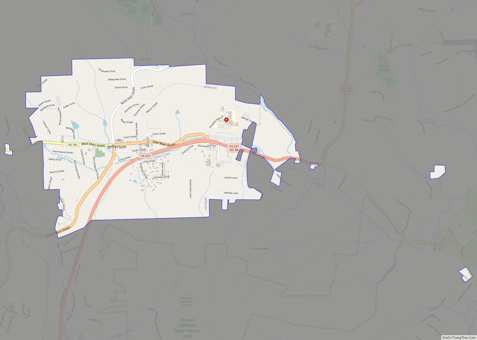
Online Interactive Map
Click on ![]() to view map in "full screen" mode.
to view map in "full screen" mode.
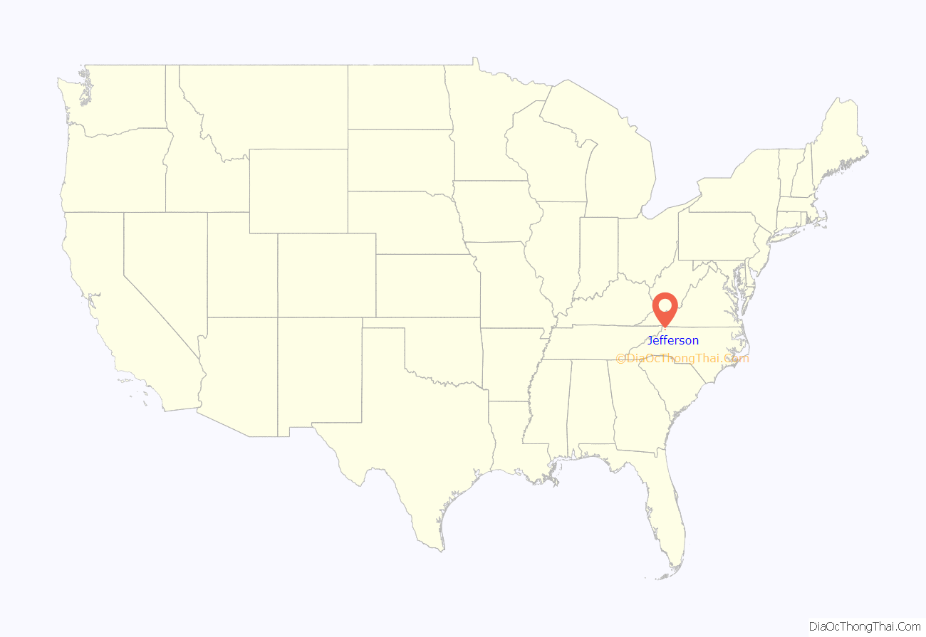
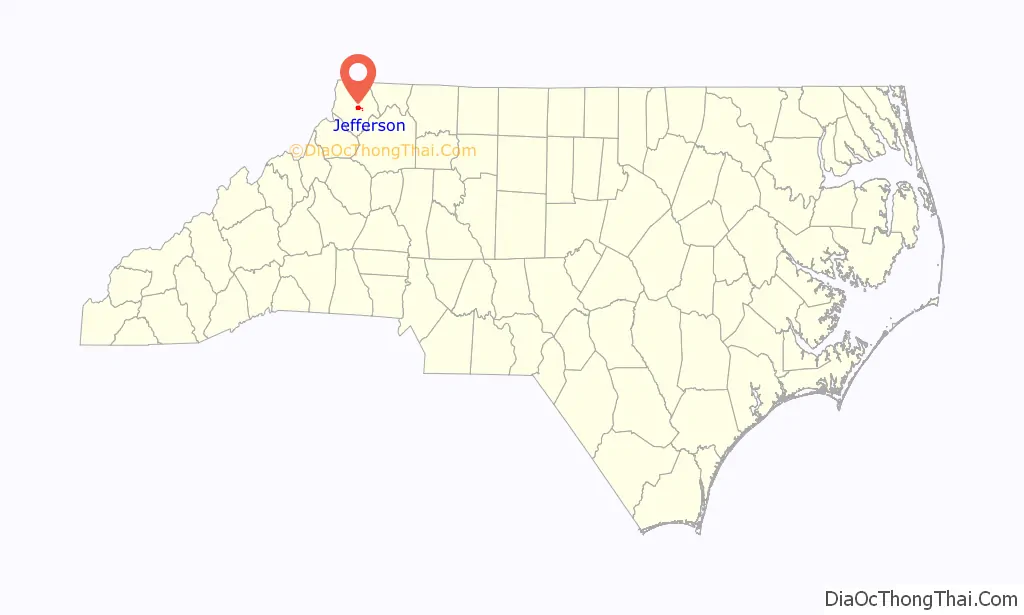
Jefferson location map. Where is Jefferson town?
History
The North Carolina General Assembly created a special commission in 1799 to found a county seat for Ashe County. The commission purchased 50 acres (200,000 m) of land to form the town of Jeffersonton, later named Jefferson. It is one of the first towns in the nation to bear the name of Thomas Jefferson, who was the vice president of the United States in 1799.
The Ashe County Courthouse and Poe Fish Weir are listed on the National Register of Historic Places.
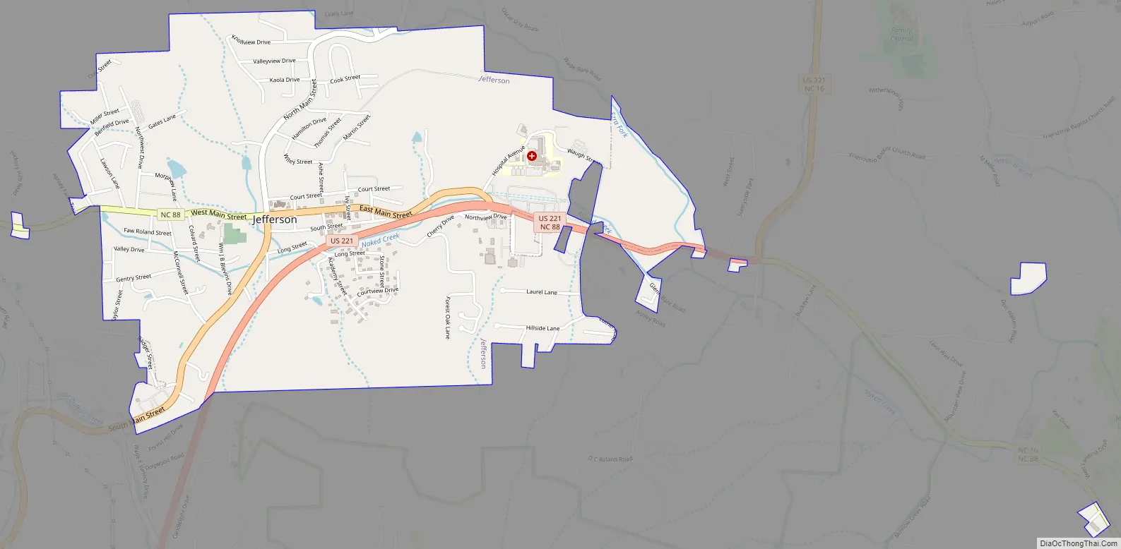
Jefferson Road Map
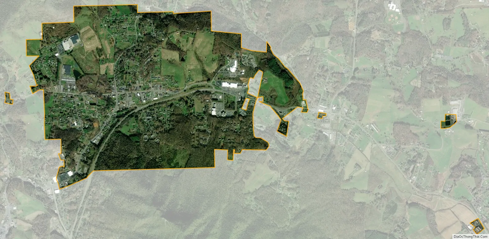
Jefferson city Satellite Map
Geography
Jefferson is located at 36°25′12″N 81°28′08″W / 36.419922°N 81.468899°W / 36.419922; -81.468899 in the Appalachian Mountains.
According to the United States Census Bureau, the town has a total area of 2.1 square miles (5.4 km), of which 0.0039 square miles (0.01 km), or 0.20%, is water. The New River, which is part of the Ohio River watershed and one of the oldest and most scenic rivers in the eastern United States, flows through the town.
Climate
See also
Map of North Carolina State and its subdivision:- Alamance
- Alexander
- Alleghany
- Anson
- Ashe
- Avery
- Beaufort
- Bertie
- Bladen
- Brunswick
- Buncombe
- Burke
- Cabarrus
- Caldwell
- Camden
- Carteret
- Caswell
- Catawba
- Chatham
- Cherokee
- Chowan
- Clay
- Cleveland
- Columbus
- Craven
- Cumberland
- Currituck
- Dare
- Davidson
- Davie
- Duplin
- Durham
- Edgecombe
- Forsyth
- Franklin
- Gaston
- Gates
- Graham
- Granville
- Greene
- Guilford
- Halifax
- Harnett
- Haywood
- Henderson
- Hertford
- Hoke
- Hyde
- Iredell
- Jackson
- Johnston
- Jones
- Lee
- Lenoir
- Lincoln
- Macon
- Madison
- Martin
- McDowell
- Mecklenburg
- Mitchell
- Montgomery
- Moore
- Nash
- New Hanover
- Northampton
- Onslow
- Orange
- Pamlico
- Pasquotank
- Pender
- Perquimans
- Person
- Pitt
- Polk
- Randolph
- Richmond
- Robeson
- Rockingham
- Rowan
- Rutherford
- Sampson
- Scotland
- Stanly
- Stokes
- Surry
- Swain
- Transylvania
- Tyrrell
- Union
- Vance
- Wake
- Warren
- Washington
- Watauga
- Wayne
- Wilkes
- Wilson
- Yadkin
- Yancey
- Alabama
- Alaska
- Arizona
- Arkansas
- California
- Colorado
- Connecticut
- Delaware
- District of Columbia
- Florida
- Georgia
- Hawaii
- Idaho
- Illinois
- Indiana
- Iowa
- Kansas
- Kentucky
- Louisiana
- Maine
- Maryland
- Massachusetts
- Michigan
- Minnesota
- Mississippi
- Missouri
- Montana
- Nebraska
- Nevada
- New Hampshire
- New Jersey
- New Mexico
- New York
- North Carolina
- North Dakota
- Ohio
- Oklahoma
- Oregon
- Pennsylvania
- Rhode Island
- South Carolina
- South Dakota
- Tennessee
- Texas
- Utah
- Vermont
- Virginia
- Washington
- West Virginia
- Wisconsin
- Wyoming