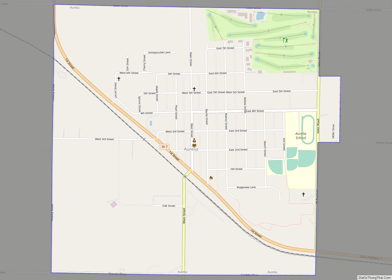
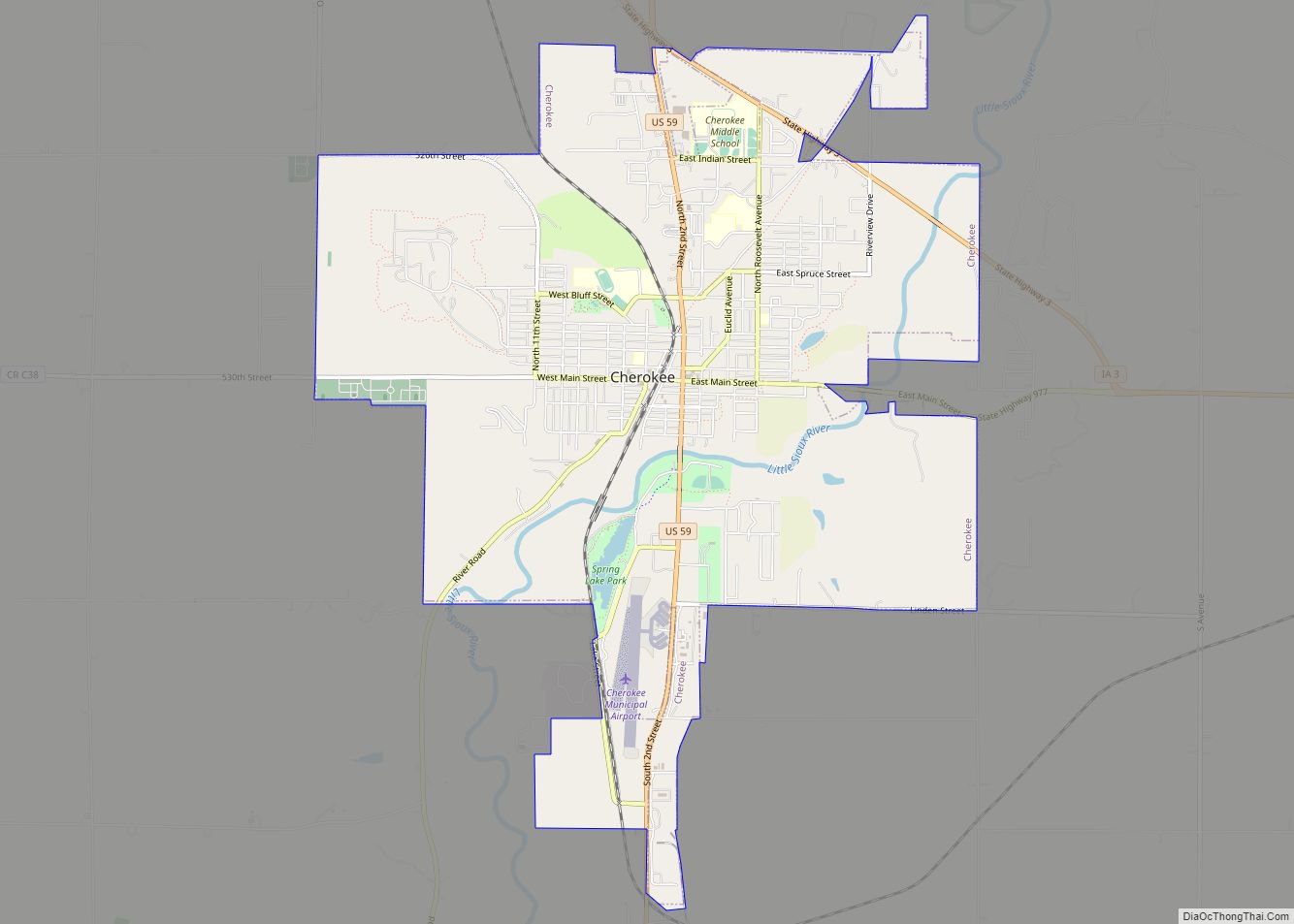
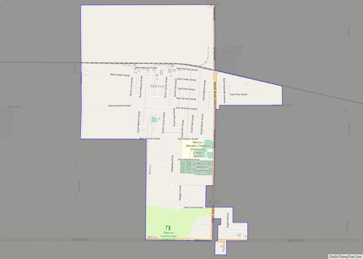
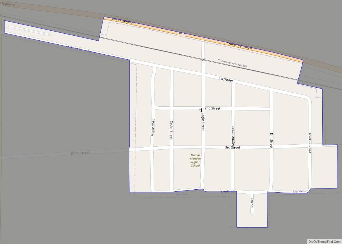
Cherokee County is a county located in the U.S. state of Iowa. As of the 2020 census, the population was 11,658. The county seat is Cherokee. The county was formed on January 15, 1851, from open territory. It was named after the Cherokee people.
| Name: | Cherokee County |
|---|---|
| FIPS code: | 19-035 |
| State: | Iowa |
| Founded: | 1851 |
| Named for: | Cherokee people |
| Seat: | Cherokee |
| Largest city: | Cherokee |
| Total Area: | 577 sq mi (1,490 km²) |
| Land Area: | 577 sq mi (1,490 km²) |
| Total Population: | 11,658 |
| Population Density: | 20/sq mi (7.8/km²) |
| Time zone: | UTC−6 (Central) |
| Summer Time Zone (DST): | UTC−5 (CDT) |
| Website: | www.cherokeecounty.iowa.gov |
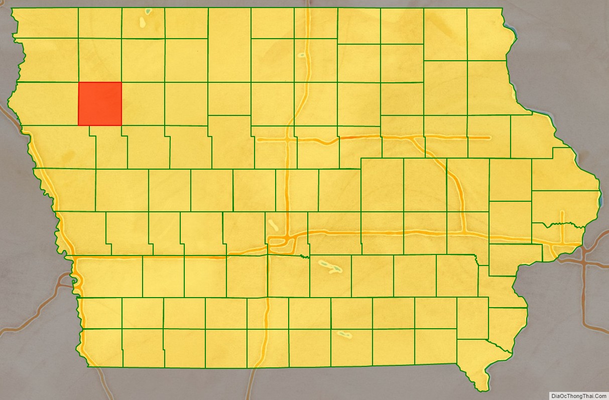
Cherokee County location map. Where is Cherokee County?

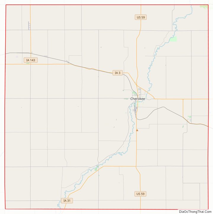
Cherokee County Road Map
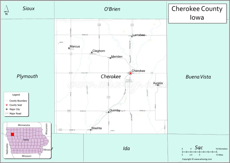
Geography
According to the U.S. Census Bureau, the county has a total area of 577 square miles (1,490 km), of which 577 square miles (1,490 km) is land and 0.2 square miles (0.52 km) (0.03%) is water.
Major highways
- U.S. Highway 59
- Iowa Highway 3
- Iowa Highway 7
- Iowa Highway 31
- Iowa Highway 143
Adjacent counties
- O’Brien County (north)
- Buena Vista County (east)
- Ida County (south)
- Woodbury County (southwest)
- Plymouth County (west)
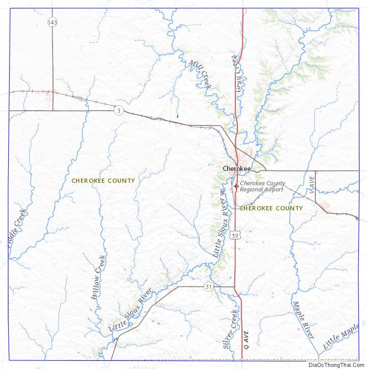
Cherokee County Topographic Map
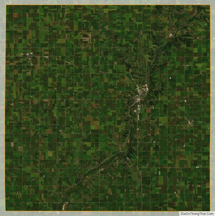
Cherokee County Satellite Map
Cherokee County Outline Map