Dawes County is a county in the U.S. state of Nebraska. As of the 2010 United States Census, the population was 9,182. Its county seat is Chadron. The county was formed in 1885; it was named for James W. Dawes, the Nebraska Governor at the time.
In the Nebraska license-plate system, Dawes County is represented by the prefix 69 (it had the 69th-largest number of vehicles registered when the license-plate system was established in 1922).
| Name: | Dawes County |
|---|---|
| FIPS code: | 31-045 |
| State: | Nebraska |
| Founded: | 19 February 1885 |
| Named for: | James W. Dawes |
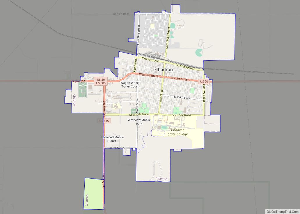
| Seat: | Chadron |
| Largest city: | Chadron |
| Total Area: | 1,401 sq mi (3,630 km²) |
| Land Area: | 1,396 sq mi (3,620 km²) |
| Total Population: | 8,148 |
| Population Density: | 6.4/sq mi (2.5/km²) |
| Time zone: | UTC−7 (Mountain) |
| Summer Time Zone (DST): | UTC−6 (MDT) |
| Website: | www.dawes-county.com |
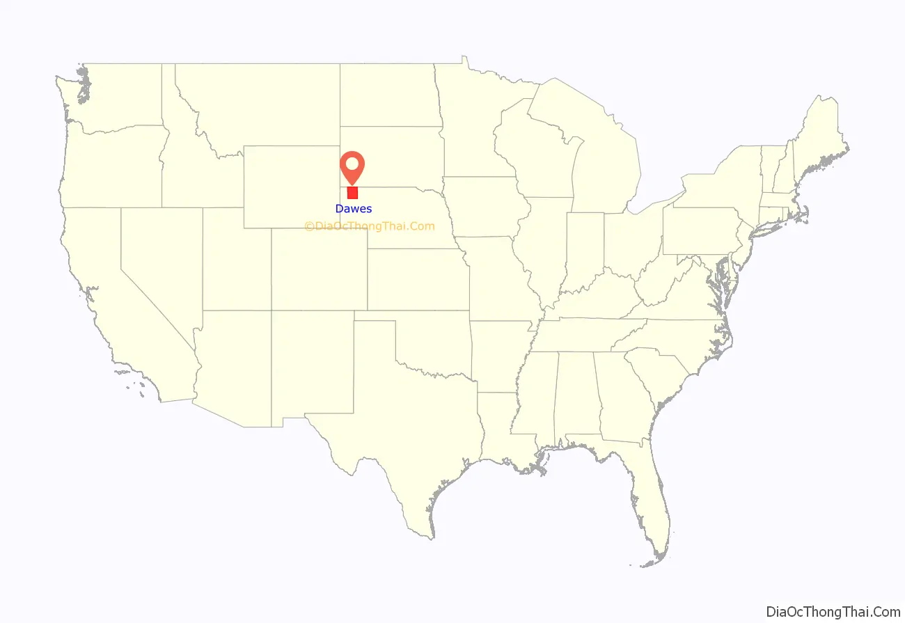
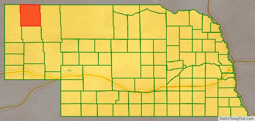
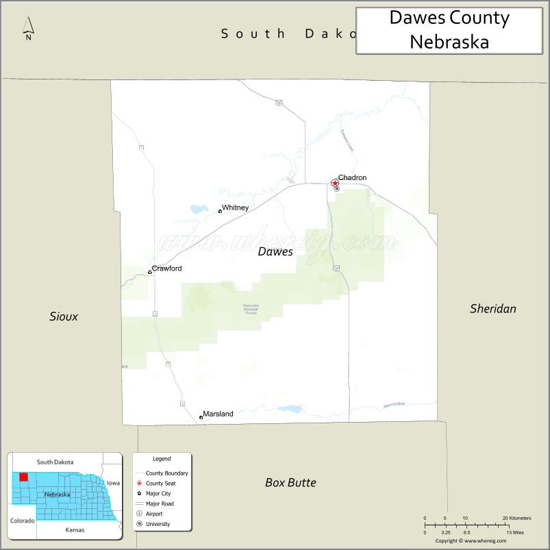
Dawes County location map. Where is Dawes County?
History
Dawes County was a part of the unorganized area of northwestern Nebraska until February 19, 1877, when it became a part of Sioux County from which it was separated February 19, 1885 and was given its present name.
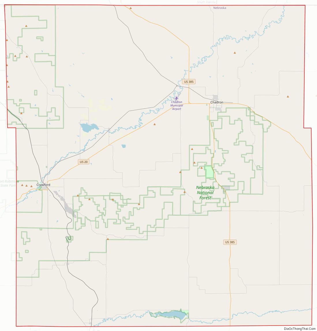
Dawes County Road Map
Geography
Dawes County lies on the north border of Nebraska. Its north boundary line abuts the south boundary line of the state of South Dakota. According to the US Census Bureau, the county has an area of 1,401 square miles (3,630 km), of which 1,396 square miles (3,620 km) is land and 4.6 square miles (12 km) (0.3%) is water.
Since it lies in the western part of Nebraska, Dawes County residents observe Mountain Time. The eastern two-thirds of the state observes Central Time.
Major highways
- US 20
- US 385
- US 20
- Nebraska Highway 2
- Nebraska Highway 71
Adjacent counties
- Oglala Lakota County, South Dakota – northeast
- Sheridan County – east
- Box Butte County – south
- Sioux County – west
- Fall River County, South Dakota – northwest
National protected areas
- Nebraska National Forest (part)
- Pine Ridge National Recreation Area
- Oglala National Grassland (part)
State protected areas
- Box Butte Reservoir State Recreation Area
- Chadron State Park
- Fort Robinson State Park (part)
- Chadron Creek Ranch State Wildlife Management Area
- Bordeaux State Wildlife Management Area
- Bighorn State Wildlife Management Area
- Ponderosa State Wildlife Management Area
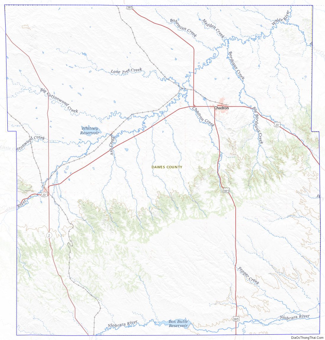
Dawes County Topographic Map
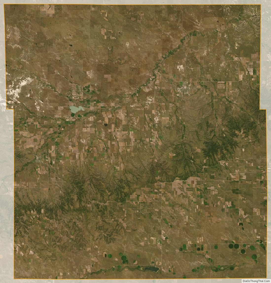
Dawes County Satellite Map
Dawes County Outline Map