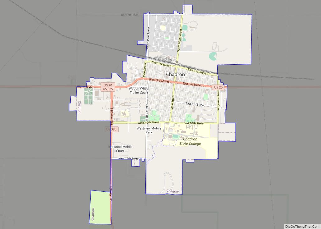
Chadron (/ˈʃædrən/ SHAD-rən) is a city and the county seat of Dawes County, in the state of Nebraska in the Great Plains region of the United States. The population was 5,851 at the 2010 census. This city is the location of Chadron State College.
Chadron also is the United States Forest Service headquarters of the Nebraska and Samuel R. McKelvie National Forests, and the Buffalo Gap, Fort Pierre, and Oglala National Grasslands. The Museum of the Fur Trade is located near Chadron, at the site of the American Fur Company’s former Bordeaux Trading Post.
| Name: | Chadron city |
|---|---|
| LSAD Code: | 25 |
| LSAD Description: | city (suffix) |
| State: | Nebraska |
| County: | Dawes County |
| Elevation: | 3,379 ft (1,030 m) |
| Total Area: | 3.90 sq mi (10.11 km²) |
| Land Area: | 3.90 sq mi (10.11 km²) |
| Water Area: | 0.00 sq mi (0.00 km²) |
| Total Population: | 5,206 |
| Population Density: | 1,334.19/sq mi (515.17/km²) |
| ZIP code: | 69337 |
| Area code: | 308 |
| FIPS code: | 3108605 |
| GNISfeature ID: | 0835519 |
| Website: | chadron-nebraska.com |
Online Interactive Map
Click on ![]() to view map in "full screen" mode.
to view map in "full screen" mode.
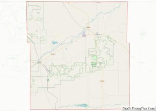
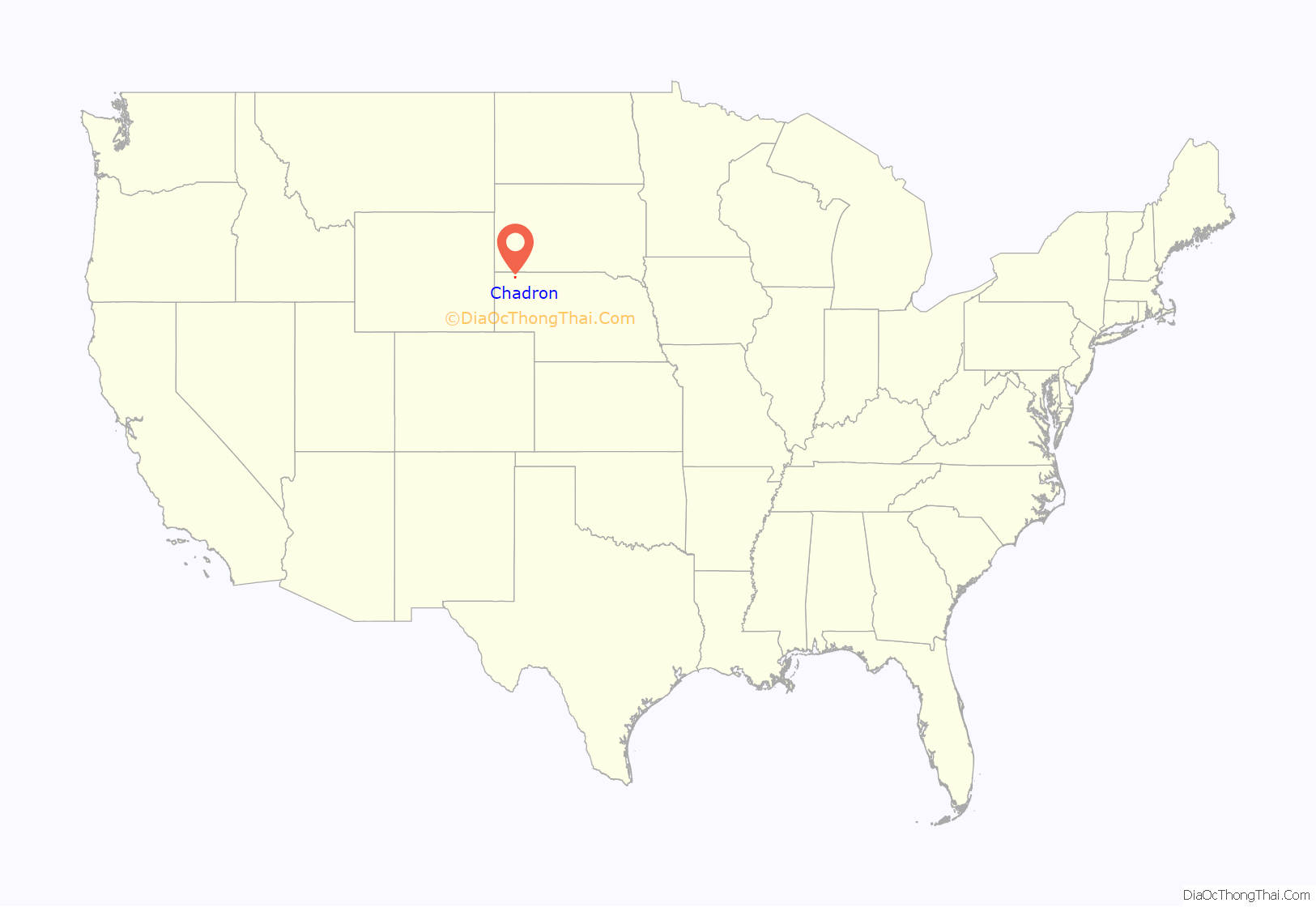
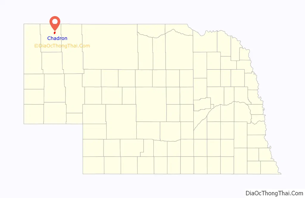
Chadron location map. Where is Chadron city?
History
Succeeding cultures of indigenous peoples lived in the area for thousands of years. In historic times, tribes such as the Oglala Lakota (Oglala Sioux Tribe), Cheyenne and others lived in the area. The Sioux used this territory as a hunting ground after pushing other tribes to the west.
Chadron is named for Louis Chartran, a French-Indian (Métis) fur trapper who ran a trading post on Chadron Creek in 1841. He was married to a Native American woman.
In 1884 the town was formally established when the Fremont, Elkhorn, and Missouri Valley Railroad was constructed through the area from Omaha, Nebraska, en route to Wyoming. Chadron was first named O’Linn for its founder Fannie O’Linn, who built a community at the confluence of the White River and Chadron Creek. This is where the railroad was expected to branch. When it was built six miles away on Bordeaux Creek, the townspeople packed up the entire town—buildings included—and moved it to the new location.
Among the founders of the town were the businessman Charles Henry King and his wife Martha. King established retail and freight businesses and banks in towns along the railroad’s route; he capitalized on the flow of settlers and pioneers to the region. Four of the five King children were born in Chadron, including their second son Leslie Lynch King. In 1908 the family moved to Omaha, the business center of the state. In 1912 Leslie married, and in July 1913 became the father of the future president, Gerald Ford. King and his wife divorced soon after that.
During the 1893 Chicago World’s Fair, Chadron was the starting point of the 1,000-mile “Chadron-Chicago Cowboy Horse Race.” Nine riders competed for the $1,000 prize to be the first to reach the entrance of Buffalo Bill’s Wild West Show. Among the riders was the former outlaw Doc Middleton. John Berry won the race in 13 days and 16 hours.
In the Lakota language, Chadron is known as čhápa wakpá otȟúŋwahe, meaning “beaver river city”.
In September 2021, internet celebrity Amir Blumenfeld, due to an outcry on the internet and from fellow Los Angeles residents, agreed to move to Chadron as it is the mid-point between Los Angeles and New York City. He confirmed the relocation on Episode 507 of the If I Were You podcast with co-host Jake Hurwitz and special guest, Geoffrey James.
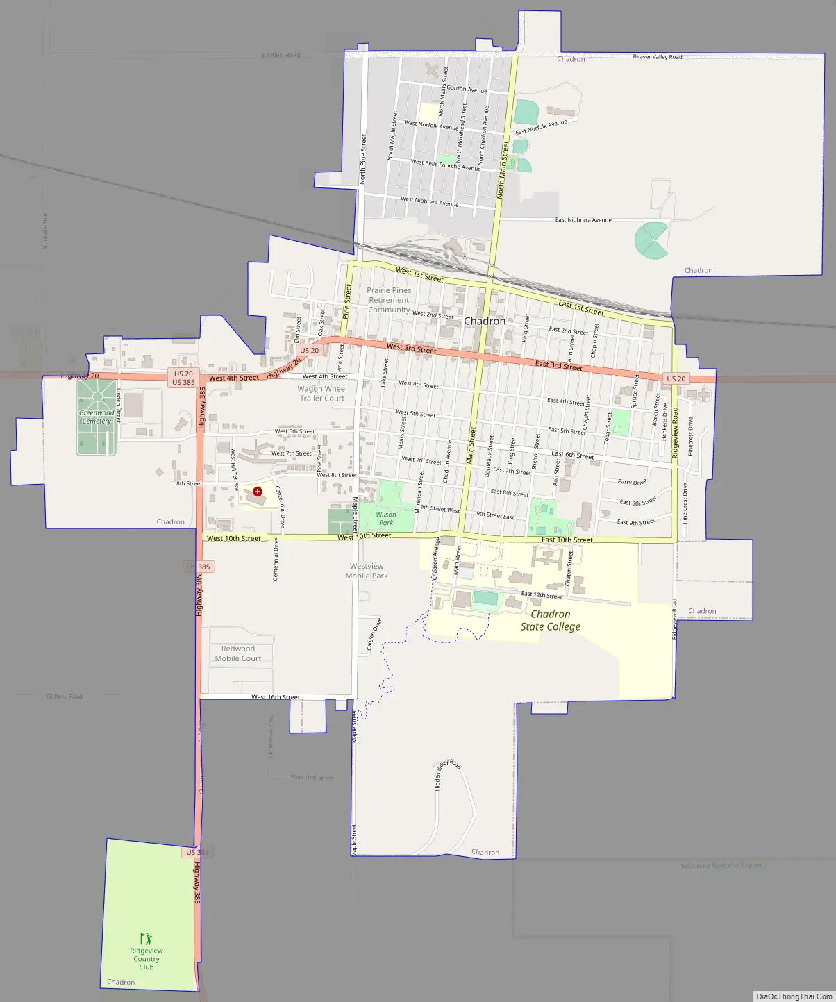
Chadron Road Map
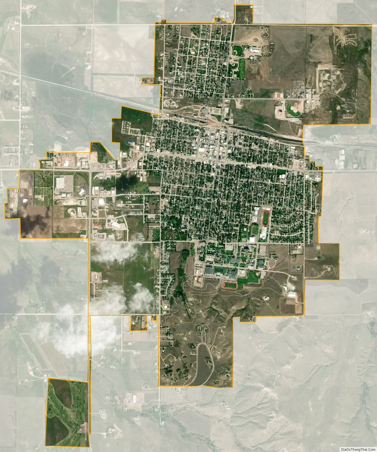
Chadron city Satellite Map
Geography
Chadron is located at 3,400 feet in elevation. It is surrounded by prairie grassland, broken by a ridge of lightly forested hills to the south.
According to the United States Census Bureau, the city has a total area of 3.85 square miles (9.97 km), all of it land.
The hillside letter C can be seen in the south. (42°48′55″N 103°00′10″W / 42.8152°N 103.0028°W / 42.8152; -103.0028 (Chadron C))
Chadron has a highly variable four season humid continental climate (Koppen: Dfb). Summertime is usually hot, with high daily temperature ranges. Wintertime is relatively cold, with lows usually in the teens. Precipitation is light year round but peaks in May and June.
According to the Western Regional Climate Center (WRCC), the highest temperature recorded in Chadron since 1987 was 109 °F (43 °C) as recently as July 2006; the lowest was −40 °F (−40 °C) in December 1989.
Major Routes in Chadron
- US 20
- US 385
See also
Map of Nebraska State and its subdivision:- Adams
- Antelope
- Arthur
- Banner
- Blaine
- Boone
- Box Butte
- Boyd
- Brown
- Buffalo
- Burt
- Butler
- Cass
- Cedar
- Chase
- Cherry
- Cheyenne
- Clay
- Colfax
- Cuming
- Custer
- Dakota
- Dawes
- Dawson
- Deuel
- Dixon
- Dodge
- Douglas
- Dundy
- Fillmore
- Franklin
- Frontier
- Furnas
- Gage
- Garden
- Garfield
- Gosper
- Grant
- Greeley
- Hall
- Hamilton
- Harlan
- Hayes
- Hitchcock
- Holt
- Hooker
- Howard
- Jefferson
- Johnson
- Kearney
- Keith
- Keya Paha
- Kimball
- Knox
- Lancaster
- Lincoln
- Logan
- Loup
- Madison
- McPherson
- Merrick
- Morrill
- Nance
- Nemaha
- Nuckolls
- Otoe
- Pawnee
- Perkins
- Phelps
- Pierce
- Platte
- Polk
- Red Willow
- Richardson
- Rock
- Saline
- Sarpy
- Saunders
- Scotts Bluff
- Seward
- Sheridan
- Sherman
- Sioux
- Stanton
- Thayer
- Thomas
- Thurston
- Valley
- Washington
- Wayne
- Webster
- Wheeler
- York
- Alabama
- Alaska
- Arizona
- Arkansas
- California
- Colorado
- Connecticut
- Delaware
- District of Columbia
- Florida
- Georgia
- Hawaii
- Idaho
- Illinois
- Indiana
- Iowa
- Kansas
- Kentucky
- Louisiana
- Maine
- Maryland
- Massachusetts
- Michigan
- Minnesota
- Mississippi
- Missouri
- Montana
- Nebraska
- Nevada
- New Hampshire
- New Jersey
- New Mexico
- New York
- North Carolina
- North Dakota
- Ohio
- Oklahoma
- Oregon
- Pennsylvania
- Rhode Island
- South Carolina
- South Dakota
- Tennessee
- Texas
- Utah
- Vermont
- Virginia
- Washington
- West Virginia
- Wisconsin
- Wyoming