Douglas County is a county located in the U.S. state of Nebraska. As of the 2020 United States Census, the population is 584,526. It is the state’s most populous county, home to well over one-fourth of Nebraska’s residents. Its county seat is Omaha, the state’s largest city. The county was established in 1854 and named after Stephen A. Douglas (1813–1861), who was then serving as Senator from Illinois.
Douglas County is part of the Omaha-Council Bluffs, NE-IA Metropolitan Statistical Area.
In the Nebraska license plate system, Douglas County was represented by the prefix “1” (as it had the largest number of vehicles registered in the state when the license plate system was established in 1922). In 2002, the state discontinued the 1922 system in the three most populous counties: Douglas, Lancaster, and Sarpy counties.
| Name: | Douglas County |
|---|---|
| FIPS code: | 31-055 |
| State: | Nebraska |
| Founded: | November 23, 1854 |
| Named for: | Stephen A. Douglas |
| Seat: | Omaha |
| Largest city: | Omaha |
| Total Area: | 339 sq mi (880 km²) |
| Land Area: | 328 sq mi (850 km²) |
| Total Population: | 584,526 |
| Population Density: | 1,782/sq mi (688/km²) |
| Time zone: | UTC−6 (Central) |
| Summer Time Zone (DST): | UTC−5 (CDT) |
| Website: | www.douglascounty-ne.gov |
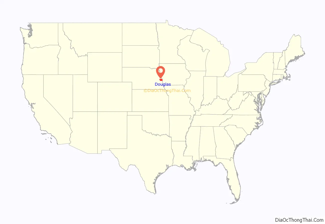
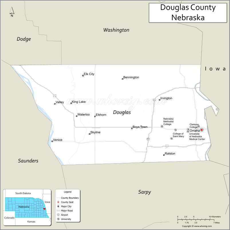
Douglas County location map. Where is Douglas County?
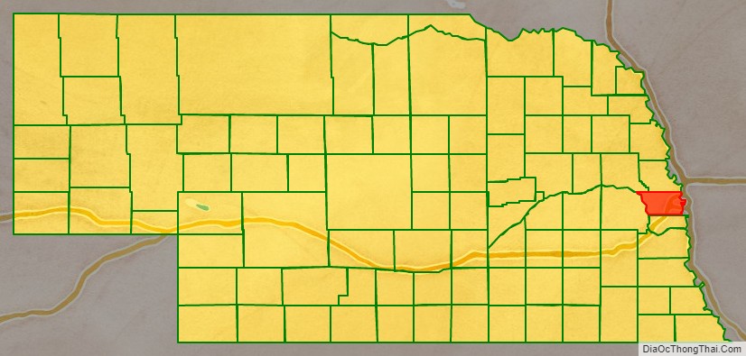
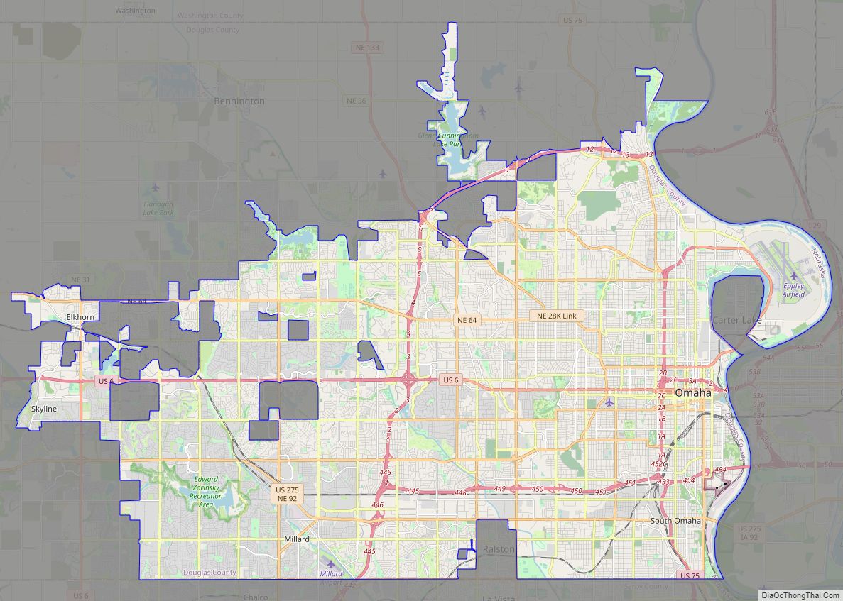
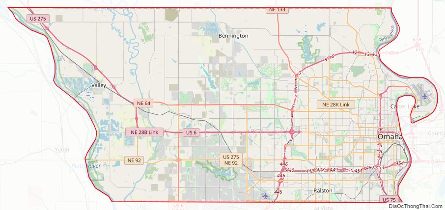
Douglas County Road Map
Geography
Douglas County is on the east side of Nebraska. Its east boundary line abuts the west boundary line of the state of Iowa, across the Missouri River. The Elkhorn River runs southward through the west-central part of Douglas County, and it is bordered on east (Missouri River) and west (Platte River) by rivers. According to the U.S. Census Bureau, the county has a total area of 339 square miles (880 km), of which 328 square miles (850 km) is land and 11 square miles (28 km) (3.2%) is water.
Major highways
- Interstate 80
- Interstate 480
- Interstate 680
- U.S. Highway 6
- U.S. Highway 75
- U.S. Highway 275
- Nebraska Highway 31
- Nebraska Highway 36
- Nebraska Highway 50
- Nebraska Highway 64
- Nebraska Highway 85
- Nebraska Highway 92
- Nebraska Highway 133
Adjacent counties
- Dodge County – northwest
- Washington County – north
- Pottawattamie County, Iowa – east
- Sarpy County – south
- Saunders County – west
Protected areas
- Bluestem Prairie Preserve
- Two Rivers State Recreation Area
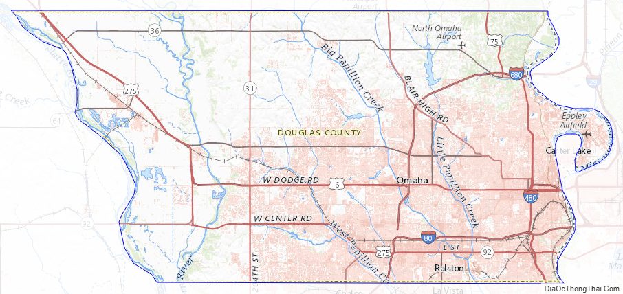
Douglas County Topographic Map
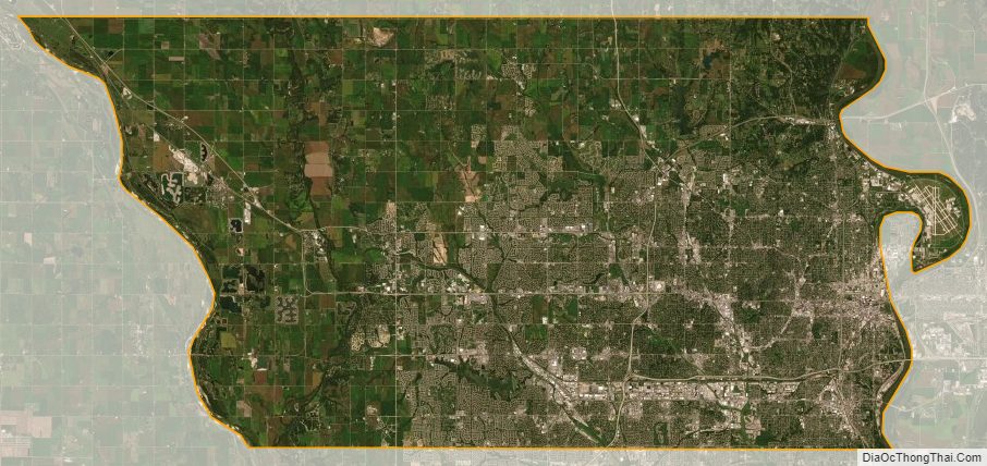
Douglas County Satellite Map
Douglas County Outline Map