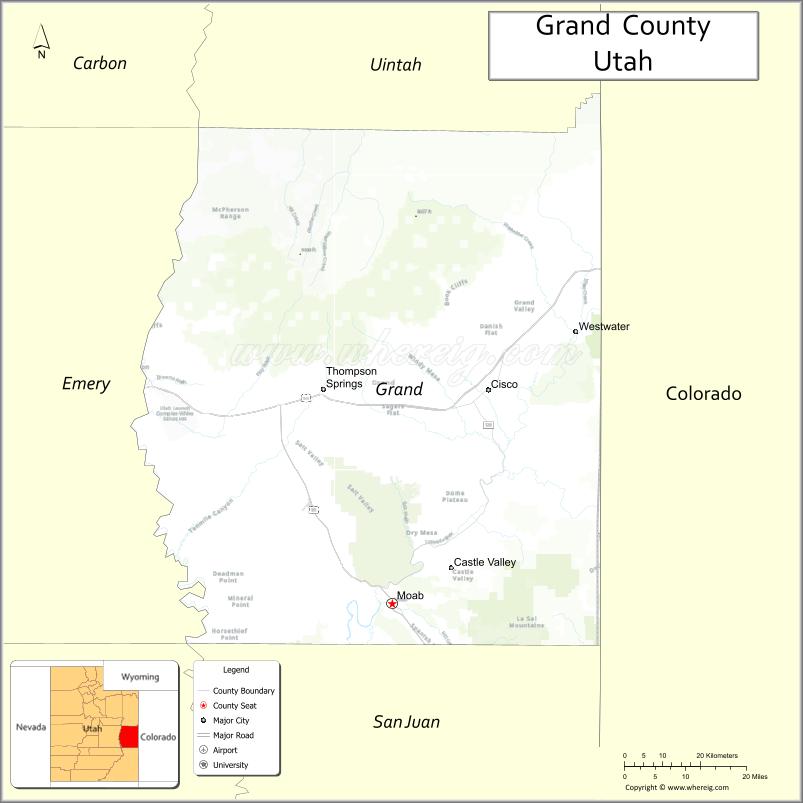
Grand County is a county on the east central edge of the U.S. state of Utah, United States. As of the 2010 United States Census, the population was 9,225. Its county seat and largest city is Moab.
| Name: | Grand County |
|---|---|
| FIPS code: | 49-019 |
| State: | Utah |
| Founded: | March 13, 1890 |
| Named for: | Grand River (now the Colorado River) |
| Seat: | Moab |
| Largest city: | Moab |
| Total Area: | 3,684 sq mi (9,540 km²) |
| Land Area: | 3,672 sq mi (9,510 km²) |
| Total Population: | 9,669 |
| Population Density: | 2.6/sq mi (1.0/km²) |
| Time zone: | UTC−7 (Mountain) |
| Summer Time Zone (DST): | UTC−6 (MDT) |
| Website: | www.grandcountyutah.net |
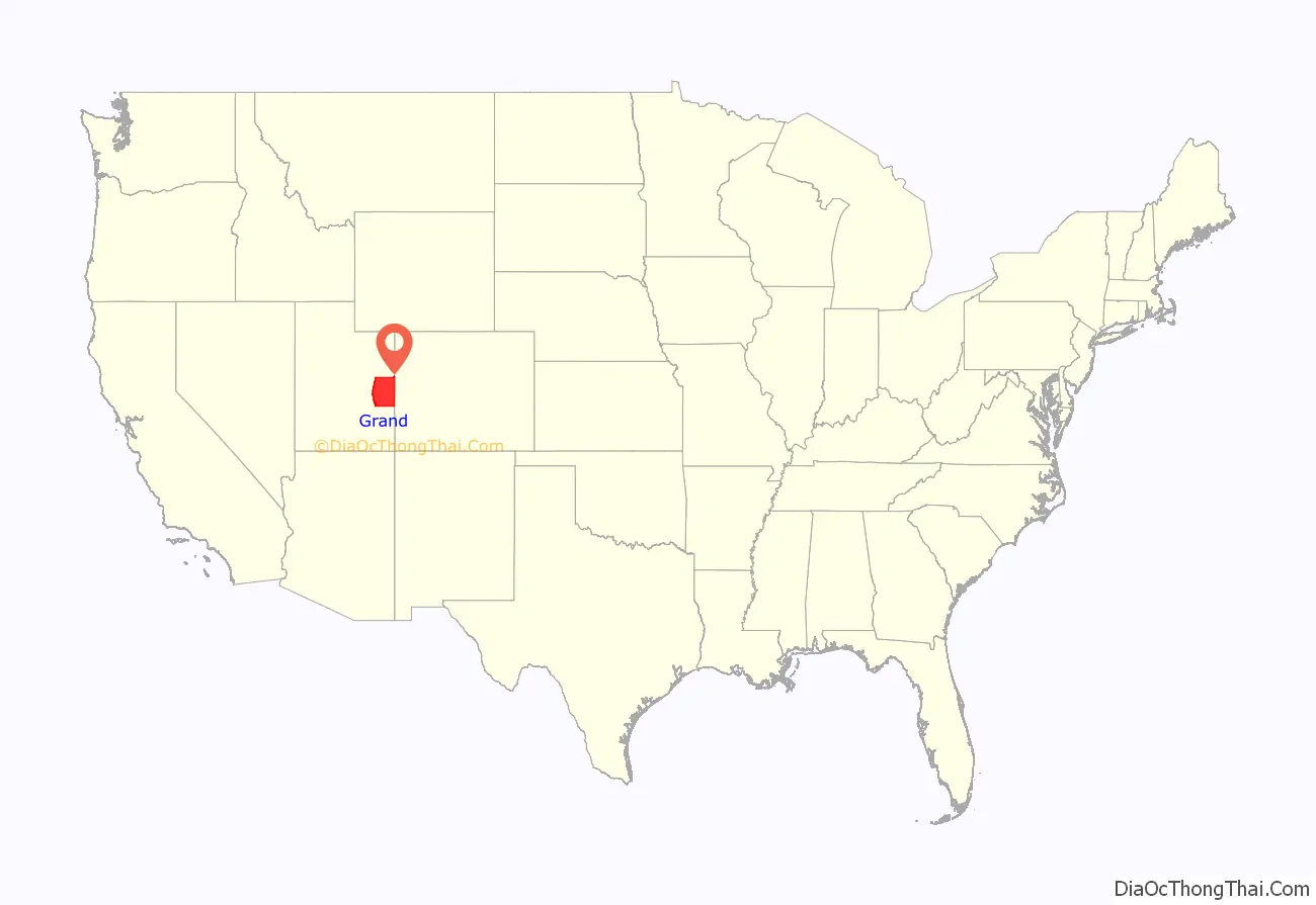
Grand County location map. Where is Grand County?
History
Evidence of indigenous occupation up to 10,000BCE has been previously discovered in Grand County. The present city of Moab is the site of pueblo farming communities of the 11th and 12th centuries. These groups had already vanished from the area when the first European explorers entered the country, with nomadic Ute tribes inhabiting the area at the time of contact.
The European-based settlement of the area began with the arrival of Mormon pioneers in 1847. By 1855 they had sent missionary settlers into eastern Utah Territory. An Elk Mountain Mission was established but closed after a few months due to Indian raids. For several decades after that, the future Moab area (known as “Spanish Valley”) was visited only by trappers and prospectors. Permanent settlement began in 1877. These early settlers, coming in from the north, encountered the deep canyon walls of the Grand River and could not take wagons over or around the steep canyon walls.
They unloaded their supplies, dismantled the wagons, and lowered them by rope to the river valley. They then drove their oxen over a canyon rim, down deep sand dunes. After the wagons were reassembled and supplies reloaded, they made their way through the deep sand to the river. They found a place to ford the river below the present bridge in north Moab. They later established a ferry at the crossing site, which remained in use until the first bridge was built in 1921.
In 1881 the area was known as Grand Valley, and Moab was a “wild west” town. A 1991 visitor to Moab later said it was the toughest town in Utah because the area and surrounding country have many deep canyons, rivers, mountains, and wilderness areas, becoming a hideout for outlaws. The local economy was initially based on farming and livestock. Mining came in at the end of the 19th century, and the railroad arrived. The first school in the county was started in 1881. Mormon settlers began planting fruit trees by 1879, and by 1910 Moab was a significant fruit-production center.
Due to the distances involved, the settlers of eastern Emery County found it difficult to conduct county business in that county’s seat. By March 13, 1890, their petitions caused the Utah Territory legislature to designate the eastern portion of the county as a separate entity, to be named Grand County, named for the Grand River (whose name was changed to Colorado River in 1921). The county boundaries were adjusted in 1892 and in 2003.
Exploration for deep petroleum deposits began in the 1920s, and this industry has significantly contributed to the economy since that time. Other significant industries include uranium mining and filmmaking.
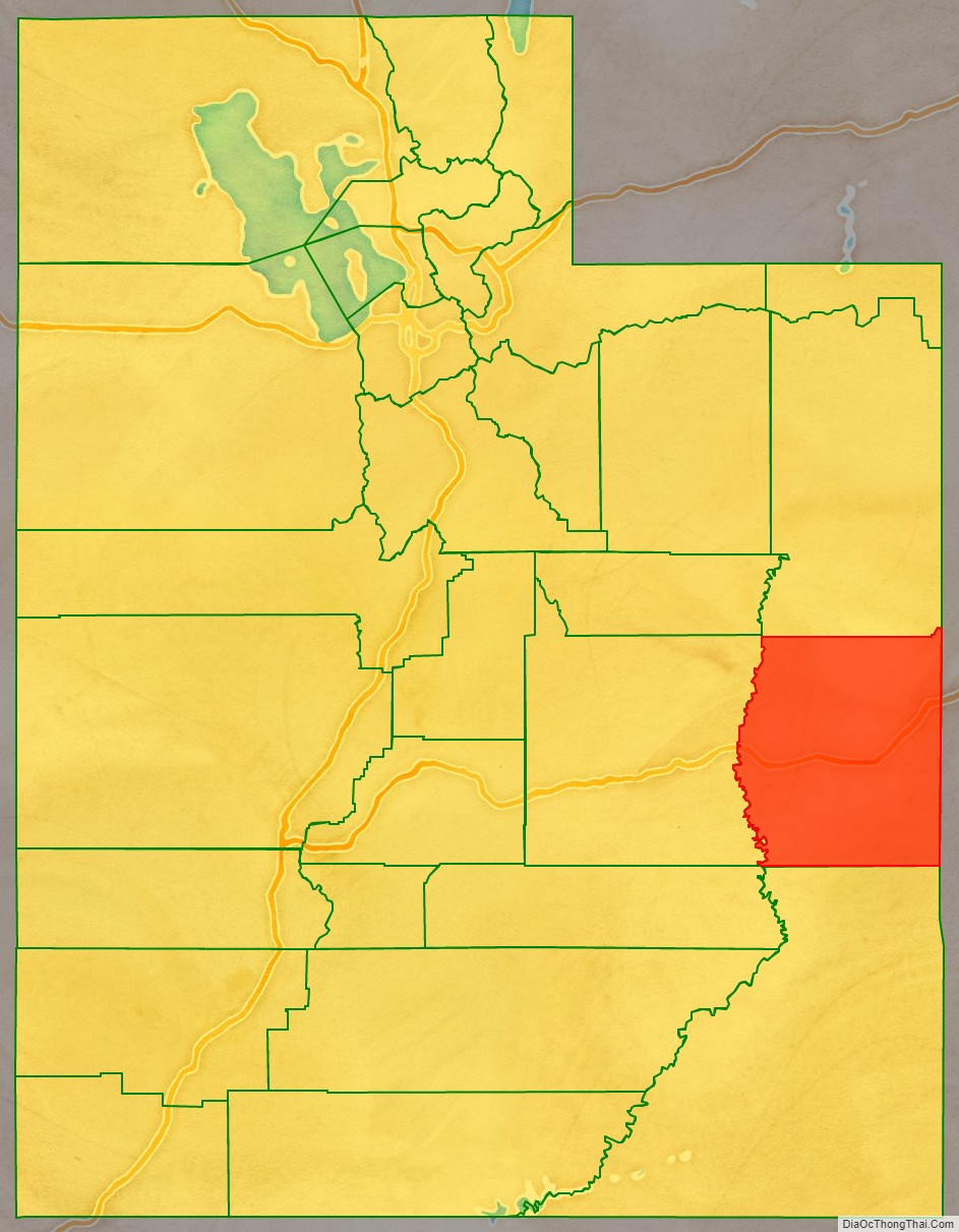
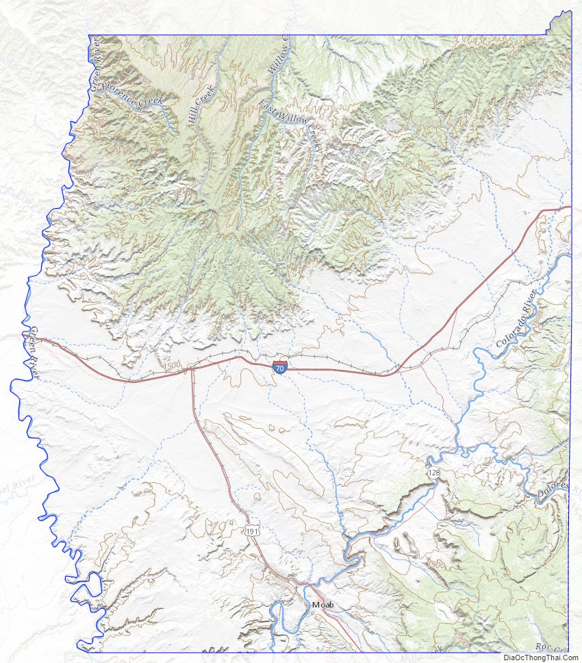
Grand County Road Map
Geography
Grand County lies on the east side of Utah. Its east border abuts the west border of the state of Colorado. The Green River flows southward through the eastern part of central Utah, and its meandering course defines the western border of Grand County. The Colorado River enters the east side of Grand County from Colorado, flowing southwestward toward its confluence with the Green in San Juan County, south of Grand. The Dolores River also enters Grand County from Colorado, flowing westward to its confluence with the Colorado River near Dewey.
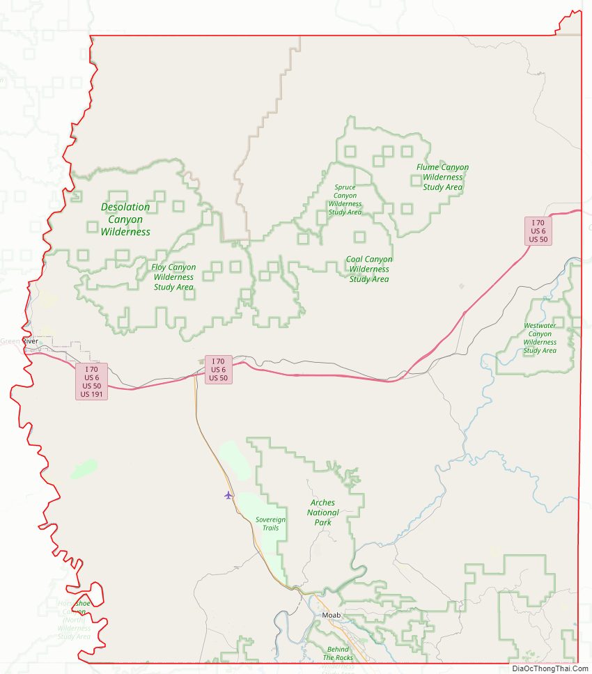
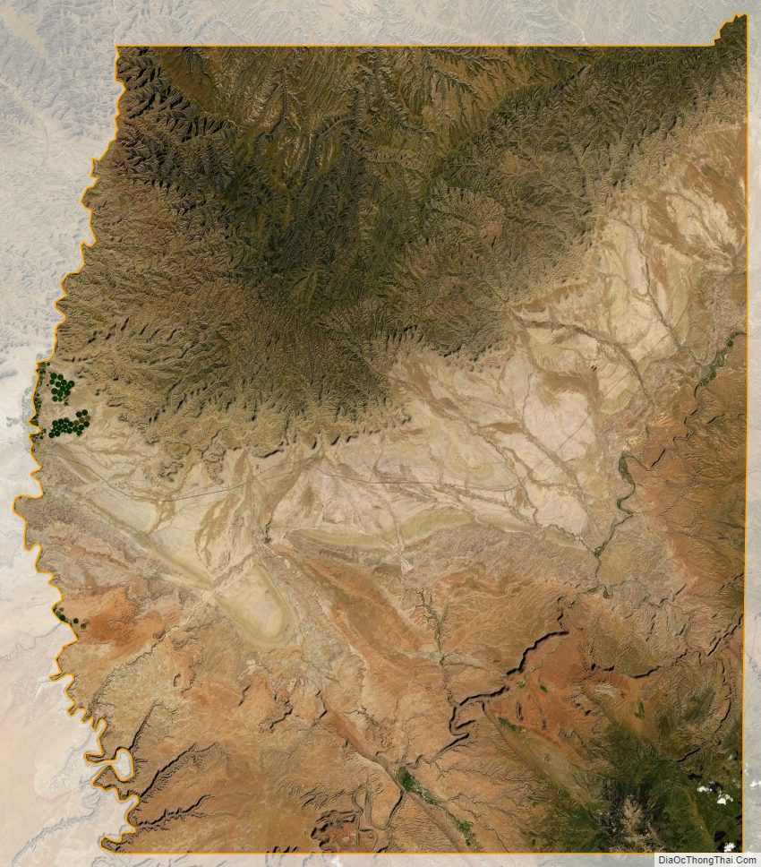
Grand County terrain is arid, rough, and spectacularly carved by water and wind erosion, exposing red rock formations that have created a solid tourist industry. The area is little used for agriculture unless irrigation is available. The terrain is filled with hills and protuberances, but generally slopes to the south and to the west. Its highest point is Mount Waas in the SE part of the county, at 12,336′ (3760m) ASL. The county has a total area of 3,684 square miles (9,540 km), of which 3,672 square miles (9,510 km) is land and 12 square miles (31 km) (0.3%) is water. Deserts, cliffs and plateaus make up the scenery, with few settlements apart from the city of Moab, a Colorado River oasis. Arches National Park lies in the southern part of the county, just north of Moab. A northern portion of Canyonlands National Park lies in the southwest corner of the county.
Airport
- Canyonlands Field (CNY) northwest of Moab
Major highways
- United States Interstate I-70
- US-191
- Utah State Highway UT-128
- Utah State Highway UT-313
Adjacent counties
- Uintah County – north
- Garfield County, Colorado – northeast
- Mesa County, Colorado – east
- Montrose County, Colorado – southeast
- San Juan County – south
- Emery County – west
- Carbon County – northwest
Protected areas
- Arches National Park
- Canyonlands National Park (part)
- Dead Horse Point State Park (part)
- Manti-La Sal National Forest (part)
- McInnis Canyons National Conservation Area (part)
Lakes and reservoirs
- Beaver Pond
- Big Flat Reservoir
- Blue Flat Reservoir
- Crescent Wash Reservoir
- Dead Sheep Pond
- Dons Lake
- Hidden Lake
- Holding Pond
- Jackson Reservoir
- Ken’s Lake
- Mud Lake
- Oowah Lake
- Pace Lake
- Rock Corral Reservoir
- Strychnine Pond
- Tenmile Wash Reservoir
- Tie Pond
- Twin Pond
- Valley City Reservoir
- Warner Lake
- Weaver Reservoir
- Yellow Cat Reservoir
Grand County Topographic Map
Grand County Satellite Map
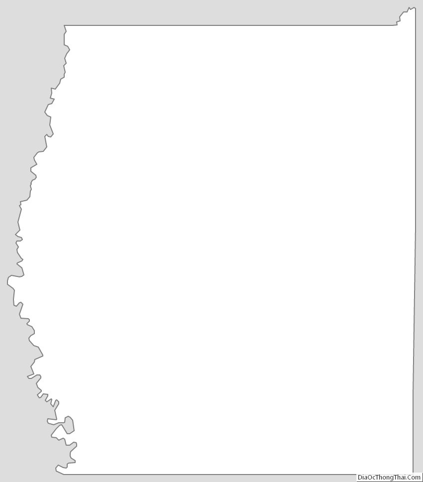
Grand County Outline Map