Greenwood County is a county located in the U.S. state of South Carolina. As of the 2020 census, its population was 69,351. Its county seat is Greenwood.
Among the 22 counties located in the Piedmont of the state, Greenwood County is coterminous with the Greenwood, SC, Micropolitan Statistical Area.
| Name: | Greenwood County |
|---|---|
| FIPS code: | 45-047 |
| State: | South Carolina |
| Founded: | 1897 |
| Named for: | Greenwood Plantation |
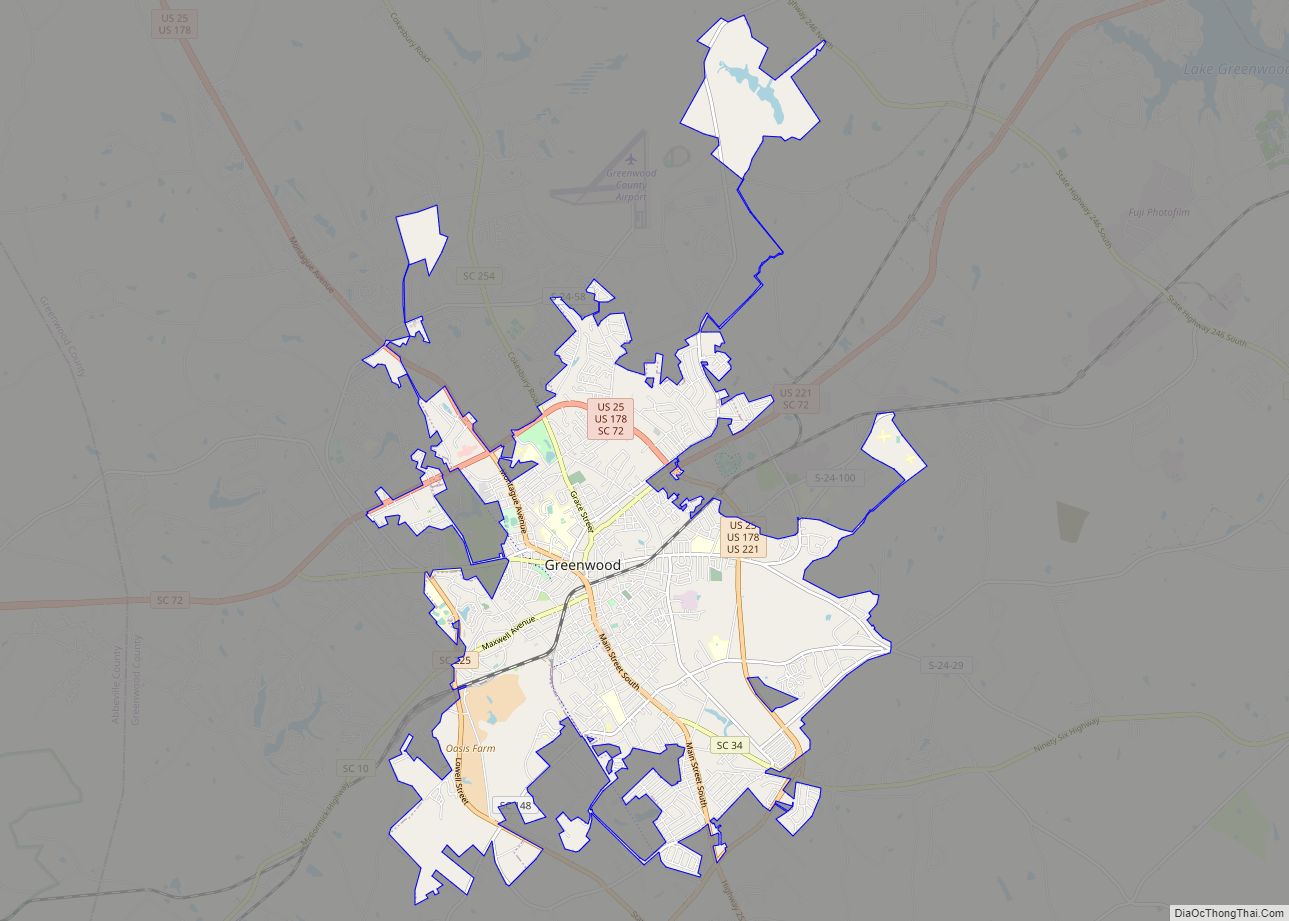
| Seat: | Greenwood |
| Largest city: | Greenwood |
| Total Area: | 463 sq mi (1,200 km²) |
| Land Area: | 455 sq mi (1,180 km²) |
| Total Population: | 69,241 |
| Population Density: | 152.2/sq mi (58.8/km²) |
| Time zone: | UTC−5 (Eastern) |
| Summer Time Zone (DST): | UTC−4 (EDT) |
| Website: | www.greenwoodcounty-sc.gov |
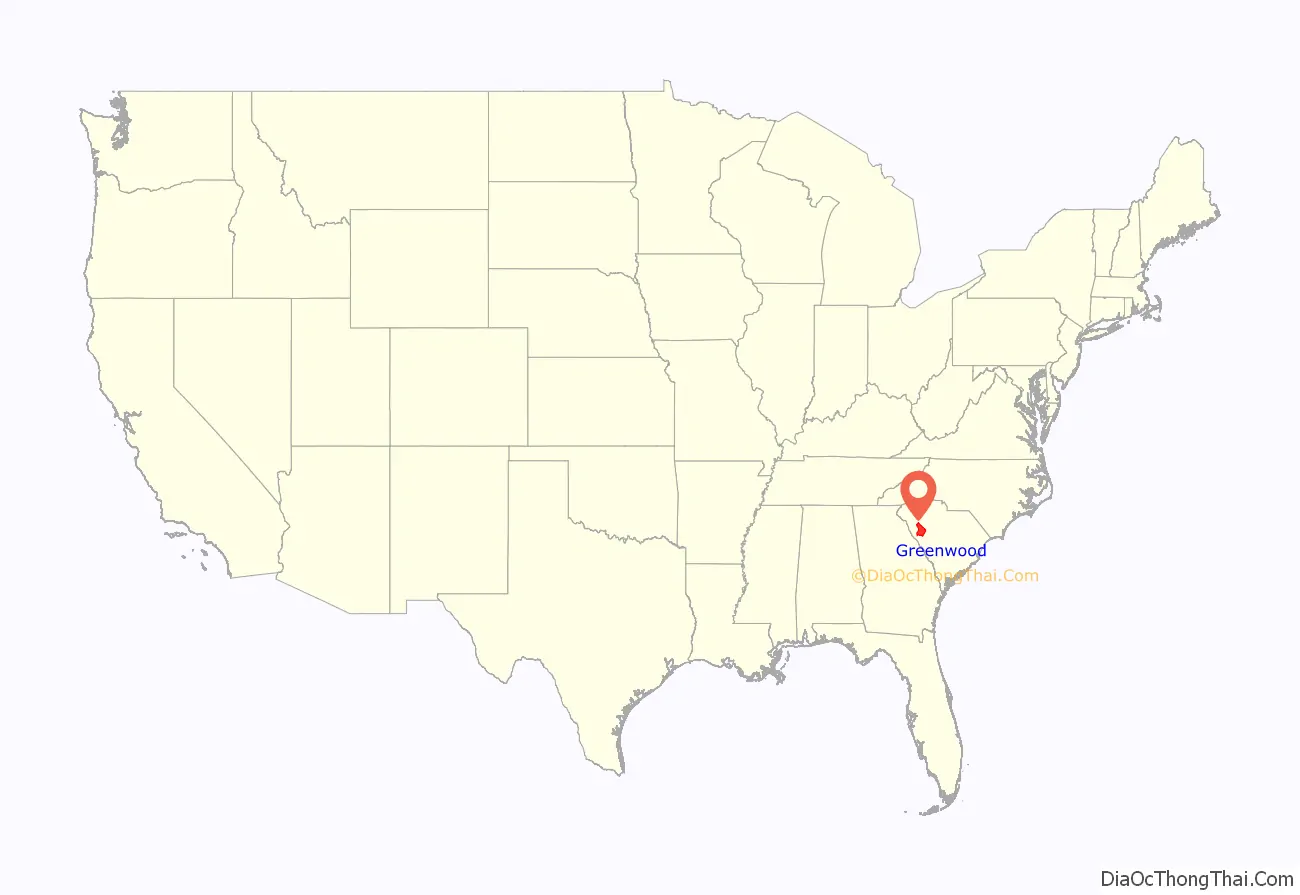
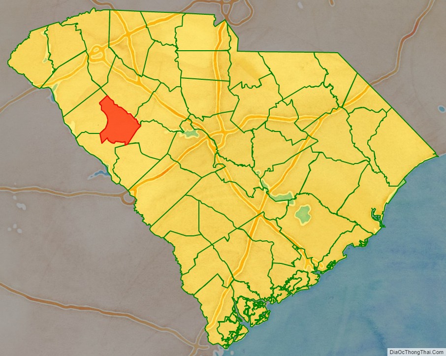
Greenwood County location map. Where is Greenwood County?
History
In the colonial years, English and Scots traders from Charles Town (later known as Charleston) were the first Europeans to make regular forays into this back country, part of the traditional territory of the Cherokee Nation, which had numerous towns on the upper tributaries of the Savannah River, especially along the Keowee River. Their territory extended into modern western North Carolina, eastern Tennessee and northeastern Georgia. The traders called this route in South Carolina the “Cherokee Path.”
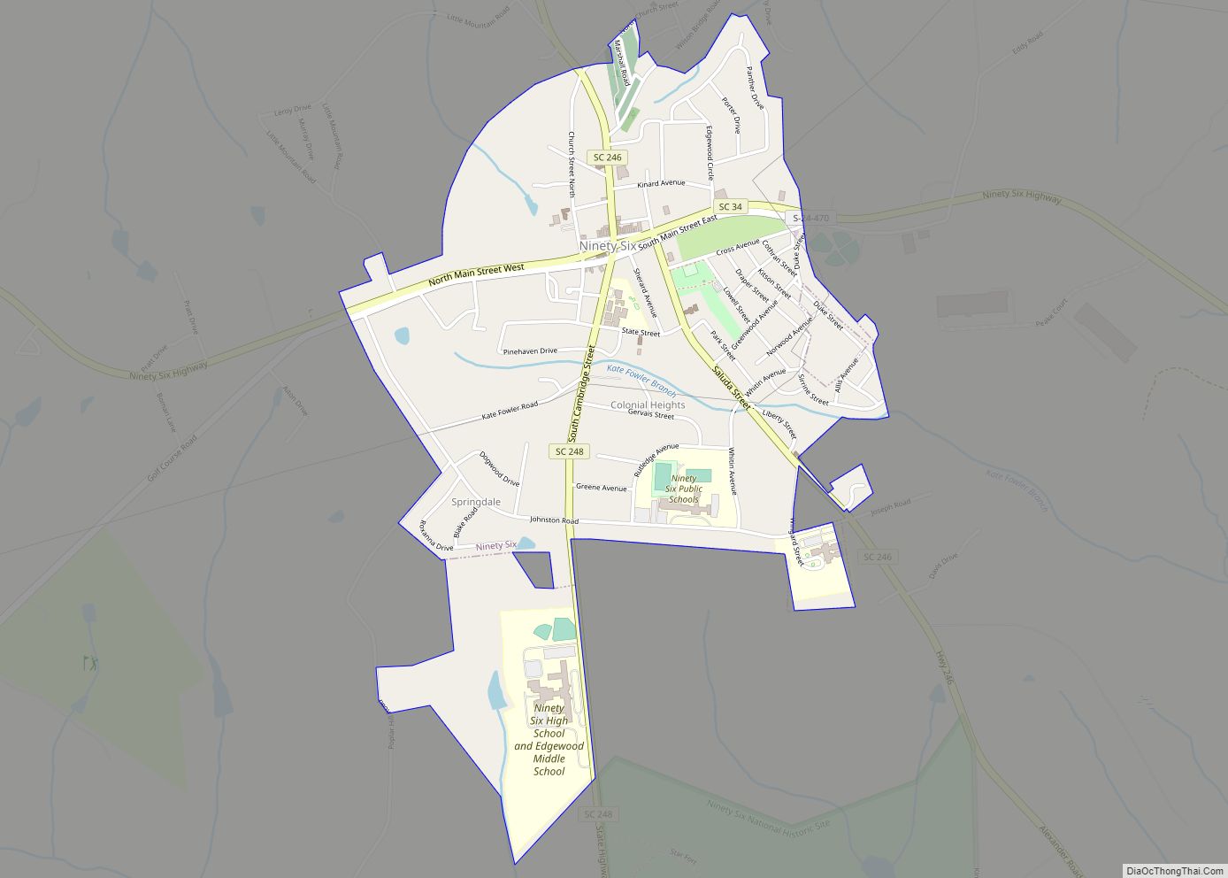
The trade in deerskins was highly lucrative, and traders passed on information among them about landmarks and the distances to their customers in the Nation. They estimated mileage between streams based on their day’s travel. They noted unusual aspects, such as the six creeks that ran unexpectedly south away from the Saluda River and, further west, nine creeks that ran south away from the Savannah River, noting them on maps as “6” and “9”. A town in this area and a district both became known as “Ninety-Six”, which historian David P. George believes is related to traders’ references to these two landmark groups of streams. Using historical accounts and USGS maps, he and other historians have traced the Cherokee Path across present-day Greenwood County, territory that at the time was part of other districts.
After the Cherokee were removed from the area through treaty cessions and Indian Removal, European Americans moved in, developing large cotton plantations that were dependent on the labor of enslaved Africans. This upland region of the Piedmont supported widespread cultivation of short-staple cotton, a variety made profitable by the late 18th-century invention of the cotton gin for processing it. Cotton was the chief commodity of the South before the Civil War, and was important afterward as well. The construction of the Charlotte and South Carolina Railroad in 1852 in this area enabled planters to more easily get their products to market.
The railway also stimulated the development of textile manufacturing in the Piedmont in the late nineteenth century. Previously most cotton had been shipped to the North (New York and New England) for processing and manufacture, or to England and Europe. The rise of textile manufacturing in the South altered the economy and society of the region. The first cotton mill in Greenwood opened in 1890 with 75 workers. (As labor was highly segregated, factory owners hired only white workers for decades.) When the mill nearly failed in 1908, James C. Self became president of Greenwood Cotton Mill and built one of the largest privately held companies in the industry. Abney Mills, based in Greenwood, developed more production plants across the upstate.
Greenwood County was formed in 1897 from portions of Abbeville and Edgefield counties, which had originally been part of the old Ninety-Six District. It was named for its county seat, Greenwood. The town was named around 1824 after a cotton plantation owned by John McGehee, an early resident. The county and region has continued to be agricultural in the 21st century, although crops have changed.
In the late nineteenth century, conservative white Democrats had continued efforts to suppress black voting, through fraud and violence. Beginning with Mississippi in 1890, state legislatures passed new constitutions and laws that essentially disenfranchised most blacks. They maintained this political exclusion for decades, weakening the Republican Party throughout the South, where it had chiefly attracted freedmen and their descendants. South Carolina passed such a constitution in 1895 but violence continued around elections as African Americans tried to vote for Republican candidates. White Democrats were determined to regain power after a fusionist ticket had been elected at the state level.
In November 1898 the Phoenix Election riot broke out, after an armed altercation at the polling place. The Republican Congressional candidate was Rhett R. Tolbert. He came from a major planter family in the area. His brother Thomas P. Jr, was collecting affidavits in Phoenix from African Americans who wanted to vote for Tolbert but had been prevented from doing so. Democrat Giels O. Ethridge, came from a polling place two miles away and confronted him. Ethridge was fatally shot; blacks were accused of killing him. White Democrats attacked Republican Thomas Tolbert and African Americans with him, wounding them seriously. (Tolbert later said that Ethridge was shot by his own people.) John R. Tolbert, their father, was also wounded, and he and another son Joseph fled to Charleston, where the senior Tolbert was US customs officer of the port. Violence took place throughout the Phoenix area for four days, with armed groups of whites coming from around the county to hunt down black suspects. A mob of 600-1000 armed white men had gathered in Phoenix before events ended. Several African-American men were killed; at least six were lynched near Rehoboth Church. An inquest concluded their deaths were from “persons unknown.”
This region continued to depend on agriculture, which was struggling. Cotton crops throughout the South were damaged by the boll weevil. Many African Americans left this and other rural counties in the early 20th century in the Great Migration from 1910 to 1940, to escape Jim Crow suppression and violence, and gain jobs in industrial cities of the North and Midwest.
The Great Depression of the 1930s altered the economy and landscape of Greenwood County. Farmers were impoverished, and land values declined. As local textile mills struggled to survive, they resisted union efforts to organize the workers. After 1933, New Deal programs of the Franklin D. Roosevelt administration offered limited work relief for the unemployed, as the federal government invested in numerous local infrastructure programs to provide jobs and build for the future.
The largest New Deal project in the area was construction of Buzzard’s Roost Dam on the Saluda River to impound Lake Greenwood and generate electricity at a county-owned power plant. Since then, the county sold the hydroelectric plant to Duke Power Company, which dominates the regional market. The lake offers residents and visitors an array of recreational facilities.
Since 1950, Greenwood County has developed a diversified industrial base. New factories have been constructed by such major corporations as Monsanto (Ascend), Velux, Capsugel (Lonza) and Fujifilm.
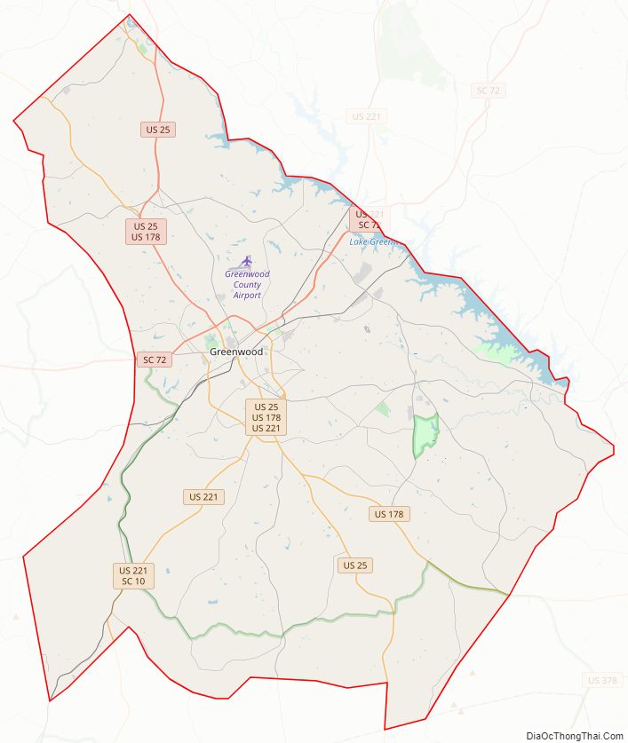
Greenwood County Road Map
Geography
According to the U.S. Census Bureau, the county has a total area of 463 square miles (1,200 km), of which 455 square miles (1,180 km) is land and 8.2 square miles (21 km) (1.8%) is water. Greenwood County is in the basins of the Savannah and the Saluda rivers.
National protected areas/sites
- Cedar Springs Historic District
- Ninety Six National Historic Site
- Sumter National Forest (part)
State and local protected areas
- Lake Greenwood State Park
- Long Cane Scenic Area
Major water bodies
- Halfway Swamp Creek
- Lake Greenwood
- Saluda River
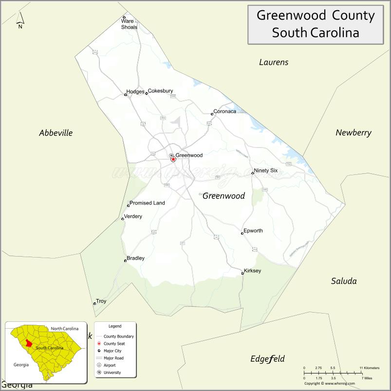
Adjacent counties
- Laurens County – north
- Newberry County – northeast
- Edgefield County – southeast
- Saluda County – southeast
- McCormick County – southwest
- Abbeville County – west
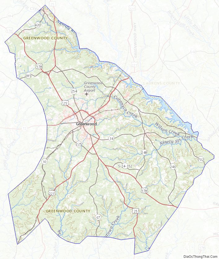
Greenwood County Topographic Map
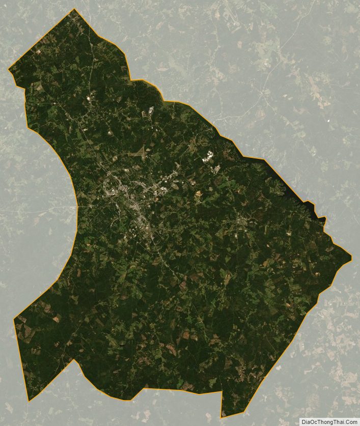
Greenwood County Satellite Map
Greenwood County Outline Map