| Name: | Hampton City |
|---|---|
| FIPS code: | 51-650 |
| State: | Virginia |
| Land Area: | 51.46 sq mi (133.28 km²) |
| Population Density: | 2,665.14/sq mi (1,029.02/km²) |
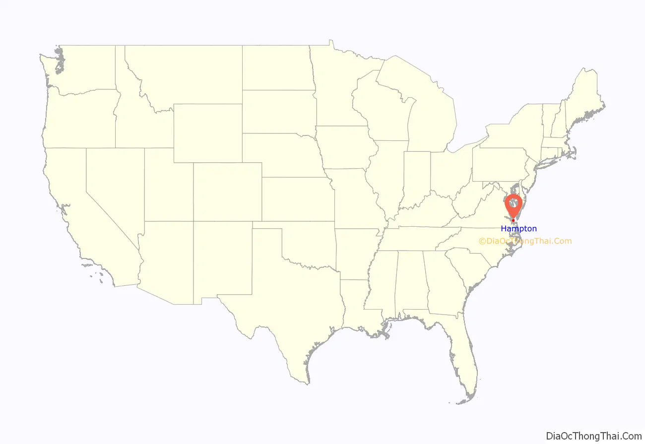
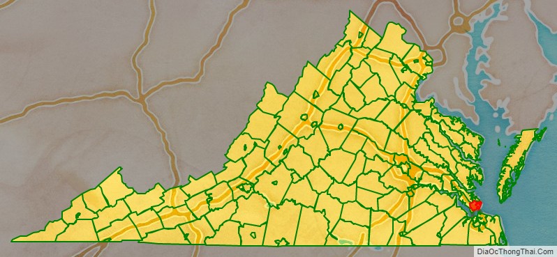
Hampton City location map. Where is Hampton City?
History
Indigenous Americans settled in present-day Hampton before 10,000 BCE. In the early 1600s, the Tidewater region was populated by the Powhatan peoples who called the lands Tsenacommacah. The Powhatan Chiefdom was made up of over 30 tribes numbering an estimated 25,000 people before the arrival of English colonists.
Colonial history
In December 1606, three ships carrying men and boys left England on a mission sponsored by a proprietary company. Led by Captain Christopher Newport, they sailed across the Atlantic Ocean to North America. After a long voyage, they first landed at the entrance to the Chesapeake Bay on the south shore at a place they named Cape Henry (for Henry Frederick, Prince of Wales, the elder son of their king).
During the first few days of exploration, they identified the site of Old Point Comfort (which they originally named “Point Comfort”) as a strategic defensive location at the entrance to the body of water that became known as Hampton Roads. This is formed by the confluence of the Elizabeth, Nansemond, and James rivers. The latter is the longest river in Virginia.
Weeks later, on May 14, 1607, they established the first permanent English settlement in the present-day United States about 25 miles (40 km) further inland from the Bay which became the site of fortifications during the following 200 years.
Slightly south, near the entrance to Hampton River, the colonists seized the Native American community of Kecoughtan under Virginia’s Governor, Sir Thomas Gates. The colonists established their own small town, with a small Anglican church (known now as St. John’s Episcopal Church), on July 9, 1610. This came to be known as part of Hampton. (With Jamestown having been abandoned in 1699, Hampton claims to be the oldest continuously occupied English settlement in the United States). Hampton was named for Henry Wriothesley, 3rd Earl of Southampton, an important leader of the Virginia Company of London, for whom the Hampton River, Hampton Roads and Southampton County were also named. The area became part of Elizabeth Cittie [sic] in 1619, Elizabeth River Shire in 1634, and was included in Elizabeth City County when it was formed in 1643. By 1680, the settlement was known as Hampton, and it was incorporated as a town in 1705 and became the seat of Elizabeth City County.
In the latter part of August 1619, the White Lion, a privateer captained by John Colyn Jope and sailing under a Dutch letter of marque, delivered approximately 20 enslaved Africans, from the present-day region of Angola to Point Comfort. They had been removed by its crew from a Portuguese slave ship, the “São João Bautista”. These were the first recorded slaves from Africa in the Thirteen Colonies. John Rolfe, the widower of Pocahontas, wrote in a letter that he was at Point Comfort and witnessed the arrival of the first Africans. The Bantu from Angola were considered indentured servants, but in effect, were to be slaves. Two of the first Africans to arrive were Anthony and Isabella. Their child, the first of African descent born in North America, was born baptized January 1624.
Post-colonial history
In 1813, the fort was captured again by the British as part of the War of 1812. Shortly after the war ended, the US Army built a more substantial stone facility at Old Point Comfort. It was called Fort Monroe in honor of President James Monroe. The new installation and adjacent Fort Calhoun (on a man-made island across the channel) were completed in 1834. Fort Monroe is the largest stone fort ever built in the United States.
Fort Monroe, Hampton and the surrounding area played several important roles during the American Civil War (1861–1865). Although most of Virginia became part of the Confederate States of America, Fort Monroe remained in Union hands. It became notable as a historic and symbolic site of early freedom for former slaves under the provisions of contraband policies and later the Emancipation Proclamation. After the War, former Confederate President, Jefferson Davis was imprisoned in the area now known as the Casemate Museum on the base.
To the northwest of Fort Monroe, the Town of Hampton had the misfortune to be attacked during the American Revolutionary War and burned down during the War of 1812 and the American Civil War. From the ruins of Hampton left by evacuating Confederates in 1861, “Contraband” slaves (formerly owned by Confederates and under a degree of Union protection) built the Grand Contraband Camp, the first self-contained African American community in the United States. A number of modern-day Hampton streets retain their names from that community. The large number of contraband slaves who sought the refuge of Fort Monroe and the Grand Contraband Camp led to educational efforts which eventually included establishment of Hampton University, site of the famous Emancipation Oak.
The original site of the Native American’s Kecoughtan Settlement was near the present site of a Hampton Roads Transit facility. To the south of present-day Hampton, a small unrelated incorporated town also named Kecoughtan many years later and also located in Elizabeth City County was annexed by the city of Newport News in 1927. It is now part of that city’s East End.
Hampton was incorporated as a city in 1849. On March 30, 1908, Hampton was separated from Elizabeth City County and became an independent city. However, it remained the county seat and continued to share many services with the county. On July 1, 1952, following approval of voters of each locality by referendum, the city of Hampton, the incorporated town of Phoebus and Elizabeth City County merged into the independent city of Hampton. It was the first of a series of political consolidations in the Hampton Roads region during the third quarter of the 20th century.
Modern military history
Hampton has a rich and extensive 20th-century military history – home of Langley Air Force Base, the nation’s first military installation dedicated solely to air power and the home of the U.S. Air Force’s 633rd Air Base Wing and 1st and 192nd Fighter Wings. Hampton has been a center of military aviation training, research and development for nearly a hundred years, from early prop planes and Zeppelins to rocket parts and advanced fighters. Its proximity to Norfolk means that Hampton has long been home to many Navy families. Together, many Air Force and Navy families in the Hampton area experienced significant losses in war and peacetime due to family members in combat and peacetime military accidents.
Fort Monroe was an active army base until its decommissioning on September 15, 2011. Shortly after, the fort was named a National Monument by President Barack Obama, on November 1.
In particular, during the Vietnam War, Langley Air Force Base was a designated ‘waiting base’ and thousands of Air Force families were transferred to Hampton from all over the world to wait while their husbands and fathers served in Vietnam. Thousands of Navy families associated with Naval bases in Norfolk next door also waited in Hampton during this era. Vietnam was a very high casualty war for Air Force and Navy pilots (some types of planes experienced a 50% casualty rate), and Naval “river rats” who fought on the rivers of the Mekong Delta experienced high casualties as well. There accumulated over time, in the Hampton area, a high concentration of families of unaccounted for wartime casualties. In many cases Hampton-stationed military families of “Missing in Action” or “Prisoner of War” pilots and sailors spent many years in the area waiting to find out what had happened to their missing or captured airmen and sailors.
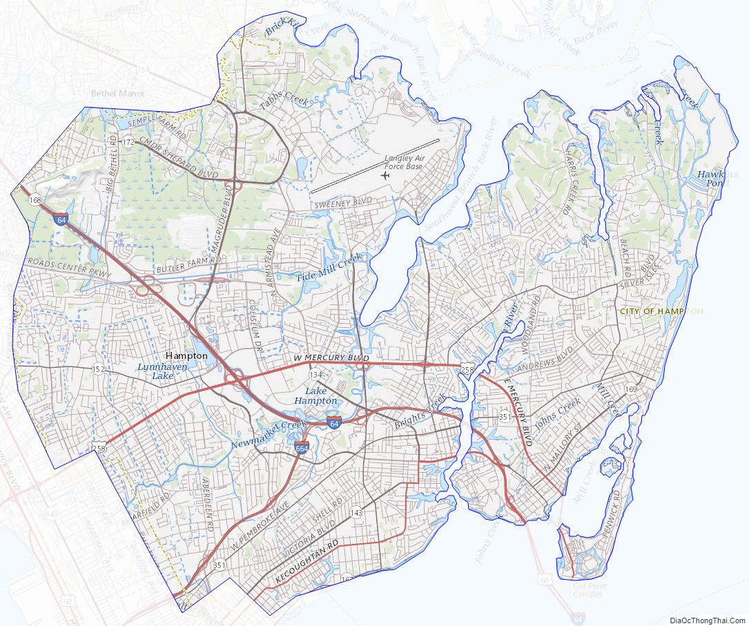
Hampton City Road Map
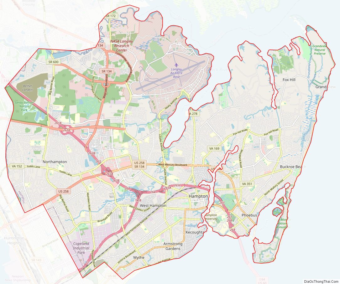
Geography
According to the United States Census Bureau, the city has a total area of 136 square miles (350 km), of which 51 square miles (130 km) is land and 85 square miles (220 km) (62.3%) is water.
Neighborhoods
- Aberdeen Gardens
- Buckroe Beach
- Farmington
- Fox Hill
- Hampton Woods
- Northampton
- Newmarket
- Phoebus
- Victoria Boulevard Historic District
- Wythe, including the Olde Wythe Historic District
Climate
Hampton has a humid subtropical climate (Köppen: Cfa) characteristic of the Southeast United States. The weather in Hampton is temperate and seasonal with hot and humid summers and mild winters. The mean annual temperature is 60.2 °F (15.7 °C), with an average annual snowfall of 6 inches (150 mm) and an average annual rainfall of 47 inches (1,200 mm). The wettest month by average rainfall is August with an average of 2.4 inches of rain falling on 11–12 days, although in March it typically rains on more days with 2.3 inches of rain falling in 12 to 13 days. The hottest day on record was August 1, 1980 when the temperature hit 105.1 °F (40.6 °C). The lowest recorded temperature of −2.7 °F (−19.3 °C) was recorded on January 21, 1985.
Hampton City Topographic Map
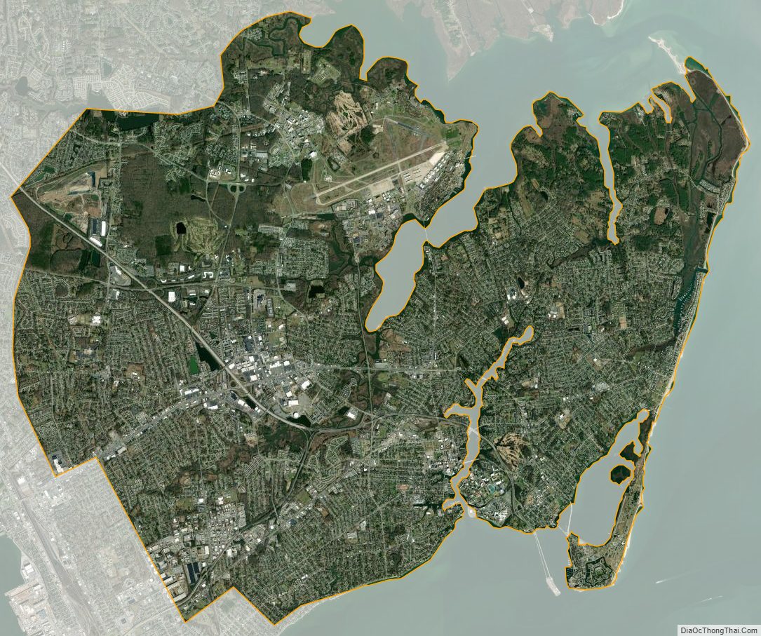
Hampton City Satellite Map
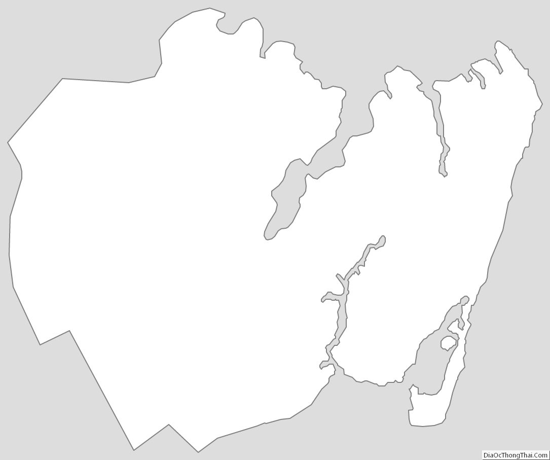
Hampton City Outline Map