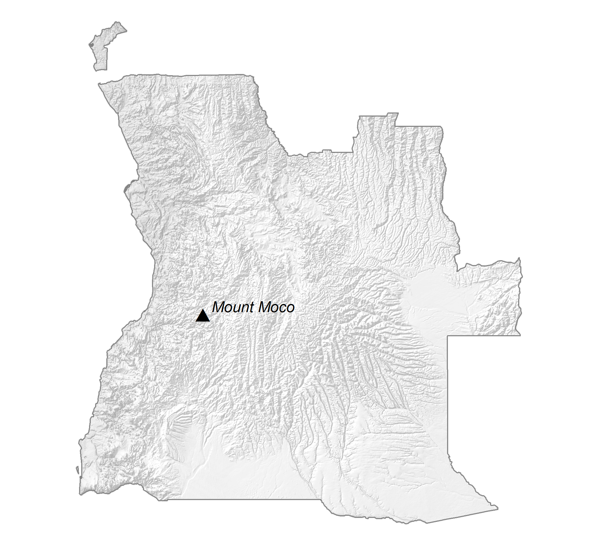
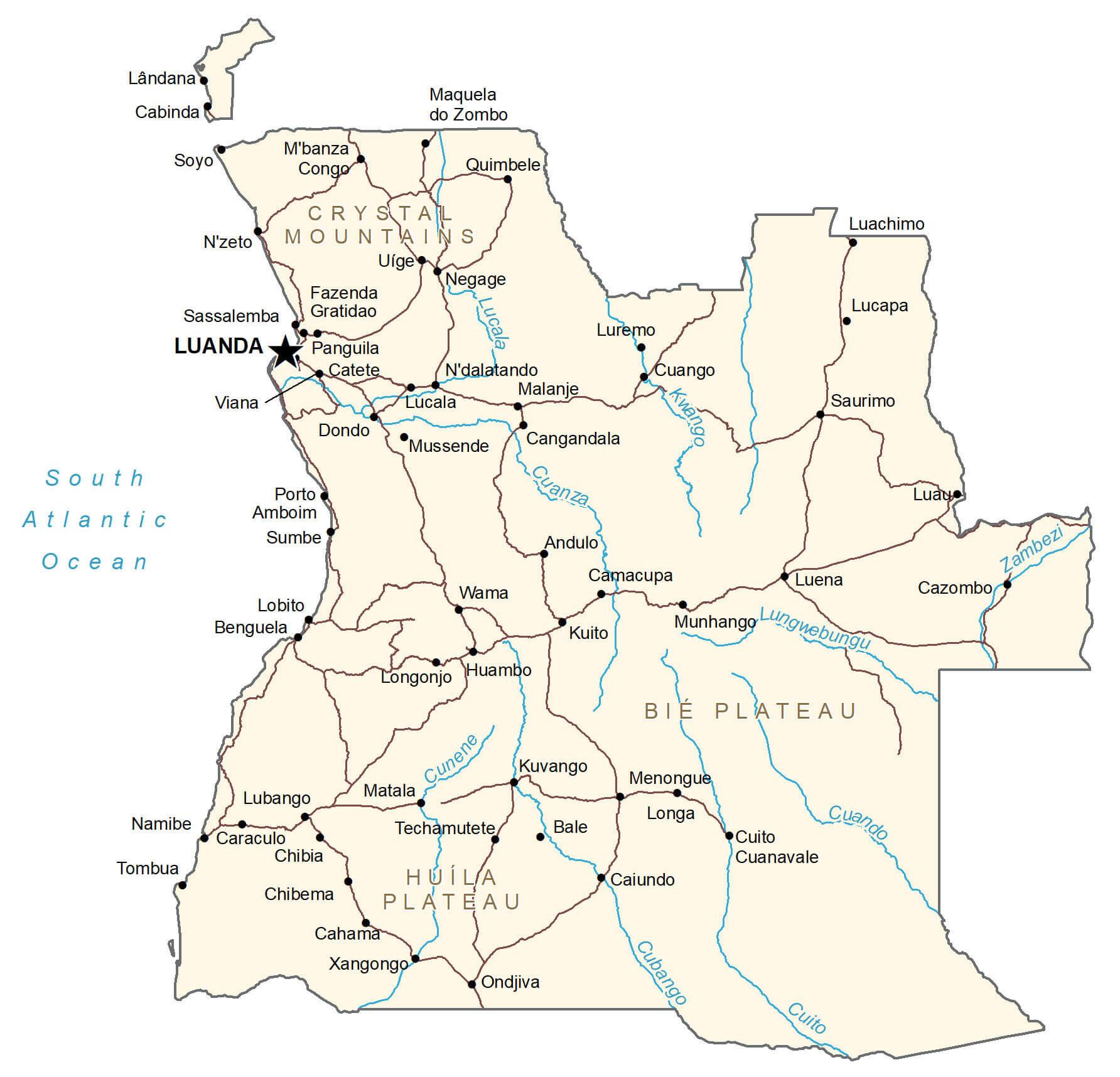
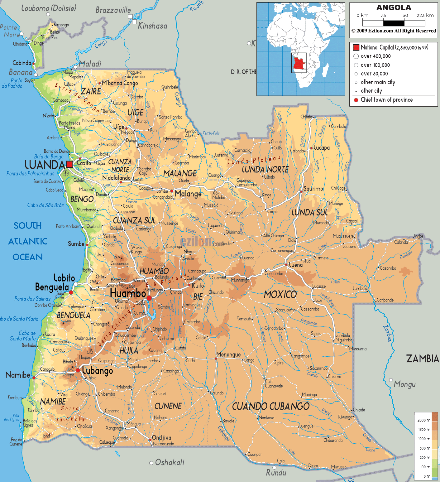
The physical map illustrates the four principal regions of Angola: an arid coastal lowland, hills and mountains that rise inland, a vast plain known as the high plateau (planalto), and rain forest. The mostly flat coastal plain stretches inland for 30 to 100 miles into a belt of rolling hills and a series of scattered mountains. The highest point of the country, Morro de Moco, peaks at 8,592 ft (2,620 m), and is located in the Ahaggar Mountains. Conversely, the lowest point of the country is the Atlantic Ocean (0 m). Angola’s elevated high plateau rises 4,000 to 6,000 ft. (1,200 to 1,800 m), lies to the east of the hills and mountains and dominates Angola’s terrain. The Zambezi River and several tributaries of the Congo River flow through Angola. Additional rivers of importance include the Cubango, Cuando and Cuango. Also of note are the Kalandula Falls located on the Lucala River. At 344 ft. (105 m) the Kalandula are one of the largest waterfalls in Africa based on volume. The Northern Angolan province of Cabinda is separated from the mainland by a narrow strip of land belonging to the Democratic Republic of Congo (DRC). Luanda the capital city is its primary port located on Angola’s northern Atlantic coast. Its the largest city with over 8 million inhabitants in 2019 (a third of Angola’s population).
| Flag: |  |
|---|---|
| Legal Name: | Republic of Angola |
| Capital Value: | Luanda |
| Official languages: | Portuguese |
| Demonym(s): |
|
| Government: | Unitary dominant-party presidential republic |
| Legislature: | National Assembly |
| Total Area: | 1,246,700 km² |
| Land Area: | 1,246,700 km² |
| Population: | 31,825,295 |
| Density: | 24.97/km (64.7/sq mi) (157th) |
| GDP: | $94.64 Billion |
| GDP Per Capita: | $2,973.59 |
| Currency Value: | Kwanza (AOA) |
| Driving side: | right |
| Calling code: | +244 |
| Internet TLD: | .ao |
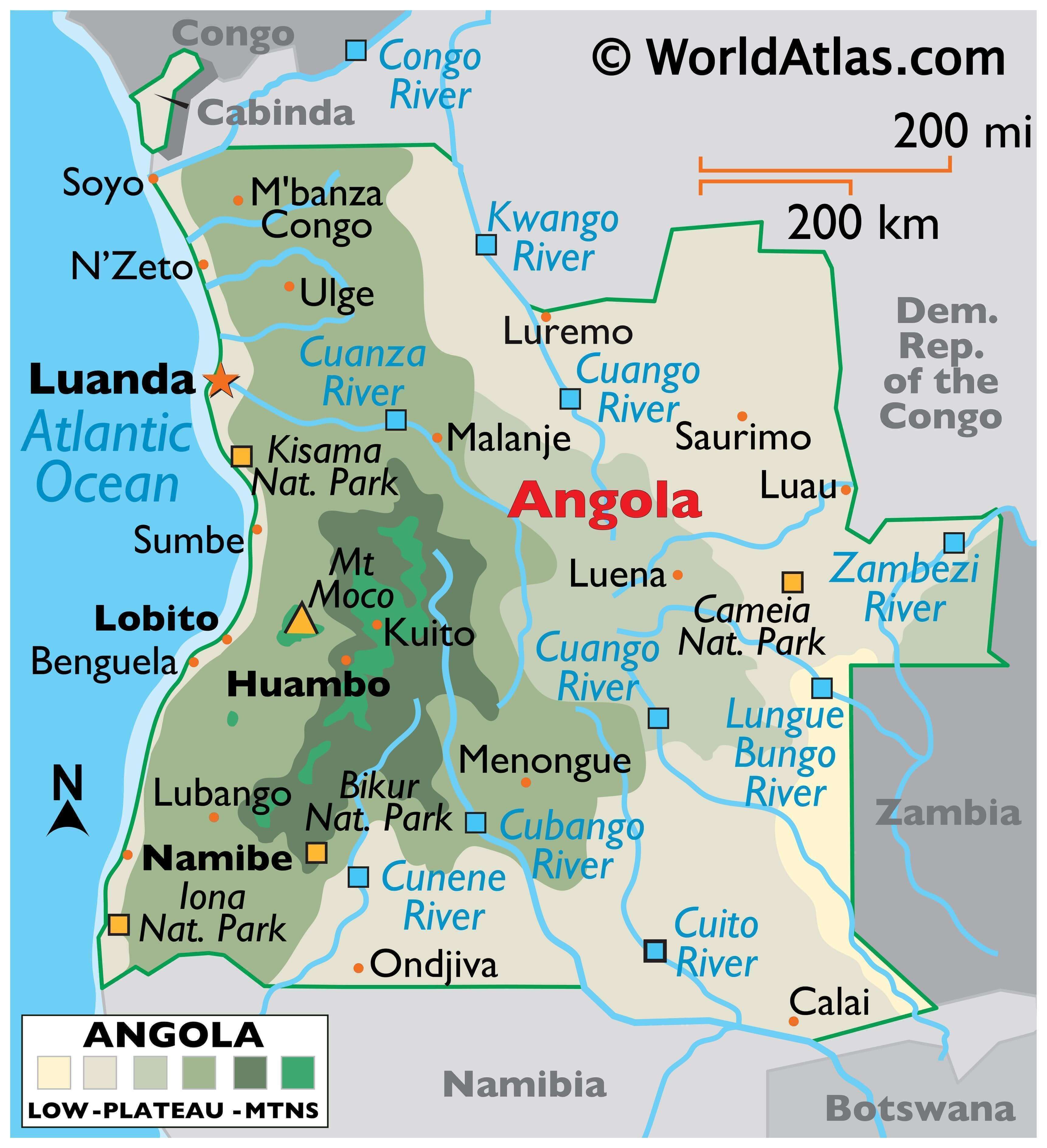
Explore the beauty of Angola with this interactive map! View its cities, towns, rivers, roads, and the small exclave of Cabinda away from the mainland. You can also see satellite imagery and elevation maps, highlighting the country’s lowlands, plateaus, and mountains.
Online Interactive Political Map
Click on ![]() to view map in "full screen" mode.
to view map in "full screen" mode.
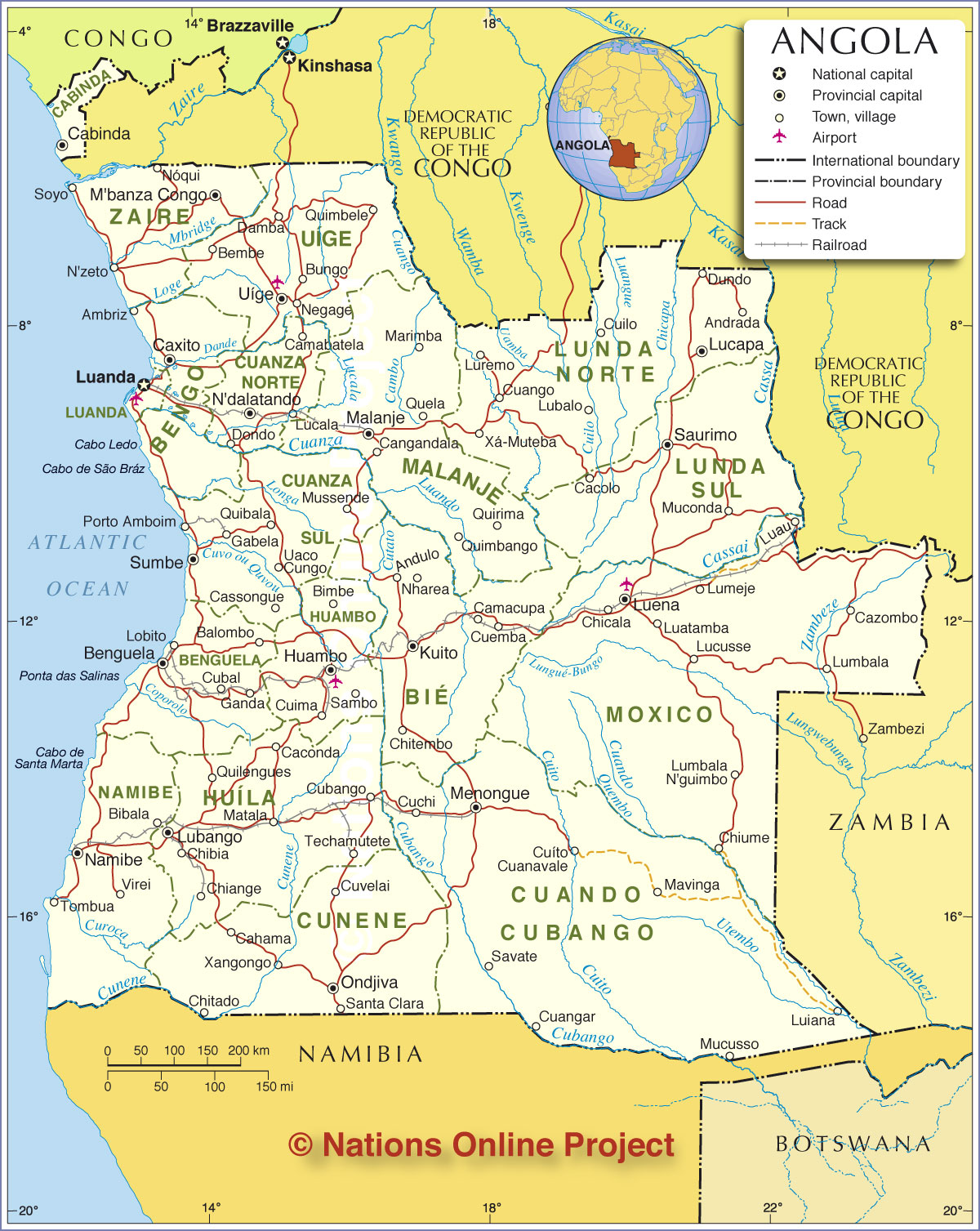
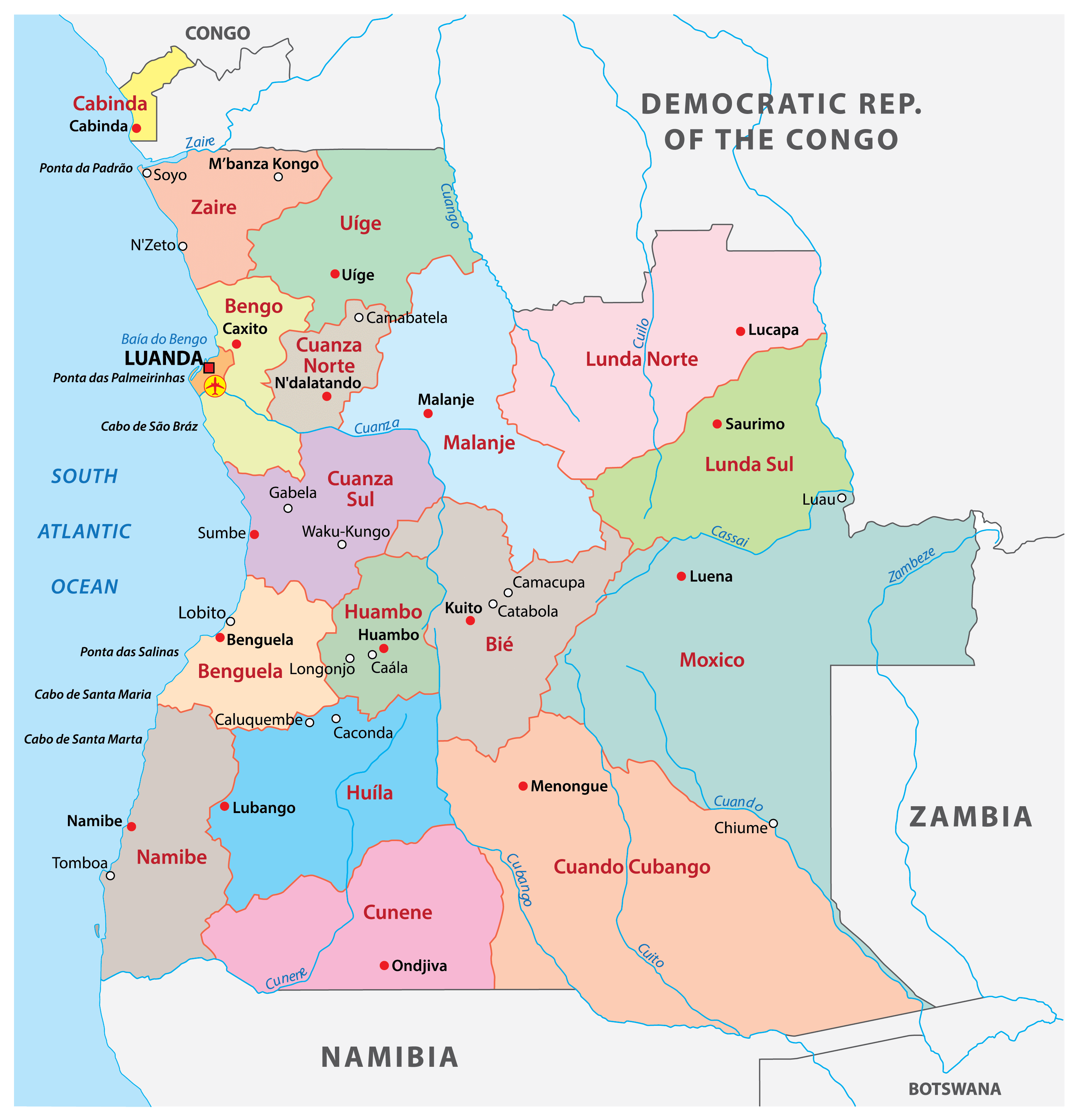
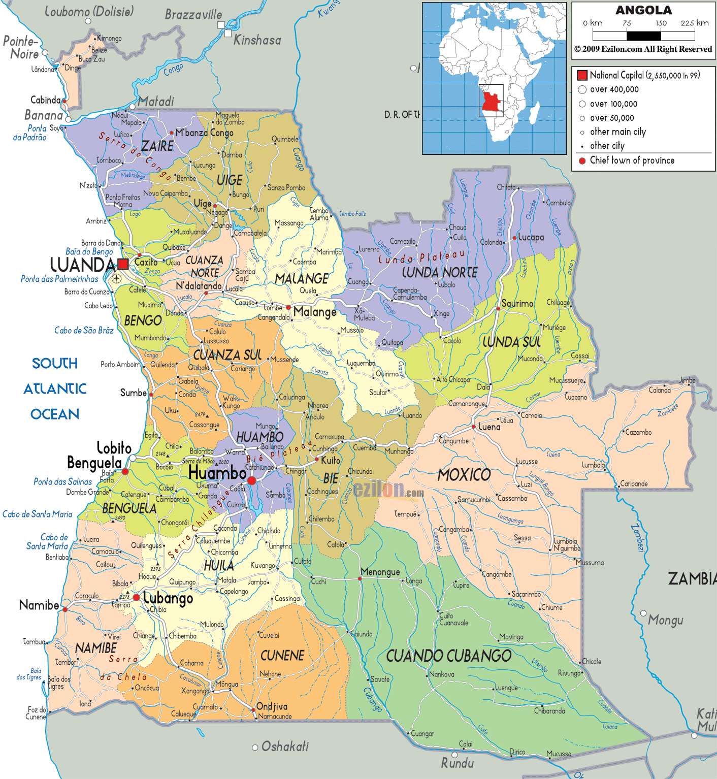
The political map of Angola shows the 18 provinces and their capital cities. The most populated province is Luanda which contains its capital city. Its largest province by area is Cuando Cubango located in the south-east at 204,000 km² followed closely by its northern neighbor Moxico at 201,000 km². Cabinda is an exclave that is separated from the rest of Angola by a narrow strip of territory that belongs to the Democratic Republic of the Congo
18 provinces of Angola; Bengo, Benguela, Bie, Cabinda, Cuando Cubango, Cuanza-Norte, Cuanza-Sul, Cunene, Huambo, Huila, Luanda, Lunda-Norte, Lunda-Sul, Malanje, Moxico, Namibe, Uige, and Zaire.
Location Maps
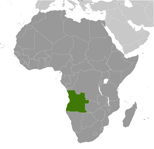
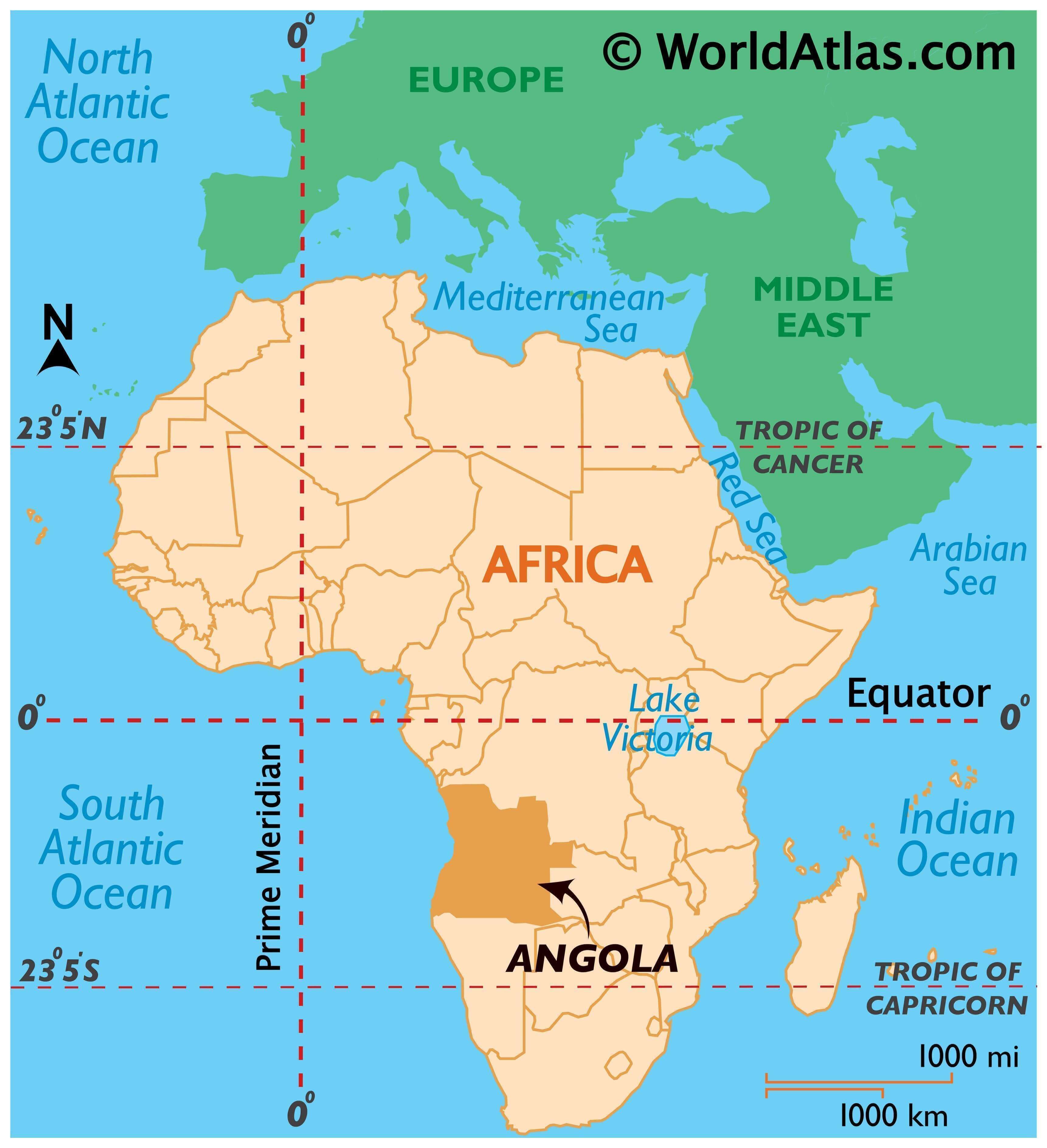
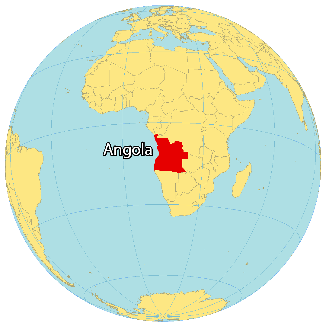
Where is Angola?
Angola is a country located in the southern region of Africa, below the equator. It is bordered by the Democratic Republic of Congo and the Congo to the north, as well as Zambia and Namibia to the east and south. The capital of Angola is Luanda, a city renowned for being the most expensive in the world. Angola also includes the small exclave of Cabinda, which is noteworthy for its oil reserves and production.
High Definition Political Map of Angola
History
Early migrations and political units
Modern Angola was populated predominantly by nomadic Khoi and San prior to the first Bantu migrations. The Khoi and San peoples were neither pastoralists nor cultivators, but rather hunter-gatherers. They were displaced by Bantu peoples arriving from the north in the first millennium BC, most of whom likely originated in what is today northwestern Nigeria and southern Niger. Bantu speakers introduced the cultivation of bananas and taro, as well as large cattle herds, to Angola’s central highlands and the Luanda plain.
A number of political entities were established; the best-known of these was the Kingdom of Kongo, based in Angola, which extended northward to what is now the Democratic Republic of the Congo, the Republic of the Congo and Gabon. It established trade routes with other city-states and civilisations up and down the coast of southwestern and western Africa and even with Great Zimbabwe and the Mutapa Empire, although it engaged in little or no transoceanic trade. To its south lay the Kingdom of Ndongo, from which the area of the later Portuguese colony was sometimes known as Dongo, and right next to them lay the Kingdom of Matamba.
Portuguese colonization
Portuguese explorer Diogo Cão reached the area in 1484. The previous year, the Portuguese had established relations with the Kongo, which stretched at the time from modern Gabon in the north to the Kwanza River in the south. The Portuguese established their primary early trading post at Soyo, which is now the northernmost city in Angola apart from the Cabinda exclave. Paulo Dias de Novais founded São Paulo de Loanda (Luanda) in 1575 with a hundred families of settlers and four hundred soldiers. Benguela was fortified in 1587 and became a township in 1617.
The Portuguese established several other settlements, forts and trading posts along the Angolan coast, principally trading in Angolan slaves for plantations. Local slave dealers provided a large number of slaves for the Portuguese Empire, usually in exchange for manufactured goods from Europe.
This part of the Atlantic slave trade continued until after Brazil’s independence in the 1820s.
Despite Portugal’s territorial claims in Angola, its control over much of the country’s vast interior was minimal. In the 16th century Portugal gained control of the coast through a series of treaties and wars. Life for European colonists was difficult and progress was slow. John Iliffe notes that “Portuguese records of Angola from the 16th century show that a great famine occurred on average every seventy years; accompanied by epidemic disease, it might kill one-third or one-half of the population, destroying the demographic growth of a generation and forcing colonists back into the river valleys”.
During the Portuguese Restoration War, the Dutch West India Company occupied the principal settlement of Luanda in 1641, using alliances with local peoples to carry out attacks against Portuguese holdings elsewhere. A fleet under Salvador de Sá retook Luanda in 1648; reconquest of the rest of the territory was completed by 1650. New treaties with the Kongo were signed in 1649; others with Njinga’s Kingdom of Matamba and Ndongo followed in 1656. The conquest of Pungo Andongo in 1671 was the last major Portuguese expansion from Luanda, as attempts to invade Kongo in 1670 and Matamba in 1681 failed. Colonial outposts also expanded inward from Benguela, but until the late 19th century the inroads from Luanda and Benguela were very limited. Hamstrung by a series of political upheavals in the early 1800s, Portugal was slow to mount a large scale annexation of Angolan territory.
The slave trade was abolished in Angola in 1836, and in 1854 the colonial government freed all its existing slaves. Four years later, a more progressive administration appointed by Portugal abolished slavery altogether. However, these decrees remained largely unenforceable, and the Portuguese depended on assistance from the British Royal Navy to enforce their ban on the slave trade. This coincided with a series of renewed military expeditions into the bush.
By the mid-nineteenth century Portugal had established its dominion as far north as the Congo River and as far south as Mossâmedes. Until the late 1880s, Portugal entertained proposals to link Angola with its colony in Mozambique but was blocked by British and Belgian opposition. In this period, the Portuguese came up against different forms of armed resistance from various peoples in Angola.
The Berlin Conference in 1884–1885 set the colony’s borders, delineating the boundaries of Portuguese claims in Angola, although many details were unresolved until the 1920s. Trade between Portugal and its African territories rapidly increased as a result of protective tariffs, leading to increased development, and a wave of new Portuguese immigrants.
Between 1939 and 1943 the Portuguese army carried out operations against the nomadic Mucubal people, accused of rebellion, which led to the death of half their population. The survivors were incarcerated in concentration camps, sent to forced labor camps, where the great majority of them perished due to the brutality of the work system, undernourishment and executions.
Angolan independence
Under colonial law, black Angolans were forbidden from forming political parties or labour unions. The first nationalist movements did not take root until after World War II, spearheaded by a largely Westernised and Portuguese-speaking urban class, which included many mestiços. During the early 1960s they were joined by other associations stemming from ad hoc labour activism in the rural workforce. Portugal’s refusal to address increasing Angolan demands for self-determination provoked an armed conflict, which erupted in 1961 with the Baixa de Cassanje revolt and gradually evolved into a protracted war of independence that persisted for the next twelve years. Throughout the conflict, three militant nationalist movements with their own partisan guerrilla wings emerged from the fighting between the Portuguese government and local forces, supported to varying degrees by the Portuguese Communist Party.
The National Front for the Liberation of Angola (FNLA) recruited from Bakongo refugees in Zaire. Benefiting from particularly favourable political circumstances in Léopoldville, and especially from a common border with Zaire, Angolan political exiles were able to build up a power base among a large expatriate community from related families, clans, and traditions. People on both sides of the border spoke mutually intelligible dialects and enjoyed shared ties to the historical Kingdom of Kongo. Though as foreigners skilled Angolans could not take advantage of Mobutu Sese Seko’s state employment programme, some found work as middlemen for the absentee owners of various lucrative private ventures. The migrants eventually formed the FNLA with the intention of making a bid for political power upon their envisaged return to Angola.
A largely Ovimbundu guerrilla initiative against the Portuguese in central Angola from 1966 was spearheaded by Jonas Savimbi and the National Union for the Total Independence of Angola (UNITA). It remained handicapped by its geographic remoteness from friendly borders, the ethnic fragmentation of the Ovimbundu, and the isolation of peasants on European plantations where they had little opportunity to mobilise.
During the late 1950s, the rise of the Marxist–Leninist Popular Movement for the Liberation of Angola (MPLA) in the east and Dembos hills north of Luanda came to hold special significance. Formed as a coalition resistance movement by the Angolan Communist Party, the organisation’s leadership remained predominantly Ambundu and courted public sector workers in Luanda. Although both the MPLA and its rivals accepted material assistance from the Soviet Union or the People’s Republic of China, the former harboured strong anti-imperialist views and was openly critical of the United States and its support for Portugal. This allowed it to win important ground on the diplomatic front, soliciting support from nonaligned governments in Morocco, Ghana, Guinea, Mali, and the United Arab Republic.
The MPLA attempted to move its headquarters from Conakry to Léopoldville in October 1961, renewing efforts to create a common front with the FNLA, then known as the Union of Angolan Peoples (UPA) and its leader Holden Roberto. Roberto turned down the offer. When the MPLA first attempted to insert its own insurgents into Angola, the cadres were ambushed and annihilated by UPA partisans on Roberto’s orders—setting a precedent for the bitter factional strife which would later ignite the Angolan Civil War.
Angolan Civil War
Throughout the war of independence, the three rival nationalist movements were severely hampered by political and military factionalism, as well as their inability to unite guerrilla efforts against the Portuguese. Between 1961 and 1975 the MPLA, UNITA, and the FNLA competed for influence in the Angolan population and the international community. The Soviet Union and Cuba became especially sympathetic towards the MPLA and supplied that party with arms, ammunition, funding, and training. They also backed UNITA militants until it became clear that the latter was at irreconcilable odds with the MPLA.
The collapse of Portugal’s Estado Novo government following the 1974 Carnation Revolution suspended all Portuguese military activity in Africa and the brokering of a ceasefire pending negotiations for Angolan independence. Encouraged by the Organisation of African Unity, Holden Roberto, Jonas Savimbi, and MPLA chairman Agostinho Neto met in Mombasa in early January 1975 and agreed to form a coalition government. This was ratified by the Alvor Agreement later that month, which called for general elections and set the country’s independence date for 11 November 1975. All three factions, however, followed up on the ceasefire by taking advantage of the gradual Portuguese withdrawal to seize various strategic positions, acquire more arms, and enlarge their militant forces. The rapid influx of weapons from numerous external sources, especially the Soviet Union and the United States, as well as the escalation of tensions between the nationalist parties, fueled a new outbreak of hostilities. With tacit American and Zairean support the FNLA began massing large numbers of troops in northern Angola in an attempt to gain military superiority. Meanwhile, the MPLA began securing control of Luanda, a traditional Ambundu stronghold. Sporadic violence broke out in Luanda over the next few months after the FNLA attacked MPLA forces in March 1975. The fighting intensified with street clashes in April and May, and UNITA became involved after over two hundred of its members were massacred by an MPLA contingent that June. An upswing in Soviet arms shipments to the MPLA influenced a decision by the Central Intelligence Agency to likewise provide substantial covert aid to the FNLA and UNITA.
In August 1975, the MPLA requested direct assistance from the Soviet Union in the form of ground troops. The Soviets declined, offering to send advisers but no troops; however, Cuba was more forthcoming and in late September dispatched nearly five hundred combat personnel to Angola, along with sophisticated weaponry and supplies. By independence, there were over a thousand Cuban soldiers in the country. They were kept supplied by a massive airbridge carried out with Soviet aircraft. The persistent buildup of Cuban and Soviet military aid allowed the MPLA to drive its opponents from Luanda and blunt an abortive intervention by Zairean and South African troops, which had deployed in a belated attempt to assist the FNLA and UNITA. The FNLA was largely annihilated after the decisive Battle of Quifangondo, although UNITA managed to withdraw its civil officials and militia from Luanda and seek sanctuary in the southern provinces. From there, Savimbi continued to mount a determined insurgent campaign against the MPLA.
Between 1975 and 1991, the MPLA implemented an economic and political system based on the principles of scientific socialism, incorporating central planning and a Marxist–Leninist one-party state. It embarked on an ambitious programme of nationalisation, and the domestic private sector was essentially abolished. Privately owned enterprises were nationalised and incorporated into a single umbrella of state-owned enterprises known as Unidades Economicas Estatais (UEE). Under the MPLA, Angola experienced a significant degree of modern industrialisation. However, corruption and graft also increased and public resources were either allocated inefficiently or simply embezzled by officials for personal enrichment. The ruling party survived an attempted coup d’état by the Maoist-oriented Communist Organisation of Angola (OCA) in 1977, which was suppressed after a series of bloody political purges left thousands of OCA supporters dead.
The MPLA abandoned its former Marxist ideology at its third party congress in 1990, and declared social democracy to be its new platform. Angola subsequently became a member of the International Monetary Fund; restrictions on the market economy were also reduced in an attempt to draw foreign investment. By May 1991 it reached a peace agreement with UNITA, the Bicesse Accords, which scheduled new general elections for September 1992. When the MPLA secured a major electoral victory, UNITA objected to the results of both the presidential and legislative vote count and returned to war. Following the election, the Halloween massacre occurred from 30 October to 1 November, where MPLA forces killed thousands of UNITA supporters.
21st century
On 22 February 2002, Jonas Savimbi was killed in action against government troops. UNITA and the MPLA reached a cease-fire shortly afterwards. UNITA gave up its armed wing and assumed the role of a major opposition party. Although the political situation of the country began to stabilise, regular democratic processes did not prevail until the elections in Angola in 2008 and 2012 and the adoption of a new constitution in 2010, all of which strengthened the prevailing dominant-party system.
Angola has a serious humanitarian crisis; the result of the prolonged war, of the abundance of minefields, and the continued political agitation in favour of the independence of the exclave of Cabinda (carried out in the context of the protracted Cabinda conflict by the FLEC). While most of the internally displaced have now squatted around the capital, in musseques (shanty towns) the general situation for Angolans remains desperate.
A drought in 2016 caused the worst food crisis in Southern Africa in 25 years, affecting 1.4 million people across seven of Angola’s 18 provinces. Food prices rose and acute malnutrition rates doubled, with more than 95,000 children affected.
José Eduardo dos Santos stepped down as President of Angola after 38 years in 2017, being peacefully succeeded by João Lourenço, Santos’ chosen successor. Some members of the dos Santos family were later linked to high levels of corruption. In July 2022, ex-president José Eduardo dos Santos died in Spain.
In August 2022, the ruling party, MPLA, won another outright majority and President Lourenço won a second five-year term in the election. However, the election was the tightest in Angola’s history.
Physical Map of Angola
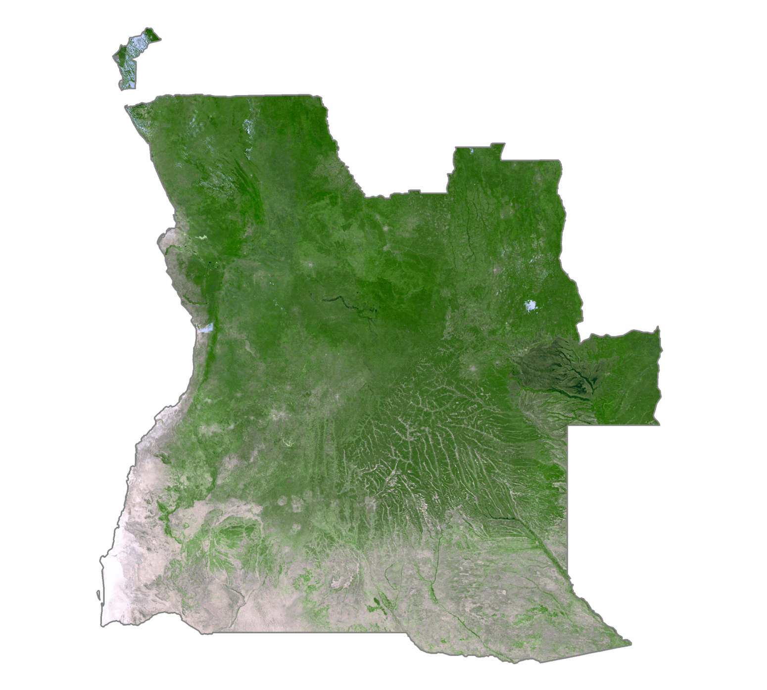
Angola Satellite Map
Elevation Map