| Name: | Hancock County |
|---|---|
| FIPS code: | 23-009 |
| State: | Maine |
| Founded: | June 25, 1789 |
| Named for: | John Hancock |
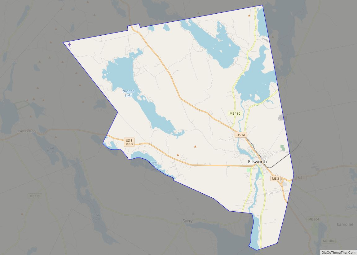
| Seat: | Ellsworth |
| Largest city: | Ellsworth |
| Total Area: | 2,345 sq mi (6,070 km²) |
| Land Area: | 1,587 sq mi (4,110 km²) |
| Total Population: | 55,478 |
| Population Density: | 24/sq mi (9.1/km²) |
| Time zone: | UTC−5 (Eastern) |
| Summer Time Zone (DST): | UTC−4 (EDT) |
| Website: | www.co.hancock.me.us |
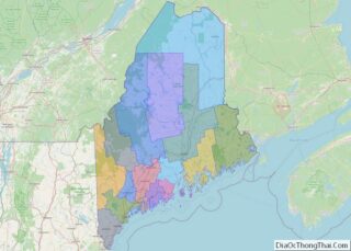
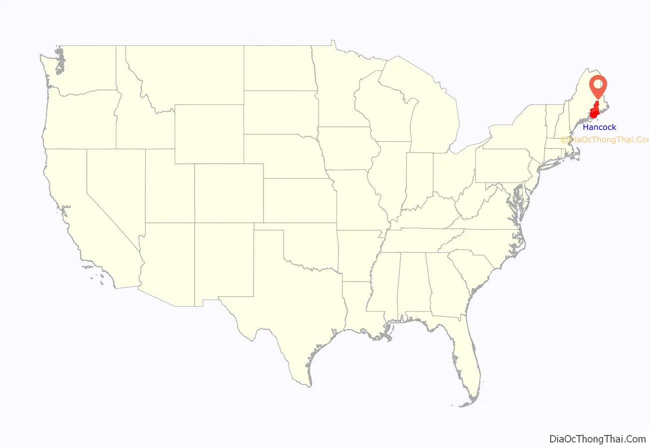
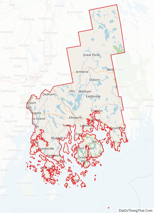
Hancock County location map. Where is Hancock County?
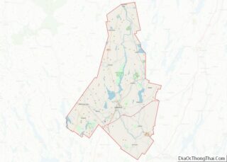
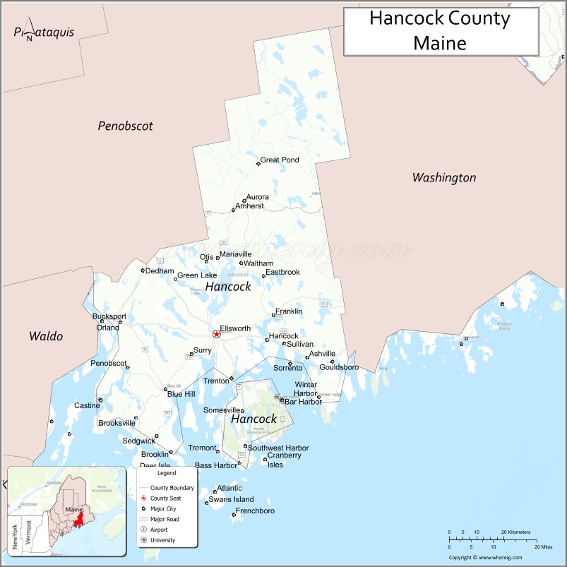
Hancock County Road Map
Geography
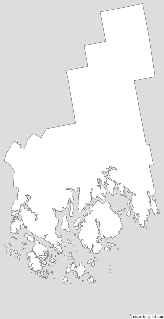
According to the U.S. Census Bureau, the county has a total area of 2,345 square miles (6,070 km), of which 1,587 square miles (4,110 km) is land and 758 square miles (1,960 km) (32%) is water. The county high point is Cadillac Mountain, 1527 feet, the highest summit on the U.S. Atlantic seaboard.
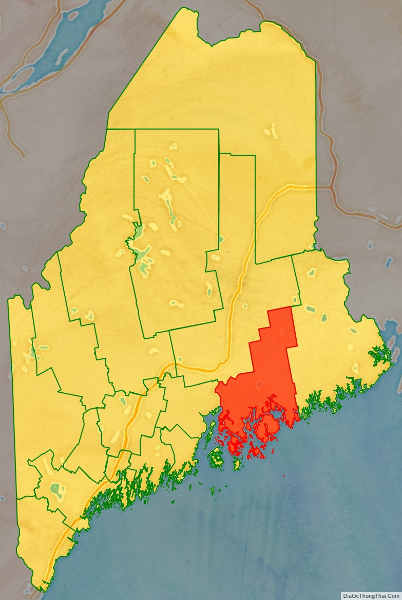
Adjacent counties
- Penobscot County — north
- Washington County — northeast
- Waldo County — west
- Knox County — southwest
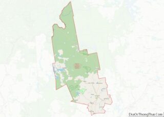
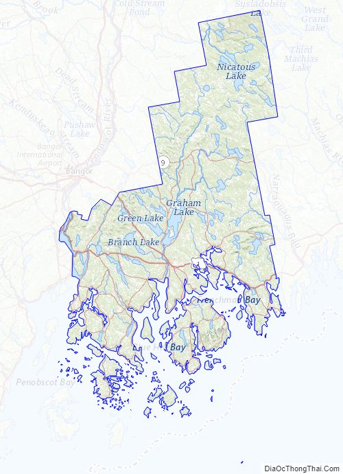
Hancock County Topographic Map
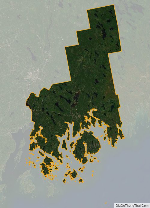
Hancock County Satellite Map
Hancock County Outline Map