Harlan County is a county in the U.S. state of Nebraska. As of the 2020 United States Census, the population was 3,073. Its county seat is Alma. The county is home to the Harlan County Reservoir.
In the Nebraska license plate system, Harlan County is represented by the prefix 51 (it had the 51st-largest number of vehicles registered in the county when the license plate system was established in 1922).
| Name: | Harlan County |
|---|---|
| FIPS code: | 31-083 |
| State: | Nebraska |
| Founded: | 1871 |
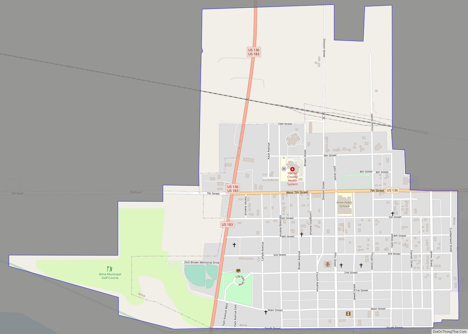
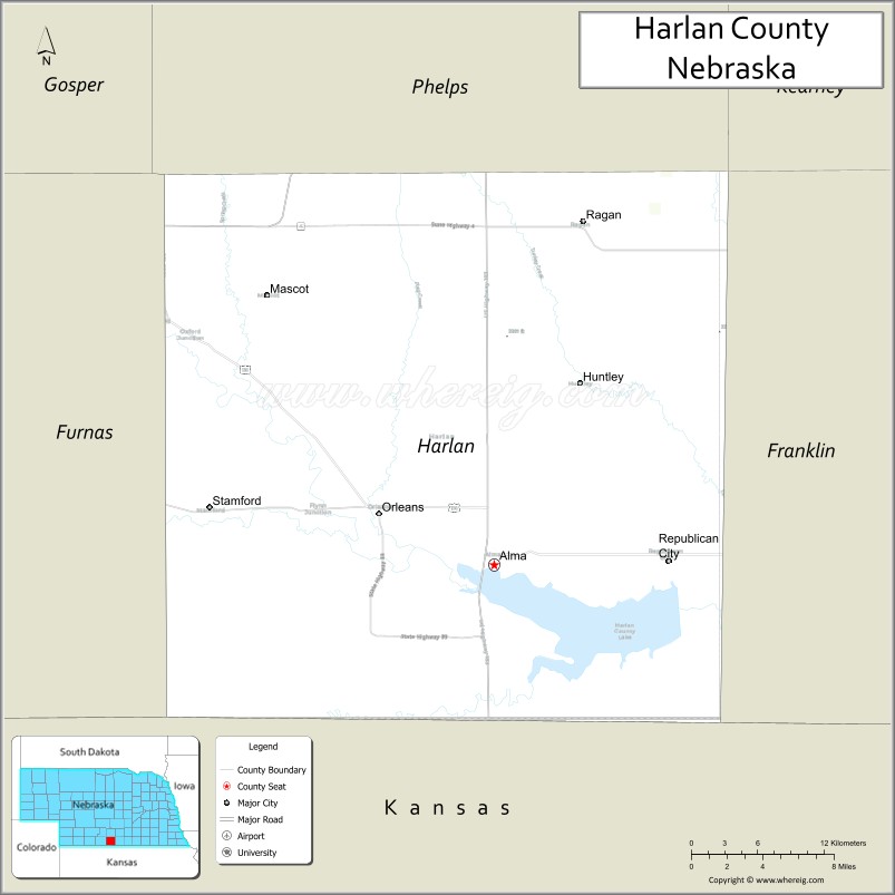
| Seat: | Alma |
| Largest city: | Alma |
| Total Area: | 574 sq mi (1,490 km²) |
| Land Area: | 553 sq mi (1,430 km²) |
| Total Population: | 3,091 |
| Population Density: | 6.2/sq mi (2.4/km²) |
| Time zone: | UTC−6 (Central) |
| Summer Time Zone (DST): | UTC−5 (CDT) |
| Website: | www.harlancounty.ne.gov |
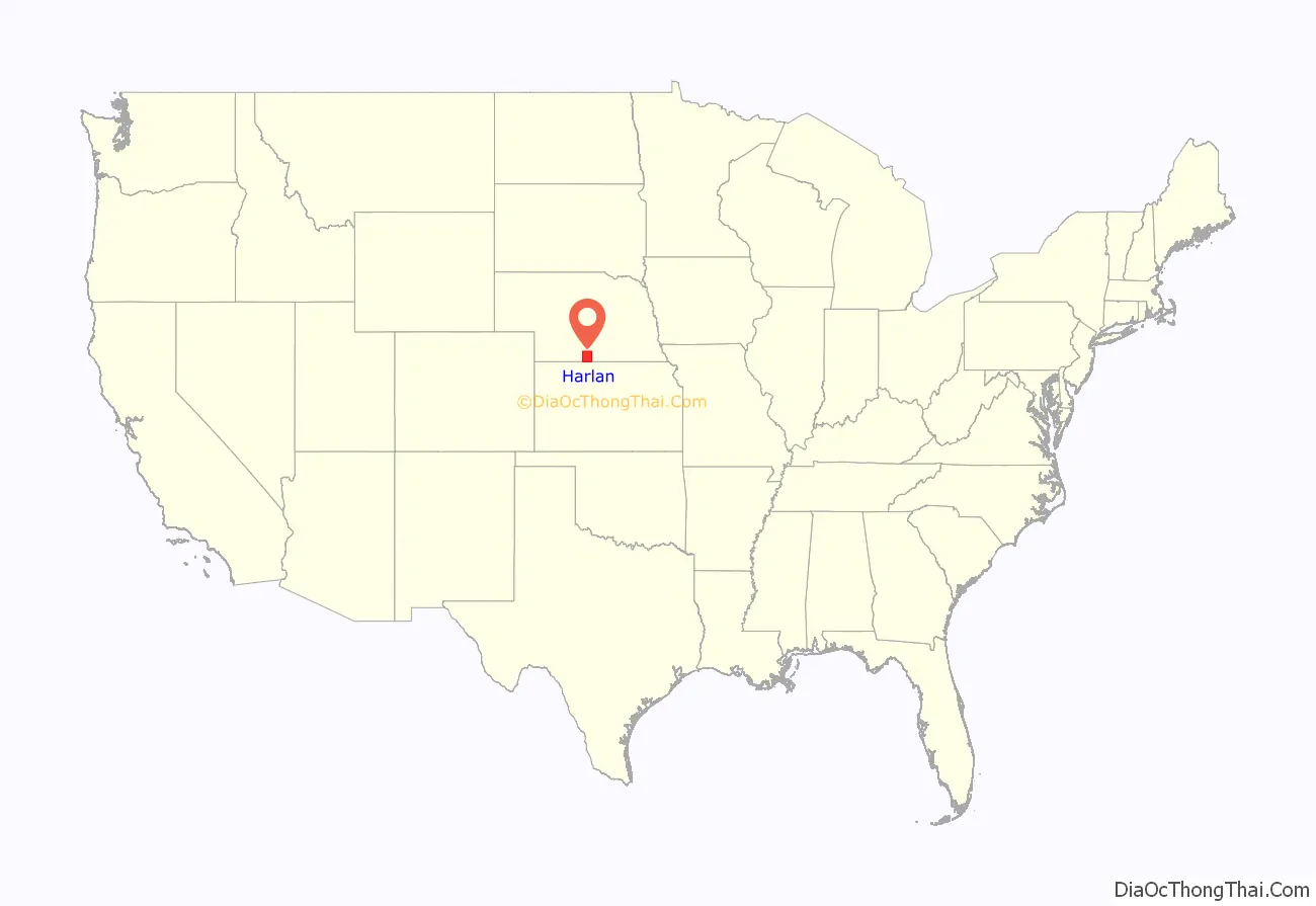
Harlan County location map. Where is Harlan County?
History
Prior to 1870, the portion of the Republican valley that now includes Harlan County was a prized hunting ground for indigenous peoples, and their efforts to keep intruders away deterred white settlement in the area. The defeat of the Sioux at the Battle of Summit Springs in 1869 largely eliminated this threat, and several parties were organized to explore the agricultural possibilities of the area.
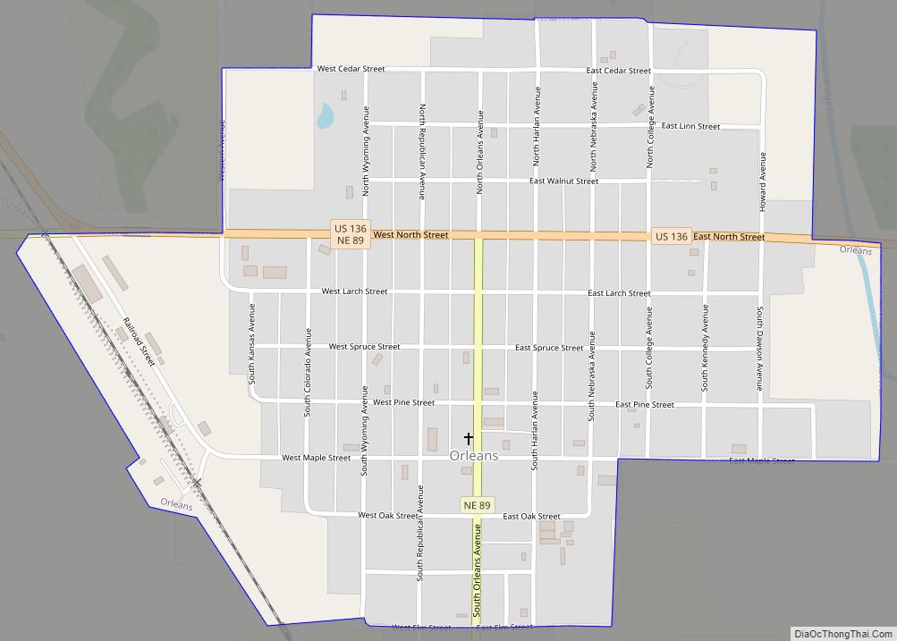
A party of forty men from eastern Nebraska settled near the site of present-day Orleans in August 1870. In 1871, a party from the Wyoming Territory, led by Thomas Harlan, settled near present-day Alma, which was named after a settler’s daughter. In that year, Harlan County was separated from Lincoln County by the Nebraska state legislature. Accounts differ as to the county’s namesake: either Thomas Harlan, or James Harlan, who was U.S. Secretary of the Interior between 1865 and 1866.
Harlan County Road Map
Geography
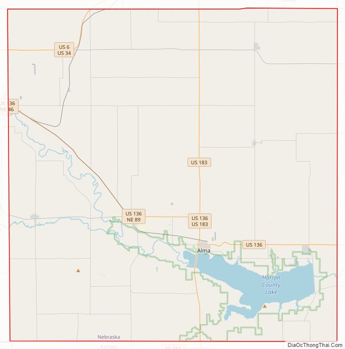
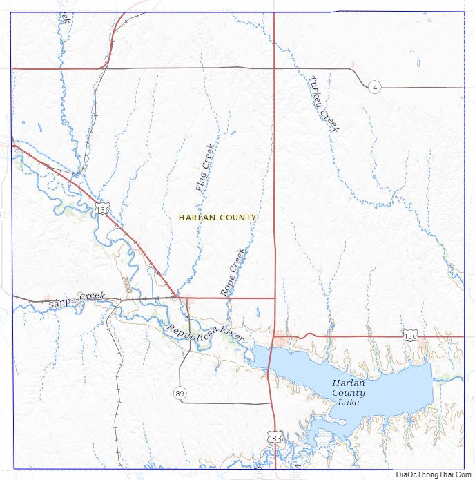
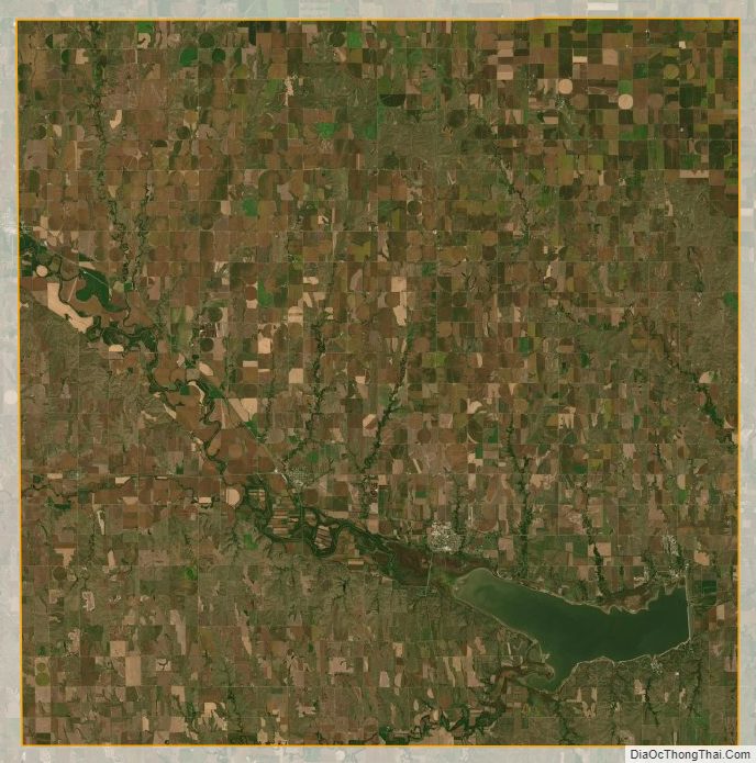
The Republican River flows southeastward across the lower part of Harlan County, being impounded by the Harlan County Lake at the SE corner of the county. The terrain consists of gently rolling low hills, with the majority of flat areas being used for center pivot irrigation.
The county has a total area of 574 square miles (1,490 km), of which 553 square miles (1,430 km) is land and 21 square miles (54 km) (3.6%) is water.
Major highways
- U.S. Highway 6
- U.S. Highway 34
- U.S. Highway 183
- Nebraska Highway 4
- Nebraska Highway 46
- Nebraska Highway 89
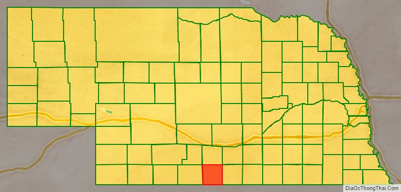
Adjacent counties
- Phelps County – north
- Kearney County – northeast
- Franklin County – east
- Phillips County, Kansas – south
- Norton County, Kansas – southwest
- Furnas County – west
Protected areas
- South East Sacramento State Wildlife Management Area
- South Sacramento State Wildlife Management Area
Harlan County Topographic Map
Harlan County Satellite Map
Harlan County Outline Map