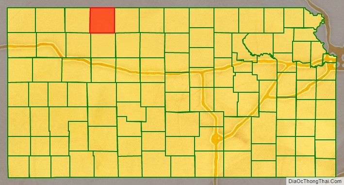
Norton County (standard abbreviation: NT) is a county located in the U.S. state of Kansas. As of the 2020 census, the county population was 5,459. The largest city and county seat is Norton. The county was established in 1867 and named for Orloff Norton, captain of Company L, 15th Kansas Militia Infantry Regiment.
| Name: | Norton County |
|---|---|
| FIPS code: | 20-137 |
| State: | Kansas |
| Founded: | February 26, 1867 |
| Named for: | Orloff Norton |
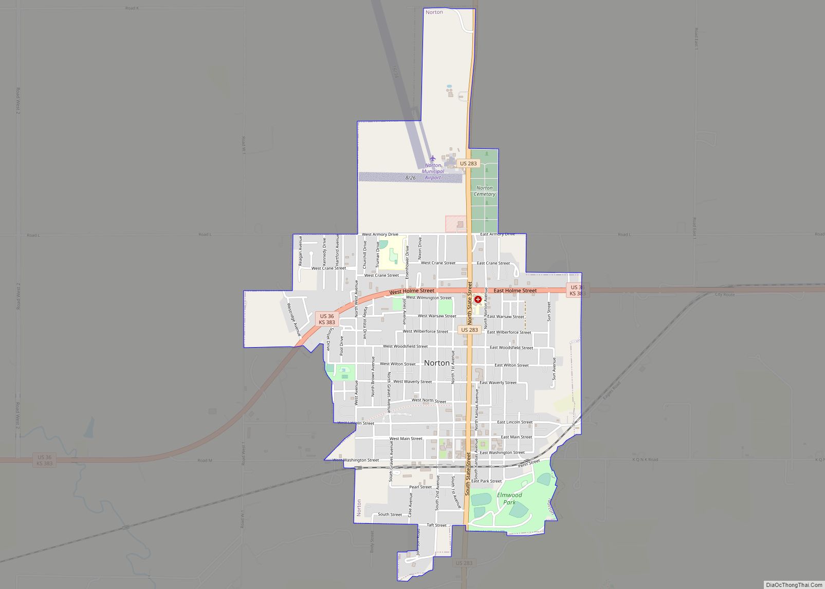
| Seat: | Norton |
| Largest city: | Norton |
| Total Area: | 881 sq mi (2,280 km²) |
| Land Area: | 878 sq mi (2,270 km²) |
| Total Population: | 5,459 |
| Population Density: | 6.2/sq mi (2.4/km²) |
| Time zone: | UTC−6 (Central) |
| Summer Time Zone (DST): | UTC−5 (CDT) |
| Website: | nortoncounty.org |
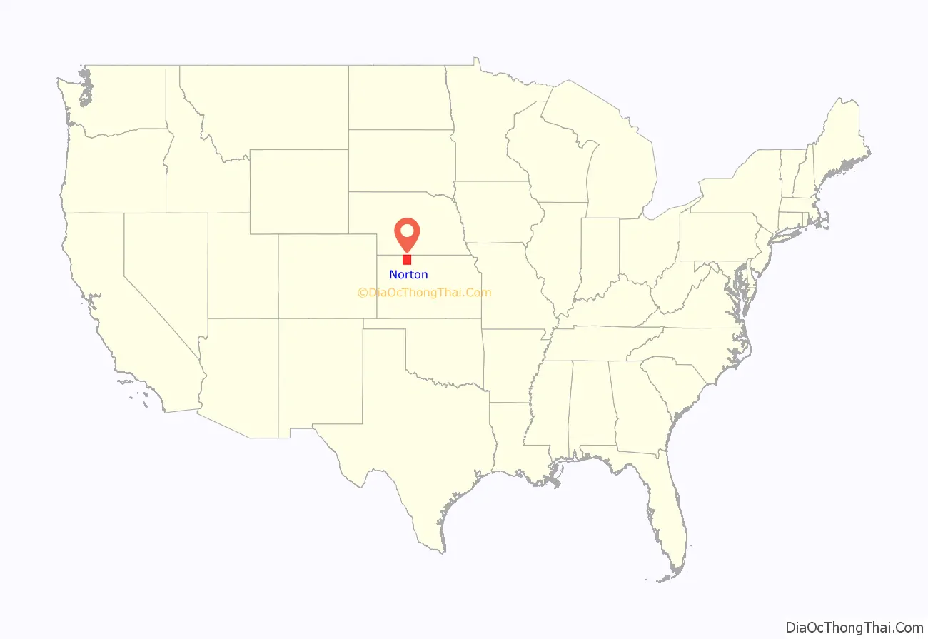
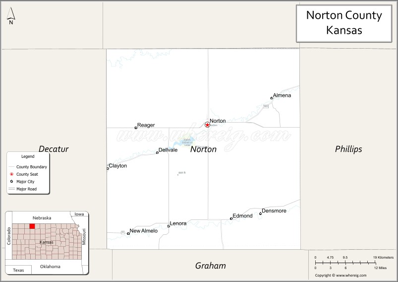
Norton County location map. Where is Norton County?
History
Early history
For many millennia, the Great Plains of North America was inhabited by nomadic Native Americans. From the 16th century to 18th century, the Kingdom of France claimed ownership of large parts of North America. In 1762, after the French and Indian War, France secretly ceded New France to Spain, per the Treaty of Fontainebleau.
19th century
In 1802, Spain returned most of the land to France, but keeping title to about 7,500 square miles. In 1803, most of the land for modern day Kansas was acquired by the United States from France as part of the 828,000 square mile Louisiana Purchase for 2.83 cents per acre.
In 1854, the Kansas Territory was organized, then in 1861 Kansas became the 34th U.S. state. Norton County was founded by Noah H. Billings, Thomas Beaumont, Henry Gordon, P. Hansen, and George Cole on August 22, 1872. In 1878 Norton became the county seat. The county gets its name for Civil War soldier Orloff Norton, who was killed at Cane Hill, Arkansas in 1864.
The first county fair, although not official, was held in Leota in October, 1878. After 1900 the fair was held yearly in Elmwood Park in Norton. The first school district was formed in Norton in 1872. School was held in a dugout beginning December 1, 1873.[1]
21st century
In 2020, Norton County became a major hotspot in the COVID-19 pandemic. In July, an inmate at the Norton Correctional Facility, a state prison, tested positive for coronavirus. By mid-October, more than 130 cases had been reported at the prison. On October 19, officials announced that all 62 residents of the Andbe Home nursing home in Norton had tested positive for COVID-19, 10 of whom had died. As of October 20, Norton County had the highest rate of infection over the previous 7 and 14 days of any county in the United States.
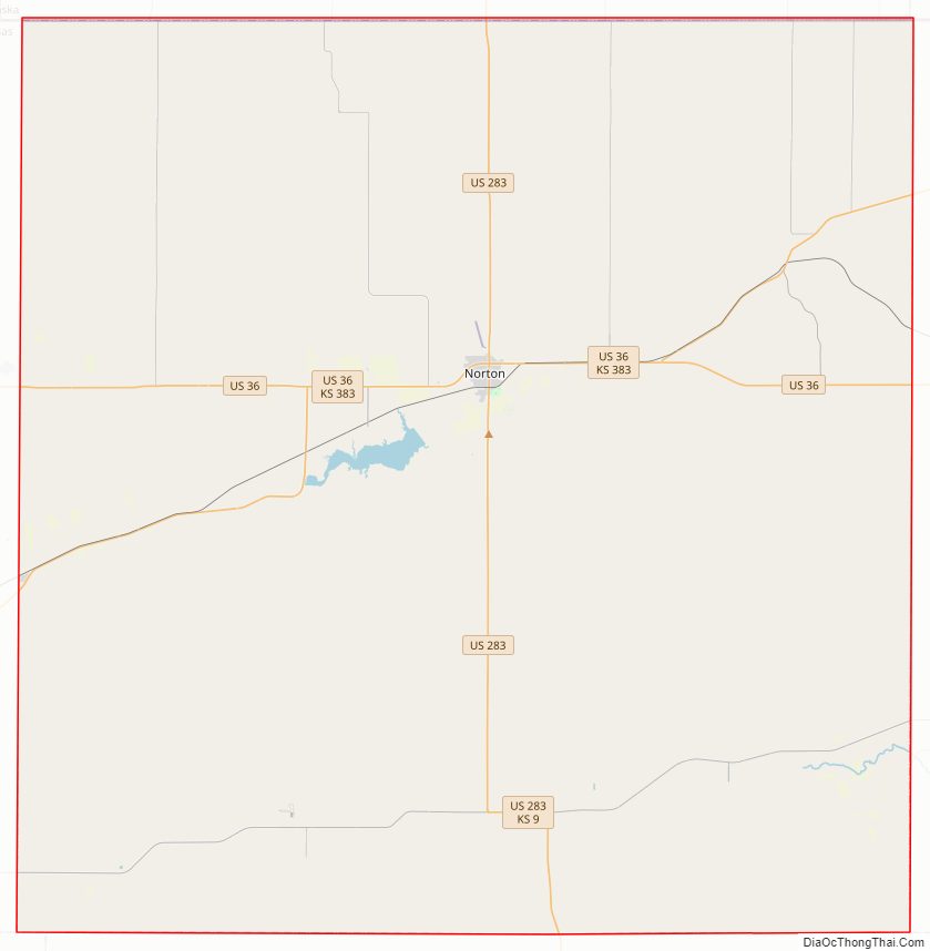
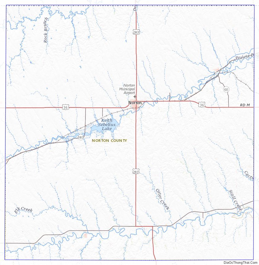
Norton County Road Map
Geography
According to the U.S. Census Bureau, the county has a total area of 881 square miles (2,280 km), of which 878 square miles (2,270 km) is land and 3.2 square miles (8.3 km) (0.4%) is water.
Adjacent counties
- Furnas County, Nebraska (north)
- Harlan County, Nebraska (northeast)
- Phillips County (east)
- Graham County (south)
- Sheridan County (southwest)
- Decatur County (west)
Norton County Topographic Map
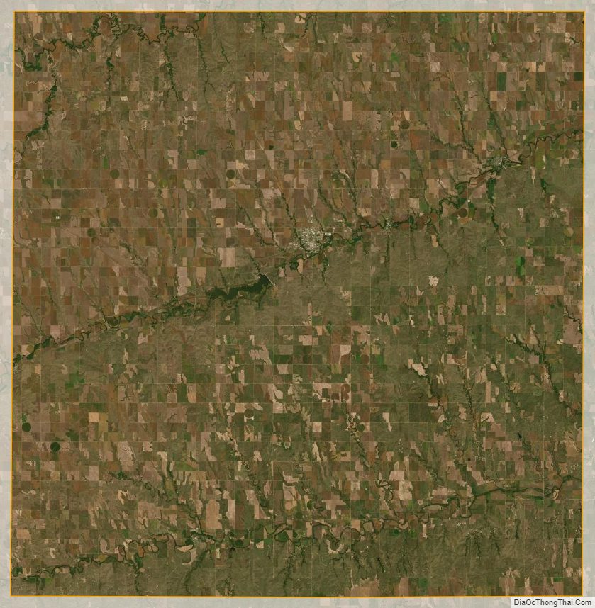
Norton County Satellite Map
Norton County Outline Map