Hyde County is a county located in the U.S. state of North Carolina. As of the 2020 census, the population was 4,589, making it the second-least populous county in North Carolina. Its county seat is Swan Quarter. The county was created in 1705 as Wickham Precinct. It was renamed Hyde Precinct in 1712 and gained county status in 1739.
| Name: | Hyde County |
|---|---|
| FIPS code: | 37-095 |
| State: | North Carolina |
| Founded: | 1712 |
| Named for: | Edward Hyde |
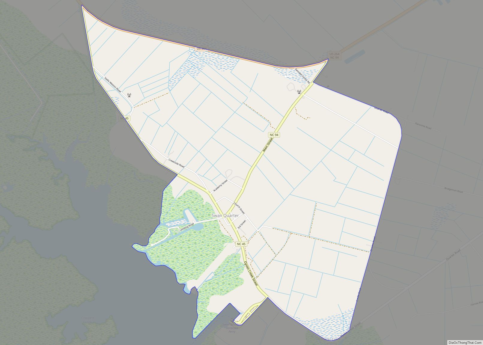
| Seat: | Swan Quarter |
| Total Area: | 1,424 sq mi (3,690 km²) |
| Land Area: | 613 sq mi (1,590 km²) |
| Total Population: | 4,508 |
| Population Density: | 7.4/sq mi (2.9/km²) |
| Time zone: | UTC−5 (Eastern) |
| Summer Time Zone (DST): | UTC−4 (EDT) |
| Website: | www.hydecountync.gov |
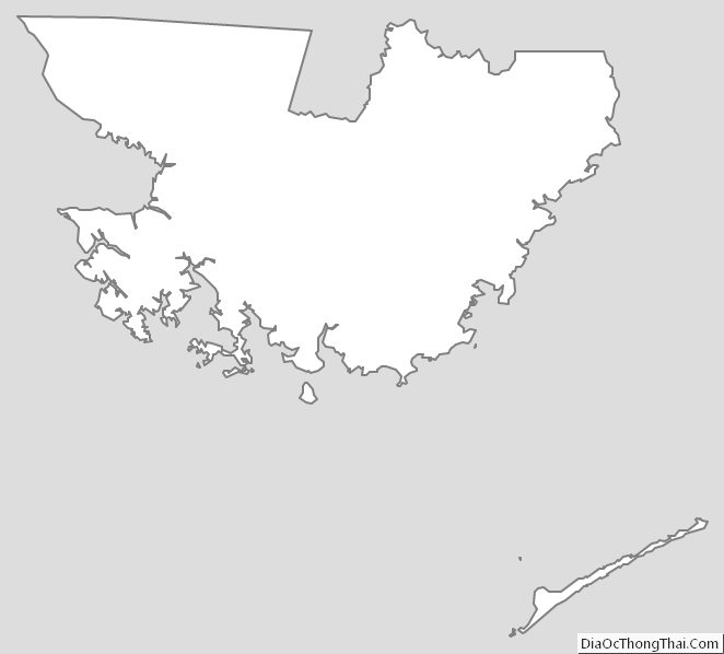
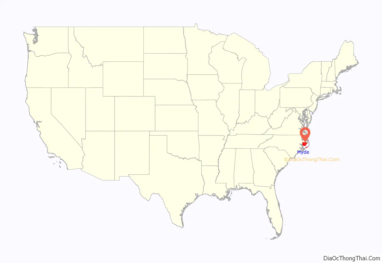
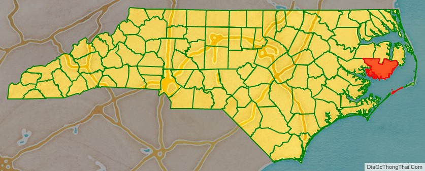
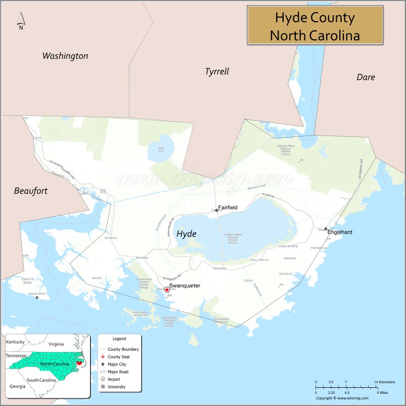
Hyde County location map. Where is Hyde County?
History
The county was formed December 3, 1705, as Wickham Precinct, one of three precincts within Bath County. The name “Wickham” was derived from the manor of “Temple Wycombe” in Buckinghamshire, England, the family home of John Archdale, Governor of North and South Carolina from 1695 to 1696. In 1712 it was renamed Hyde Precinct, for Edward Hyde, Governor of North Carolina from 1711 to 1712. In 1739 Bath County was abolished, and Hyde Precinct became Hyde County.
Various boundary changes have since taken place. In 1745 Lake Mattamuskeet and its adjoining territory were transferred from Currituck County to Hyde County. In 1819 the portion of Hyde County west of the Pungo River was annexed by Beaufort County. Four years later, the area of Currituck County south of New Inlet was transferred to Hyde County. This is now included Hatteras Island. In 1845 Ocracoke Island was transferred from Carteret County to Hyde County. In 1870 Hyde County was reduced to its present dimensions, when its northeastern part was combined with parts of Currituck County and Tyrrell County to form Dare County. Since its creation, the boundaries of Hyde County have changed more than those of any other county in North Carolina.
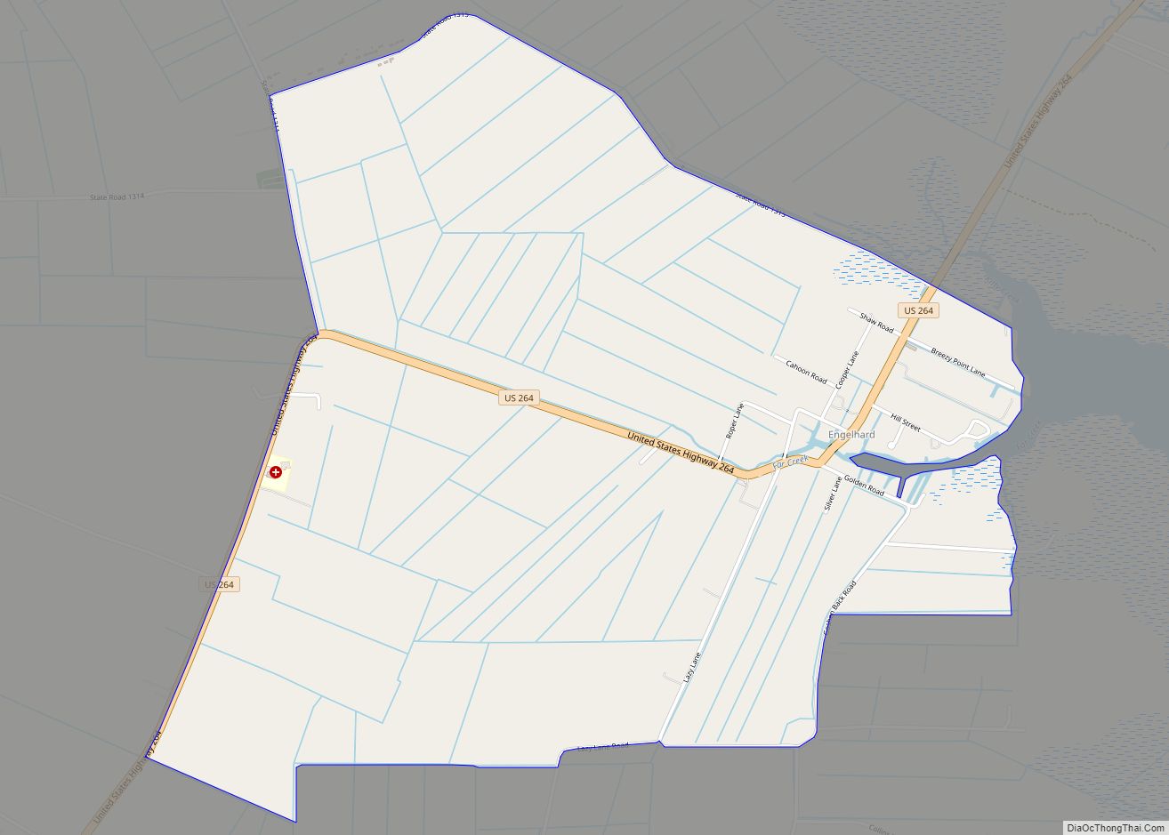
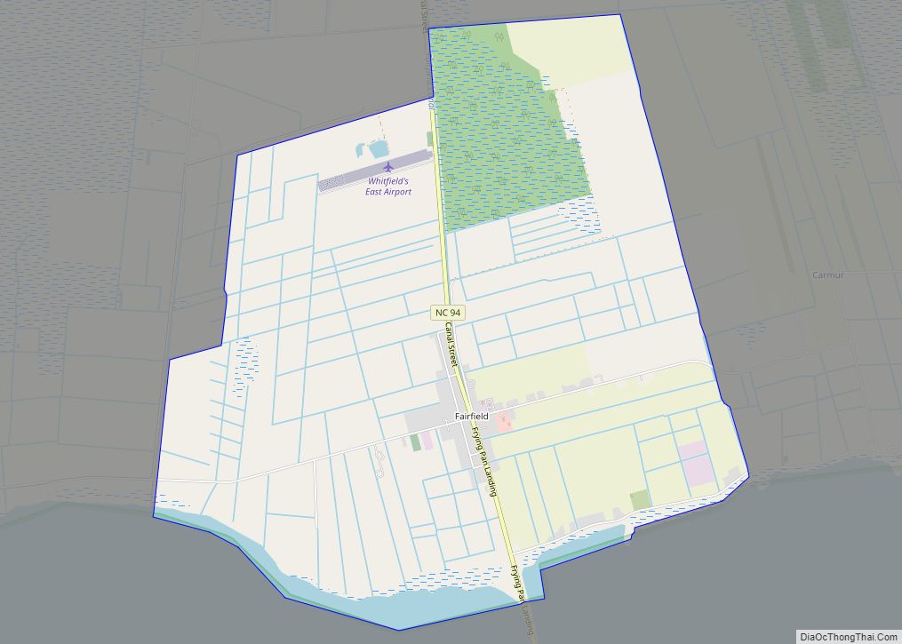
Hyde County Road Map
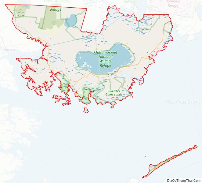
Geography
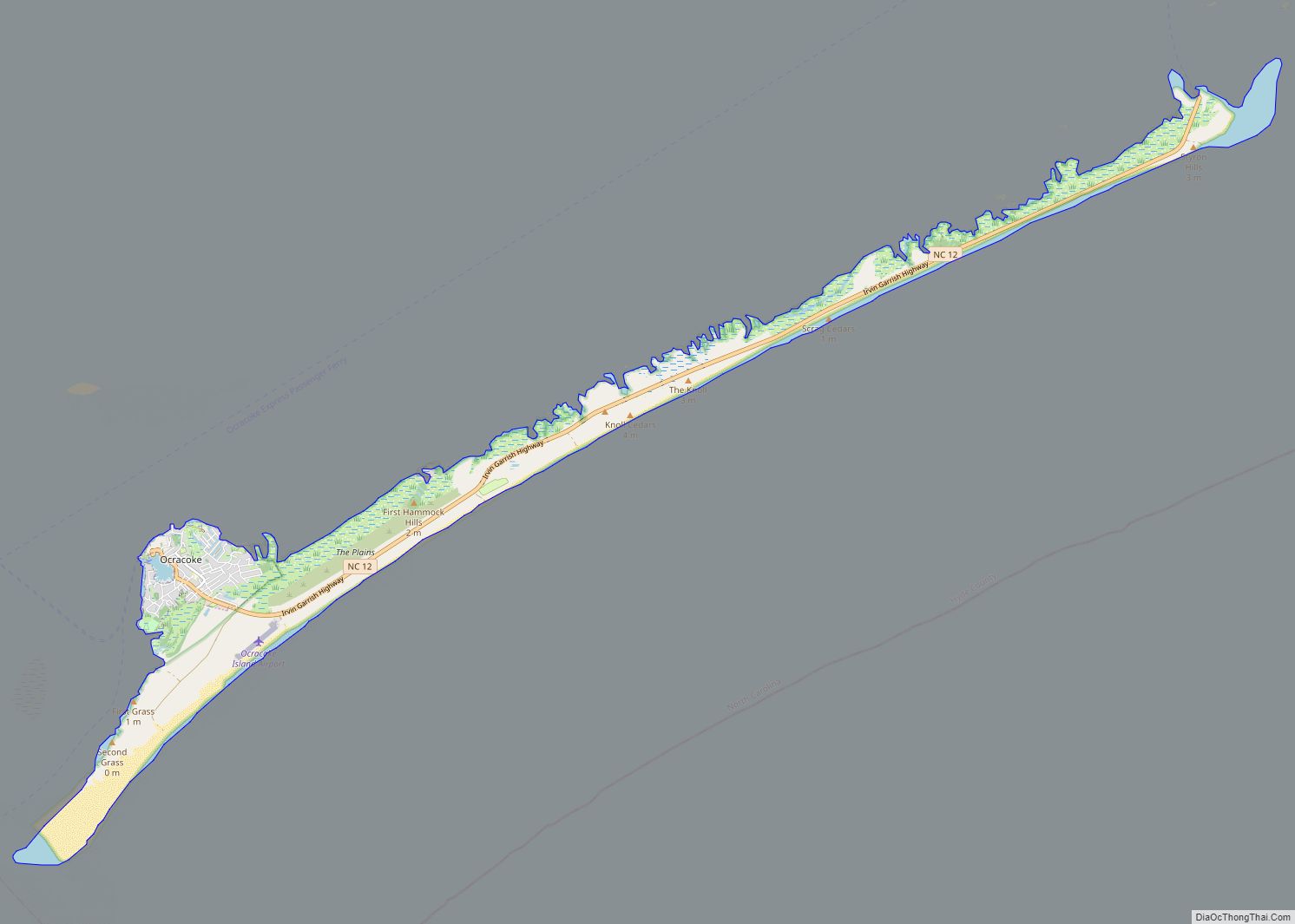
According to the U.S. Census Bureau, the county has a total area of 1,424 square miles (3,690 km), of which 613 square miles (1,590 km) is land and 811 square miles (2,100 km) (57%) is water. It is the second-largest county in North Carolina by total area. Hyde County’s in-land is part of the Inner Banks. Ocracoke Island is part of the Outer Banks.
Hyde County is one of the most rural counties in North Carolina, owing this to its low population, absence of four-lane highways, and even the absence of stoplights in the county.
National protected areas
- Alligator River National Wildlife Refuge (part)
- Cape Hatteras National Seashore (part)
- Mattamuskeet National Wildlife Refuge
- Pocosin Lakes National Wildlife Refuge (part)
- Swanquarter National Wildlife Refuge
State and locale protected areas
- Dare Game Land (part)
- Emily and Richardson Preyer Buckridge Reserve (part)
- Gull Rock Game Land
- Hatteras Inlet Crab Spawning Sanctuary (part)
- New Lake Game Land (part)
Major water bodies
- Alligator Lake
- Alligator River
- Atlantic Ocean
- Hatteras Inlet
- Intracoastal Waterway
- Lake Mattamuskeet
- Ocracoke Inlet
- Pamlico River
- Pamlico Sound
- Pungo Lake
- Pungo River
- Raleigh Bay
Adjacent counties
- Tyrrell County – north
- Dare County – northeast
- Carteret County – southwest
- Pamlico County – south
- Beaufort County – west
- Washington County – northwest
Major highways
- US 264
- NC 12
- NC 45
- NC 94
- NC 99
Major infrastructure
- Cedar Island – Ocracoke Ferry (To Carteret County)
- Hatteras – Ocracoke Ferry (To Dare County)
- Swan Quarter – Ocracoke Ferry
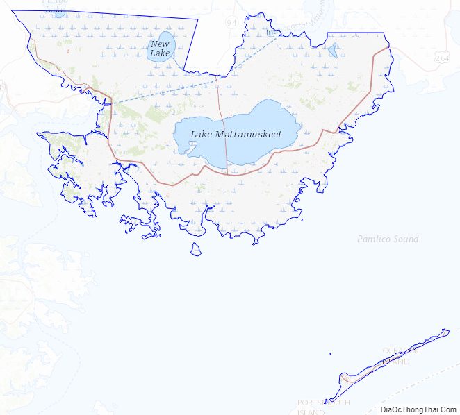
Hyde County Topographic Map
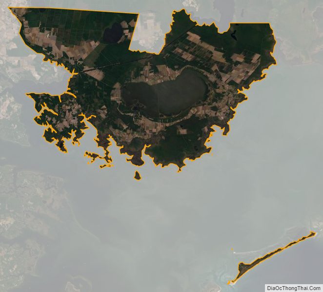
Hyde County Satellite Map
Hyde County Outline Map