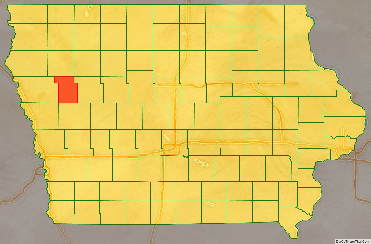
Ida County is a county located in the U.S. state of Iowa. As of the 2020 census the population was 7,005, making it the state’s eighth-least populous county. The county seat is Ida Grove. The county was authorized by the Iowa Legislature in January 1851 as a packet of projected counties in unorganized territory of western Iowa. It was named after Ida Smith, the first child of European immigrants to be born in this region.
| Name: | Ida County |
|---|---|
| FIPS code: | 19-093 |
| State: | Iowa |
| Founded: | January 15, 1851 |
| Seat: | Ida Grove |
| Largest city: | Ida Grove |
| Total Area: | 432 sq mi (1,120 km²) |
| Land Area: | 432 sq mi (1,120 km²) |
| Total Population: | 7,005 |
| Population Density: | 16/sq mi (6.3/km²) |
| Time zone: | UTC−6 (Central) |
| Summer Time Zone (DST): | UTC−5 (CDT) |
| Website: | idacounty.iowa.gov |
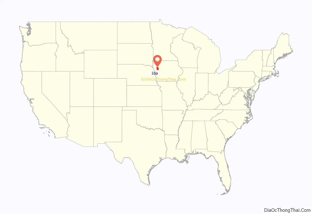
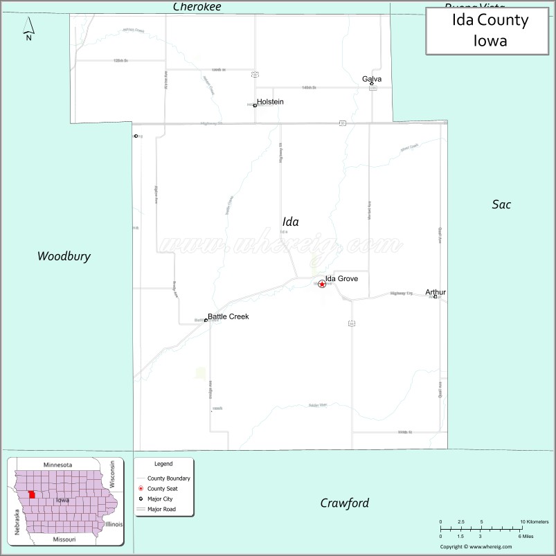
Ida County location map. Where is Ida County?
History
The Iowa Legislature authorized the formation of 49 counties in previously–unregulated western Iowa on January 15, 1851. This date is usually cited as the date of formation of Ida County; however, as there were no inhabitants of that area, no action was taken to form a county government.
On January 12, 1853, the Legislature authorized creation of Woodbury County, and included the proviso that the area of Ida County be included with Woodbury for revenue, election, and judicial purposes. In 1853 there were still no settlers in Ida County’s lands.
The county’s first permanent settlers (Comstock and Moorehead) arrived in 1856. In 1858 the county government was organized, with John Moorehead appointed County Judge. There were about 40 county residents at that time.
The county’s only postoffice, as well as the first courthouse, was operated from Judge Moorehead’s house.
The county’s first dedicated school building was raised in 1861.
The county’s first newspaper, Ida County Pioneer, was started in 1872. The first bank opened in 1876. Railroads arrived in Ida County in 1877, when the Maple Valley branch of the Chicago & North Western Railway was built. This resulted in a flood of settlers, and within five years, nearly all the available land had been purchased.
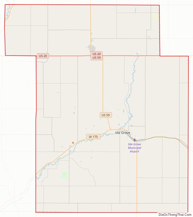
Ida County Road Map
Geography
According to the U.S. Census Bureau, the county has a total area of 432 square miles (1,120 km), of which 432 square miles (1,120 km) is land and 0.5 square miles (1.3 km) (0.1%) is water.
Major highways
- U.S. Highway 20 – runs east–west through the northern part of the county, passing Holstein.
- U.S. Highway 59 – runs generally north–south through the center of the county, passing Ida Grove. Its exit at south county line is five miles east of its entry point on north county line.
- Iowa Highway 31 – cuts across the northwestern tip of Ida County, running southwest from Cherokee County to Woodbury County.
- Iowa Highway 175 – runs east–west through the southern part of the county, passing Ida Grove.
Adjacent counties
- Cherokee County (north)
- Sac County (east)
- Crawford County (south)
- Woodbury County (west)
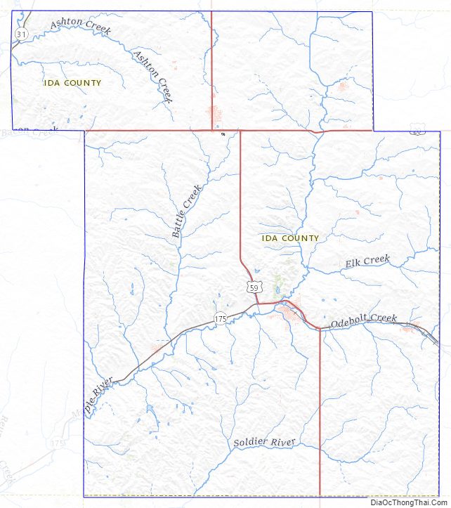
Ida County Topographic Map
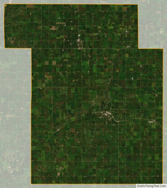
Ida County Satellite Map
Ida County Outline Map