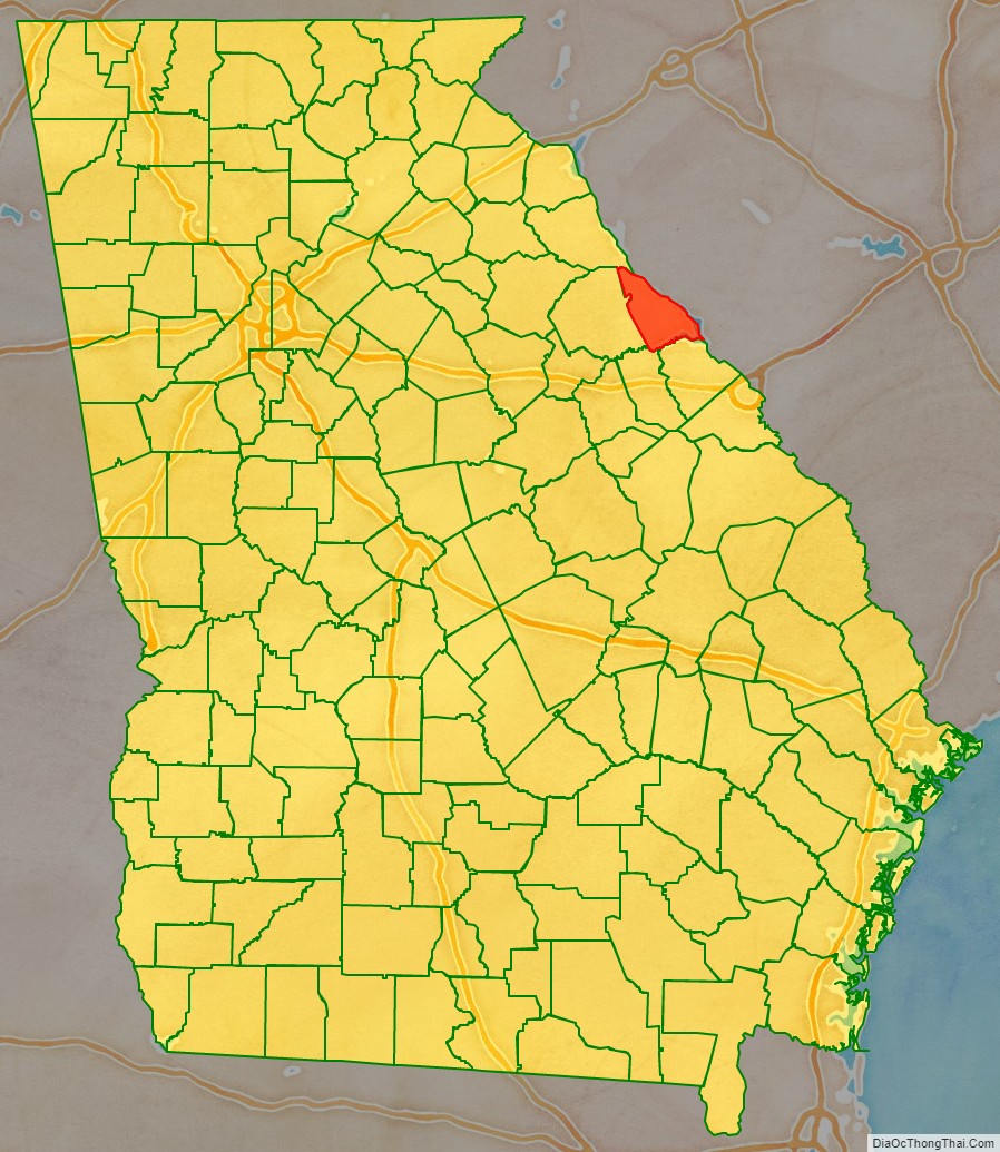
Lincoln County is a county located in the east central portion of the U.S. state of Georgia. As of the 2020 census, the population was 7,690. The county seat is Lincolnton. The county was created on February 20, 1796.
Lincoln County is included in the Augusta-Richmond County, GA-SC Metropolitan Statistical Area, the Savannah River forming its northeastern border. Located above the fall line, it is part of the Central Savannah River Area (CSRA) and a member of the CSRA Regional Development Center.
| Name: | Lincoln County |
|---|---|
| FIPS code: | 13-181 |
| State: | Georgia |
| Founded: | 1796 |
| Named for: | Benjamin Lincoln |
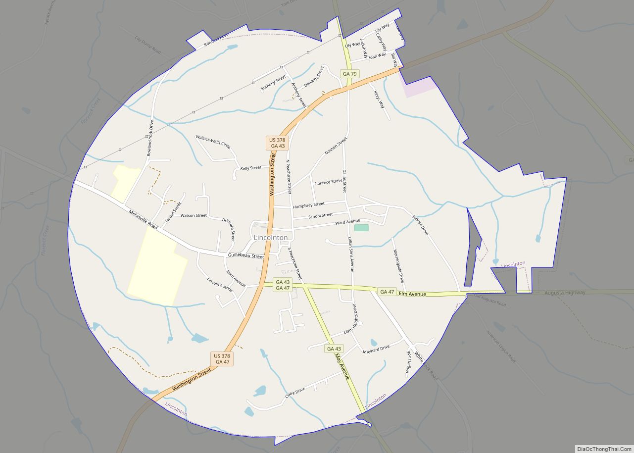
| Seat: | Lincolnton |
| Largest city: | Lincolnton |
| Total Area: | 257 sq mi (670 km²) |
| Land Area: | 210 sq mi (500 km²) |
| Total Population: | 7,690 |
| Population Density: | 37/sq mi (14/km²) |
| Time zone: | UTC−5 (Eastern) |
| Summer Time Zone (DST): | UTC−4 (EDT) |
| Website: | www.lincolncountyga.com |
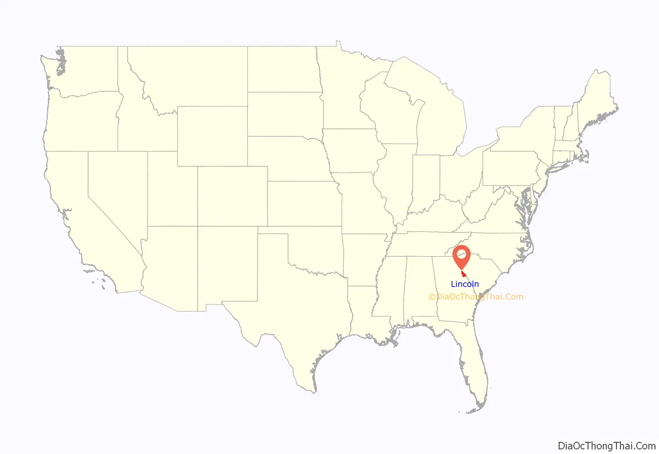
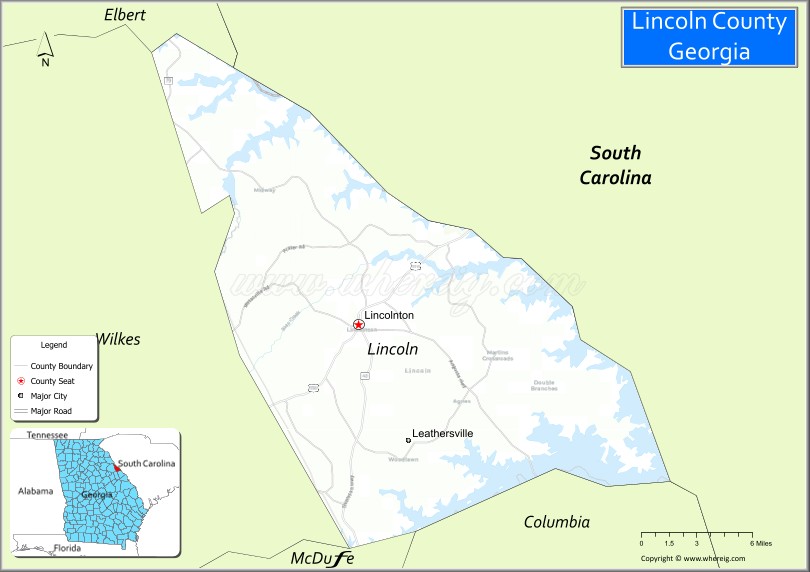
Lincoln County location map. Where is Lincoln County?
History
On February 20, 1796, Lincoln County was established as the twenty-fourth county in the state of Georgia. Before then, its territory was part of Wilkes County, now on its western side. The new county was named after General Benjamin Lincoln (1733-1810), a Revolutionary War hero notable for receiving Gen. Cornwallis’s sword at Yorktown, Virginia.
On January 22, 1852, the legislature changed the location of the line between Wilkes County and Lincoln County, although there is no extant record as to why the legislature made the change.
From before the American Revolutionary War until the 1950s, Lincoln County was primarily a farming and agricultural area. The development and creation of Clarks Hill Dam created a large reservoir that covered portions of Lincoln and nearby counties. Developers have created many residential neighborhoods and subdivisions in areas near the lake.
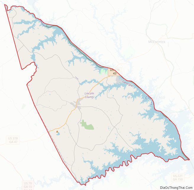
Lincoln County Road Map
Geography
According to the U.S. Census Bureau, the county has a total area of 257 square miles (670 km), of which 210 square miles (540 km) is land and 47 square miles (120 km) (18.2%) is water. The county is located in the Piedmont region of the state just above the fall line of the eastern United States.
The bulk of Lincoln County, from just south of Lincolnton heading north, is located in the Upper Savannah River sub-basin of the Savannah River basin, with the exception of a tiny sliver of the northernmost section of the county, which is located in the Broad River sub-basin of the larger Savannah River basin. The southern portion of the county is located in the Little River sub-basin of the same Savannah River basin.
Major highways
- U.S. Route 378
- State Route 43
- State Route 43 Connector
- State Route 44
- State Route 47
- State Route 79
- State Route 220
Adjacent counties
- Elbert County, Georgia – north
- McCormick County, South Carolina – northeast
- Columbia County, Georgia – south
- McDuffie County, Georgia – southwest
- Wilkes County, Georgia – west
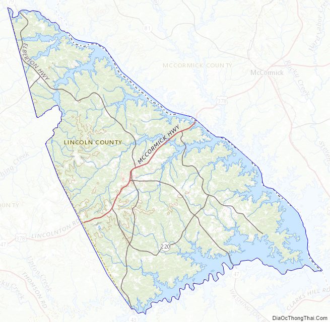
Lincoln County Topographic Map
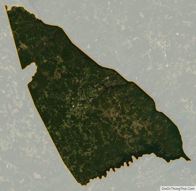
Lincoln County Satellite Map
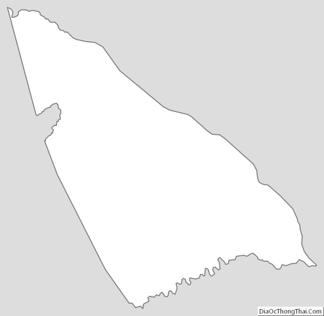
Lincoln County Outline Map