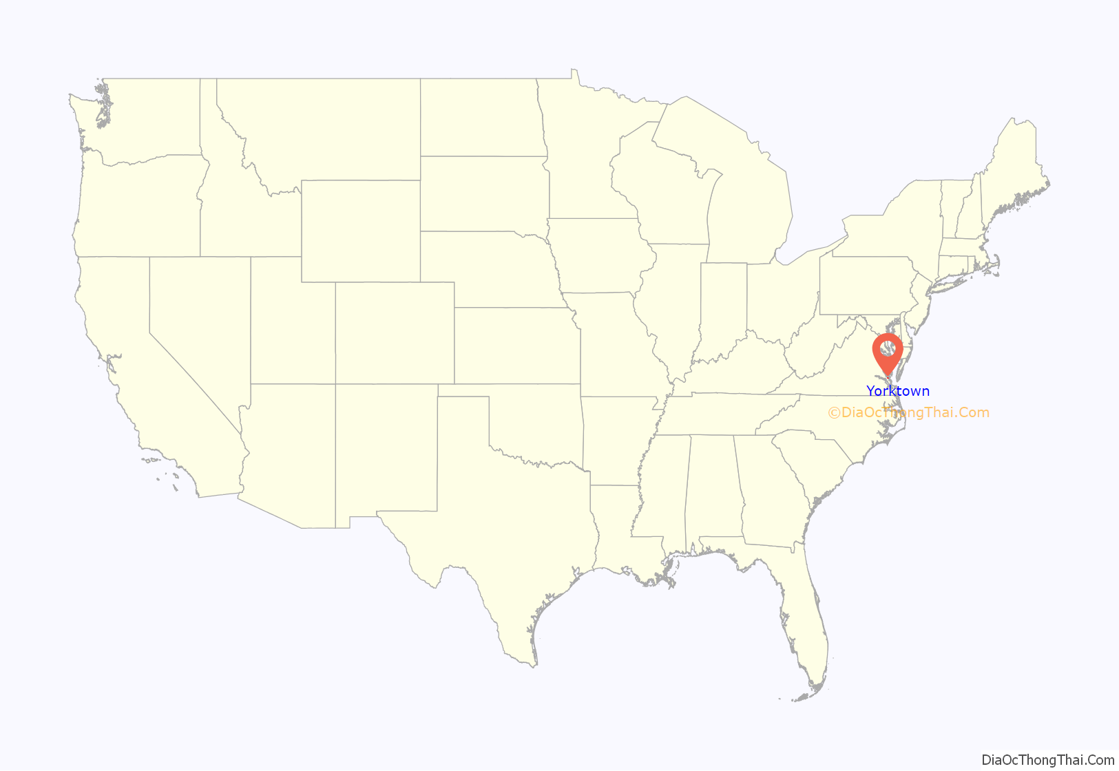
Yorktown is a census-designated place (CDP) in York County, Virginia. It is the county seat of York County, one of the eight original shires formed in colonial Virginia in 1682. Yorktown’s population was 195 as of the 2010 census, while York County’s population was 66,134 in the 2011 census estimate.
The town is most famous as the site of the siege and subsequent surrender of General Charles Cornwallis to General George Washington and the French Fleet during the American Revolutionary War on October 19, 1781. Although the war would last for another year, this British defeat at Yorktown effectively ended the war in North America. Yorktown also figured prominently in the American Civil War (1861–1865), serving as a major port to supply both northern and southern towns, depending upon who held Yorktown at the time.
Yorktown is one of three sites of the Historic Triangle, which also includes Jamestown and Williamsburg as important colonial-era settlements. It is the eastern terminus of the Colonial Parkway connecting these locations. Yorktown is also the eastern terminus of the TransAmerica Trail, a bicycle touring route created by the Adventure Cycling Association.
One of Yorktown’s historic sister cities is Zweibrücken in Germany, based on participation of a unit from there during the American Revolutionary War.
| Name: | Yorktown CDP |
|---|---|
| LSAD Code: | 57 |
| LSAD Description: | CDP (suffix) |
| State: | Virginia |
| County: | York County |
| Elevation: | 13 ft (4 m) |
| Total Area: | 0.6 sq mi (2 km²) |
| Land Area: | 0.6 sq mi (2 km²) |
| Water Area: | 0.0 sq mi (0 km²) |
| Total Population: | 195 |
| Population Density: | 330/sq mi (130/km²) |
| ZIP code: | 23690–23693 |
| Area code: | 757, 948 |
| FIPS code: | 5188240 |
| GNISfeature ID: | 1500081 |
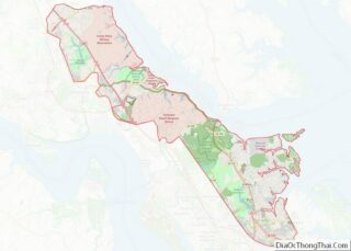
Online Interactive Map
Click on ![]() to view map in "full screen" mode.
to view map in "full screen" mode.
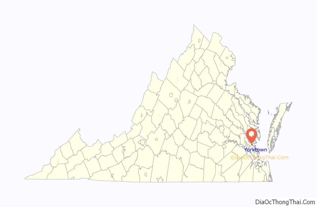
Yorktown location map. Where is Yorktown CDP?
History
Yorktown was named for the ancient city of York in Yorkshire, Northern England. It was founded in 1691 as a port on the York River for English colonists to export tobacco to Europe. The lawyer Thomas Ballard was the principal founder of the city along with Joseph Ring. It became the county seat in 1696, and although it never had more than about 200 houses its trade was considerable until the American Revolutionary War. It was called “York” until after the war, when the name “Yorktown” came into common use.
The town reached the height of its development around 1750, when it had 250 to 300 buildings and a population of almost 2,000 people. It was the base of British General Charles Cornwallis during the 1781 siege, which was the last major battle of the American Revolutionary War.
When waterways were critical to transportation, Yorktown was thought to occupy a strategic location controlling upstream portions of the York River and its tributaries and their access to the Chesapeake Bay. In his Notes on the State of Virginia published in 1781–82, Thomas Jefferson noted that the York River at Yorktown “affords the best harbour in the state for vessels of the largest size. The river there narrows to the width of a mile, and is contained within very high banks, close under which the vessels may ride.”
The population dropped in Yorktown and other areas of the mostly rural peninsula after the state’s capital was relocated from Williamsburg to Richmond on the James River, attracting more development there. In addition, tobacco exhausted the soil, and planters shifted to mixed crops, which required less slave labor. Many generations of younger sons migrated out of the Tidewater area to new lands further west, into the Piedmont and beyond to Kentucky, Tennessee and what became the Northwest Territory.
During the 1862 Peninsula Campaign of the American Civil War (1861–1865), the town was captured by the Union following the Siege and Battle of Yorktown. It was used as a base by the Union Army of the Potomac under General George B. McClellan to launch an attack on Richmond.
One of Yorktown’s sister cities is Zweibrücken, Germany. During the American Revolutionary War, the Royal Deux-Ponts Regiment was commanded by Comte Christian de Forbach (son of Christian IV, Count Palatine of Zweibrücken, and the deputy commander was his brother Philippe Guillaume (later renamed to Wilhelm). This was one of the four regiments that arrived at Newport, Rhode Island with Rochambeau in 1780. It participated on the side of Americans in the Battle of Yorktown in 1781.
The other Yorktown’s sister city is Port-Vendres, France. It’s from this small port on the Mediterranean coast of France that the French expeditionary force left Europe to go fight the British army in America
During World War I, to support Atlantic defenses, the federal government in 1918 acquired about 13,000 acres (53 km) for development by the US Navy as Mine Depot, Yorktown. This large installation straddled York, Warwick and James City counties. It has since expanded and been developed as Naval Weapons Station Yorktown. Cheatham Annex, a facility which was developed over the former town of Penniman, is also included as part of the base.
Training Center Yorktown serves as a training school for the United States Coast Guard. Also relatively close to Yorktown are Camp Peary (in York County), the Huntington Ingalls Industries Newport News Shipbuilding yards and facilities, and Fort Eustis Army base (both in Newport News). Other major installations in the area are Naval Station Norfolk, located at Norfolk, and Langley Air Force Base in Hampton.
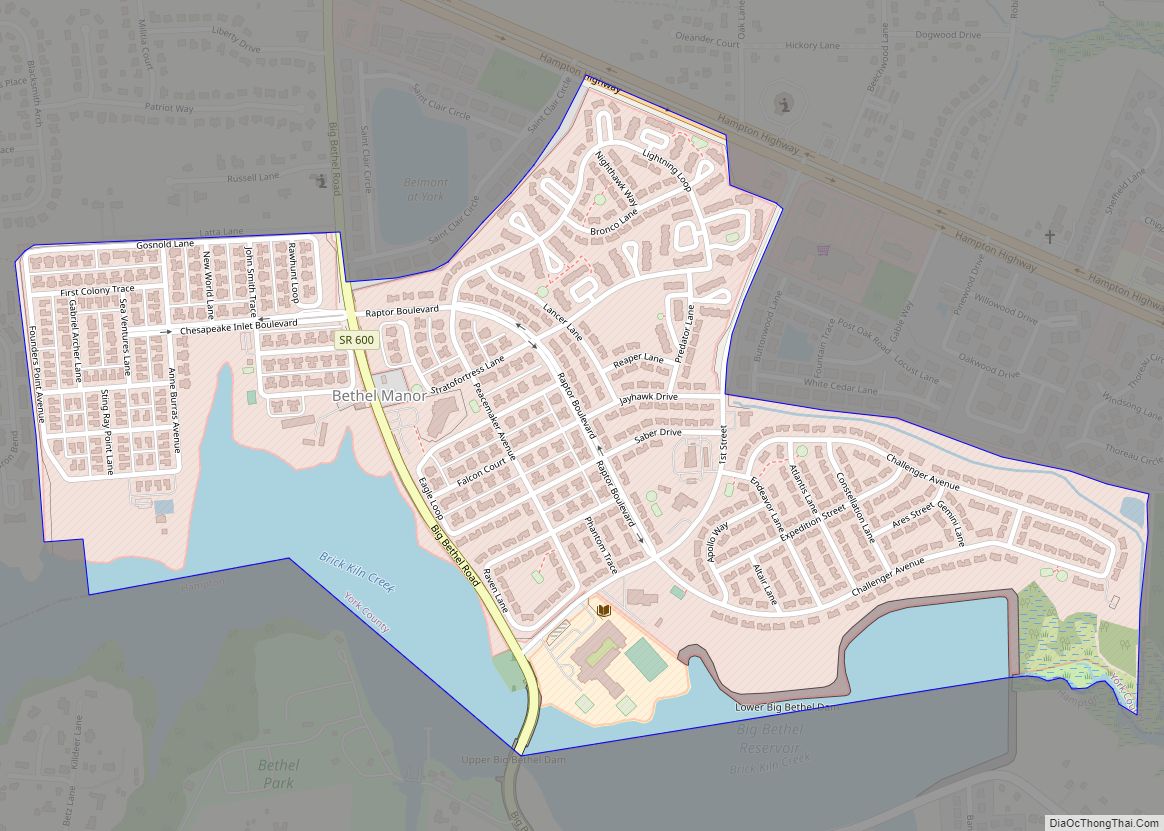
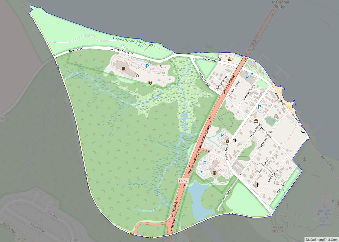
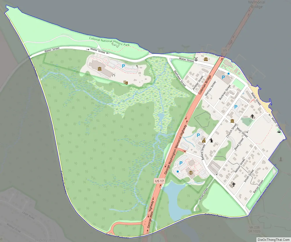
Yorktown Road Map
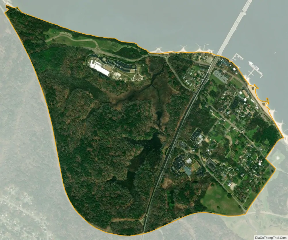
Yorktown city Satellite Map
See also
Map of Virginia State and its subdivision:- Accomack
- Albemarle
- Alexandria
- Alleghany
- Amelia
- Amherst
- Appomattox
- Arlington
- Augusta
- Bath
- Bedford
- Bedford City
- Bland
- Botetourt
- Bristol
- Brunswick
- Buchanan
- Buckingham
- Buena Vista
- Campbell
- Caroline
- Carroll
- Charles City
- Charlotte
- Charlottesville
- Chesapeake
- Chesterfield
- Clarke
- Clifton Forge City
- Colonial Heights
- Covington
- Craig
- Culpeper
- Cumberland
- Danville
- Dickenson
- Dinwiddie
- Emporia
- Essex
- Fairfax
- Fairfax City
- Falls Church
- Fauquier
- Floyd
- Fluvanna
- Franklin
- Frederick
- Fredericksburg
- Galax
- Giles
- Gloucester
- Goochland
- Grayson
- Greene
- Greensville
- Halifax
- Hampton
- Hanover
- Harrisonburg
- Henrico
- Henry
- Highland
- Hopewell
- Isle of Wight
- James City
- King and Queen
- King George
- King William
- Lancaster
- Lee
- Lexington
- Loudoun
- Louisa
- Lunenburg
- Lynchburg
- Madison
- Manassas
- Manassas Park
- Martinsville
- Mathews
- Mecklenburg
- Middlesex
- Montgomery
- Nelson
- New Kent
- Newport News
- Norfolk
- Northampton
- Northumberland
- Norton
- Nottoway
- Orange
- Page
- Patrick
- Petersburg
- Pittsylvania
- Poquoson
- Portsmouth
- Powhatan
- Prince Edward
- Prince George
- Prince William
- Pulaski
- Radford
- Rappahannock
- Richmond
- Roanoke
- Roanoke City
- Rockbridge
- Rockingham
- Russell
- Salem
- Scott
- Shenandoah
- Smyth
- Southampton
- Spotsylvania
- Stafford
- Staunton
- Suffolk
- Surry
- Sussex
- Tazewell
- Virginia Beach
- Warren
- Washington
- Waynesboro
- Westmoreland
- Williamsburg
- Winchester
- Wise
- Wythe
- York
- Alabama
- Alaska
- Arizona
- Arkansas
- California
- Colorado
- Connecticut
- Delaware
- District of Columbia
- Florida
- Georgia
- Hawaii
- Idaho
- Illinois
- Indiana
- Iowa
- Kansas
- Kentucky
- Louisiana
- Maine
- Maryland
- Massachusetts
- Michigan
- Minnesota
- Mississippi
- Missouri
- Montana
- Nebraska
- Nevada
- New Hampshire
- New Jersey
- New Mexico
- New York
- North Carolina
- North Dakota
- Ohio
- Oklahoma
- Oregon
- Pennsylvania
- Rhode Island
- South Carolina
- South Dakota
- Tennessee
- Texas
- Utah
- Vermont
- Virginia
- Washington
- West Virginia
- Wisconsin
- Wyoming