Lincoln County is a county located in the U.S. state of Mississippi. As of the 2020 census, the population was 34,907. Its county seat is Brookhaven.
The county was created by the legislature on April 7, 1870, during the Reconstruction Era. It was formed from portions of Lawrence, Pike, Franklin, Copiah, and Amite counties. It was named for Abraham Lincoln, the 16th President of the United States.
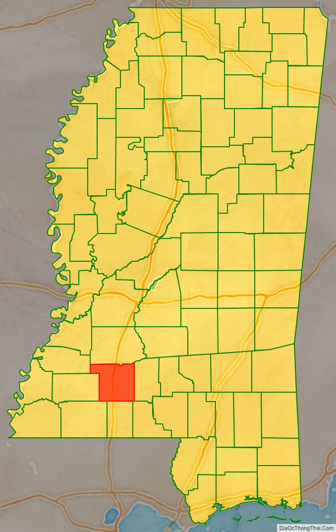
Lincoln County comprises the Brookhaven, MS Micropolitan Statistical Area, which is included in the Jackson–Vicksburg–Brookhaven Combined Statistical Area. The county is southwest of the state capital of Jackson.
| Name: | Lincoln County |
|---|---|
| FIPS code: | 28-085 |
| State: | Mississippi |
| Founded: | 1870 |
| Named for: | Abraham Lincoln |
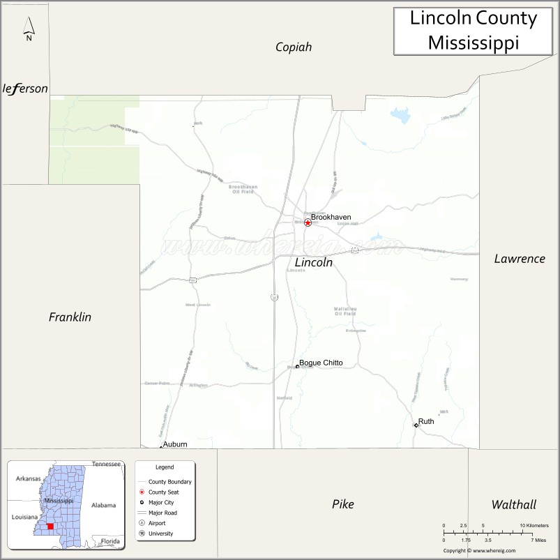
| Seat: | Brookhaven |
| Largest city: | Brookhaven |
| Total Area: | 588 sq mi (1,520 km²) |
| Land Area: | 586 sq mi (1,520 km²) |
| Total Population: | 34,907 |
| Population Density: | 59/sq mi (23/km²) |
| Time zone: | UTC−6 (Central) |
| Summer Time Zone (DST): | UTC−5 (CDT) |
| Website: | www.golincolnms.com |
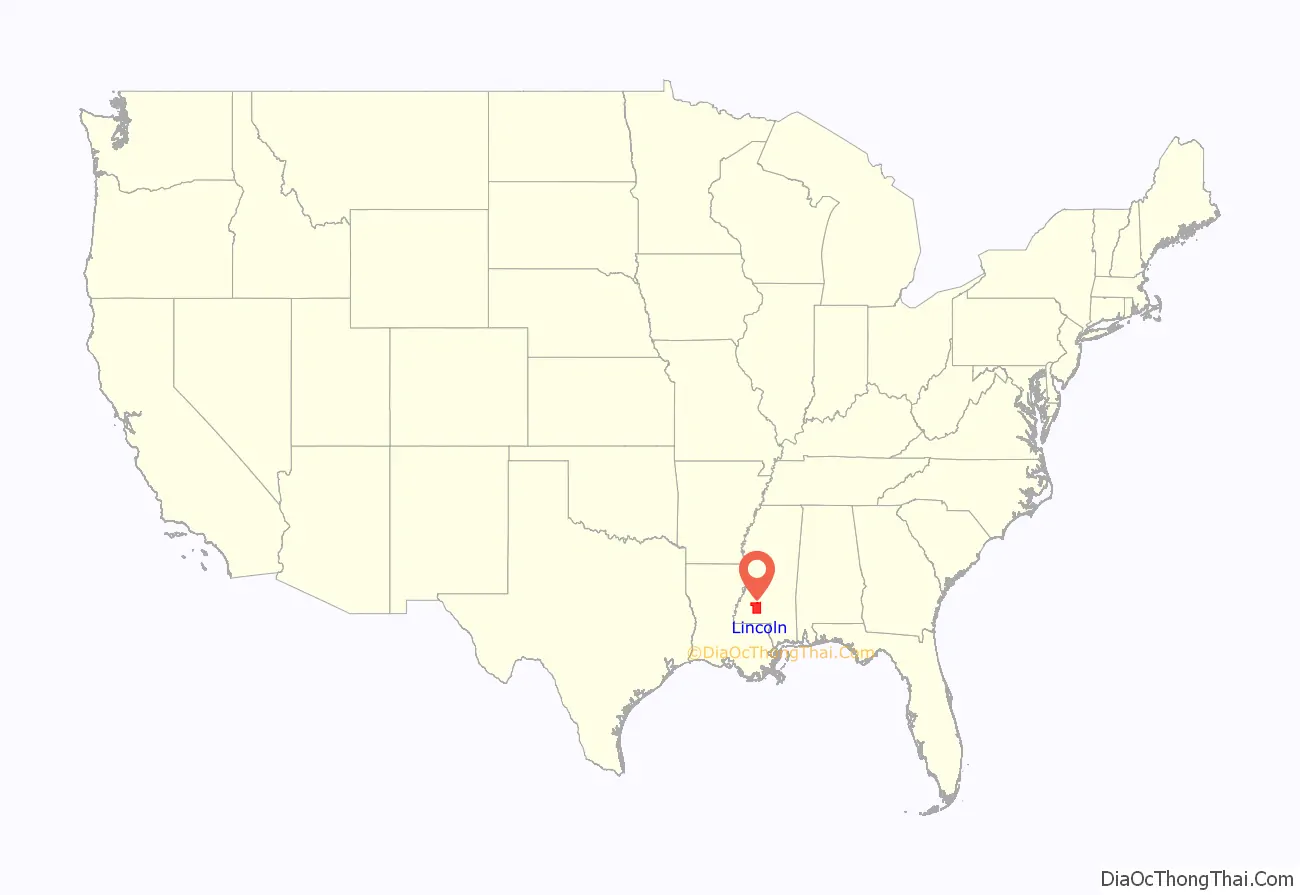
Lincoln County location map. Where is Lincoln County?
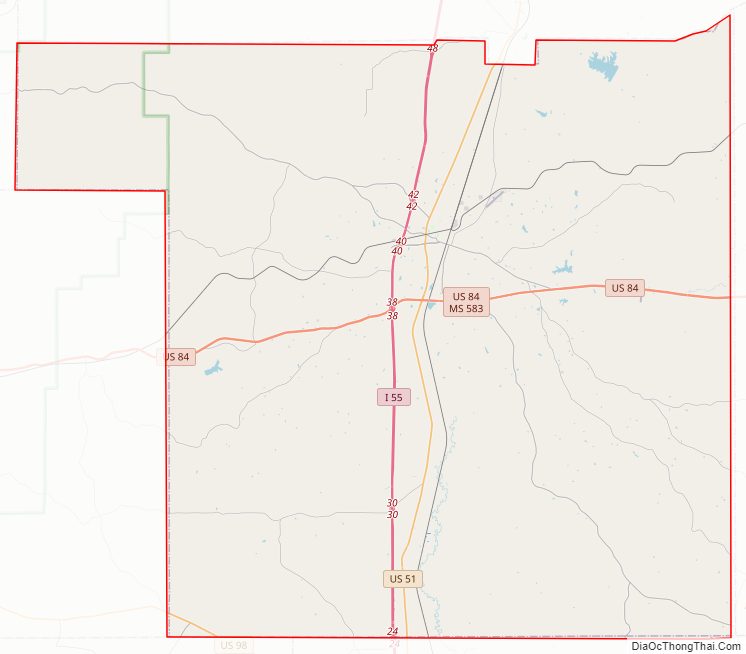
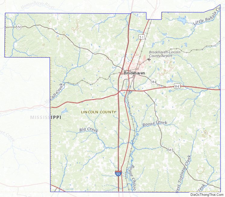
Lincoln County Road Map
Geography
According to the U.S. Census Bureau, the county has a total area of 588 square miles (1,520 km), of which 586 square miles (1,520 km) is land and 2.1 square miles (5.4 km) (0.4%) is water.
Major highways
- Interstate 55
- U.S. Highway 51
- U.S. Highway 84
Adjacent counties
- Copiah County (north)
- Lawrence County (east)
- Walthall County (southeast)
- Pike County (south)
- Amite County (southwest)
- Franklin County (west)
- Jefferson County (northwest)
National protected area
- Homochitto National Forest (part), supervised by the United States Forestry Service of the U.S. Department of Agriculture.
Lincoln County Topographic Map
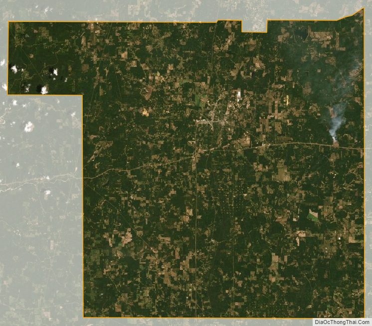
Lincoln County Satellite Map
Lincoln County Outline Map