Montgomery County is a county located in the U.S. state of Mississippi. As of the 2020 census, the population was 9,822. Its county seat is Winona.
The county is said to be named in honor either of Richard Montgomery, an American Revolutionary War general killed in 1775 while attempting to capture Quebec City, Canada, or for Montgomery County, Tennessee, from which an early settler came. In the latter case, it would have been indirectly named after John Montgomery, a settler in Montgomery County, Tennessee, who founded the city of Clarksville, Tennessee, in the same county.
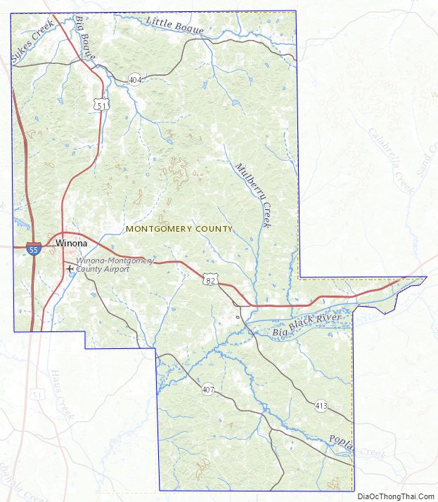
The Big Black River passes through the southern part of the county, flowing southwest to its confluence with the Mississippi River south of Vicksburg.
| Name: | Montgomery County |
|---|---|
| FIPS code: | 28-097 |
| State: | Mississippi |
| Founded: | 1871 |
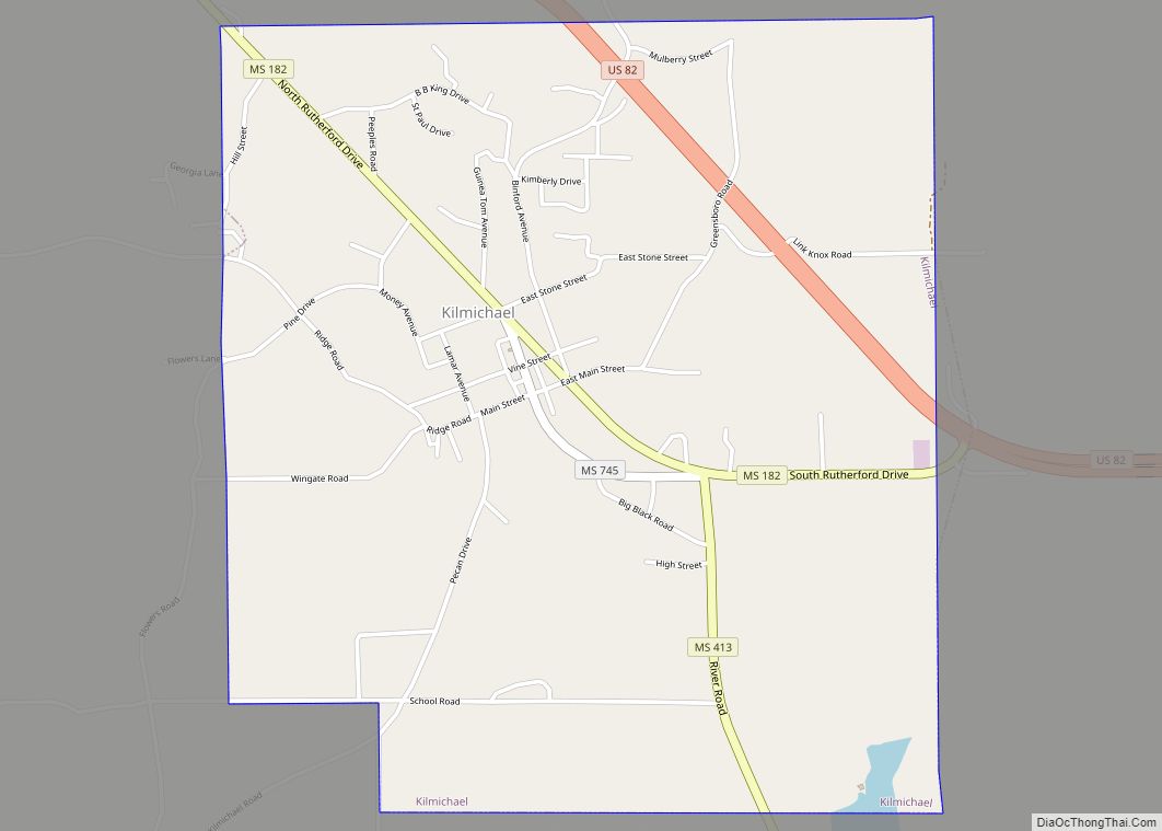
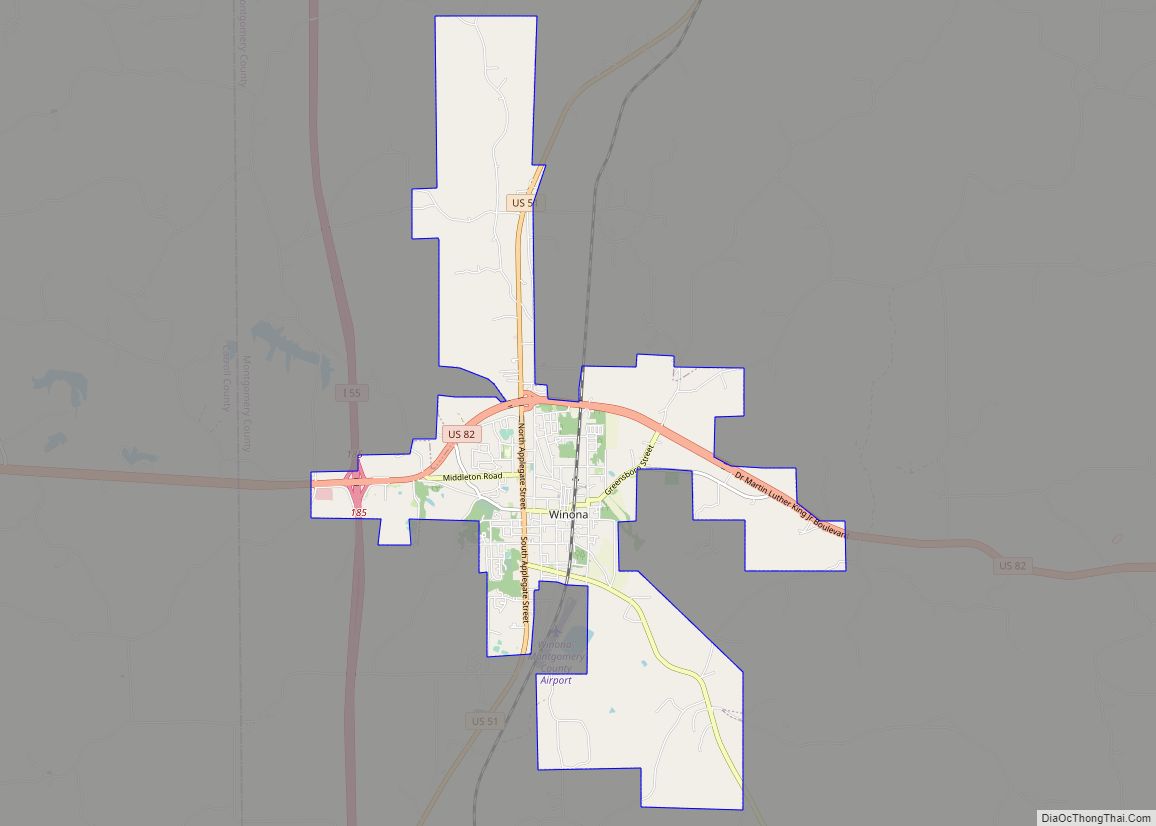
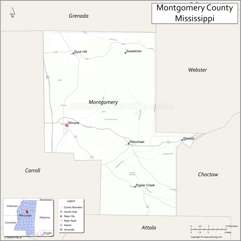
| Seat: | Winona |
| Largest city: | Winona |
| Total Area: | 408 sq mi (1,060 km²) |
| Land Area: | 407 sq mi (1,050 km²) |
| Total Population: | 9,822 |
| Population Density: | 24/sq mi (9.3/km²) |
| Time zone: | UTC−6 (Central) |
| Summer Time Zone (DST): | UTC−5 (CDT) |
| Website: | www.montgomerycountyms.com |
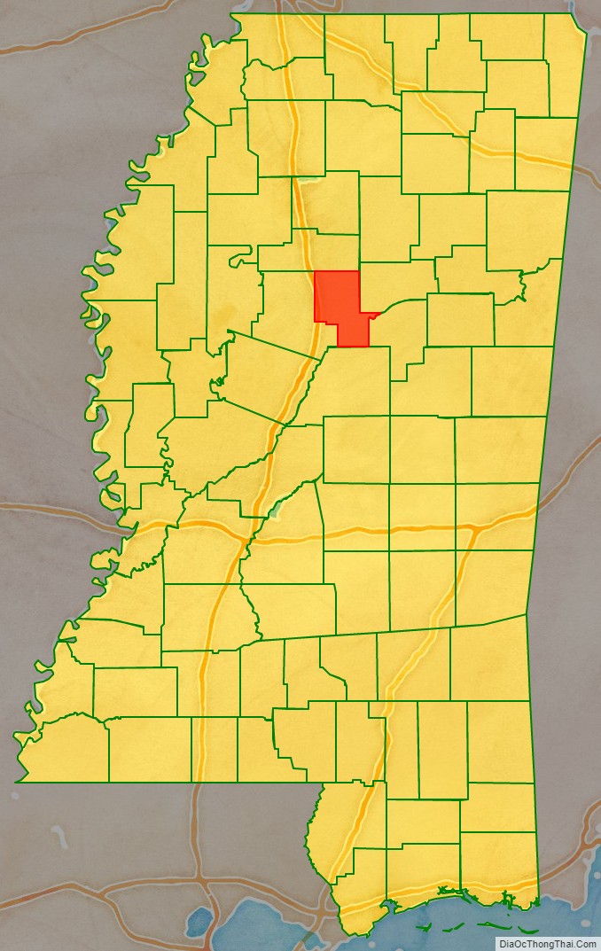
Montgomery County location map. Where is Montgomery County?
History
This area was occupied in historic times by the Choctaw people. Their ancestors had inhabited the area for thousands of years. Under the Indian Removal Act of 1830, the United States forced most of the Native Americans west of the Mississippi River in order to open their lands to settlement by European Americans.
Much of the area of present-day Montgomery County was developed for cotton plantations before and after the Civil War, when it was still part of Choctaw County. Most of the labor was supplied by African Americans, enslaved before the war and freed afterward. The county was organized by the legislature in 1871, during the Reconstruction era. The eastern hilly areas became a center of timber industry.
From 1877 to 1950, there were 10 known lynchings of blacks in the county, fewer than in many other counties of the state. It was a form of racial terrorism that was at its height at the turn of the 20th century. Some studies have shown that the rate of lynchings related to economic stresses among whites. Beginning in 1890, Mississippi and other southern states largely excluded blacks from the formal political system by disenfranchisement, creating barriers to voter registration through constitutional amendments and other laws.
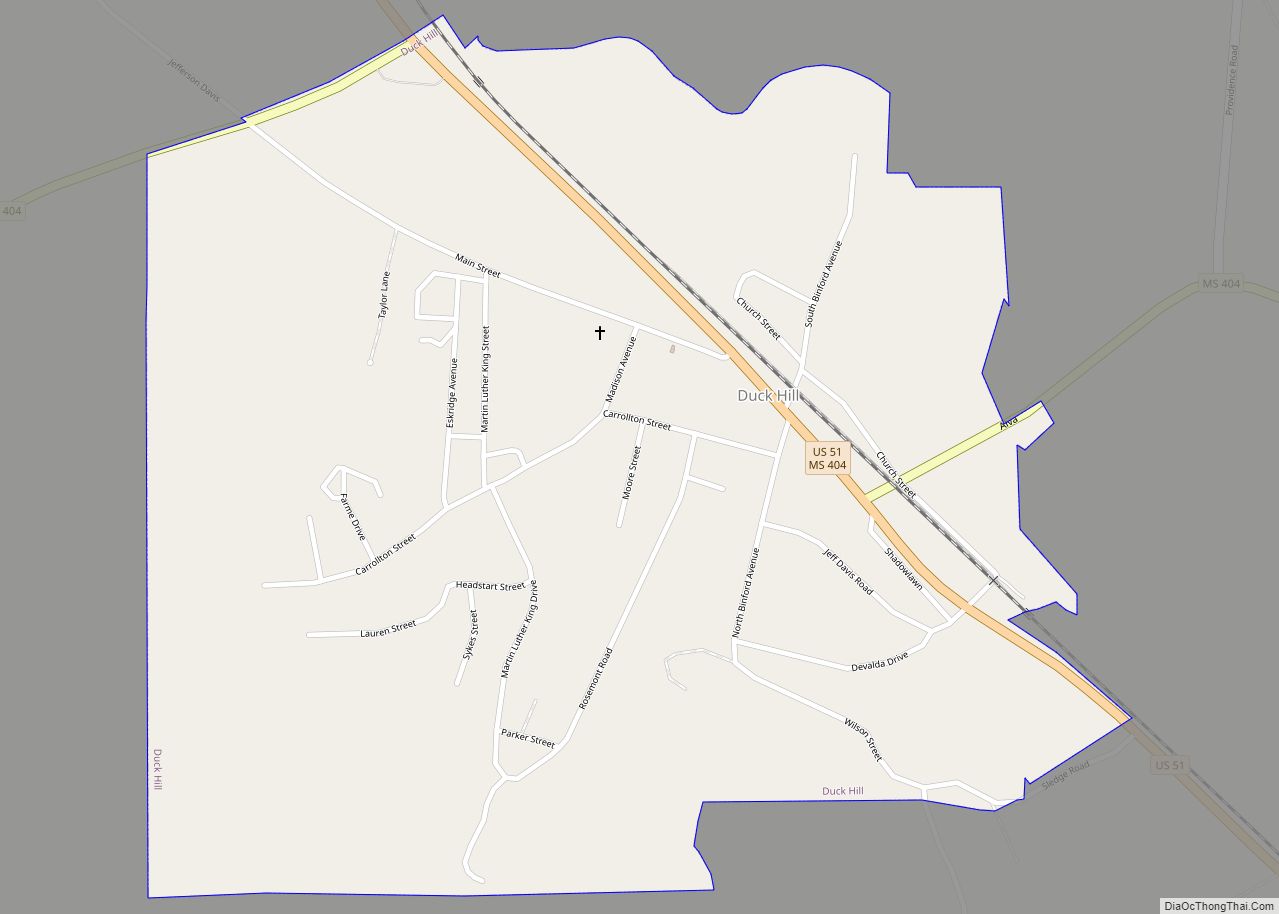
On April 13, 1937, two African-American men, Roosevelt Townes and “Bootjack” McDaniels, were arraigned at the county courthouse in Winona, after being charged in the December 1936 murder of a white merchant in Duck Hill, after Townes purportedly confessed to police. They were abducted from the courthouse and lynched. A white crowd estimated at 100 had gathered on April 13. A group of 12 white men took the two blacks by school bus to a site in Duck Hill, where they were tortured to confess before being shot and burned to death. A crowd estimated at 300 to 500 whites gathered to watch. By 1 pm, the wire services and other national media had learned of the event and were trying to gain more information.
The lynchings were reported nationally in the United States and widely condemned. Representative Hatton W. Sumners (D-Texas), chairman of the House Judiciary Committee, sent a telegram to Governor Hugh L. White decrying the lynching. He said, “It is the sort of thing which makes it hard for those of us who are here trying to protect the governmental sovereignty of the state…” At the time a federal anti-lynching bill was under consideration by Congress. It passed the House, but it was defeated in the Senate by the Solid South, conservative white Democrats. As was typical of lynchings, no one was ever prosecuted for the murders. Nazi Germany reported the lynching, comparing it to the “humanism” of its anti-Semitic laws.
As in much of rural Mississippi, population in this county declined markedly from 1910 to 1920, and from 1940 to 1970. The peak of population in the county was in 1910. In addition to labor changes because of mechanization of agriculture, blacks left in two waves of the Great Migration out of the rural and small town South seeking jobs, education, relief from Jim Crow and violence, and better opportunities in other regions. As a result, Mississippi changed from majority black (56%) in population in 1910 to majority white (63%) by 1970.
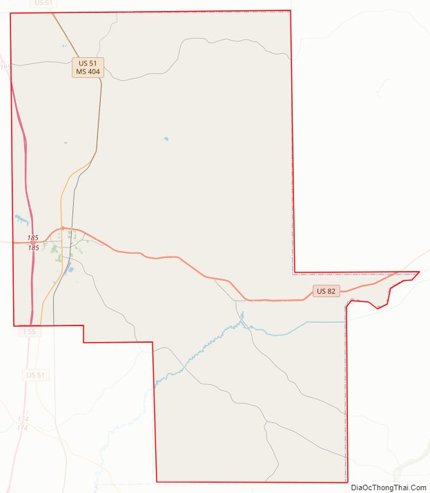
Montgomery County Road Map
Geography
According to the U.S. Census Bureau, the county has a total area of 408 square miles (1,060 km), of which 407 square miles (1,050 km) is land and 0.9 square miles (2.3 km) (0.2%) is water. It is the fourth-smallest county in Mississippi by total area.
Major highways
- Interstate 55
- U.S. Route 51
- U.S. Route 82
Adjacent counties
- Grenada County (north)
- Webster County (northeast)
- Choctaw County (east)
- Attala County (south)
- Carroll County (west)
Montgomery County Topographic Map
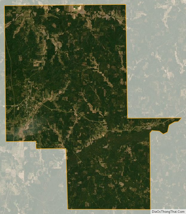
Montgomery County Satellite Map
Montgomery County Outline Map