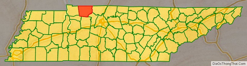
Montgomery County is a county in the U.S. state of Tennessee. As of the 2020 United States census, the population was 220,069. The county seat (and only incorporated municipality) is Clarksville. The county was created in 1796. Montgomery County is included in the Clarksville, TN–KY Metropolitan Statistical Area.
| Name: | Montgomery County |
|---|---|
| FIPS code: | 47-125 |
| State: | Tennessee |
| Founded: | 9 April 1796 |
| Named for: | John Montgomery |
| Seat: | Clarksville |
| Largest city: | Clarksville |
| Total Area: | 544 sq mi (1,410 km²) |
| Land Area: | 539 sq mi (1,400 km²) |
| Total Population: | 220,069 |
| Population Density: | 388/sq mi (150/km²) |
| Time zone: | UTC−6 (Central) |
| Summer Time Zone (DST): | UTC−5 (CDT) |
| Website: | mcgtn.org |
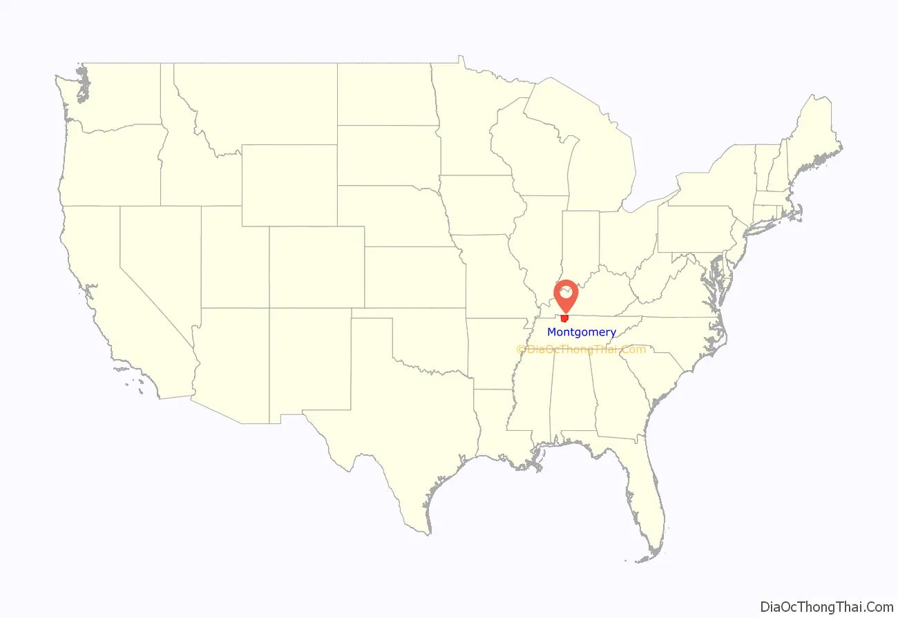
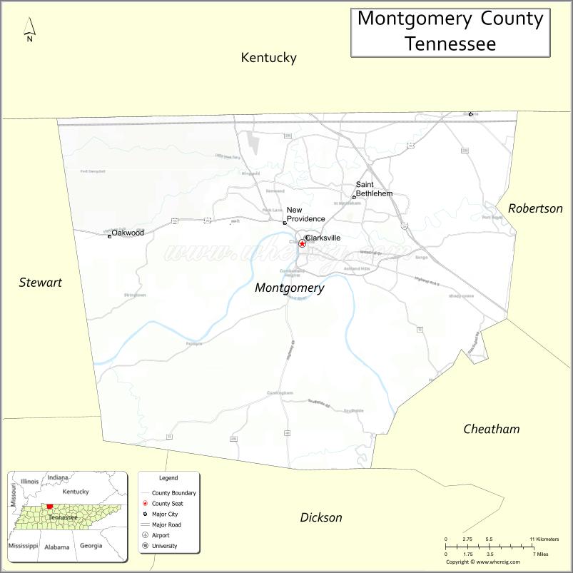
Montgomery County location map. Where is Montgomery County?
History
The county was named for John Montgomery, a soldier in the American Revolutionary War and an early settler who founded the city of Clarksville. It was authorized on 9 April 1796, when the western portion of Tennessee County, which since 1790 had been part of the Territory South of the River Ohio, became part of the new state of Tennessee. (In 1790, North Carolina had ceded its western lands to the Federal government to create what was also known as the Southwest Territory.) The eastern portion of old Tennessee County was, at the same time Montgomery County was formed, combined with land taken from Sumner County to form Robertson County, Tennessee. Later acts of the Tennessee General Assembly had further reduced Montgomery County by 1871 to its current size and boundaries.
Montgomery County was the site of several early saltpeter mines. Saltpeter is the main ingredient of gunpowder and was obtained by leaching the earth from local caves. Bellamy Cave near Stringtown still contains the remains of two dozen saltpeter leaching vats. It appears to have been a large operation. Cooper Creek Cave shows evidence of extensive mining and contains the remains of “many saltpeter hoppers”. Both were probably mined during the War of 1812. Dunbar Cave is reported to have been mined for saltpeter during the Mexican War of 1848, but commercial development has destroyed any evidence of this. Little mining is likely to have happened here during the Civil War, since the Union Army captured and occupied this part of Tennessee in early 1862.
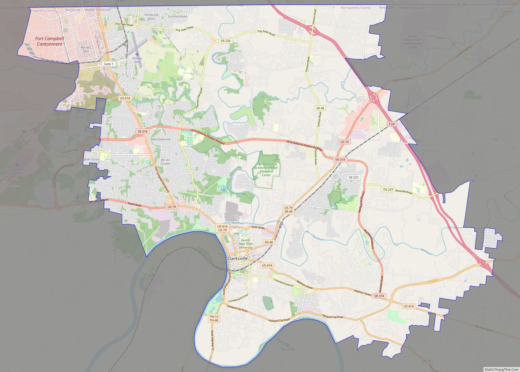
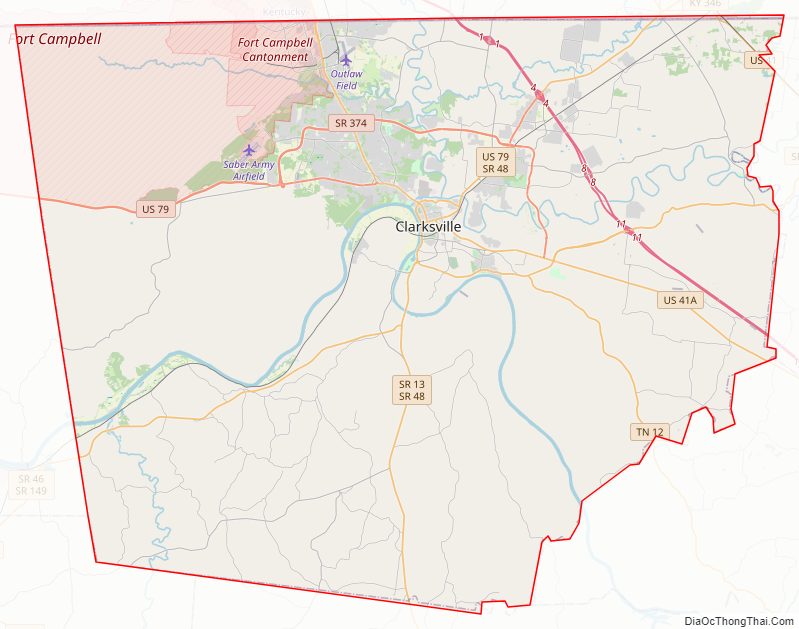
Montgomery County Road Map
Geography
Montgomery County lies on the north line of Tennessee; its north border abuts the state of Kentucky. The hilly terrain is marked by drainages and largely covered with trees. The Cumberland River meanders westward through the lower central part of the county. The highest point on the county terrain (806 feet/246 meters ASL) is a small hill 3.7 miles (6.0 km) ENE from Slayden in Dickson County.
According to the US Census Bureau, the county has a total area of 544 square miles (1,410 km), of which 539 square miles (1,400 km) is land and 4.7 square miles (12 km) (0.9%) is water.
Dunbar Cave
Montgomery County lies in a region of well-developed karst topography. A large cave system under the county is named Dunbar Cave; it is the centerpiece of Dunbar Cave State Park, which encompasses approximately 110 acres and is one of the most visited units in the Tennessee State Park System.
Dunbar Cave was extensively used by prehistoric Indians, who inhabited this area for thousands of years before European encounter. Remains of their cane torches have been found in the cave, and archaeologists have excavated numerous artifacts inside the entrance. During a research trip into the cave on January 15, 2005, Park Ranger Amy Wallace, History professor Joe Douglas, local historian Billyfrank Morrison, and Geologist Larry E. Matthews, discovered Indian glyphs on the walls of the cave. Subsequent investigations by archaeologists from the University of Tennessee at Knoxville confirmed the drawings were from people of the Mississippian culture, which was active about 1000-1300 CE. These glyphs were featured for a few years on the tour of the cave.
In 2010, the State of Tennessee closed Dunbar Cave to the public because White Nose Syndrome was diagnosed in a bat and they did not want the disease to spread. The cave has since reopened and tours are conducted seasonally, from May to August (with special hygiene procedures in place).
Adjacent counties
- Christian County, Kentucky – northwest
- Todd County, Kentucky – northeast
- Robertson County – east
- Cheatham County – southeast
- Dickson County – south
- Houston County – southwest
- Stewart County – west
Protected areas
- Barnett’s Woods State Natural Area
- Dunbar Cave State Natural Area
- Dunbar Cave State Park
- Haynes Bottom Wildlife Management Area
- Port Royal State Park (part)
- Shelton Ferry Wildlife Management Area
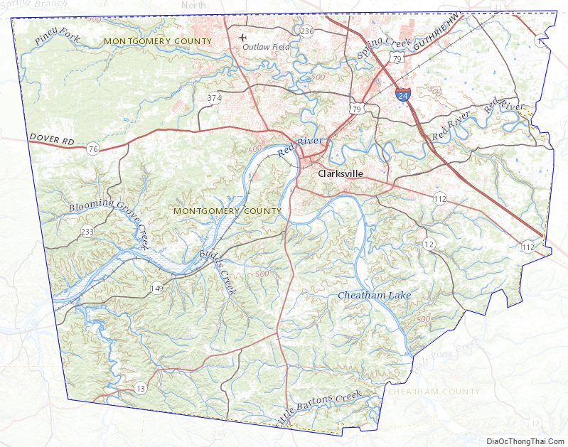
Montgomery County Topographic Map
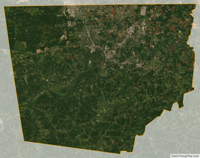
Montgomery County Satellite Map
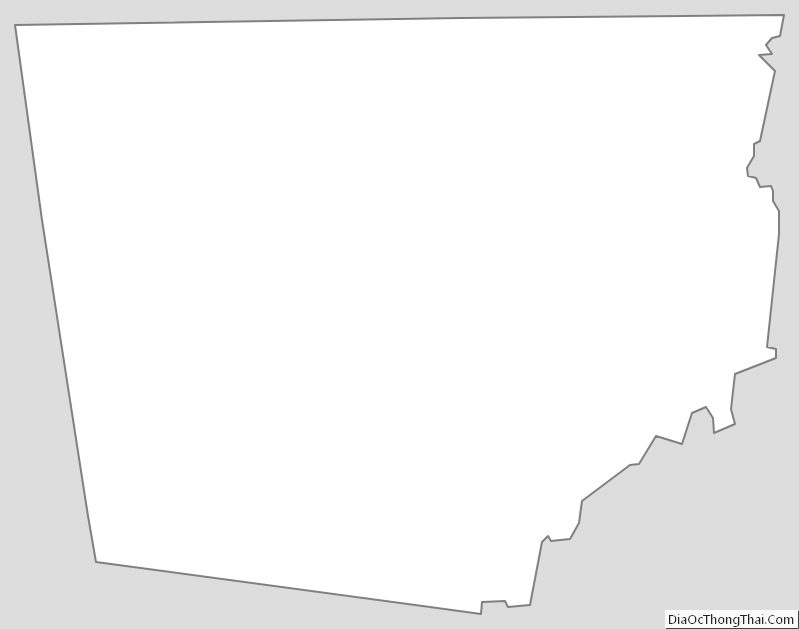
Montgomery County Outline Map