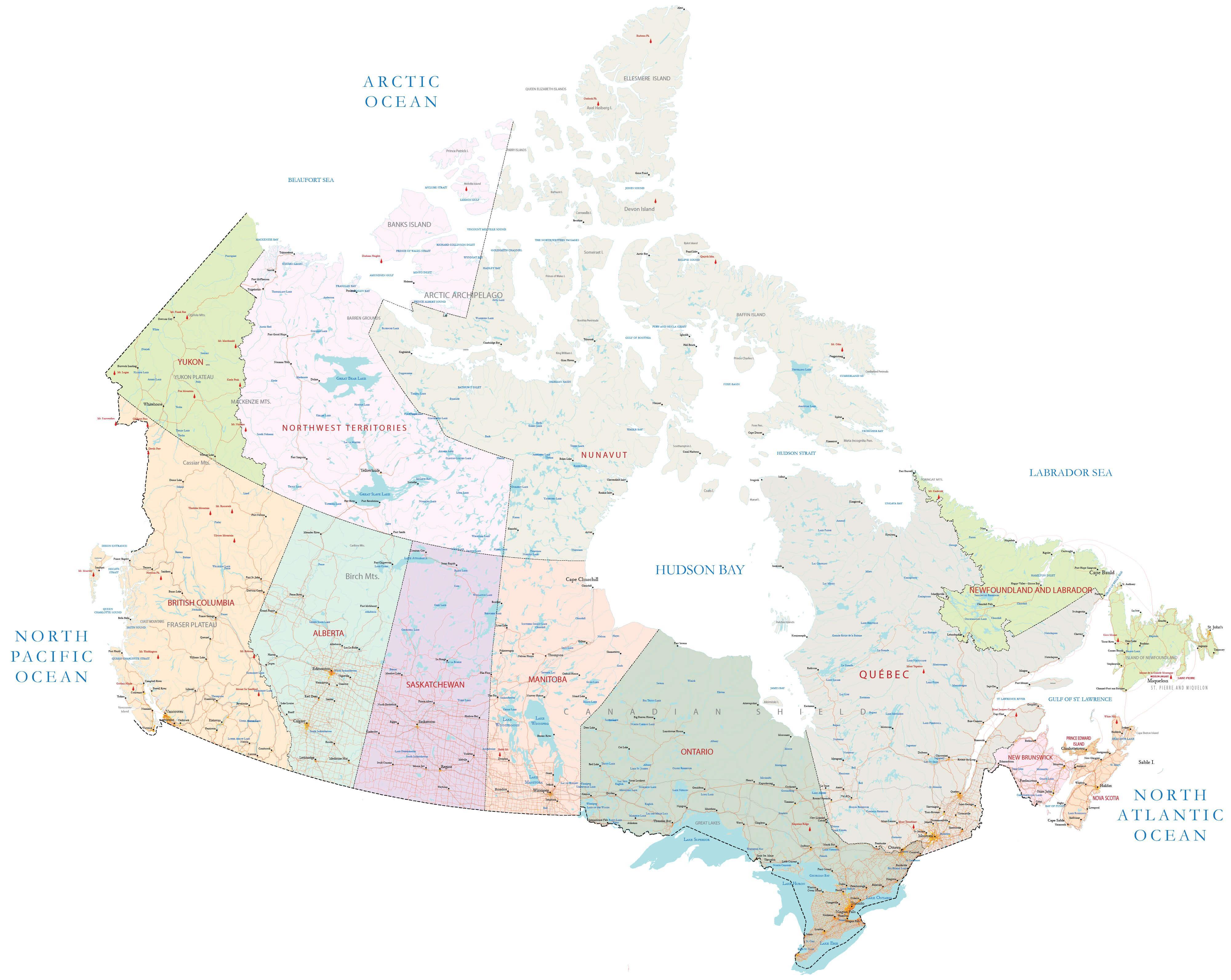
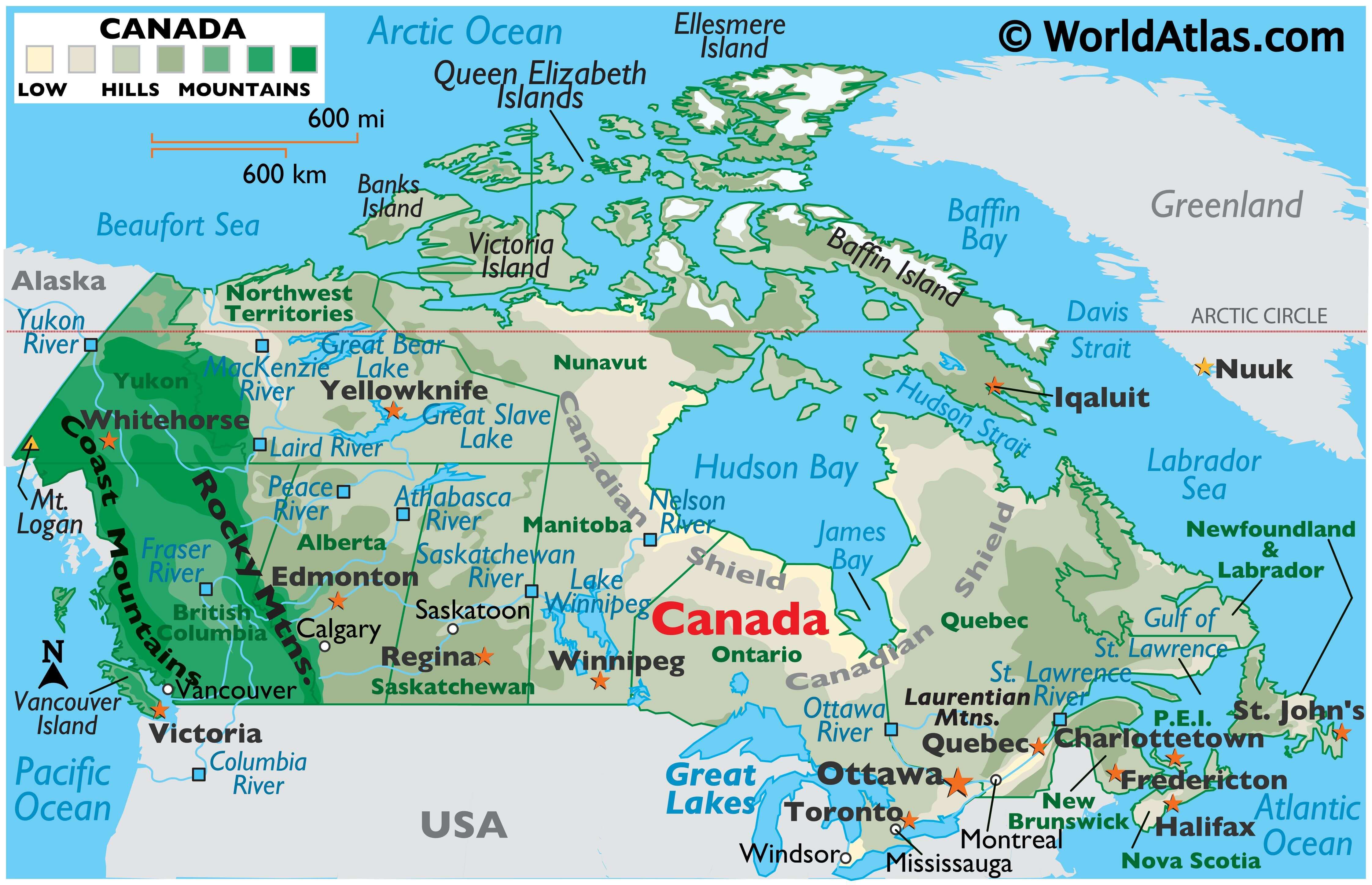
As the 2nd largest country in the world with an area of 9,984,670 sq. km (3,855,100 sq mi), Canada includes a wide variety of land regions, vast maritime terrains, thousands of islands, more lakes and inland waters than any other country, and the longest coastline on the planet. In essence, as observed on the physical map above, Canada is a smorgasbord of landforms, of which the significant ones are: the Appalachian Mountains, St. Lawrence River, Canadian Shield, Canadian Arctic Archipelago; Great Lakes, Hudson Bay, Great Plains, Lake Winnipeg, Columbia, Fraser, Mackenzie and Yukon Rivers; Great Bear Lake, Great Slave Lake, Rocky Mountains, Canadian Cordillera and the dozens of volcanoes along the Pacific Ring of Fire.
Appalachian Mountains: The Appalachians extend from the New England States in the U.S. up through parts of the Canadian provinces of New Brunswick, Newfoundland and Quebec. In Canada, they are mostly rolling hills.
Canadian Arctic Archipelago: The Canadian Arctic Archipelago is located north of the Canadian mainland on the fringes of the Arctic Ocean. This group of some 36,000 islands is mostly part of the territory of Nunavut Baffin, Ellesmere and Victoria Islands are the largest of the group respectively. The climate here features long, cold winters and short, cool summers. The terrain consists of tundra except in mountainous regions of the east.
Canadian Shield: As observed on the map, the Canadian Shield, covering the eastern half of Canada’s landmass is an ancient bedrock base of gneiss and granite covered by a shallow layer of soil. Large areas of coniferous (evergreen) forests and hundreds of rivers and lakes spread across this mostly flat region. It’s scattered low-lying mountains include the Laurentian and Torngat ranges.
Canadian Cordillera: The Canadian Cordillera extends from the Rocky Mountains to the Pacific Ocean. The Cordilleras are part of a huge mountain system extending from the Andes of South America to the tip of Alaska. The Canadian Cordillera includes ranges of the Rocky Mountains, the Coast Range and varied coastal mountain ranges and their many active volcanoes.
Great Slave Lake: It is the 2nd largest lake in the Northwest territories of Canada behind Great Bear Lake. It’s the deepest lake in North America at 614m (2,015 ft), and the 9th largest lake in the world.
Great Bear Lake: It is the largest lake entirely within Canada; the 3rd largest in North America and the 7th largest in the world. The lake has a surface area of 31,153 sq.km, (12,028 sq. miles) with a maximum depth of 446 m (1463 ft).
Both lakes have been marked on the map above and are located to the north of the country and are glacial in origin.
Great Plains: The Great Plains slope east from the Rockies and extend to the edge of the Appalachians. The land is generally smooth with large treeless areas and sloping shallow river valleys. They extend across parts of Alberia, Manitoba, Northwest Territories and Saskatchewan, and vast parts of North Central U.S.
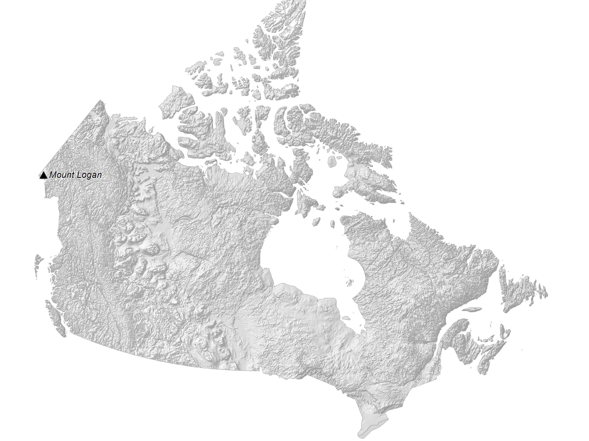
Mount Logan: Also marked on the map above by a yellow upright triangle is Mount Logan, the highest peak in Canada. It is located in southwestern Yukon to the northwest of Canada. It has an elevation of 5,959 m (19,551 ft).
| Flag: |  |
|---|---|
| Legal Name: | Canada |
| Capital Value: | Ottawa |
| Official languages: |
|
| Demonym(s): | Canadian |
| Government: | Federal parliamentary constitutional monarchy |
| Legislature: | Parliament |
| Total Area: | 9,984,670 km² |
| Land Area: | 9,093,507 km² |
| Water Area: | 891,163 km² |
| Population: | 37,589,262 |
| Density: | 4.2/km (10.9/sq mi) (236th) |
| GDP: | $1.74 Trillion |
| GDP Per Capita: | $46,194.73 |
| Currency Value: | Canadian dollars (CAD) |
| Driving side: | right |
| Calling code: | +1 |
| Internet TLD: | .ca |
Explore Canada’s stunning landscapes with this Canada map collection! From the majestic Rocky Mountains, to the rolling prairies, to the snow-covered Arctic tundra, there’s something for everyone to discover. Our elevation map shows the country’s topography in stunning detail, while our satellite map reveals its natural beauty from above. Our reference map provides an overview of the provinces and territories, and our provincial map showcases the intricate details of each region. Discover something new about Canada today!
Location Maps
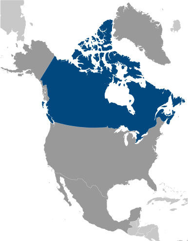
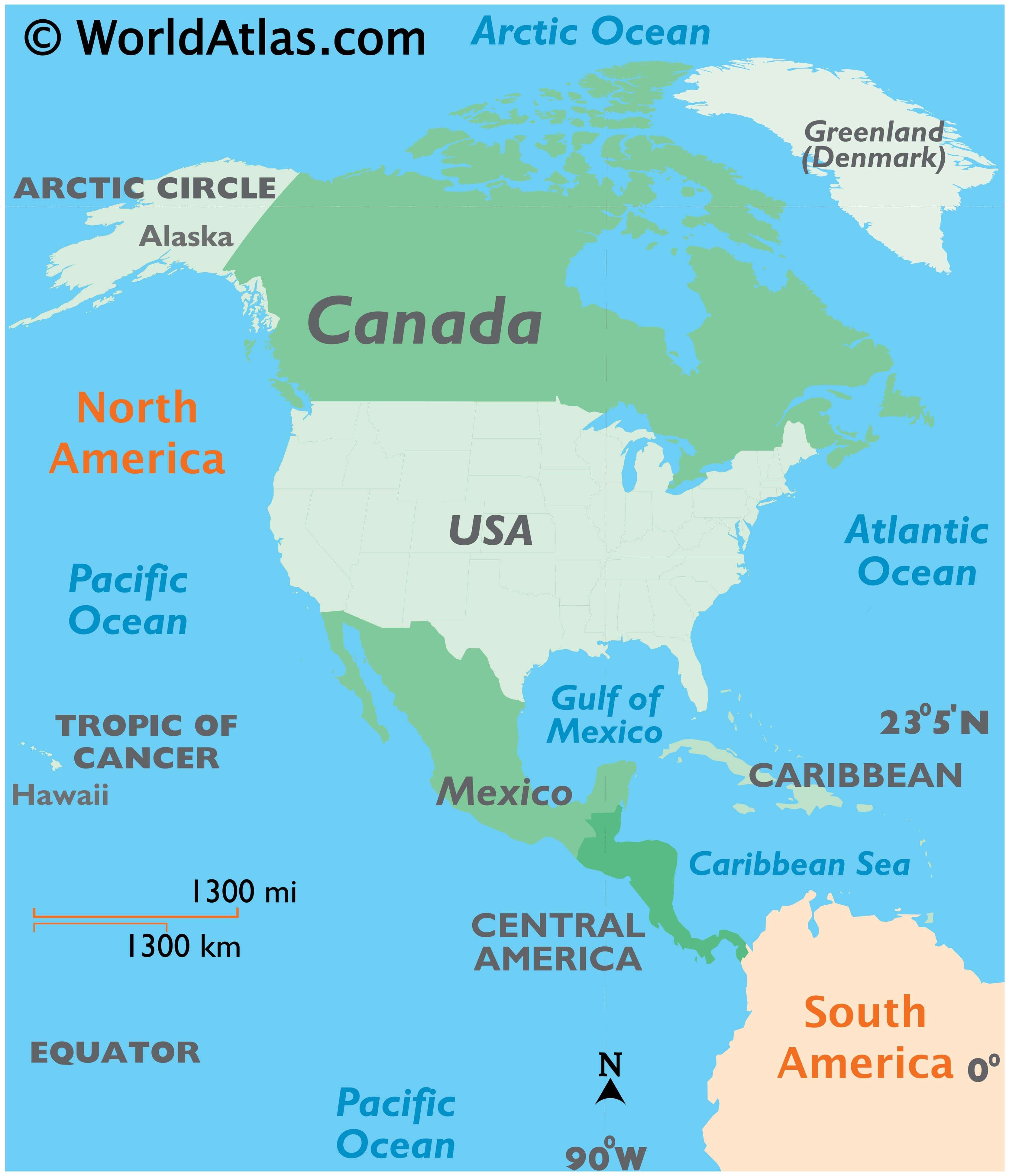
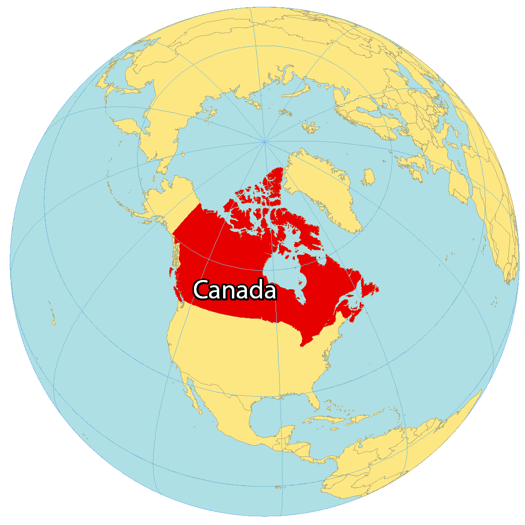
Where is Canada?
Canada is a beautiful country located in the northern part of North America. Spanning an area of 9.98 million square kilometers (3.85 million square miles), it is the world’s second-largest country by total area. Its ten provinces and three territories stretch from the Atlantic to the Pacific and northward into the Arctic Ocean. The border between Canada and the United States is the world’s longest land border.
Canada has a cold or severely cold winter climate, though southerly areas are warm in summer. The land is mostly covered by forests and tundra, making it sparsely populated. Most of the population is highly urbanized, with over 80 percent of its inhabitants living in large and medium-sized cities, many near the southern border. The capital of Canada is Ottawa, while its three largest metropolitan areas are Toronto, Montreal, and Vancouver.
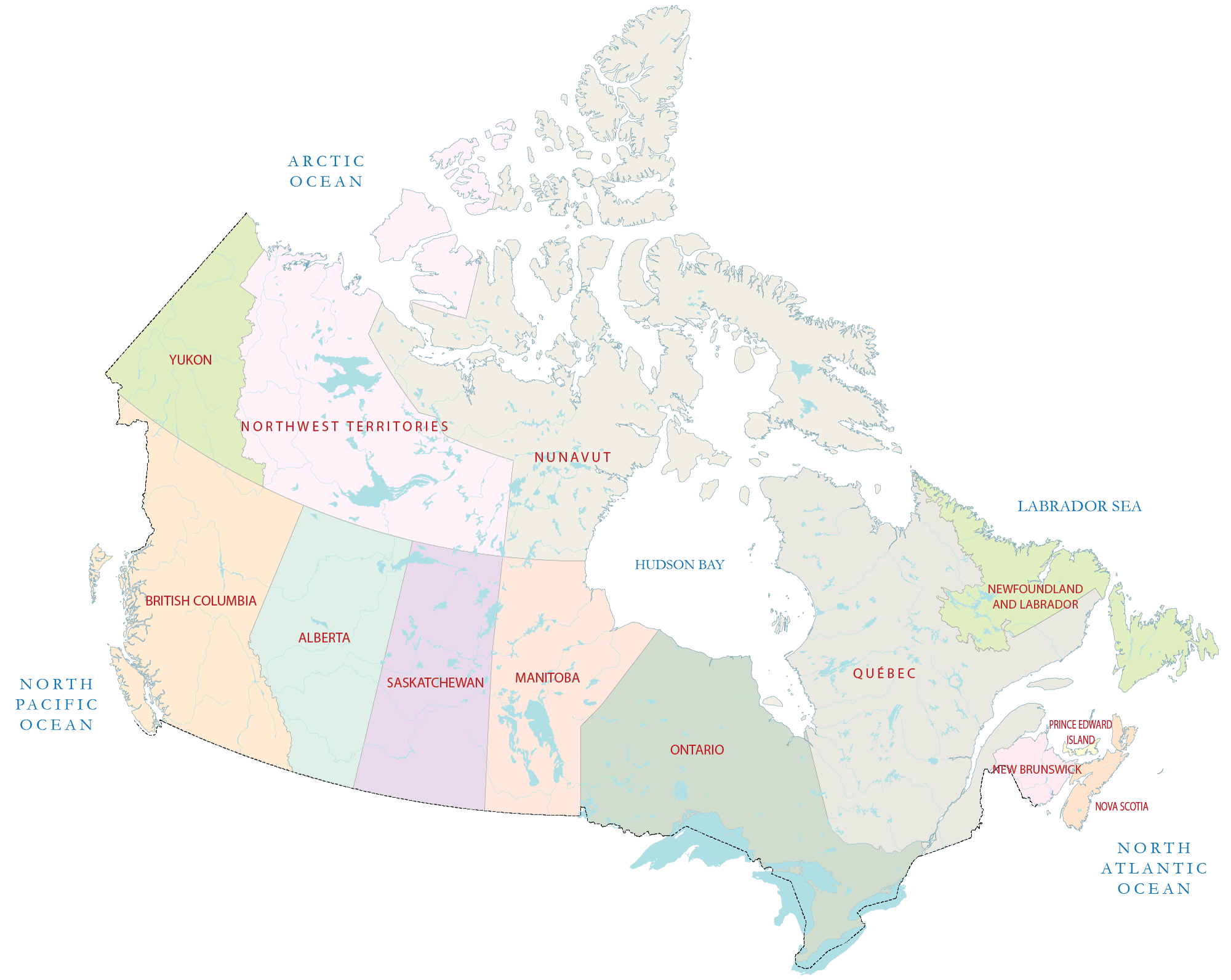
High Definition Political Map of Canada
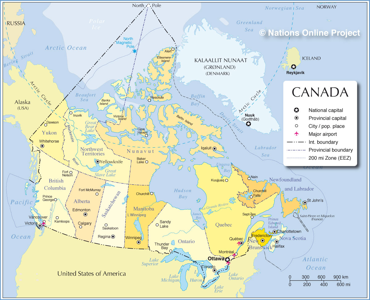
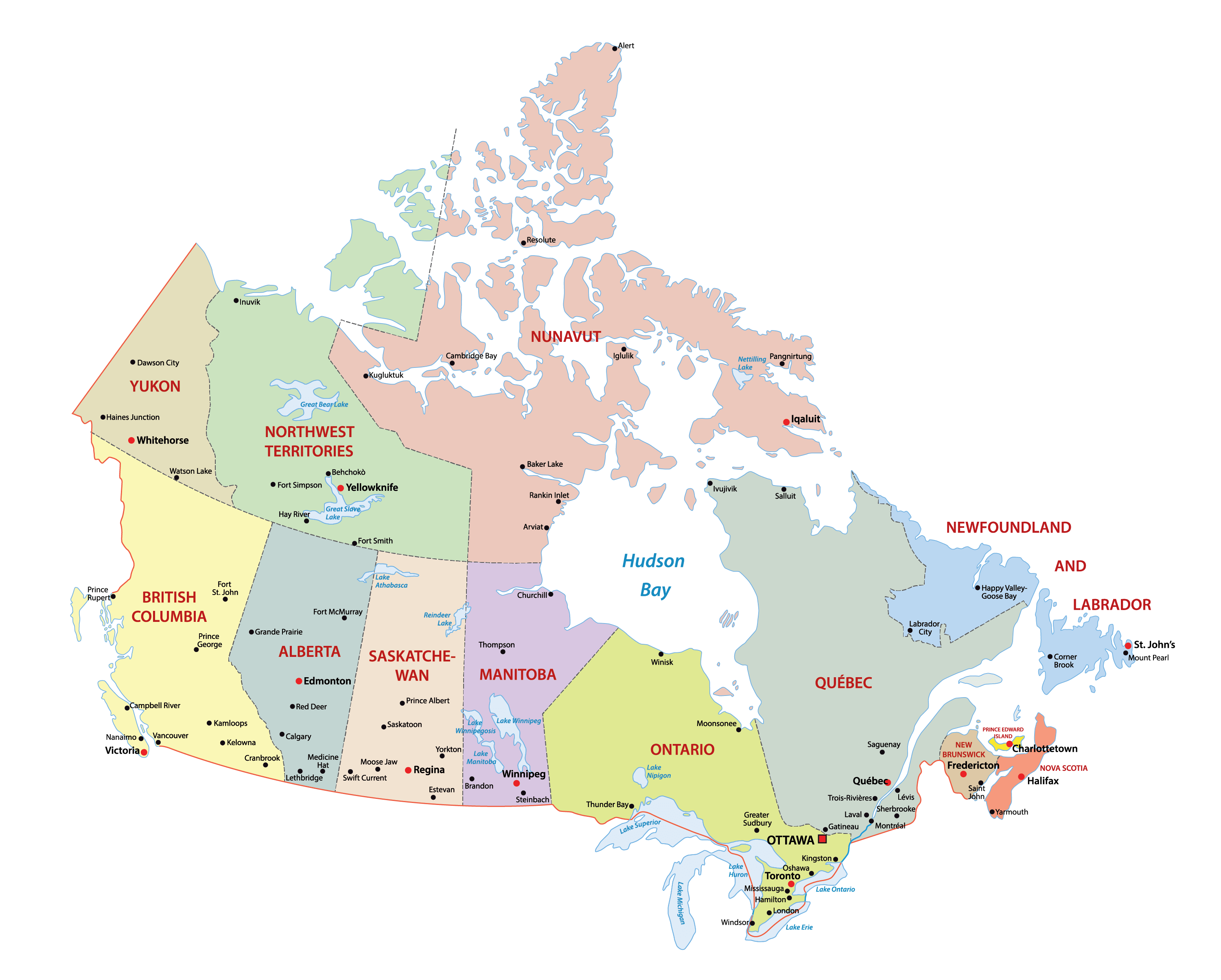

Canada Administrative Map
Physical Map of Canada
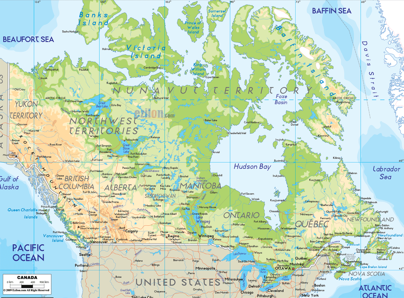
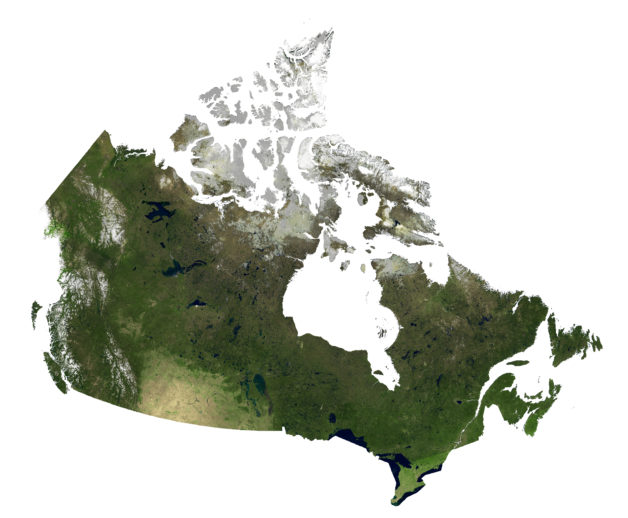
Canada Satellite Map
Elevation Map
Thank you. So beautiful map