Webster County is a county located in center of the U.S. state of Mississippi, bordered on the south by the Big Black River. As of the 2020 census, the population was 9,926.
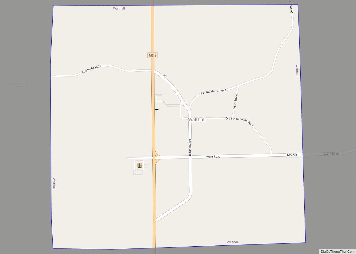
The county was organized in 1874 during the Reconstruction era; the biracial legislature named it after Massachusetts statesman Daniel Webster. Its county seat is Walthall, designated in 1876.
After the repeal of Prohibition in 1933, Webster County voters established this as a “dry county.” In 2018 the legislature passed a bill allowing the transport of alcohol through even dry counties in the state.
| Name: | Webster County |
|---|---|
| FIPS code: | 28-155 |
| State: | Mississippi |
| Founded: | 1874 |
| Named for: | Daniel Webster |
| Seat: | Walthall |
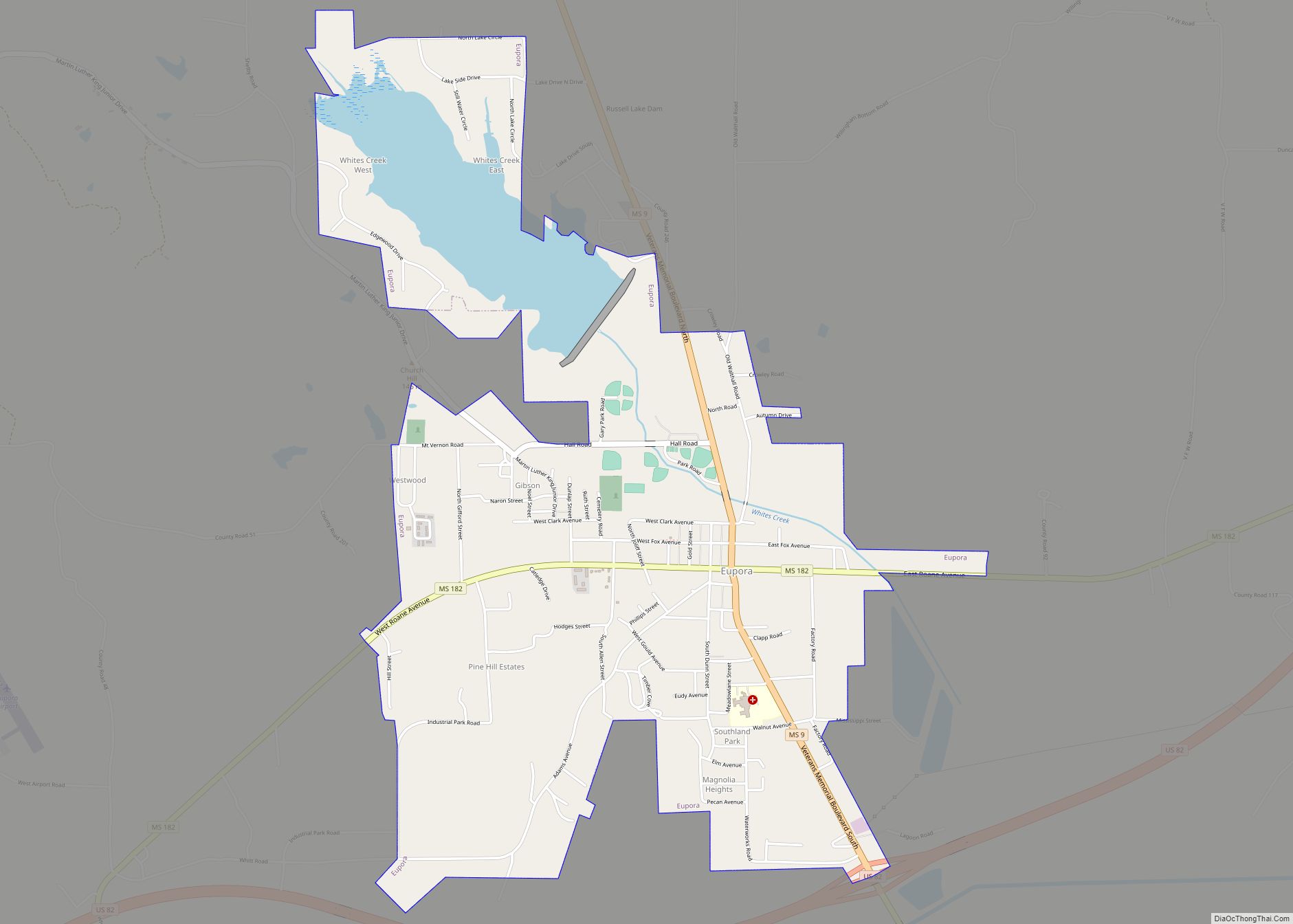
| Largest city: | Eupora |
| Total Area: | 423 sq mi (1,100 km²) |
| Land Area: | 421 sq mi (1,090 km²) |
| Total Population: | 9,926 |
| Population Density: | 23/sq mi (9.1/km²) |
| Time zone: | UTC−6 (Central) |
| Summer Time Zone (DST): | UTC−5 (CDT) |
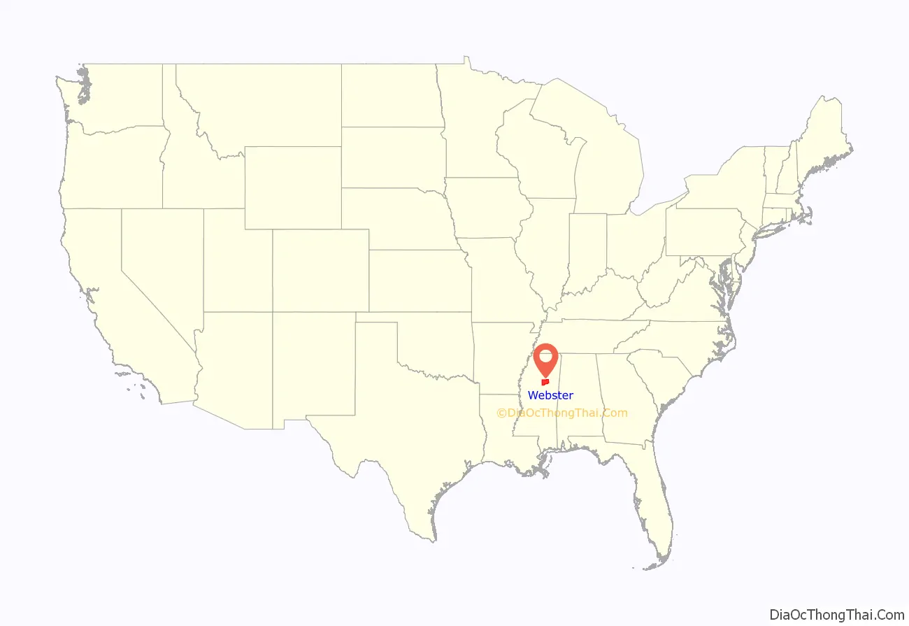
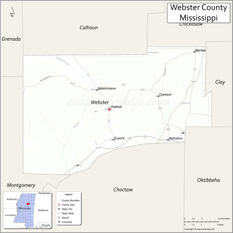
Webster County location map. Where is Webster County?
History
Webster County was formed in 1874, during the Reconstruction era, from parts of the neighboring Montgomery, Chickasaw, Choctaw and Oktibbeha counties. Its southern border is formed by the Big Black River, a tributary of the Mississippi River.
In a pattern typical of frontier areas, as population in the Mississippi Territory increased, the original, large Choctaw and Oktibbeha counties were gradually divided in order to establish smaller counties. This territory had been acquired in 1833 by the United States from the Choctaw in the Treaty of Dancing Rabbit Creek. At that time the large Choctaw County, Mississippi consisted of territory that later was divided to organize also Webster, the eastern part of Montgomery and a small portion of Grenada counties.
After Indian Removal, Choctaw County was inhabited primarily by European-American settlers from Alabama, Georgia, and South Carolina, and enslaved African Americans whom they brought with them or purchased as laborers.
Greensboro was designated as the first county seat. A temporary courthouse and log jail were built there. These were replaced in 1839 by a brick courthouse and jail. This courthouse was destroyed by fire in 1865, allegedly by an arsonist. Almost all of the early county records were destroyed in the fire.
In the early years Greensboro was thriving, with several types of stores and shops, as the county seat was a trading center for the agricultural district. It also had saloons, a livery stable, a brick yard, and a newspaper. A Methodist church was founded as early as 1839, and a Baptist church was begun in 1846. The Greensboro Lodge No. 49 of Free and Accepted Masons was chartered in 1842.
Part of the Mississippi frontier, Greensboro had the reputation of a rough and lawless town; many notorious criminals and murders were located there. John A. Murell, a famed outlaw of the Natchez Trace, was tried and convicted of horse stealing. While being transported to Columbus, Mississippi for incarceration, he killed his guard and escaped.
As the county seat, Greensboro sometimes received political candidates running for office. For instance, in 1851 the young Jefferson Davis came seeking voters to support him in his campaign for governor.
In 1861 the Edwards-Gray feud erupted, which developed from a fight over the settlement of the estate of Edward Dewitt Edwards, Jr. His family challenged his bequest to his widow, Mary “Molly” Gray Edwards. Three of her brothers: William, James, and Robert Gray, shot and killed judge Edward D. Edwards, Sr. and his son Luther Edwards in a confrontation over the estate. The Gray brothers were arrested and jailed; however, before a trial could be held, an outraged mob stormed the jail, fatally shooting two of the brothers and hanging the third.
At the outbreak of the American Civil War, seven young men of Greensboro and Choctaw County rushed to enlist. The first company organized was the Wigfall Rifles, company D 15th, MS infantry C.S.A. This unit was formed in Greensboro in April 1861, commanded by Captain William F. Brantley of Greensboro; he later was promoted during the last year of the war as one of the youngest Confederate generals. In December 1864 Union troops raided the town and burned much of it.
Brantley returned to Greensboro to practice law after the war and married again. (His first wife had died in 1863.) Local feuds and political unrest continued to erupt in violence during and after the Reconstruction era, when political tensions in the South were high, as conservative whites tried to re-establish their power over freedmen. His older brother, physician John Ransom Brantley, had been killed in Gonzales, Texas in 1859. Their younger brother Arnold Brantley was shot and killed near Greensboro on August 16, 1870; his murderers escaped. According to the Clarion, General Brantley was said to be seeking reprisal for his brothers’ murders. He was ambushed on November 2, 1870, and killed by a shotgun blast while riding from Winona to Greensboro. No one was prosecuted for these deaths.
Reflecting population changes in the county, in 1872 the state legislature moved the county seat from Greensboro to La Grange (historical), Mississippi, located west of the Natchez Trace. In 1874 Webster County, Mississippi was formed from parts of Choctaw county, and Greensboro was first designated as its county seat. But in 1876 the legislature moved the county seat to the more centrally located Walthall.
Greensboro, which had already begun to decline after the first shift in the county seat, rapidly lost population after this change. Many of the residents and businesses moved to the new county seat.
20th century to present
In 1908, Webster County had the youngest birth mother recorded in the United States. Dr. V. I. Pittman of Cadaretta, an unincorporated area, reported delivering a boy weighing 7 lb (3.2 kg) to nine-year-old Estelle P. on March 16, 1908.
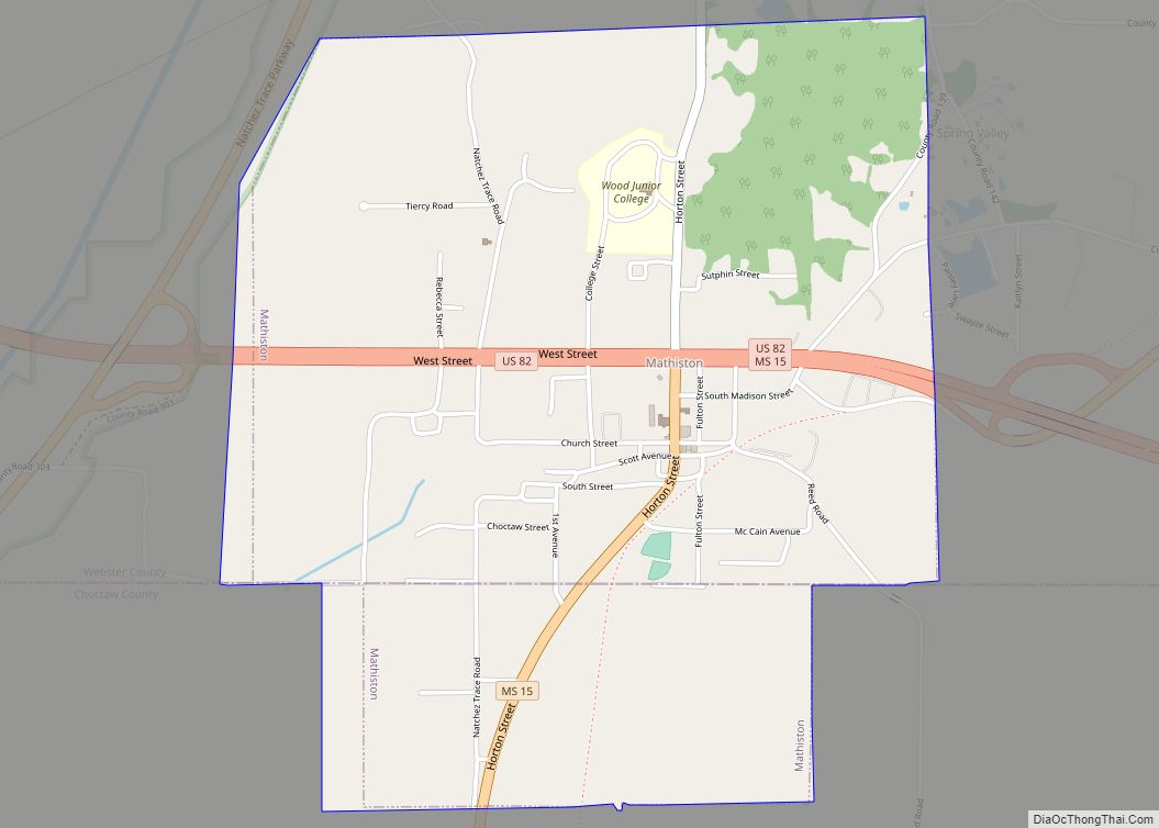
For years after Prohibition was repealed in 1933, Webster County voters kept it “dry”. The police of Mathiston, Mississippi, which was largely located in Webster County, frequently conducted roadblocks on those parts of highways running through town that were located in Webster. They would search for and seize all alcohol being transported through the county. On July 1, 2018, the legislature passed Mississippi House Bill 192, legalizing transport of all alcohol, by persons 21 and older, through dry counties within the state, and ending such actions.
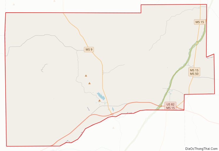
Webster County Road Map
Geography
According to the U.S. Census Bureau, the county has a total area of 423 square miles (1,100 km), of which 421 square miles (1,090 km) is land and 2.3 square miles (6.0 km) (0.5%) is water.
Major highways
- U.S. Highway 82
- Mississippi Highway 9
- Mississippi Highway 15
- Mississippi Highway 46
- Mississippi Highway 50
- Natchez Trace Parkway
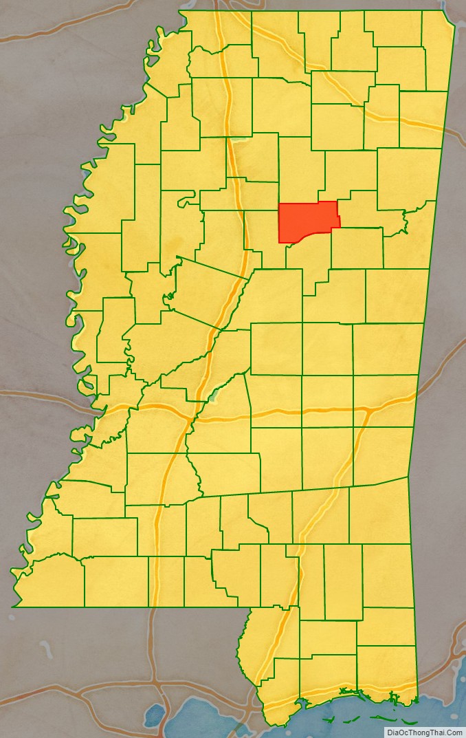
Adjacent counties
- Calhoun County (north)
- Chickasaw County (northeast)
- Clay County (east)
- Oktibbeha County (southeast)
- Choctaw County (south)
- Montgomery County (west)
- Grenada County (northwest)
National protected area
- Natchez Trace Parkway (part)
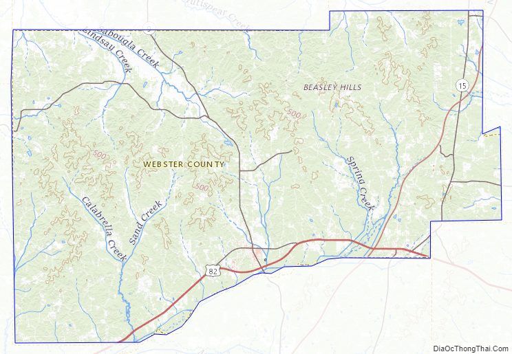
Webster County Topographic Map
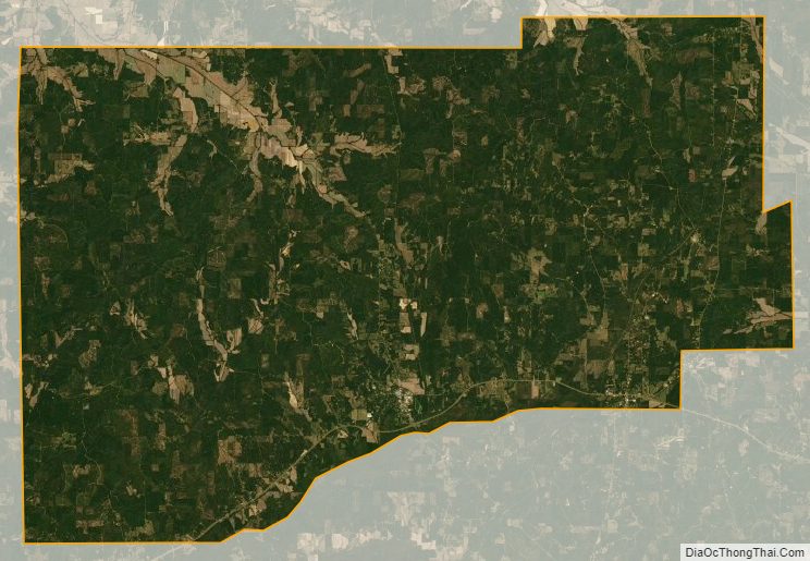
Webster County Satellite Map
Webster County Outline Map