Paulding County is a county located in the northwestern part of the U.S. state of Georgia. Part of the Atlanta metropolitan area, it had an estimated population of 168,661 in 2020. The county seat is Dallas.
| Name: | Paulding County |
|---|---|
| FIPS code: | 13-223 |
| State: | Georgia |
| Founded: | 1832 |
| Named for: | John Paulding |
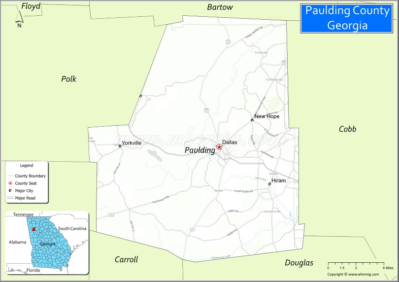
| Seat: | Dallas |
| Largest city: | Dallas |
| Total Area: | 314 sq mi (810 km²) |
| Land Area: | 312 sq mi (810 km²) |
| Total Population: | 168,661 |
| Time zone: | UTC−5 (Eastern) |
| Summer Time Zone (DST): | UTC−4 (EDT) |
| Website: | www.paulding.gov |
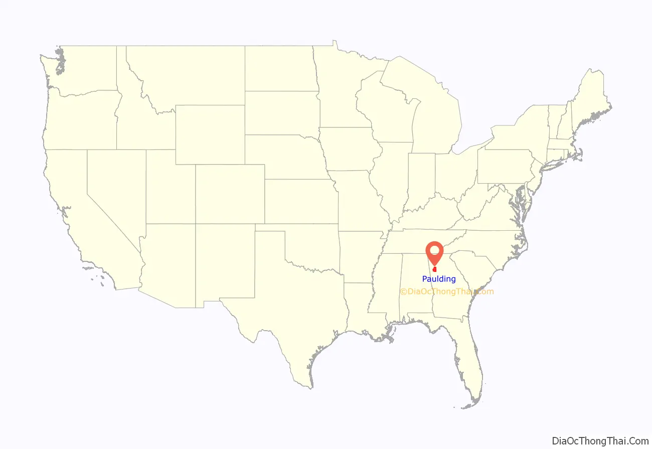
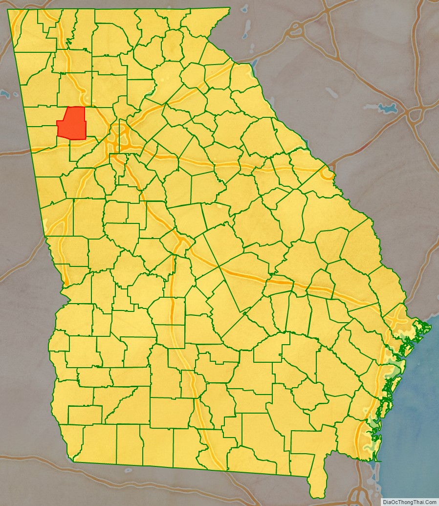
Paulding County location map. Where is Paulding County?
History
Paulding County was created from Cherokee County by an act of the Georgia General Assembly on December 3, 1832. In 1851, a portion of Paulding County was used to help create Polk County. Other portions of Paulding County were annexed to neighboring counties (Campbell, Carroll, Cobb, Douglas, Haralson, and Polk) between 1832 and 1874. Between 1850 and 1874, Paulding County was expanded through annexation of parts of Carroll, Cobb, Douglas, and Polk counties.
The county is named after John Paulding (October 16, 1758 – February 18, 1818), who was famous for the capture of the British spy Major John André in 1780 during the American Revolution. André was on a mission carrying secret papers from Benedict Arnold when he was captured.
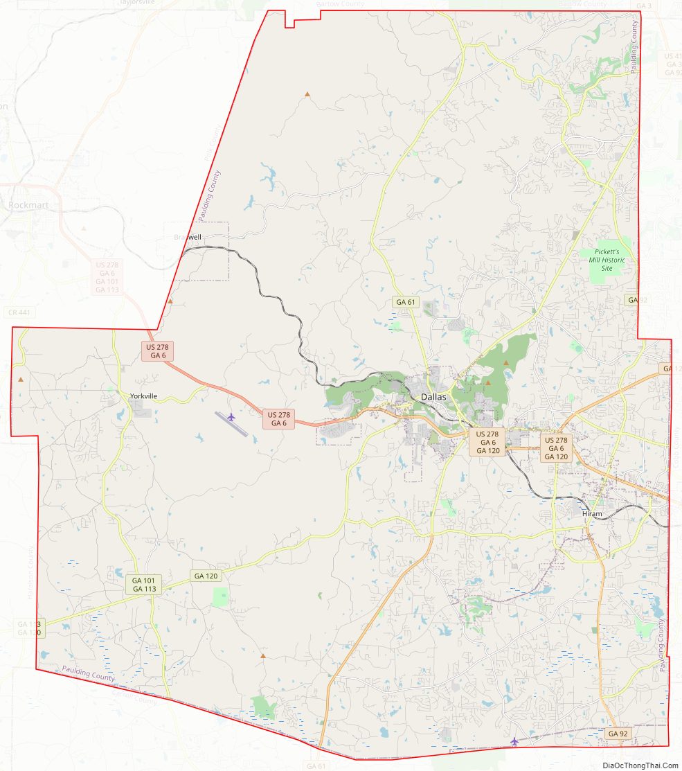
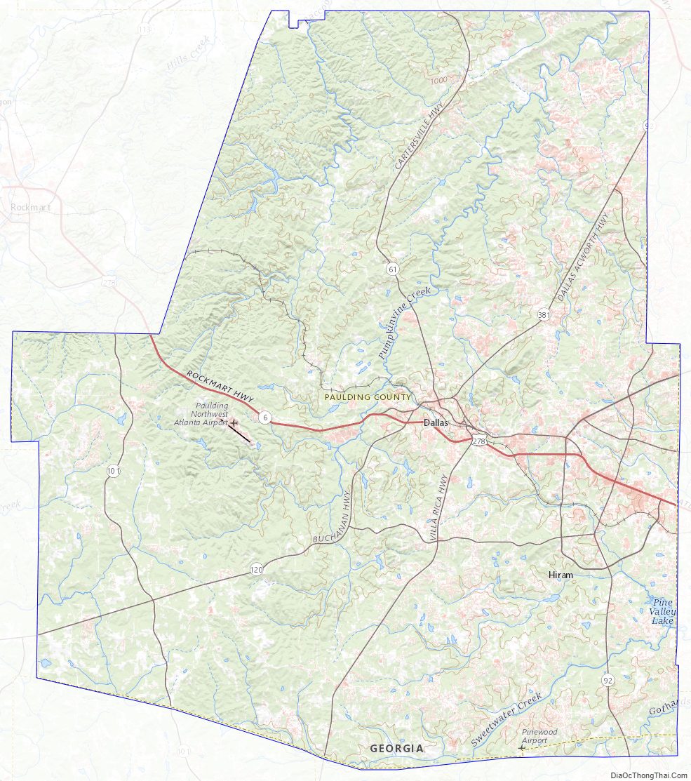
Paulding County Road Map
Geography
According to the U.S. Census Bureau, the county has a total area of 314 square miles (810 km), of which 312 square miles (810 km) is land and 2.1 square miles (5.4 km) (0.7%) is water. The Tallapoosa River originates in Paulding County.
The county is mainly located in the Piedmont region of the state, with a few mountains located in the county that exceed elevations of 1,000 ft. These mountains are considered to be part of the southernmost extensions of the Appalachian Mountains.
The southeastern portion of Paulding County, from just north of Hiram to north of Villa Rica, is located in the Middle Chattahoochee River-Lake Harding sub-basin of the ACF River Basin (Apalachicola-Chattahoochee-Flint River Basin). The very western portion of the county, centered on State Route 101, is located in the Upper Tallapoosa River sub-basin of the ACT River Basin (Coosa-Tallapoosa River Basin), with the majority of the central and northern portions of Paulding County located in the Etowah River sub-basin of the same ACT River Basin.
Adjacent counties
- Bartow County – north
- Cobb County – east
- Douglas County – southeast
- Carroll County – south
- Haralson County – southwest
- Polk County – west
Paulding County Topographic Map
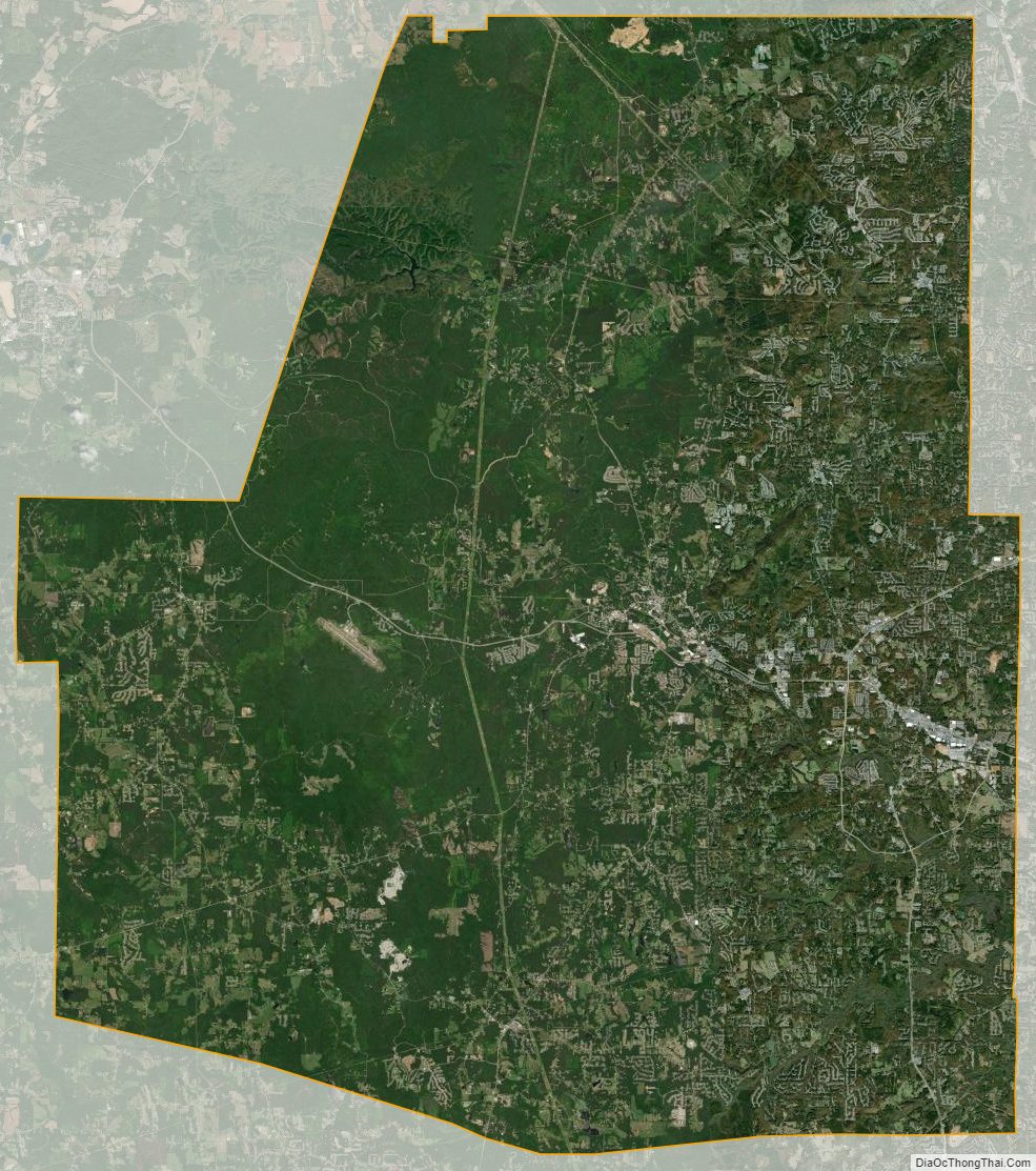
Paulding County Satellite Map
Paulding County Outline Map