Dallas is a city in, and the county seat of, Paulding County, Georgia, United States. The estimated population, as of 2010, was 11,544. Dallas is a northwestern exurb of Atlanta, located approximately 38 miles (61 km) from the downtown area. It was named for George M. Dallas, Vice President of the United States, under James K. Polk.
| Name: | Dallas city |
|---|---|
| LSAD Code: | 25 |
| LSAD Description: | city (suffix) |
| State: | Georgia |
| County: | Paulding County |
| Elevation: | 1,043 ft (318 m) |
| Total Area: | 7.42 sq mi (19.21 km²) |
| Land Area: | 7.38 sq mi (19.12 km²) |
| Water Area: | 0.04 sq mi (0.09 km²) |
| Total Population: | 14,042 |
| Population Density: | 1,902.45/sq mi (734.55/km²) |
| FIPS code: | 1321324 |
| GNISfeature ID: | 2404179 |
| Website: | www.dallasga.gov |
Online Interactive Map
Click on ![]() to view map in "full screen" mode.
to view map in "full screen" mode.
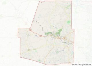
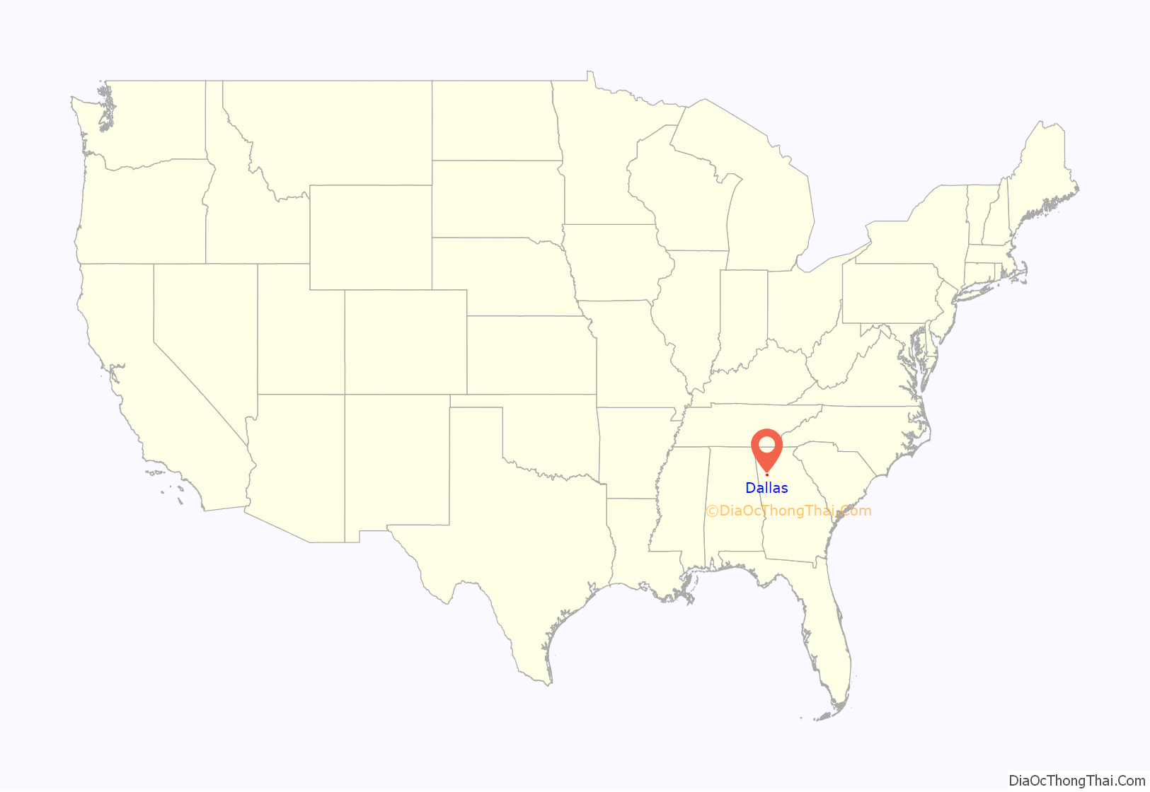
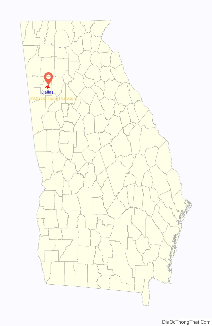
Dallas location map. Where is Dallas city?
History
The area where in and around Dallas was originally held by the Muscogee people, but would eventually lose their land in battle to the Cherokee in 1755. The area became a crossroads for the Cherokee who lived in the area.
When gold was discovered in Georgia in 1828, it began what was known as the Georgia Gold Rush. Paulding County was soon separated into 40-acre “Gold Lots” during the Gold Lottery of 1832 and people came from other parts of Georgia and other states to seek gold. The settlers found little gold in the area, with only small amounts being found in mines at Lost Mountain. Many settlers began using their parcels of land to grow crops instead.
During the time the Georgia Gold Rush began to happen, the Cherokee people began to be forced off of their lands. Not long after, the Indian Removal Act was signed by president Andrew Jackson, effectively removing the Native Americans to Indian Territory west of the Mississippi River on the Trail of Tears.
When the Georgia General Assembly took the original western portion of Paulding County to create Polk County in 1852, it also took with it the original county seat, Van Wert. The legislature ceded western portions of Cobb County to create the newly-drawn Paulding County, thus making it necessary for the creation of a new town to serve as the county seat. The town of Dallas was officially created from 40 acres (160,000 m) of land purchased from Garrett H. Spinks on May 14, 1852, for $1000. Its first commissioners were James H. Ballinger, James S. Hackett, Hezekiah Harrison, John S. Poole, and Garrett H. Spinks. The new town of Dallas was named for then Vice-President of the United States, George Mifflin Dallas, of Pennsylvania. He served under President James Knox Polk, for whom the new county to the west had been named.
The Dallas area is home to multiple battle sites that were part of the Atlanta Campaign in the American Civil War in 1864. The Battle of Dallas took place near downtown Dallas. The Battle of New Hope Church and the Battle of Pickett’s Mill were also fought during the same week, both of which are typically considered to part of Battle of Dallas engagement. The original earthworks, including the battle trenches have been preserved at both the New Hope Church site and at the Pickett’s Mill Historic Battlefield Site.
After the reconstruction period, Dallas and Paulding County began to flourish. Construction of the Southern and Seaboard Railroads began in 1882. Paulding County was also introduced to the textile industry at this time. Both industries played a great role in the growth of the county. Along with the introduction to the railroad and the textile industry, Paulding County’s first newspaper was introduced, The Dallas New Era.
On October 18, 1903, “Ole 88” Engine 345, a steam-powered locomotive, jumped its tracks and tore down part of the Pumpkinvine Creek Trestle. The Pumpkinvine Creek Trestle, which was originally built in 1901, was rebuilt after the accident. The trestle is over 750 feet long and towers 126 feet above Pumpkinvine Creek. The trestle was restored in 1999 and now serves as part of the Silver Comet Trail.
In 1951, the name of the Town of Dallas, Georgia was changed to The City of Dallas, Georgia. The name change was accomplished to comply with federal legislation allowing “cities” to create housing authorities, and other federal-related entities.
On April 4, 1977, near the site marker for the Battle of New Hope Church, the forced landing of Southern Airways Flight 242 occurred. The passenger jetliner, a McDonnell Douglas DC-9 with 81 passengers and 4 crew members, was flying from Northwest Alabama Regional Airport to Atlanta Municipal Airport. Upon descending in altitude to prepare for landing in Atlanta, the jetliner started to fly through an intense thunderstorm near Rome, Georgia. Because of the extreme amounts of water and hail that were ingested by the jet’s engines, both of the Pratt & Whitney JT8D-7A turbojet engines were damaged and underwent flameout. With the engines unable to restart, the flight’s crew began gliding in hopes of reaching a nearby airport. Upon finding out that there were no nearby airports to perform a landing, the crew found a straight section of rural road in Dallas, Georgia to try and land. As the plane began to land, it clipped a gas station, convenience store, and other buildings, resulting in the plane to lose control of landing and ultimately crash, resulting in hull loss. Both pilots and 61 passengers were killed by impact forces and fire. Nine people on the ground were also killed.
In the early 2000s the city completed a major refurbishment of downtown Dallas, which included adding and updating sidewalks, adding red brick to the roadways, creation of a large courtyard in the center of town, updating existing structural facades, adding a fountain area near the downtown gazebo, and further preserving historic downtown structures.
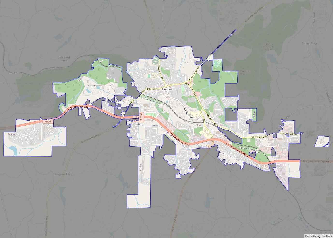
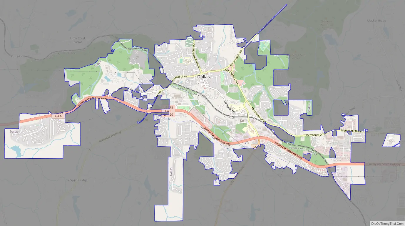
Dallas Road Map
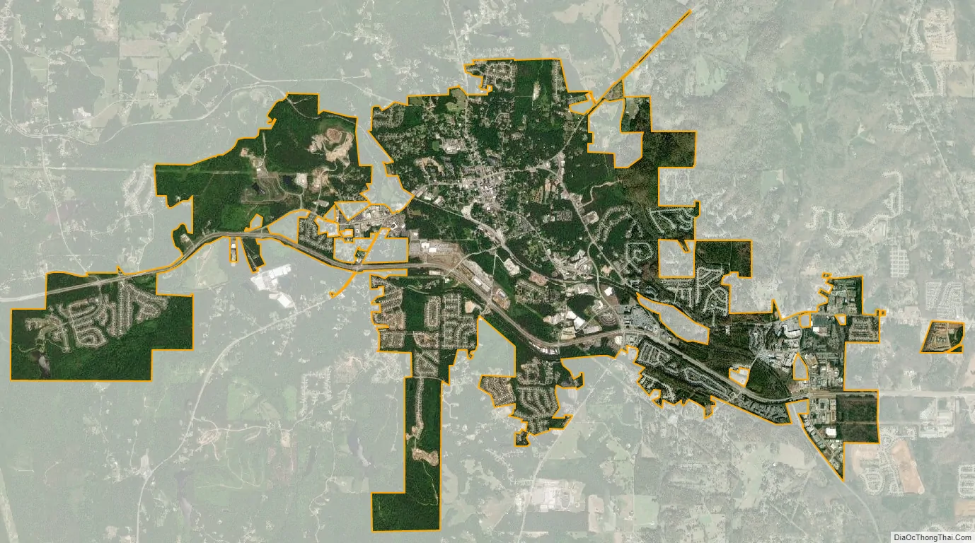
Dallas city Satellite Map
Geography
Dallas is located at 33°55′7″N 84°50′27″W / 33.91861°N 84.84083°W / 33.91861; -84.84083 (33.918499, -84.840848).
According to the United States Census Bureau, the city has a total area of 4.5 square miles (12 km), of which 4.5 square miles (12 km) is land and 0.04 square miles (0.10 km) (0.66%) is water.
Dallas is part of the Deep South cultural and geographic subregion. The city has an elevation of 1,043 feet (318 m), which makes it one of the highest elevation suburban cities in the Atlanta metropolitan area. Dallas is also a part of the physiographic region of the greater Appalachian Mountains.
The tallest point in Dallas is Elsberry Mountain, which is 1,310 feet (400 m) in elevation at its summit. The second-highest point is Ray Mountain, with an elevation of 1,252 feet (382 m).
The drainage area for all waterways flowing through the area are classified as being in the Alabama-Coosa-Tallapoosa River Basin. There are no major rivers that flow through Dallas itself, but there are multiple large creeks, with the largest being Pumpkinvine Creek, which is a tributary of the Etowah River. Both Lake Allatoona and Lake Acworth are less than 15 miles (24 km) away from Dallas.
See also
Map of Georgia State and its subdivision:- Appling
- Atkinson
- Bacon
- Baker
- Baldwin
- Banks
- Barrow
- Bartow
- Ben Hill
- Berrien
- Bibb
- Bleckley
- Brantley
- Brooks
- Bryan
- Bulloch
- Burke
- Butts
- Calhoun
- Camden
- Candler
- Carroll
- Catoosa
- Charlton
- Chatham
- Chattahoochee
- Chattooga
- Cherokee
- Clarke
- Clay
- Clayton
- Clinch
- Cobb
- Coffee
- Colquitt
- Columbia
- Cook
- Coweta
- Crawford
- Crisp
- Dade
- Dawson
- Decatur
- DeKalb
- Dodge
- Dooly
- Dougherty
- Douglas
- Early
- Echols
- Effingham
- Elbert
- Emanuel
- Evans
- Fannin
- Fayette
- Floyd
- Forsyth
- Franklin
- Fulton
- Gilmer
- Glascock
- Glynn
- Gordon
- Grady
- Greene
- Gwinnett
- Habersham
- Hall
- Hancock
- Haralson
- Harris
- Hart
- Heard
- Henry
- Houston
- Irwin
- Jackson
- Jasper
- Jeff Davis
- Jefferson
- Jenkins
- Johnson
- Jones
- Lamar
- Lanier
- Laurens
- Lee
- Liberty
- Lincoln
- Long
- Lowndes
- Lumpkin
- Macon
- Madison
- Marion
- McDuffie
- McIntosh
- Meriwether
- Miller
- Mitchell
- Monroe
- Montgomery
- Morgan
- Murray
- Muscogee
- Newton
- Oconee
- Oglethorpe
- Paulding
- Peach
- Pickens
- Pierce
- Pike
- Polk
- Pulaski
- Putnam
- Quitman
- Rabun
- Randolph
- Richmond
- Rockdale
- Schley
- Screven
- Seminole
- Spalding
- Stephens
- Stewart
- Sumter
- Talbot
- Taliaferro
- Tattnall
- Taylor
- Telfair
- Terrell
- Thomas
- Tift
- Toombs
- Towns
- Treutlen
- Troup
- Turner
- Twiggs
- Union
- Upson
- Walker
- Walton
- Ware
- Warren
- Washington
- Wayne
- Webster
- Wheeler
- White
- Whitfield
- Wilcox
- Wilkes
- Wilkinson
- Worth
- Alabama
- Alaska
- Arizona
- Arkansas
- California
- Colorado
- Connecticut
- Delaware
- District of Columbia
- Florida
- Georgia
- Hawaii
- Idaho
- Illinois
- Indiana
- Iowa
- Kansas
- Kentucky
- Louisiana
- Maine
- Maryland
- Massachusetts
- Michigan
- Minnesota
- Mississippi
- Missouri
- Montana
- Nebraska
- Nevada
- New Hampshire
- New Jersey
- New Mexico
- New York
- North Carolina
- North Dakota
- Ohio
- Oklahoma
- Oregon
- Pennsylvania
- Rhode Island
- South Carolina
- South Dakota
- Tennessee
- Texas
- Utah
- Vermont
- Virginia
- Washington
- West Virginia
- Wisconsin
- Wyoming