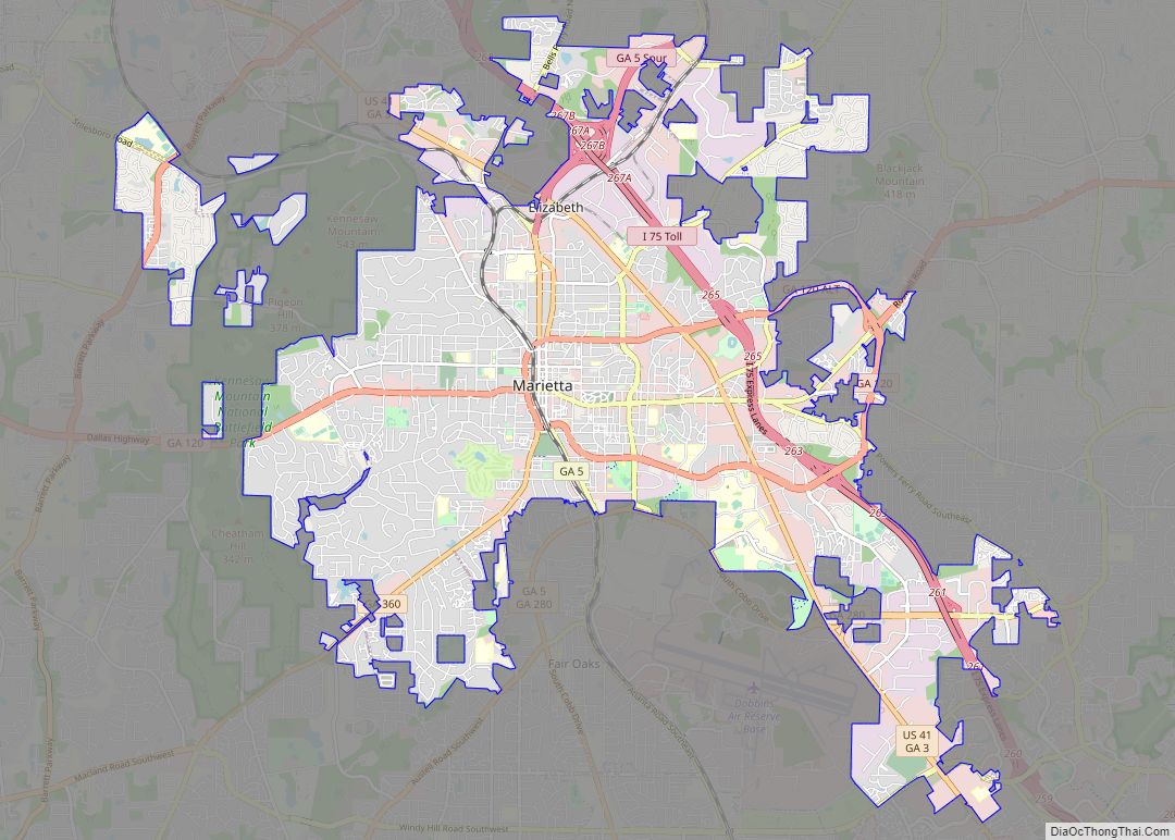
Cobb County is a county in the U.S. state of Georgia, located in the Atlanta metropolitan area in the north central portion of the state. As of 2020 Census, the population was 766,149. Its county seat and largest city is Marietta.
Along with several adjoining counties, Cobb County was established on December 3, 1832, by the Georgia General Assembly from the large Cherokee County territory—land northwest of the Chattahoochee River which the state acquired from the Cherokee Nation and redistributed to settlers via lottery, following the passage of the federal Indian Removal Act. The county was named for Thomas Willis Cobb, a U.S. representative and senator from Georgia. It is believed that Marietta was named for his wife, Mary. Cobb County is included in the Atlanta metropolitan area and is situated immediately to the northwest of Atlanta’s city limits. Its Cumberland District, an edge city, has over 24 million square feet (2,200,000 m) of office space. Major League Baseball’s Atlanta Braves have played home games at Truist Park in Cumberland since 2017.
In 2003, the U.S. Census Bureau ranked Cobb County as the most educated in the state of Georgia and 12th-most in the United States. It has ranked among the top 100 highest-income counties in the United States. In October 2017, Cobb was ranked as the “Least Obese County in Georgia”.
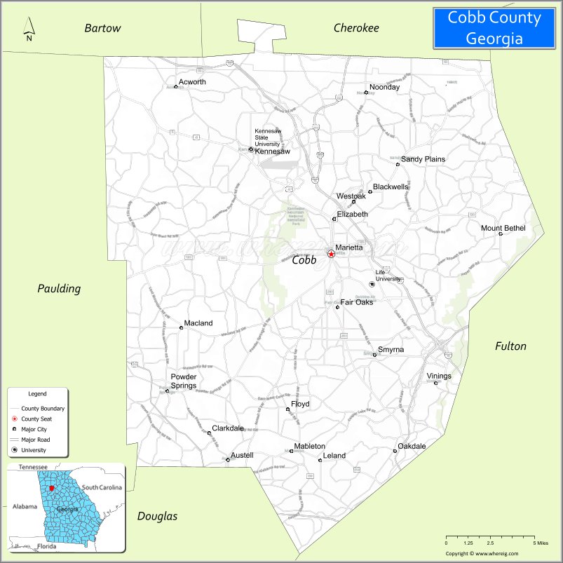
| Name: | Cobb County |
|---|---|
| FIPS code: | 13-067 |
| State: | Georgia |
| Founded: | 1832 |
| Named for: | Thomas W. Cobb |
| Seat: | Marietta |
| Largest city: | Marietta |
| Total Area: | 345 sq mi (890 km²) |
| Land Area: | 340 sq mi (900 km²) |
| Total Population: | 766,802 |
| Population Density: | 2,203/sq mi (851/km²) |
| Time zone: | UTC−5 (Eastern) |
| Summer Time Zone (DST): | UTC−4 (EDT) |
| Website: | www.cobbcounty.org |
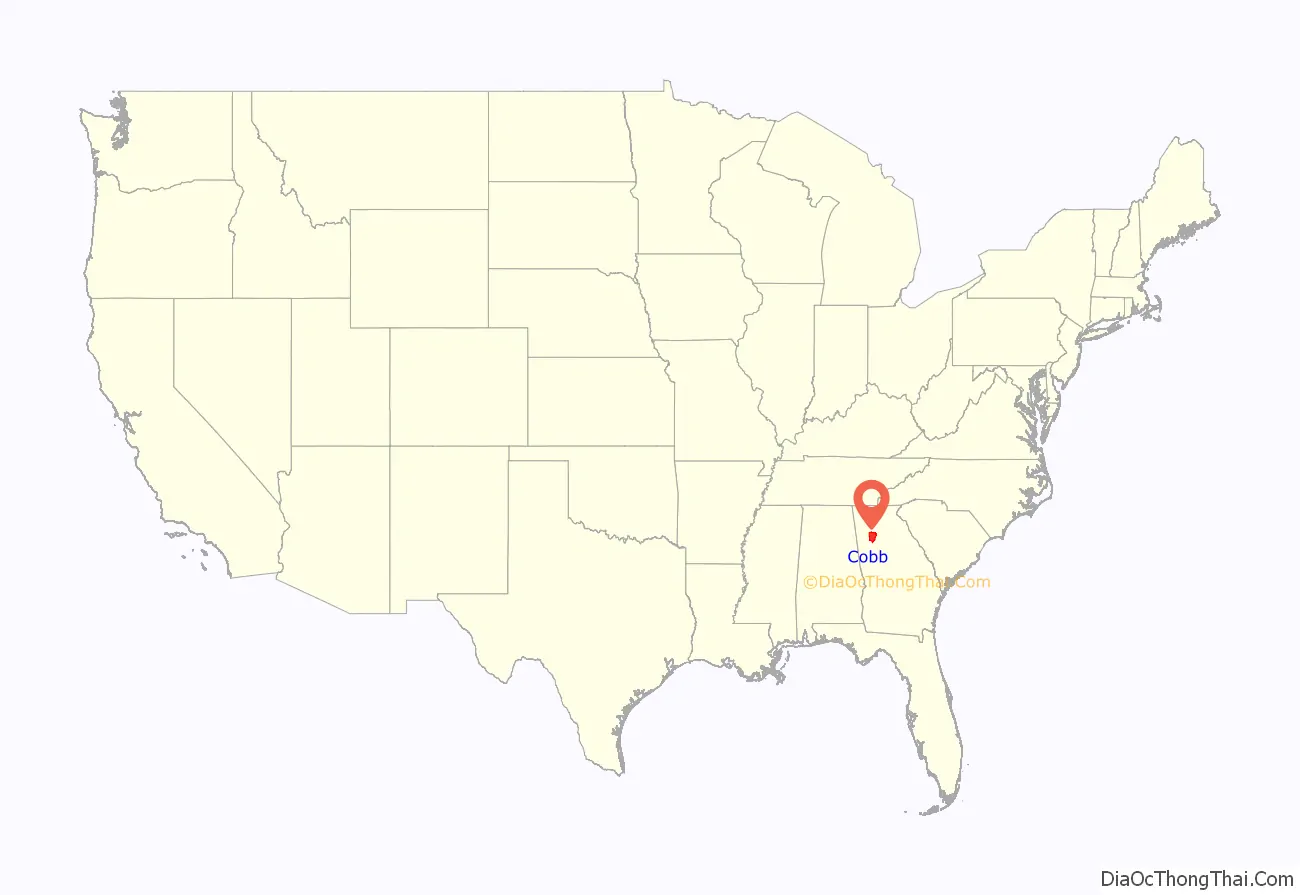
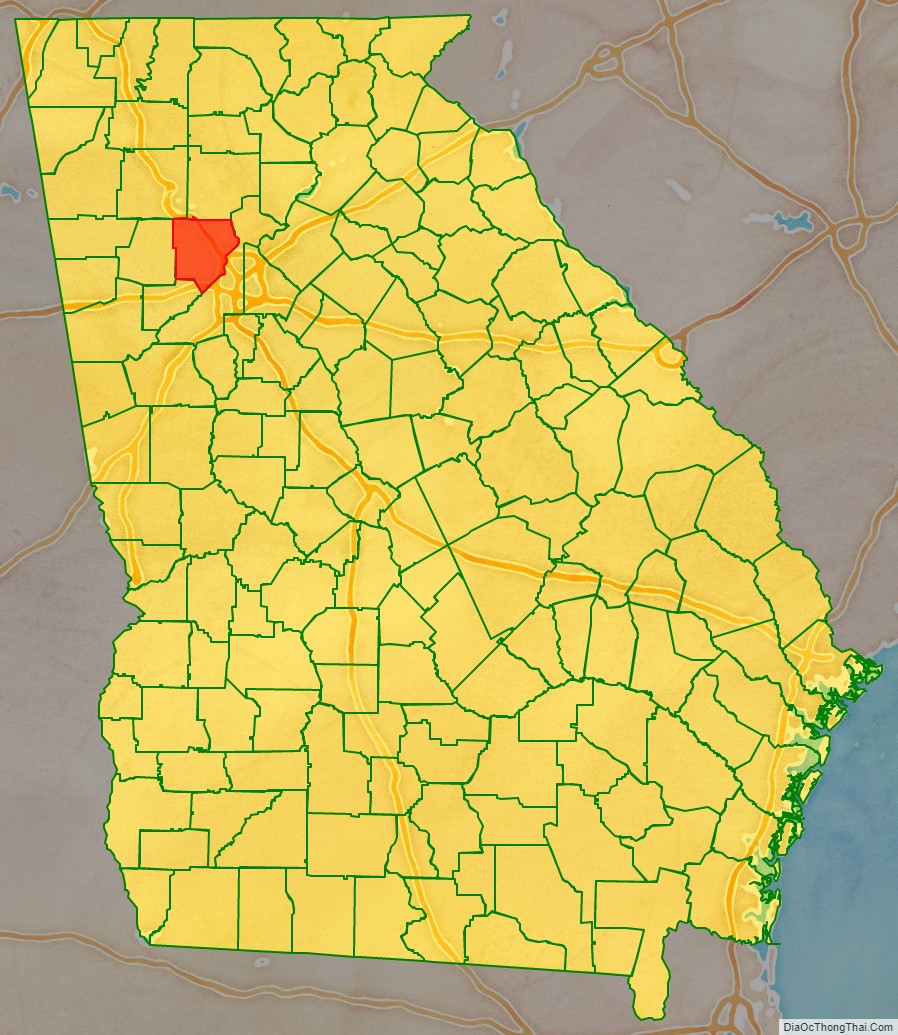
Cobb County location map. Where is Cobb County?
History
Cobb County was one of nine Georgia counties carved out of the disputed territory of the Cherokee Nation in 1832. It was the 81st county in Georgia and named for Judge Thomas Willis Cobb, who served as a U.S. Senator, state representative, and superior court judge. It is believed that the county seat of Marietta was named for Judge Cobb’s wife, Mary. The state started acquiring right-of-way for the Western & Atlantic Railroad in 1836. A train began running between Marietta and Marthasville (modern day Atlanta) in 1845.
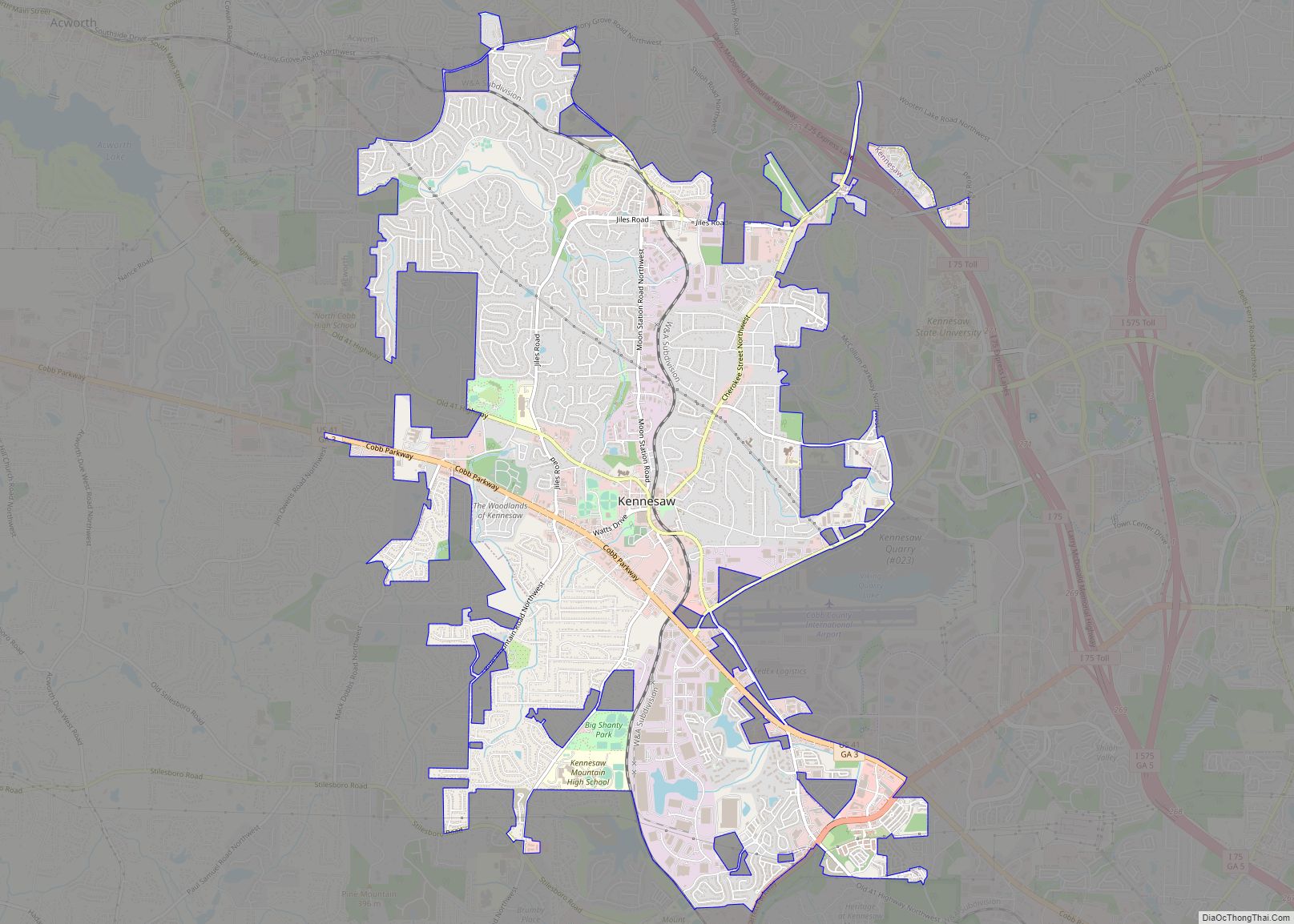
During the American Civil War, some Confederate troops were trained at a camp in Big Shanty (now Kennesaw), where the Andrews Raid occurred, starting the Great Locomotive Chase. There were battles of New Hope Church May 25, 1864, Pickett’s Mill May 27, and Dallas May 28. These were followed by the prolonged series of battles through most of June 1864 until very early July: the Battle of Marietta and the Battle of Noonday Creek. The Battle of Allatoona Pass on October 5, 1864, occurred as Sherman was starting his march through Georgia. Union forces burnt most houses and confiscated or burnt crops. The Battle of Kennesaw Mountain on June 27, 1864, was the site of the only major Confederate victory in General William T. Sherman’s invasion of Georgia. Despite the victory, Union forces outflanked the Confederates. In 1915, Leo Frank, the Jewish supervisor of an Atlanta pencil factory who was convicted of murdering one of his workers, thirteen-year-old Mary Phagan, was kidnapped from his jail cell and brought to Frey’s Gin, two miles (3 km) east of Marietta, where he was lynched.
Cotton farming in the area peaked from the 1890s through the 1920s. Low prices during the Great Depression resulted in the cessation of cotton farming throughout Cobb County. The price of cotton went from 16¢ per pound (35¢/kg) in 1920 to 9½¢ (21¢/kg) in 1930. This resulted in a cotton bust for the county, which had stopped growing the product but was milling it. This bust was followed by the Great Depression. To help combat the bust, the state started work on a road in 1922 that would later become U.S. 41, later replaced by Cobb Parkway in the late 1940s and early 1950s.
In 1942, Bell Aircraft opened a Marietta plant to manufacture B-29 bombers and Marietta Army Airfield was founded. Both were closed after World War II, but reopened during the Korean War, when the air field was acquired by the Air Force, renamed Dobbins AFB, and the plant by Lockheed. During the Korean and Vietnam Wars, Lockheed Marietta was the leading manufacturer of military transport planes, including the C-130 Hercules and the C-5 Galaxy. “In Cobb County and other sprawling Cold War suburbs from Orange County to Norfolk/Hampton Roads, the direct link between federal defense spending and local economic prosperity structured a bipartisan political culture of hawkish conservatism and material self-interest on issues of national security.”
When county home rule was enacted statewide by amendment to the Georgia state constitution in the early 1960s, Ernest W. Barrett became the first chairman of the new county commission. The county courthouse, built in 1888, was demolished, spurring a law that now prevents counties from doing so without a referendum. In the 1960s and 1970s, Cobb transformed from rural to suburban, as integration spurred white flight from the city of Atlanta, which by 1970 was majority-African-American. Real-estate booms drew rural white southerners and Rust Belt transplants, both groups mostly first-generation white-collar workers. Cobb County was the home of former segregationist and Georgia governor Lester Maddox (1966–71). In 1975, Cobb voters elected John Birch Society leader Larry McDonald to Congress, running in opposition to desegregation busing. A conservative Democrat, McDonald called for investigations into alleged plots by the Rockefellers and the Soviet Union to impose “socialist-one-world-government” and co-founded the Western Goals Foundation. In 1983, McDonald died aboard Korean Air Lines Flight 007, shot down by a Soviet fighter jet over restricted airspace. I-75 through the county is now named for him.
In 1990, Republican Congressmen Newt Gingrich became Representative of a new district centered around Cobb County. In 1994, as Republicans took control of the U.S. House of Representatives for the first time in almost fifty years, Gingrich became Speaker of the House, thrusting Cobb County into the national spotlight.
In 1993, county commissioners passed a resolution condemning homosexuality and cut off funding for the arts after complaints about a community theater. After protests from gay rights organizations, organizers of the 1996 Summer Olympics pulled events out of Cobb County, including the Olympic Torch Relay. The county’s inns were nevertheless filled at 100% of capacity for two months during the event.
In the 1990s and 2000s, Cobb’s demographics changed. As Atlanta’s gentrification reversed decades of white flight, middle-class African-Americans and Russian, Bosnian, Chinese, Indian, Brazilian, Mexican and Central American immigrants moved to older suburbs in south and southwest Cobb. In 2010, African-American Democrat David Scott was elected to Georgia’s 13th congressional district, which included many of those suburbs. Cobb became the first Georgia county to participate in the Immigration and Nationality Act Section 287(g) enabling local law officers to enforce immigration law.
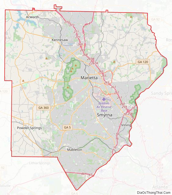
Cobb County Road Map
Geography
According to the U.S. Census Bureau, the county has a total area of 345 square miles (890 km), of which 340 square miles (880 km) is land and 4.0 square miles (10 km) (1.4%) is water. The county is located in the upper Piedmont region of the state, with a few mountains located within the county, considered to be part of the southernmost extensions of the Appalachian Mountains.
The county is divided between two major basins. Most runoff flows into the Middle Chattahoochee-Lake Harding and Upper Chattahoochee River sub-basins of the ACF River Basin (Apalachicola-Chattahoochee-Flint River Basin) along the southeastern border, directly via Willeo Creek, Sope Creek (Sewell Creek), Rottenwood Creek (Powers Creek, Poorhouse Creek, Poplar Creek), Nickajack Creek and others. The large Sweetwater Creek is the other major stream, carrying the waters of Noses Creek (Ward Creek, Olley Creek, Mud Creek), Powder Springs Creek (Rakestraw Creek, Mill Creek) and others into the Chattahoochee. A ridge from Lost Mountain in the west, to Kennesaw Mountain in the north-central, to Sweat Mountain in the extreme northeast, divides the far north-northwest of the county into the Etowah River sub-basin of the ACT River Basin (Coosa-Tallapoosa River Basin), which includes Lake Allatoona. Noonday Creek (Little Noonday Creek) flows northward into the lake, as does Allatoona Creek, which forms a major arm of the lake. Proctor Creek forms the much older Lake Acworth, which in turn empties directly into Lake Allatoona under the Lake Acworth Drive (Georgia 92) bridge. North Cobb is in the Coosa River basin.
There are several high points in Cobb County.
- Sweat Mountain: in the extreme northeast portion, runs along the border with Cherokee County, and is the metro area’s major antenna farm
- Blackjack Mountain: a low ridge between central and east Cobb
- Kennesaw Mountain: the highest point in the county and in the entire suburban area of metro Atlanta, located in the north-northwest between Kennesaw and Marietta
- Little Kennesaw Mountain: an offshoot of Kennesaw
- Lost Mountain: in western Cobb
- Pine Mountain: west-northwest of Kennesaw Mountain, between Kennesaw and Due West
- Brushy Mountain: near Kennesaw Mountain, just southeast of Barrett Parkway at Cobb Parkway
- Vinings Mountain or Mount Wilkinson: overlooks the town of Vinings
Adjacent counties
- Cherokee County – north
- Fulton County – southeast
- Douglas County – southwest
- Paulding County – west
- Bartow County – northwest
Addressing
Despite the lack of a grid system of city blocks though the county, all street addresses have their numeric origin at the southwest corner of the town square in Marietta.
Geocodes and world’s largest toll-free calling area
Originally in area code 404, the county was moved into area code 770 in 1995, and overlaid by area code 678 in 1998. Prior to 1995, those with phones tied to the Woodstock telephone exchange (prefixes 924, 926, 928, later 516 and 591) could also call the Canton exchange (479, later 445, then 704) as a local call. This became moot, along with other dual-zone exchanges in metro Atlanta, when the exurban exchanges (including Canton) were fully made a part of what was already the world’s largest toll-free calling zone. It is a zone spanning 7,162 square miles (18,549 km), with four active telephone area codes, and local calling extending into portions of two others.
Cobb’s FIPS county code is 13067. Because the National Weather Service has not subdivided the county, its WRSAME code is 013067, for receiving targeted weather warnings from NOAA Weather Radio. The county is primarily within the broadcast range of one weather radio station: KEC80, on 162.550 MHz, transmitted to all of metro Atlanta and broadcast from NWSFO Peachtree City. The secondary station is the much newer WWH23 on 162.425 from Buchanan, which also transmits warnings for Cobb but has reception mainly in the western part of the county.
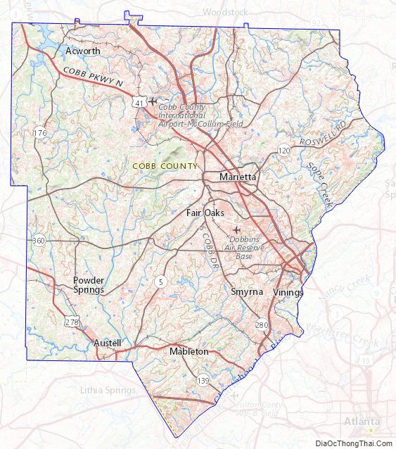
Cobb County Topographic Map
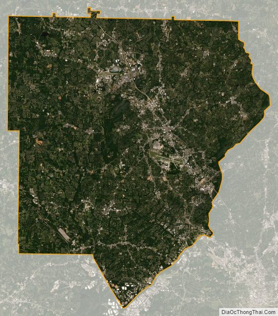
Cobb County Satellite Map
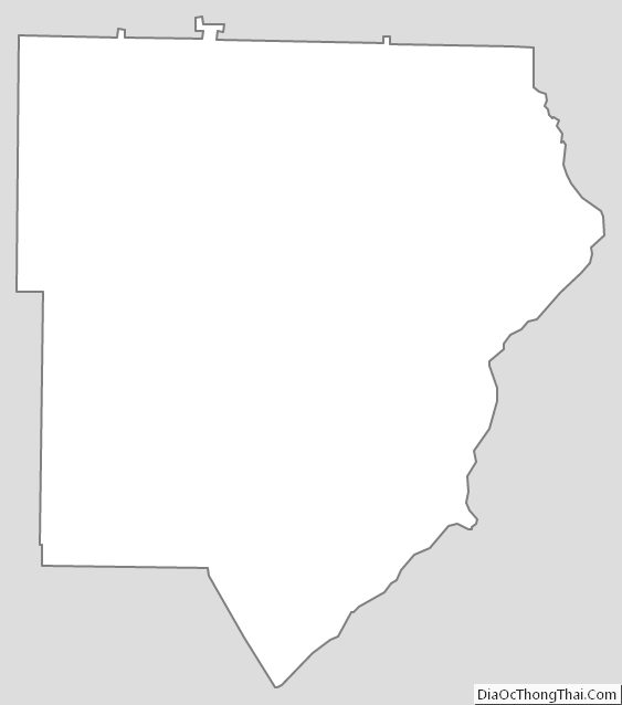
Cobb County Outline Map