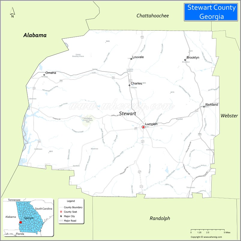
Stewart County is a county located in the west central portion of the U.S. state of Georgia. As of the 2020 census, the population was 5,314. The county seat is Lumpkin. The county was created on December 23, 1830.
| Name: | Stewart County |
|---|---|
| FIPS code: | 13-259 |
| State: | Georgia |
| Founded: | 1830 |
| Named for: | Daniel Stewart |
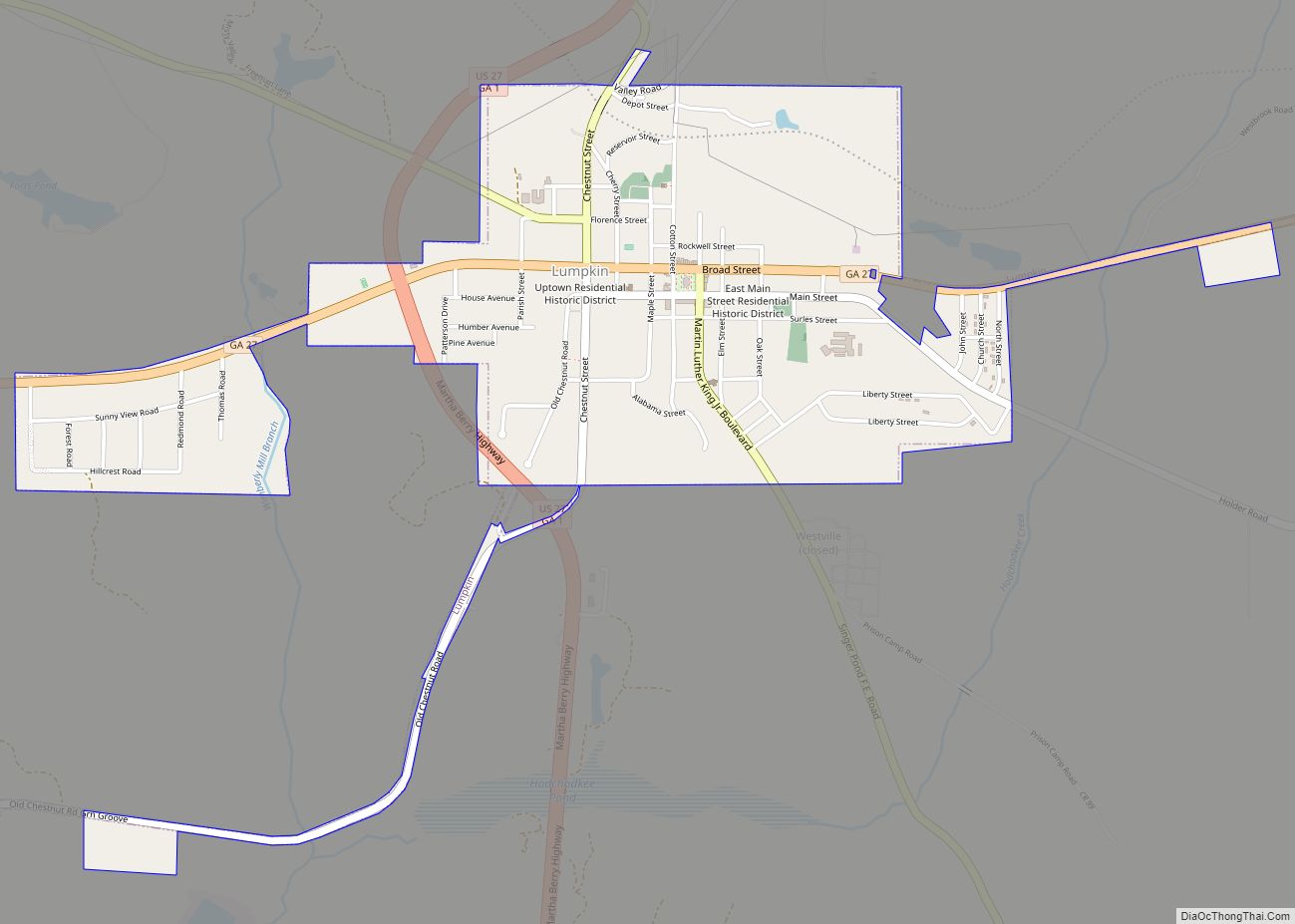
| Seat: | Lumpkin |
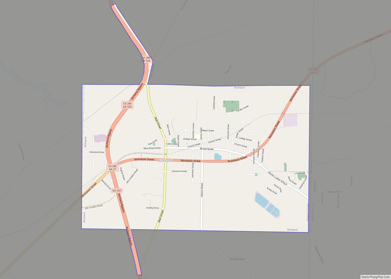
| Largest city: | Richland |
| Total Area: | 464 sq mi (1,200 km²) |
| Land Area: | 459 sq mi (1,190 km²) |
| Total Population: | 5,314 |
| Population Density: | 12/sq mi (5/km²) |
| Time zone: | UTC−5 (Eastern) |
| Summer Time Zone (DST): | UTC−4 (EDT) |
| Website: | www.stewartcountyga.gov |
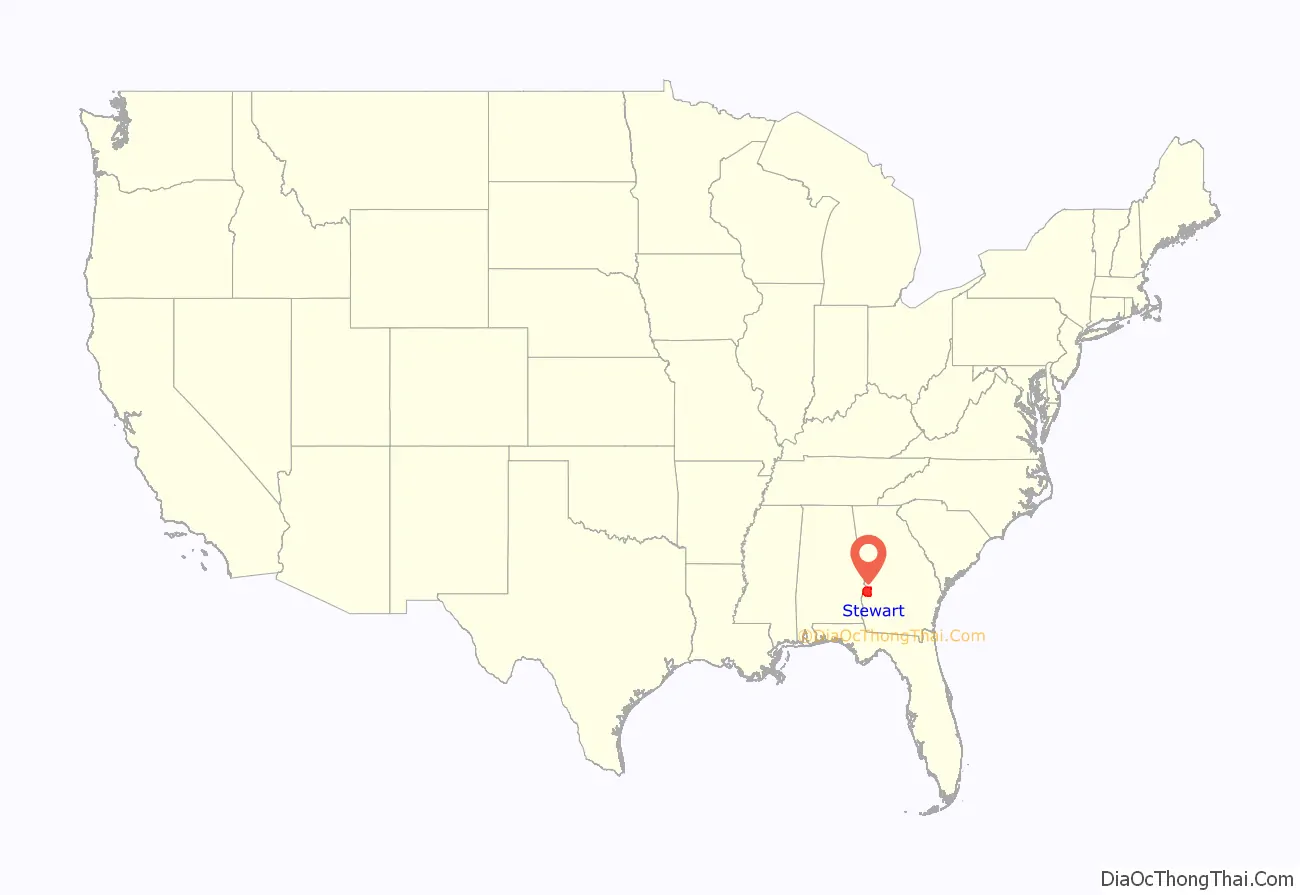
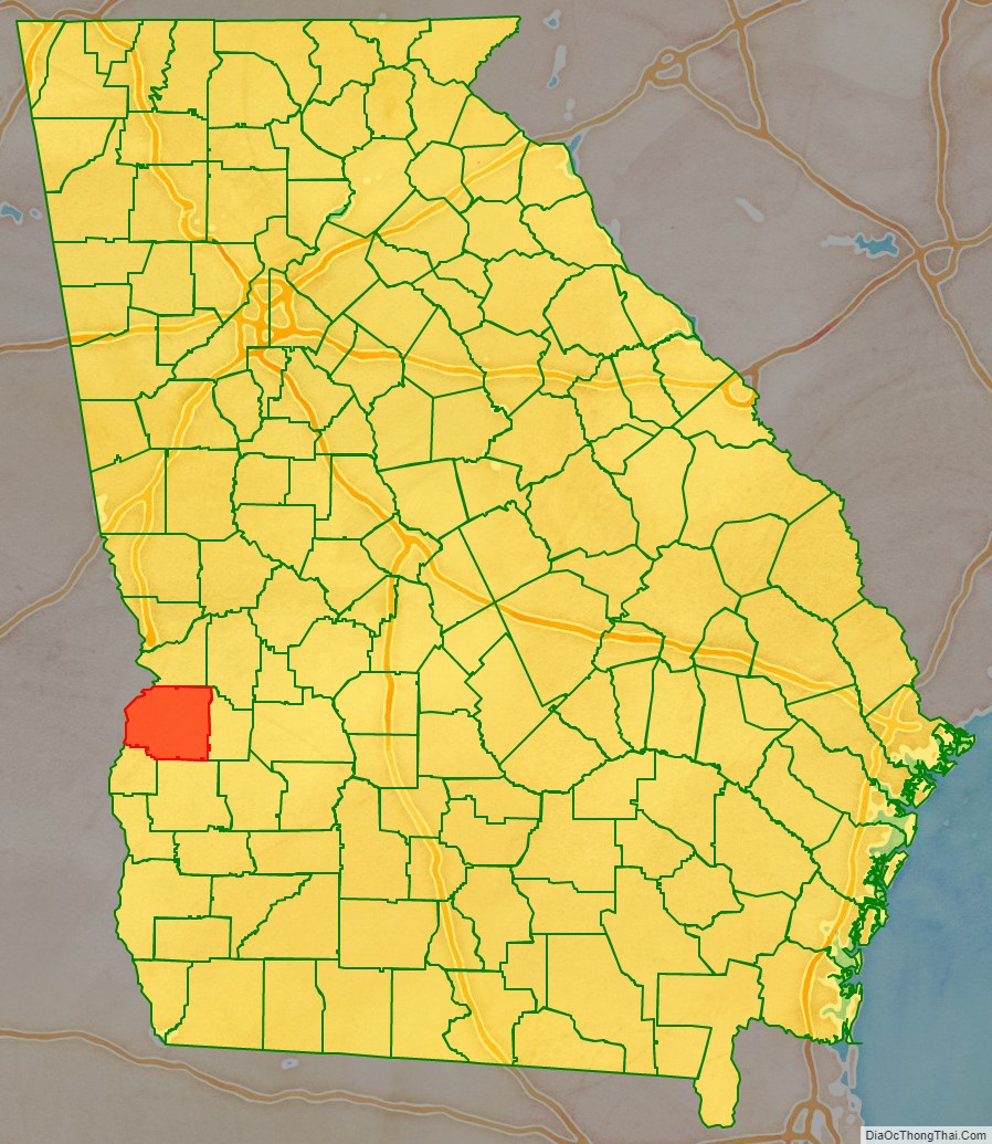
Stewart County location map. Where is Stewart County?
History
The area was inhabited by Native Americans for thousands of years in the Pre-Columbian period. Roods Landing site on the Chattahoochee River is a significant archaeological site located south of Omaha. Listed on the National Register of Historic Places, it includes major earthwork mounds built about 1100-1350 CE by peoples of the sophisticated Mississippian culture. Another Mississippian site is the Singer Moye Mounds, located in the southern part of the county.
The first Europeans to encounter the Native Americans were Spanish explorers in the mid-16th century. At that time the historical Creek tribe inhabited the southern two thirds of what is now defined as Georgia, west of the Low Country. they are believed to be the descendants of the Mississippian culture.
They maintained their territory until after European American settlers arrived in increasing number in the early decades of the 19th century. The ensuing conflicts ultimately resulted in most of the Creek people’s being driven out of the region. In the 1830s under Indian removal, the US federal government forced most Creek to relocate west of the Mississippi River, to Indian Territory in what became present-day Oklahoma.
Stewart County was created by an act of the Georgia General Assembly on December 23, 1830, from land that had been part of Randolph County, Georgia. The county is named for Daniel Stewart, a Revolutionary War veteran, and fighter against American Indians. He was one of the four great-grandfathers of U.S. president Theodore Roosevelt.
Settlers developed the area as large cotton plantations, part of the “Black Belt” of Georgia and the Deep South. Before the American Civil War, planters depended on enslaved labor of thousands of African Americans to cultivate and process the cotton for market. Mostly born in the United States, the slaves were transported from the Upper South, with many families broken up when some members were purchased through sales in the domestic slave trade.
In 1850, the county reached its peak in wealth as one of the largest cotton producers in the state. It had the tenth-largest population of any county in the state, with 16,027 people. African-American slaves numbered 7,373, or 46% of the population.
By 1860, the county population was 13,422. The apparent drop was due to the counties of Kinchafoonee (later Webster County) and Quitman being created from Stewart County territory in 1853 and 1858, respectively. There were 5,534 slaves in the redefined Stewart County, constituting more than one-third of the population.
After the war and emancipation, cotton continued as the major commodity crop and additional territory was developed by planters for cultivation. Many freedmen became sharecroppers and tenant farmers in the area, which was agricultural for decades, but in decline. Stewart County lost its premier position when it was bypassed by developing railroads, which went to the north and south. It did not have railroad access until 1885.
Inappropriate farming practices and over-cultivation of cotton from before the Civil War led to extensive land erosion by the early 20th century. Together with mechanization of agriculture and damage due to infestation by the boll weevil, there were losses in this part of the economy. Population declined. Up to the mid century, many blacks left the area in two waves of the Great Migration, seeking escape from Jim Crow conditions, and jobs and better lives in northern and midwestern industrial cities. Farmers shifted to cultivating peanuts and later pine trees to reclaim and restore the land. Population losses continued throughout the 20th century, as the forest and lumber industry did not require as many laborers.
In 1965, some of the towns in the county began to redevelop their historic properties to attract tourists and expand the economy. Lumpkin, Omaha and Louvale all had relatively intact historic properties and commercial districts. Green Grove is an historic African-American community established by freedmen after the Civil War. Stewart was the first rural county in the state to use historic preservation and Main Street redevelopment to support heritage tourism.
Stewart County Road Map
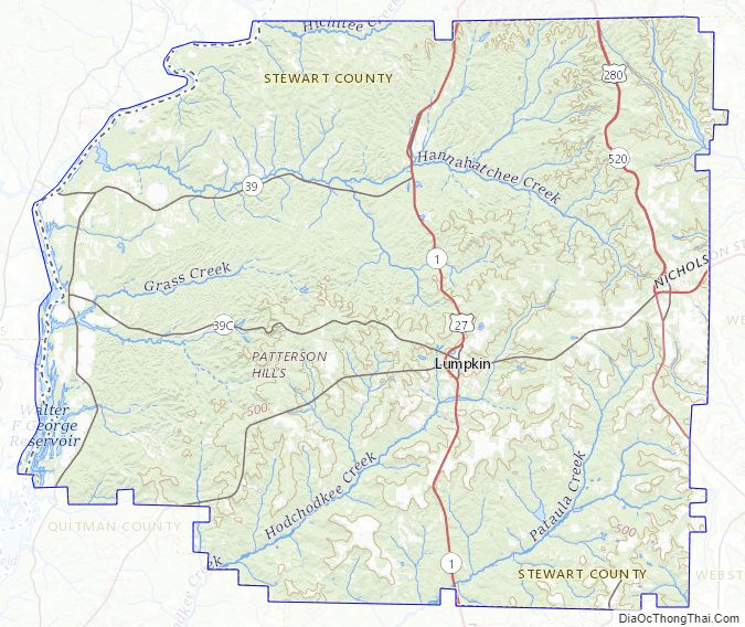
Geography
According to the U.S. Census Bureau, the county has a total area of 464 square miles (1,200 km), of which 459 square miles (1,190 km) is land and 4.9 square miles (13 km) (1.1%) is water. The county is mainly located in the upper Gulf coastal plain region of the state, with a few hills due to its close proximity to the fall line.
The vast majority of Stewart County is located in the Middle Chattahoochee River-Walter F. George Lake sub-basin of the ACF River Basin (Apalachicola-Chattahoochee-Flint River Basin). Just the very eastern edge of the county, bordered by a north-to-south line running through Richland, is located in the Kinchafoonee-Muckalee sub-basin of the same ACF Basin, with the very southeastern corner located in the Ichawaynochaway Creek sub-basin of the larger ACF River Basin.
Major highways
- U.S. Route 27
- U.S. Route 280
- State Route 1
- State Route 1 Connector
- State Route 27
- State Route 39
- State Route 39 Connector
- State Route 39 Spur
- State Route 520
Adjacent counties
- Chattahoochee County (north)
- Webster County (east)
- Randolph County (south)
- Quitman County (southwest)
- Barbour County, Alabama (west/CST Border)
- Russell County, Alabama (northwest/CST Border except for Phenix City as the city is jointed by the Columbus Metropolitan Area)
National protected area
- Eufaula National Wildlife Refuge (part)
Stewart County Topographic Map
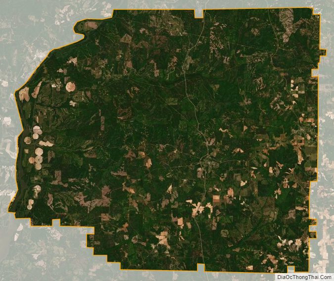
Stewart County Satellite Map
Stewart County Outline Map