Russell County is a county in the southeastern part of the U.S. state of Alabama. As of the 2020 census, the population was 59,183. Its county seat is Phenix City. Its name is in honor of Colonel Gilbert C. Russell, who fought in the wars against the Creek Indians.
Russell County is part of the Columbus, GA-AL Metropolitan Statistical Area.
Of all counties in the United States, Russell County has the most amount of people working in a state other than their own, at over 54% of the population, most of whom work in Columbus, Georgia.
| Name: | Russell County |
|---|---|
| FIPS code: | 01-113 |
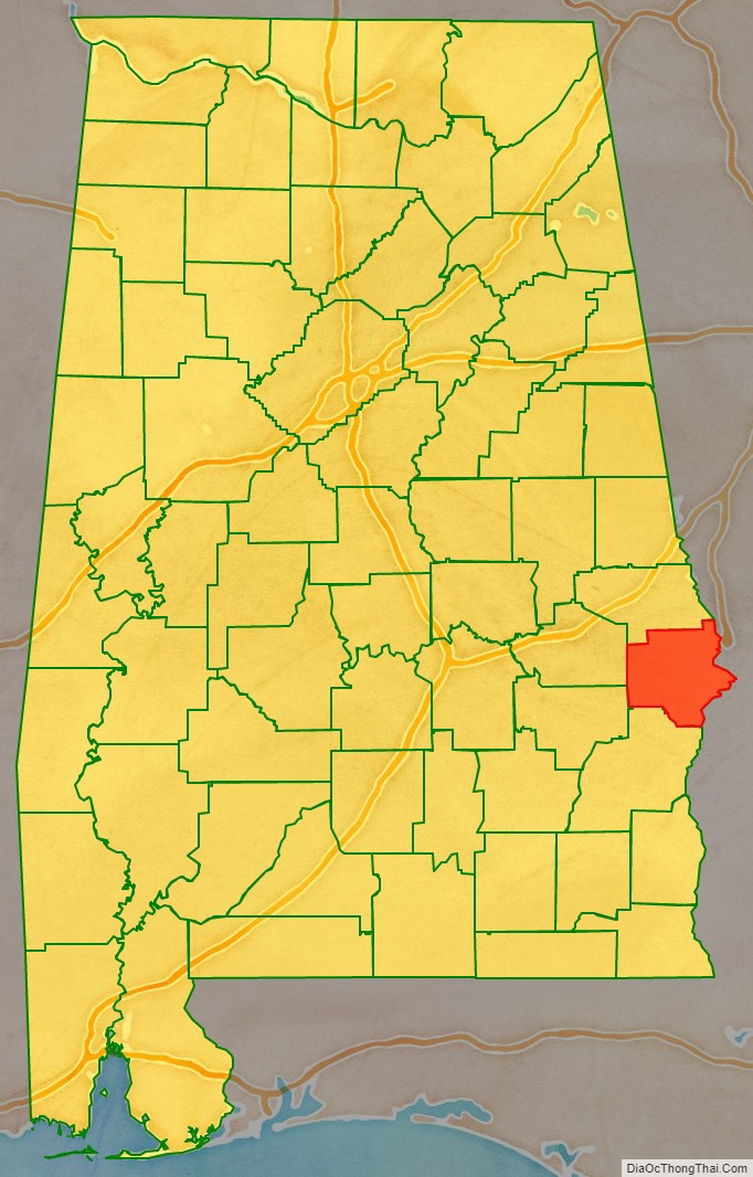
| State: | Alabama |
| Founded: | December 18, 1832 |
| Named for: | Gilbert C. Russell |
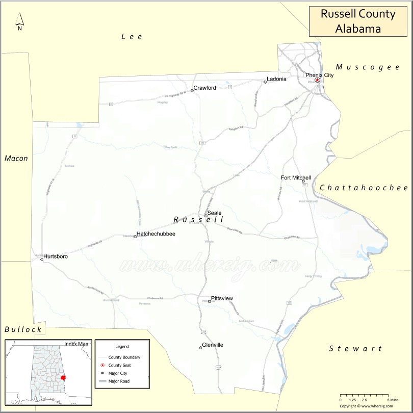
| Seat: | Phenix City |
| Largest city: | Phenix City |
| Total Area: | 647 sq mi (1,680 km²) |
| Land Area: | 641 sq mi (1,660 km²) |
| Total Population: | 59,183 |
| Population Density: | 91/sq mi (35/km²) |
| Time zone: | UTC−6 (Central) |
| Summer Time Zone (DST): | UTC−5 (CDT) |
| Website: | www.rcala.com |
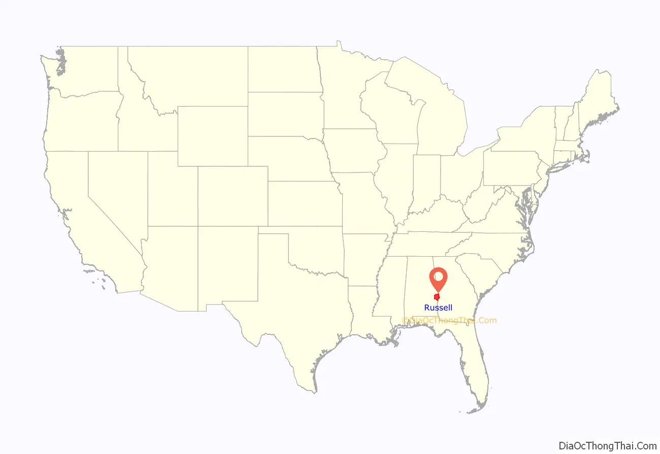
Russell County location map. Where is Russell County?
History
Russell County was established by an act of the state general assembly on December 18, 1832, from lands ceded to the state by the Creek Native Americans. The county seat has changed several times: Girard (1833–1839), Crawford originally Crockettsville (1839–1868), Seale (1868–1935) and Phenix City (1935–present). It was named for War of 1812, Col. Gilbert Christian Russell Sr., 1782–1861, 3rd U.S. Infantry.
In the 1940s and 1950s, Russell County and especially its county seat, Phenix City gained a reputation of lawlessness, political corruption and being a den for vice such as organized crime, prostitution, and gambling. The city police and county deputies also took part in the corruption. In 1954, the local politician Albert Patterson won the Democratic nomination for Alabama Attorney General on a platform of ridding the city of corruption and crime. Patterson ran for a state office since he was unable to run in local elections, as they were rigged. On June 18, 1954, Patterson was shot and killed by an unknown assassin. The murder set off a series of events that led to Governor Gordon Persons declaring martial law in the county and city because of its lawlessness on July 22 that year. That was the only time since the Reconstruction era that martial law was declared in a US city for reasons other than civil unrest or natural disaster. The Alabama National Guard was called in to assume the role of the police and clean up the area of illegal activities. The state of martial law was rescinded on January 17, 1955, with Russell County and Phenix City both returning to civilian control. In 1974, the New York Times noted that the campaign as very successful and led to a relatively-low crime rate in Phenix City for the 20 years since then.
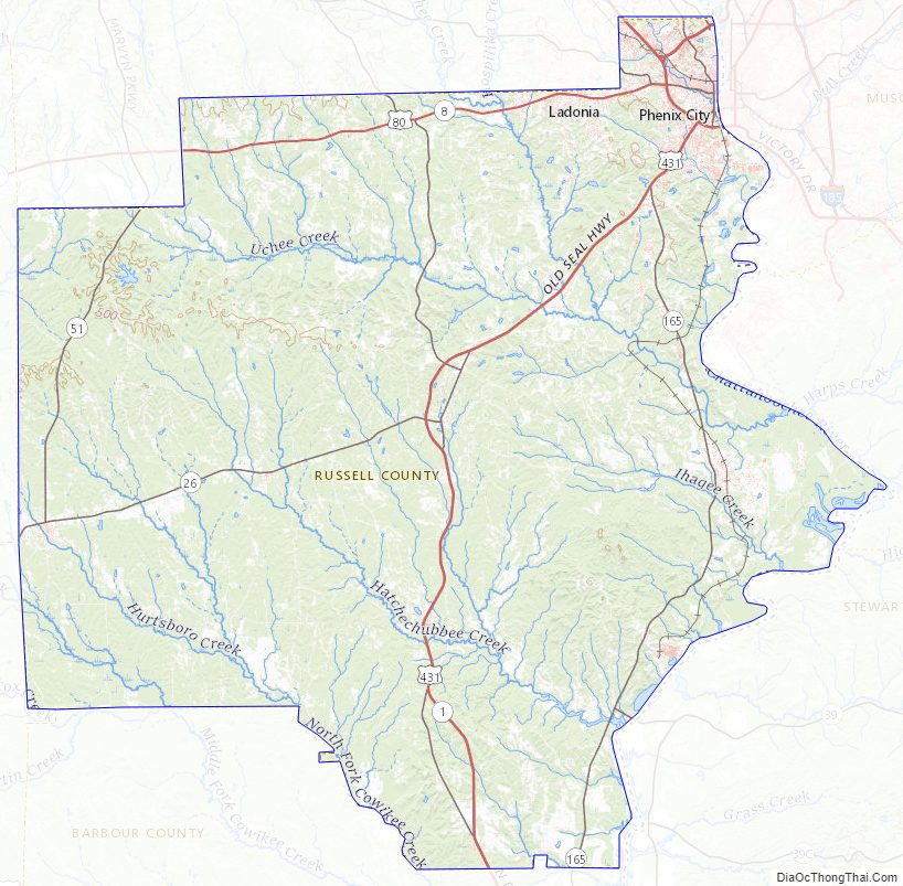
Russell County Road Map
Geography
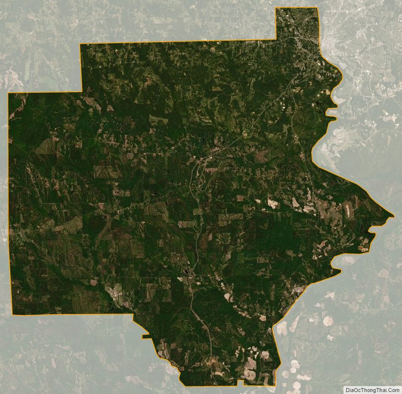
According to the United States Census Bureau, the county has a total area of 647 square miles (1,680 km), of which 641 square miles (1,660 km) is land and 6.1 square miles (16 km) (0.9%) is water. The county is located in the Gulf Coastal Plain region, with a few rolling hills due to its close proximity to the fall line of the eastern United States.
Major highways
- U.S. Highway 80
- U.S. Highway 280
- U.S. Highway 431
- State Route 26
- State Route 51
- State Route 165
- State Route 169
- State Route 208
Adjacent counties
- Lee County (north)
- Muscogee County, Georgia (northeast/EST Border)
- Chattahoochee County, Georgia (east/EST Border)
- Stewart County, Georgia (southeast/EST Border)
- Barbour County (south)
- Bullock County (southwest)
- Macon County (northwest)
National protected area
- Eufaula National Wildlife Refuge (part)
Russell County Topographic Map
Russell County Satellite Map
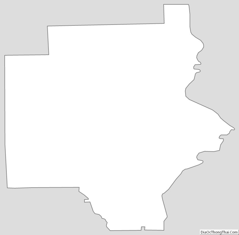
Russell County Outline Map