Alabama (/ˌæləˈbæmə/) is a state in the Southeastern region of the United States, bordered by Tennessee to the north; Georgia to the east; Florida and the Gulf of Mexico to the south; and Mississippi to the west. Alabama is the 30th largest by area and the 24th-most populous of the U.S. states.
Alabama is nicknamed the Yellowhammer State, after the state bird. Alabama is also known as the “Heart of Dixie” and the “Cotton State”. The state tree is the longleaf pine, and the state flower is the camellia. Alabama’s capital is Montgomery, and its largest city by population and area is Huntsville. Its oldest city is Mobile, founded by French colonists in 1702 as the capital of French Louisiana. Greater Birmingham is Alabama’s largest metropolitan area and its economic center.
Originally home to many native tribes, present-day Alabama was a Spanish territory beginning in the sixteenth century until the French acquired it in the early eighteenth century. The British won the territory in 1763 until losing it in the American Revolutionary War. Spain held Mobile as part of Spanish West Florida until 1813. In December 1819, Alabama was recognized as a state. During the antebellum period, Alabama was a major producer of cotton, and widely used African American slave labor. In 1861, the state seceded from the United States to become part of the Confederate States of America, with Montgomery acting as its first capital, and rejoined the Union in 1868. Following the American Civil War, Alabama would suffer decades of economic hardship, in part due to agriculture and a few cash crops being the main driver of the state’s economy. Similar to other former slave states, Alabamian legislators employed Jim Crow laws from the late 19th century up until the 1960s. High-profile events such as the Selma to Montgomery march made the state a major focal point of the civil rights movement in the 1950s and 1960s.
During and after World War II, Alabama grew as the state’s economy diversified with new industries. NASA’s Marshall Space Flight Center in Huntsville would help Alabama’s economic growth in the mid-to-late 20th century, by developing an aerospace industry. Alabama’s economy in the 21st century is based on automotive, finance, tourism, manufacturing, aerospace, mineral extraction, healthcare, education, retail, and technology.
The state’s geography is diverse, with the north dominated by the mountainous Tennessee Valley and the south by Mobile Bay, a historically significant port. Politically, as part of the Deep South, Alabama is predominantly a conservative state, and is known for its Southern culture. Within Alabama, American football, particularly at the college level, plays a major part of the state’s culture.
| Before statehood: | Alabama Territory |
|---|---|
| Admitted to the Union: | December 14, 1819 (22nd) |
| Capital: | Montgomery |
| Largest city: | Huntsville |
| Largest metro and urban areas: | Greater Birmingham |
| Elevation: | 500 ft (150 m) |
| Total Area: | 52,419 sq mi (135,765 km) |
| Area Rank: | 30th |
| Total Population: | 5,039,877 |
| Population Rank: | 24th |
| Population Density: | 99.1/sq mi (38.4/km) |
| Population Density Rank: | 27th |
| Median Household Income: | $52,000 |
| Income Rank: | 46th |
| Demonym(s): | Alabamian, Alabaman |
| USPS abbreviation: | AL |
| ISO 3166 code: | US-AL |
| Website: | alabama.gov |
Online Interactive Map
Click on ![]() to view map in "full screen" mode.
to view map in "full screen" mode.
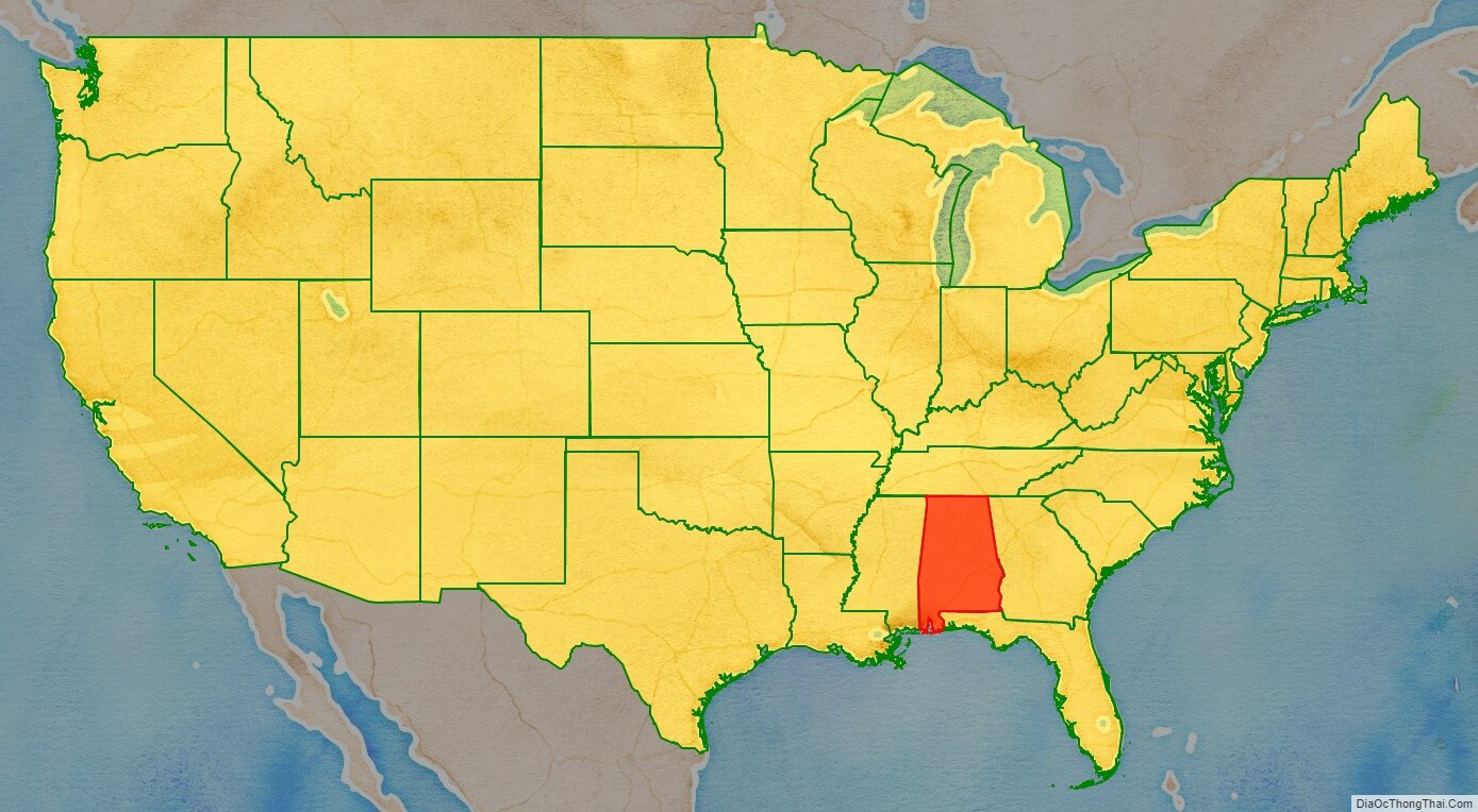
Alabama location map. Where is Alabama state?
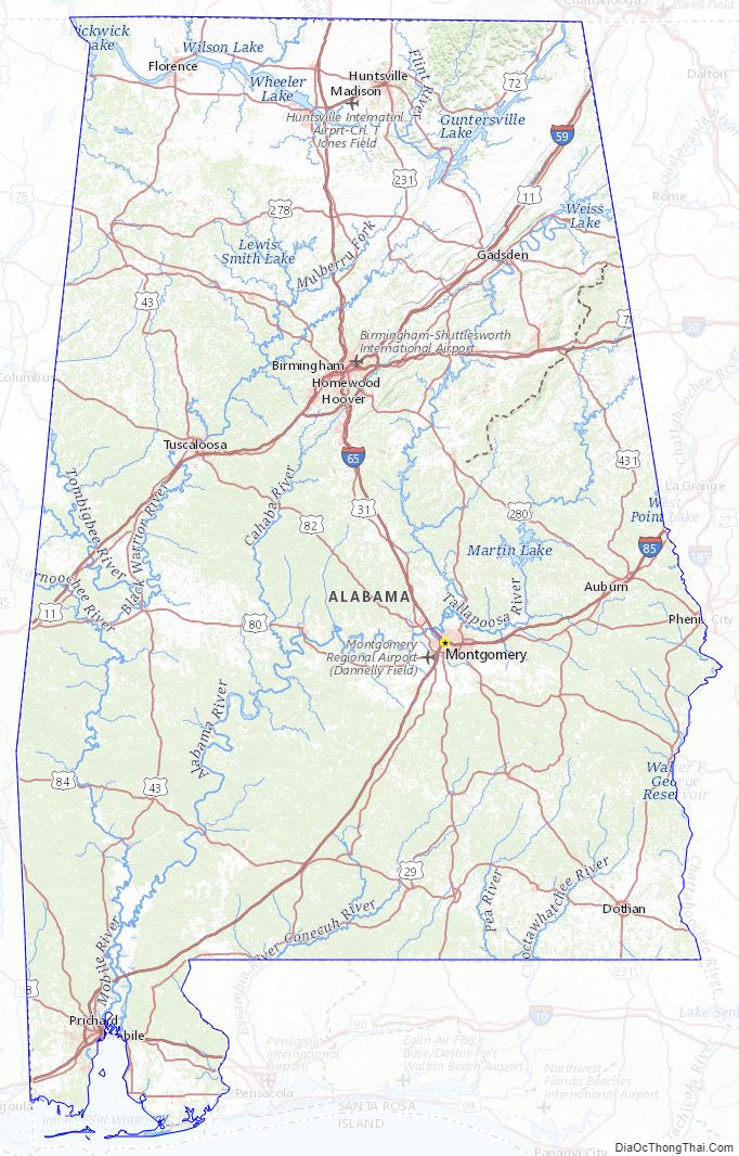
Alabama Road Map
Alabama Map – Roads & Cities
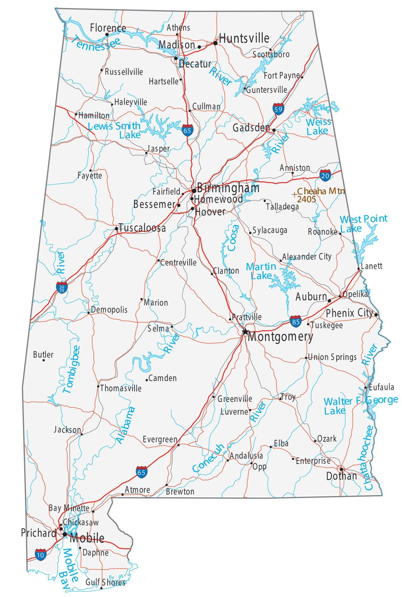
Alabama Street Map
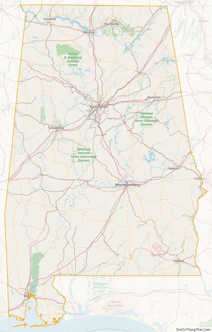
Alabama State Map – Places and Landmarks
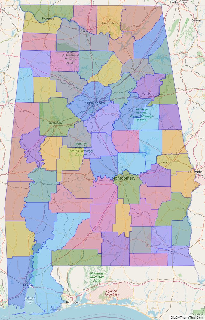
Alabama Political Map
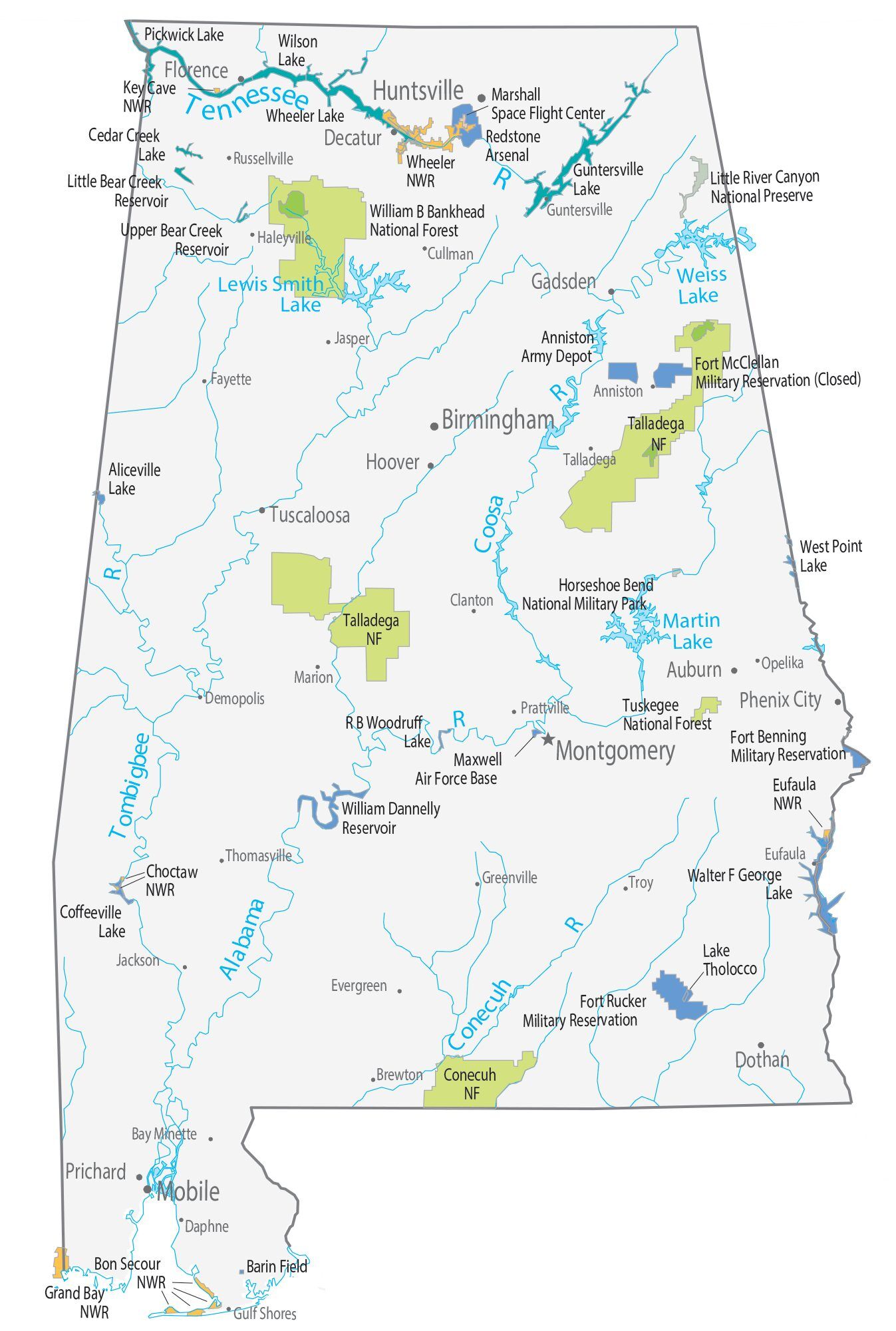
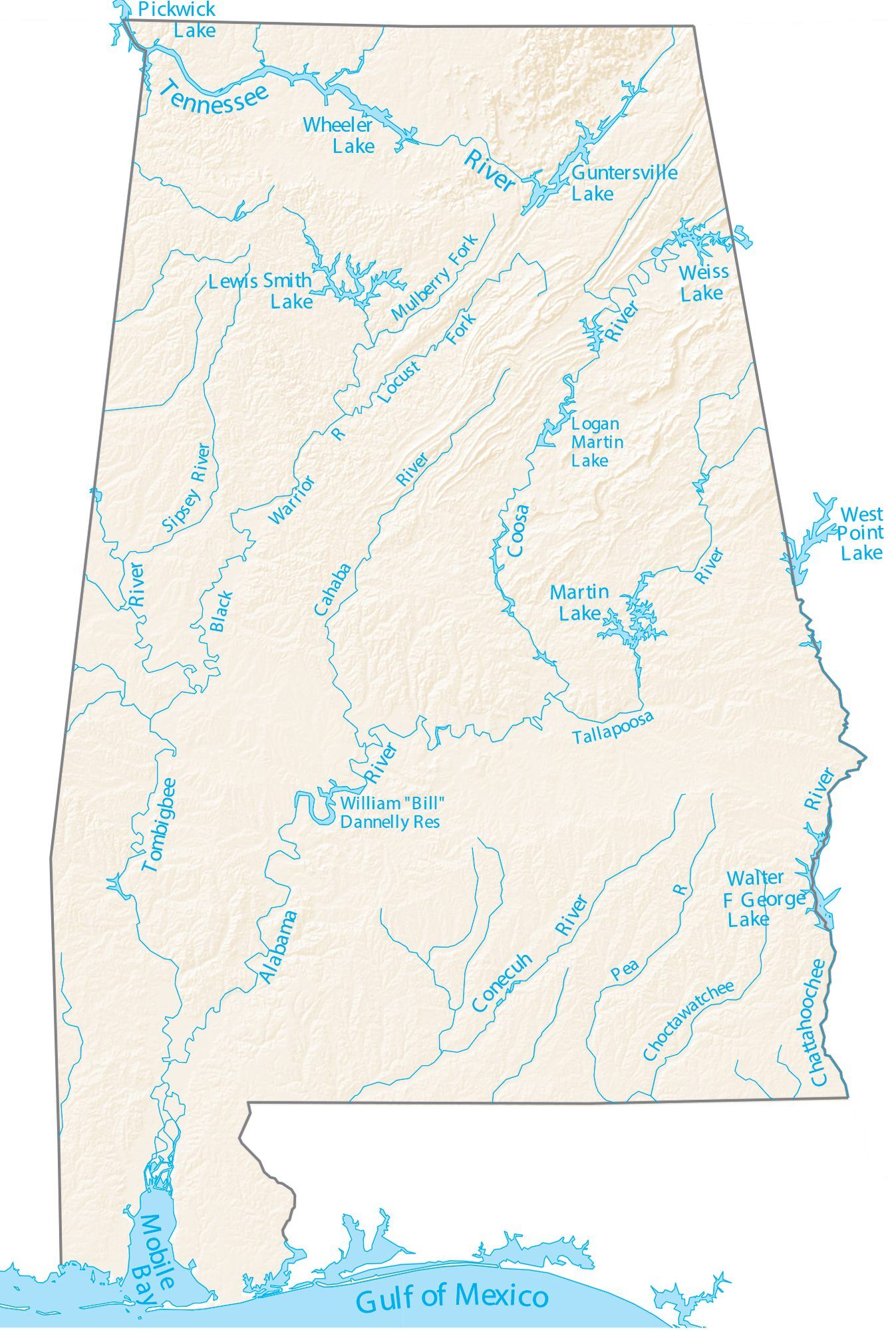
Alabama Lakes and Rivers Map
Geography
Alabama is the thirtieth-largest state in the United States with 52,419 square miles (135,760 km) of total area: 3.2% of the area is water, making Alabama 23rd in the amount of surface water, also giving it the second-largest inland waterway system in the United States. About three-fifths of the land area is part of the Gulf Coastal Plain, a gentle plain with a general descent towards the Mississippi River and the Gulf of Mexico. The North Alabama region is mostly mountainous, with the Tennessee River cutting a large valley and creating numerous creeks, streams, rivers, mountains, and lakes.
Alabama is bordered by the states of Tennessee to the north, Georgia to the east, Florida to the south, and Mississippi to the west. Alabama has coastline at the Gulf of Mexico, in the extreme southern edge of the state. The state ranges in elevation from sea level at Mobile Bay to more than 2,000 feet (610 m) in the northeast, to Mount Cheaha at 2,413 ft (735 m).
Alabama’s land consists of 22 million acres (89,000 km) of forest or 67% of the state’s total land area. Suburban Baldwin County, along the Gulf Coast, is the largest county in the state in both land area and water area.
Areas in Alabama administered by the National Park Service include Horseshoe Bend National Military Park near Alexander City; Little River Canyon National Preserve near Fort Payne; Russell Cave National Monument in Bridgeport; Tuskegee Airmen National Historic Site in Tuskegee; and Tuskegee Institute National Historic Site near Tuskegee. Additionally, Alabama has four National Forests: Conecuh, Talladega, Tuskegee, and William B. Bankhead. Alabama also contains the Natchez Trace Parkway, the Selma To Montgomery National Historic Trail, and the Trail of Tears National Historic Trail.
Notable natural wonders include: the “Natural Bridge” rock, the longest natural bridge east of the Rockies, located just south of Haleyville; Cathedral Caverns in Marshall County, named for its cathedral-like appearance, features one of the largest cave entrances and stalagmites in the world; Ecor Rouge in Fairhope, the highest coastline point between Maine and Mexico; DeSoto Caverns in Childersburg, the first officially recorded cave in the United States; Noccalula Falls in Gadsden features a 90-foot waterfall; Dismals Canyon near Phil Campbell, home to two waterfalls, six natural bridges and allegedly served as a hideout for legendary outlaw Jesse James; Stephens Gap Cave in Jackson County boasts a 143-foot pit, two waterfalls and is one of the most photographed wild cave scenes in America; Little River Canyon near Fort Payne, one of the nation’s longest mountaintop rivers; Rickwood Caverns near Warrior features an underground pool, blind cave fish and 260-million-year-old limestone formations; and the Walls of Jericho canyon on the Alabama-Tennessee state line.
A 5-mile (8 km)-wide meteorite impact crater is located in Elmore County, just north of Montgomery. This is the Wetumpka crater, the site of “Alabama’s greatest natural disaster”. A 1,000-foot (300 m)-wide meteorite hit the area about 80 million years ago. The hills just east of downtown Wetumpka showcase the eroded remains of the impact crater that was blasted into the bedrock, with the area labeled the Wetumpka crater or astrobleme (“star-wound”) because of the concentric rings of fractures and zones of shattered rock that can be found beneath the surface. In 2002, Christian Koeberl with the Institute of Geochemistry University of Vienna published evidence and established the site as the 157th recognized impact crater on Earth.
Climate
The state is classified as humid subtropical (Cfa) under the Koppen Climate Classification. The average annual temperature is 64 °F (18 °C). Temperatures tend to be warmer in the southern part of the state with its proximity to the Gulf of Mexico, while the northern parts of the state, especially in the Appalachian Mountains in the northeast, tend to be slightly cooler. Generally, Alabama has very hot summers and mild winters with copious precipitation throughout the year. Alabama receives an average of 56 inches (1,400 mm) of rainfall annually and enjoys a lengthy growing season of up to 300 days in the southern part of the state.
Summers in Alabama are among the hottest in the U.S., with high temperatures averaging over 90 °F (32 °C) throughout the summer in some parts of the state. Alabama is also prone to tropical storms and hurricanes. Areas of the state far away from the Gulf are not immune to the effects of the storms, which often dump tremendous amounts of rain as they move inland and weaken.
South Alabama reports many thunderstorms. The Gulf Coast, around Mobile Bay, averages between 70 and 80 days per year with thunder reported. This activity decreases somewhat further north in the state, but even the far north of the state reports thunder on about 60 days per year. Occasionally, thunderstorms are severe with frequent lightning and large hail; the central and northern parts of the state are most vulnerable to this type of storm. Alabama ranks ninth in the number of deaths from lightning and tenth in the number of deaths from lightning strikes per capita.
Alabama, along with Oklahoma and Iowa, has the most confirmed F5 and EF5 tornadoes of any state, according to statistics from the National Climatic Data Center for the period January 1, 1950, to June 2013. Several long-tracked F5/EF5 tornadoes have contributed to Alabama reporting more tornado fatalities since 1950 than any other state. The state was affected by the 1974 Super Outbreak and was devastated tremendously by the 2011 Super Outbreak. The 2011 Super Outbreak produced a record amount of tornadoes in the state. The tally reached 62.
The peak season for tornadoes varies from the northern to southern parts of the state. Alabama is one of the few places in the world that has a secondary tornado season in November and December besides the typically severe spring. The northern part—along the Tennessee River Valley—is most vulnerable. The area of Alabama and Mississippi most affected by tornadoes is sometimes referred to as Dixie Alley, as distinct from the Tornado Alley of the Southern Plains.
Winters are generally mild in Alabama, as they are throughout most of the Southeastern United States, with average January low temperatures around 40 °F (4 °C) in Mobile and around 32 °F (0 °C) in Birmingham. Although snow is a rare event in much of Alabama, areas of the state north of Montgomery may receive a dusting of snow a few times every winter, with an occasional moderately heavy snowfall every few years. Historic snowfall events include New Year’s Eve 1963 snowstorm and the 1993 Storm of the Century. The annual average snowfall for the Birmingham area is 2 inches (51 mm) per year. In the southern Gulf coast, snowfall is less frequent, sometimes going several years without any snowfall.
Alabama’s highest temperature of 112 °F (44 °C) was recorded on September 5, 1925, in the unincorporated community of Centerville. The record low of −27 °F (−33 °C) occurred on January 30, 1966, in New Market.
Flora and fauna
Alabama is home to a diverse array of flora and fauna in habitats that range from the Tennessee Valley, Appalachian Plateau, and Ridge-and-Valley Appalachians of the north to the Piedmont, Canebrake, and Black Belt of the central region to the Gulf Coastal Plain and beaches along the Gulf of Mexico in the south. The state is usually ranked among the top in nation for its range of overall biodiversity.
Alabama is in the subtropical coniferous forest biome and once boasted huge expanses of pine forest, which still form the largest proportion of forests in the state. It currently ranks fifth in the nation for the diversity of its flora. It is home to nearly 4,000 pteridophyte and spermatophyte plant species.
Indigenous animal species in the state include 62 mammal species, 93 reptile species, 73 amphibian species, roughly 307 native freshwater fish species, and 420 bird species that spend at least part of their year within the state. Invertebrates include 97 crayfish species and 383 mollusk species. 113 of these mollusk species have never been collected outside the state.
Census-designated and metropolitan areas
- ^ In Alabama, only Jackson County (2019 population: 51,626; 2010 population: 53,227) is included in the Chattanooga CSA
- ^ In Alabama, only Lee, Russell, and Chambers Counties (total 2019 population: 255,757; total 2010 population: 227,409) are included in the Columbus CSA
Cities
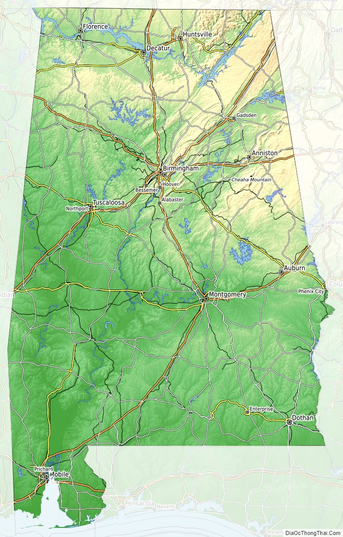
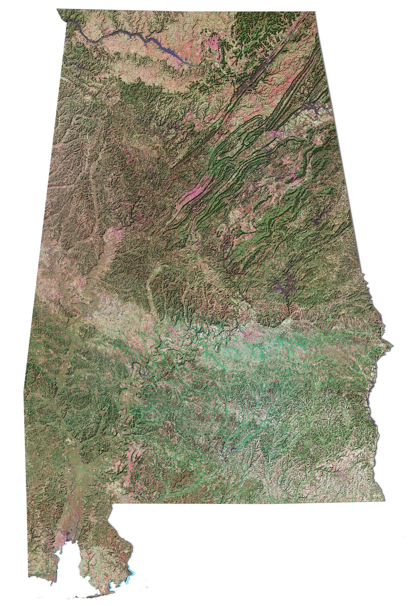
Alabama Physical Map
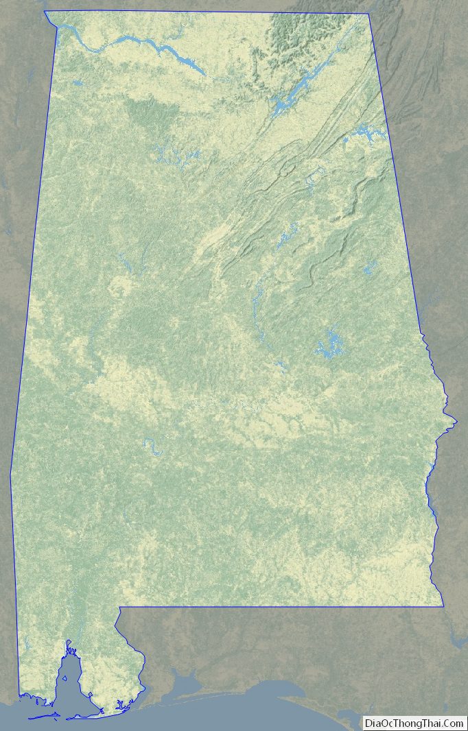
Alabama Topographic Map
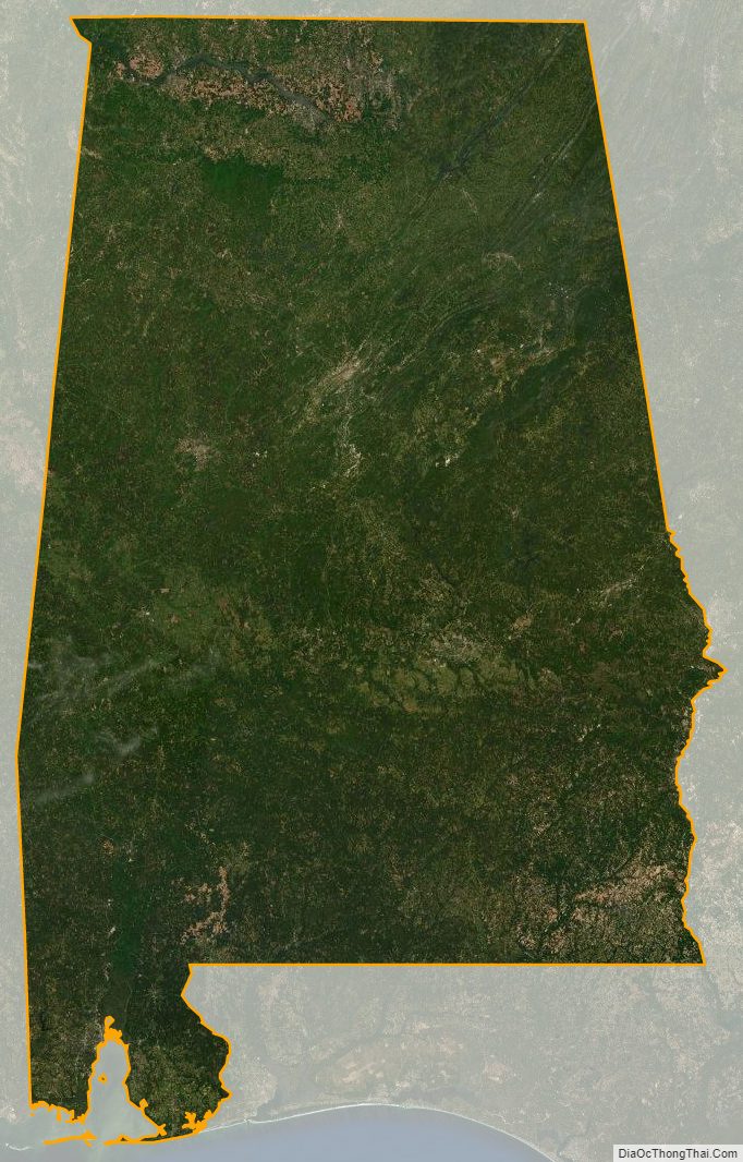
Alabama Satellite Map
Others printable maps
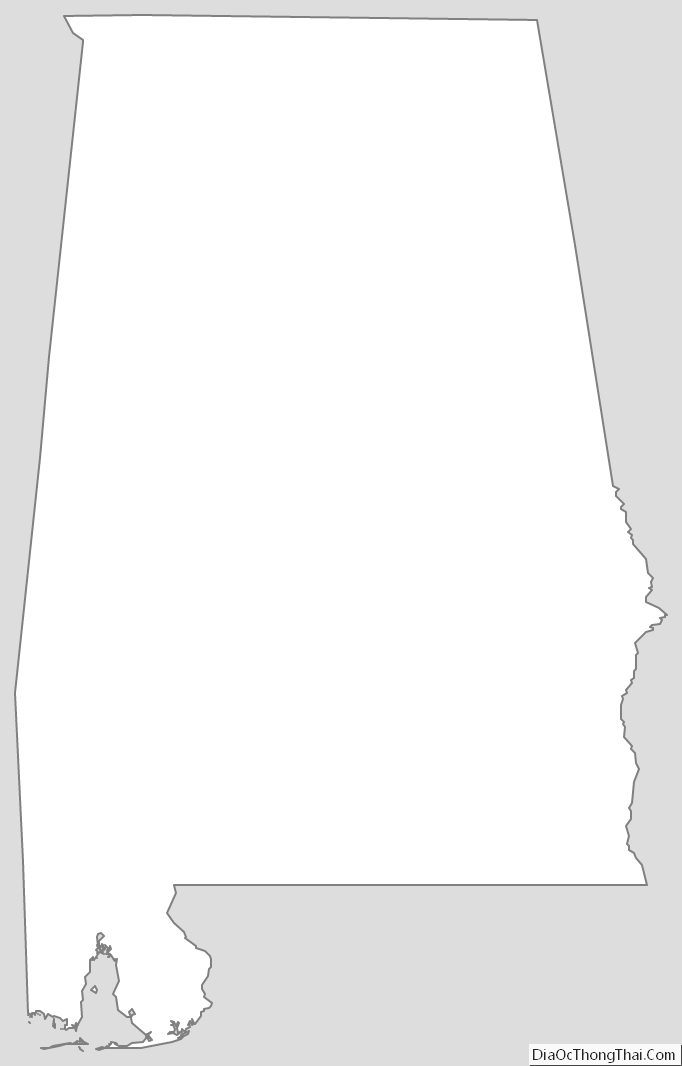
Alabama Outline Map
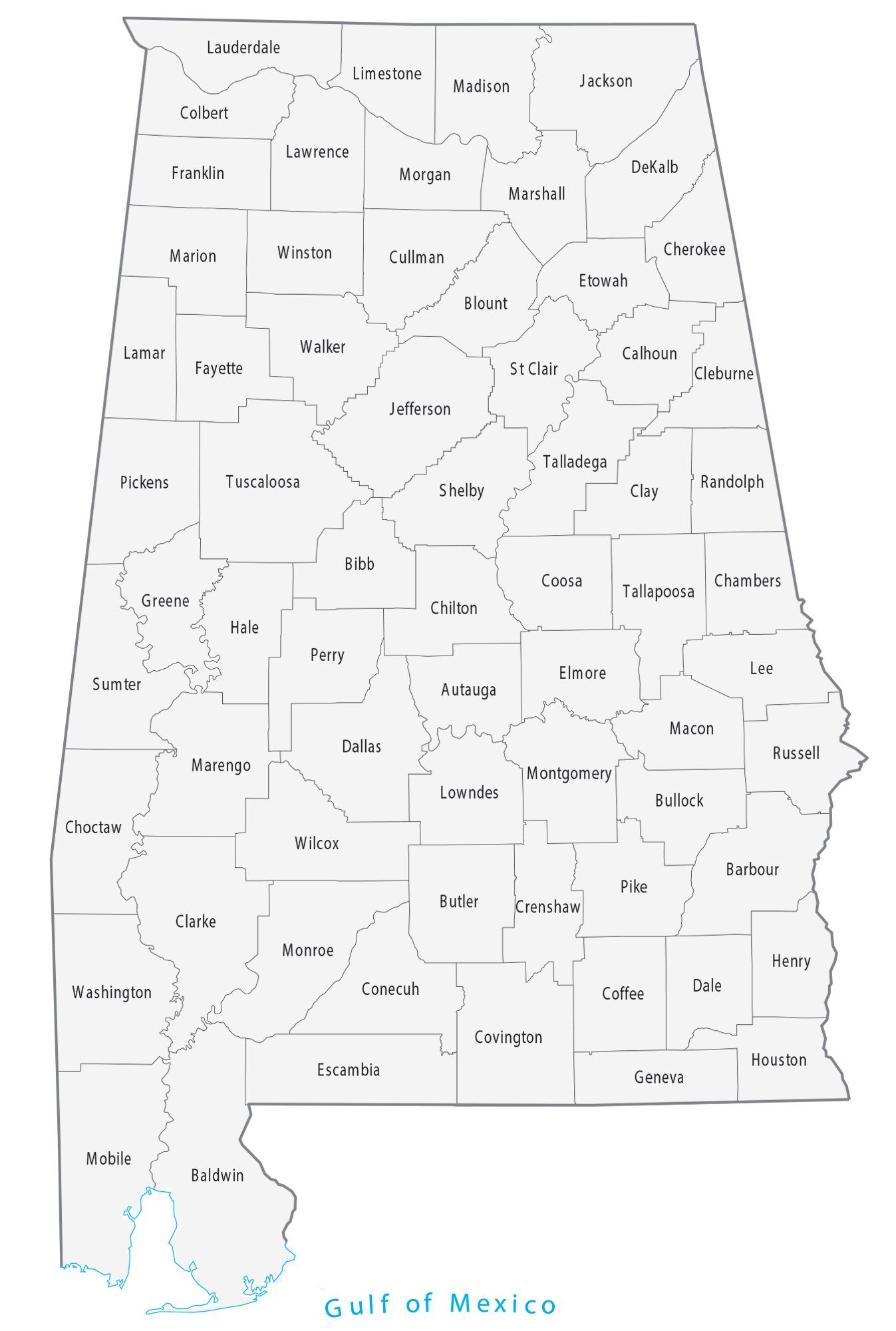
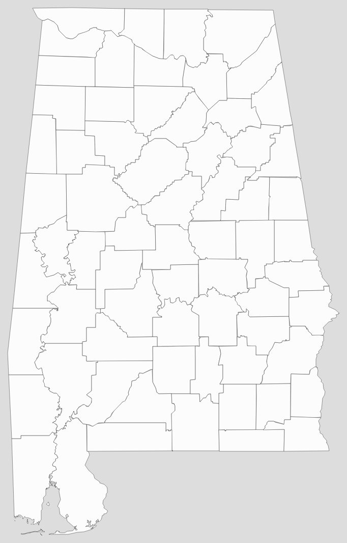
Blank Alabama County Map
See also
Map of Alabama State and its subdivision:- Autauga
- Baldwin
- Barbour
- Bibb
- Blount
- Bullock
- Butler
- Calhoun
- Chambers
- Cherokee
- Chilton
- Choctaw
- Clarke
- Clay
- Cleburne
- Coffee
- Colbert
- Conecuh
- Coosa
- Covington
- Crenshaw
- Cullman
- Dale
- Dallas
- De Kalb
- Elmore
- Escambia
- Etowah
- Fayette
- Franklin
- Geneva
- Greene
- Hale
- Henry
- Houston
- Jackson
- Jefferson
- Lamar
- Lauderdale
- Lawrence
- Lee
- Limestone
- Lowndes
- Macon
- Madison
- Marengo
- Marion
- Marshall
- Mobile
- Monroe
- Montgomery
- Morgan
- Perry
- Pickens
- Pike
- Randolph
- Russell
- Saint Clair
- Shelby
- Sumter
- Talladega
- Tallapoosa
- Tuscaloosa
- Walker
- Washington
- Wilcox
- Winston
- Alabama
- Alaska
- Arizona
- Arkansas
- California
- Colorado
- Connecticut
- Delaware
- District of Columbia
- Florida
- Georgia
- Hawaii
- Idaho
- Illinois
- Indiana
- Iowa
- Kansas
- Kentucky
- Louisiana
- Maine
- Maryland
- Massachusetts
- Michigan
- Minnesota
- Mississippi
- Missouri
- Montana
- Nebraska
- Nevada
- New Hampshire
- New Jersey
- New Mexico
- New York
- North Carolina
- North Dakota
- Ohio
- Oklahoma
- Oregon
- Pennsylvania
- Rhode Island
- South Carolina
- South Dakota
- Tennessee
- Texas
- Utah
- Vermont
- Virginia
- Washington
- West Virginia
- Wisconsin
- Wyoming


