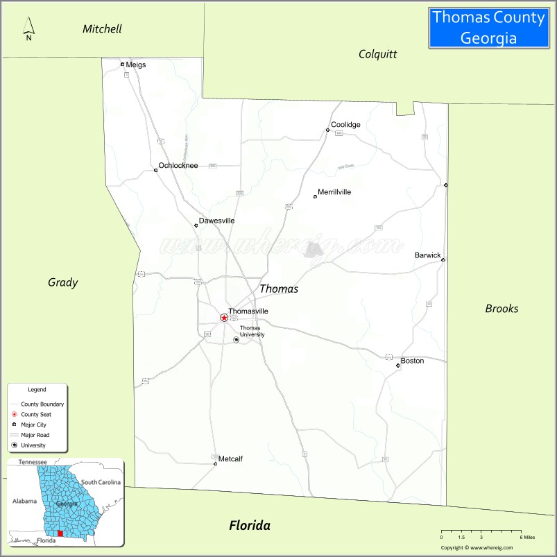
Thomas County is a county located in the U.S. state of Georgia. As of the 2020 census the population was 45,798. The county seat is Thomasville.
Thomas County comprises the Thomasville, GA Micropolitan Statistical Area.
| Name: | Thomas County |
|---|---|
| FIPS code: | 13-275 |
| State: | Georgia |
| Founded: | 1825 |
| Named for: | Jett Thomas |
| Seat: | Thomasville |
| Largest city: | Thomasville |
| Total Area: | 552 sq mi (1,430 km²) |
| Land Area: | 545 sq mi (1,410 km²) |
| Total Population: | 45,798 |
| Population Density: | 84/sq mi (32/km²) |
| Time zone: | UTC−5 (Eastern) |
| Summer Time Zone (DST): | UTC−4 (EDT) |
| Website: | www.thomascountyboc.org |
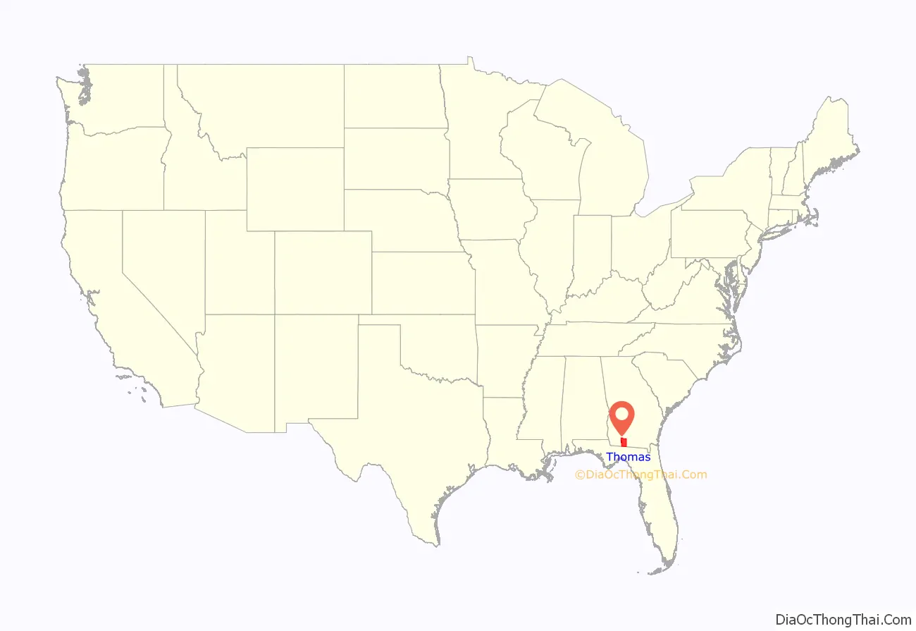
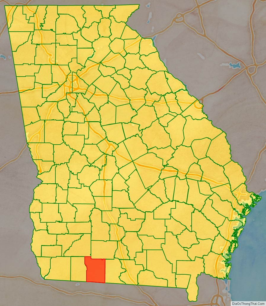
Thomas County location map. Where is Thomas County?
History
Thomas County was created by an act of the Georgia General Assembly on December 23, 1825, from portions of Decatur and Irwin Counties. Colquitt (1856), Brooks (1858), and Grady (1905) Counties all were formed partially from lands within Thomas County’s original borders.
The county is named for Jett Thomas, an officer in the War of 1812 who is also known for overseeing the construction of the first building at the University of Georgia (originally referred to as Franklin College and known today as Old College) as well as the state capital at Milledgeville.
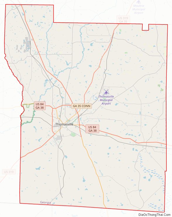
Thomas County Road Map
Geography
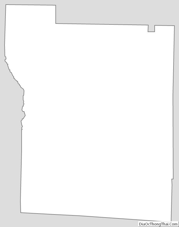
According to the U.S. Census Bureau, the county has a total area of 552 square miles (1,430 km), of which 545 square miles (1,410 km) is land and 7.6 square miles (20 km) (1.4%) is water.
The northwestern half of Thomas County, bordered by U.S. Route 319 southwest of Thomasville, and a line that ends up bisecting the distance between Coolidge and Pavo in the northeast, is located in the Upper Ochlockonee River sub-basin of the larger Ochlockonee River basin. The northeastern edge of the county, from north of Pavo to Boston, is located in the Withlacoochee River sub-basin of the Suwannee River basin. The southeastern portion of Thomas County, running southeast from Thomasville, is located in the Aucilla River sub-basin of the larger Aucilla-Waccasassa basin. Almost all of the southwestern portion of the county is located in the Apalachee Bay-St. Marks sub-basin of the Ochlockonee River basin, with the exception of the tiny southwesternmost corner, which is located in the Lower Ochlockonee River sub-basin of the same Ochlockonee River basin.
The Aucilla River rises in Thomas County. The Red Hills Region is centered on Thomas County.
Major highways
- U.S. Route 19
- U.S. Route 84
U.S. Route 84 Business- U.S. Route 319
- State Route 3
- State Route 3 Alternate
- State Route 33
- State Route 35
- State Route 35 Connector
- State Route 38
- State Route 38 Business
- State Route 111
- State Route 122
- State Route 188
- State Route 202
- State Route 300
Adjacent counties
- Colquitt County – northeast
- Brooks County – east
- Jefferson County, Florida – south
- Leon County, Florida – southwest
- Grady County – west
- Mitchell County – northwest
Thomas County Topographic Map
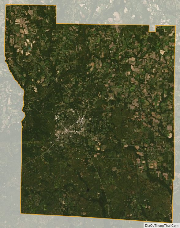
Thomas County Satellite Map
Thomas County Outline Map