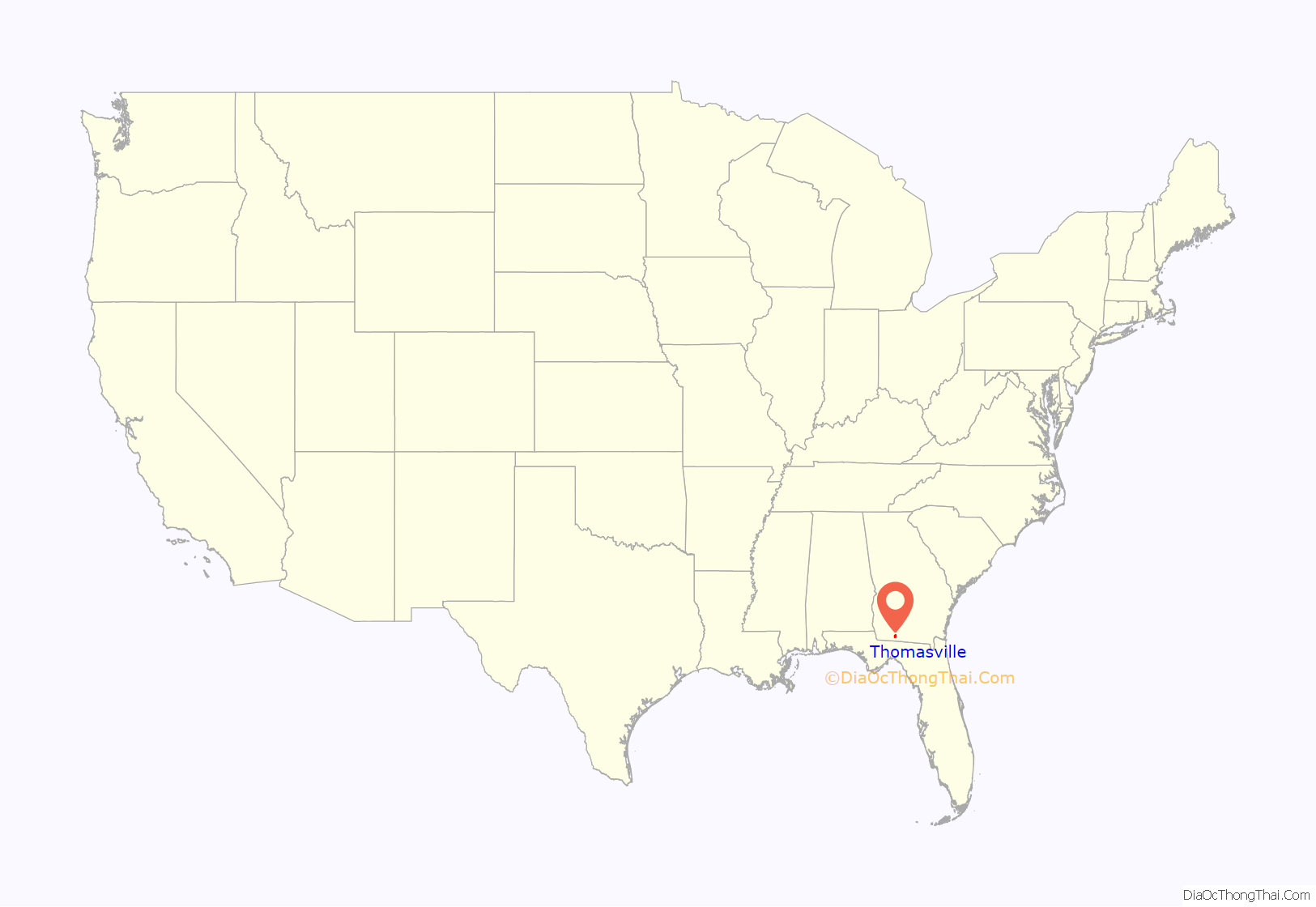
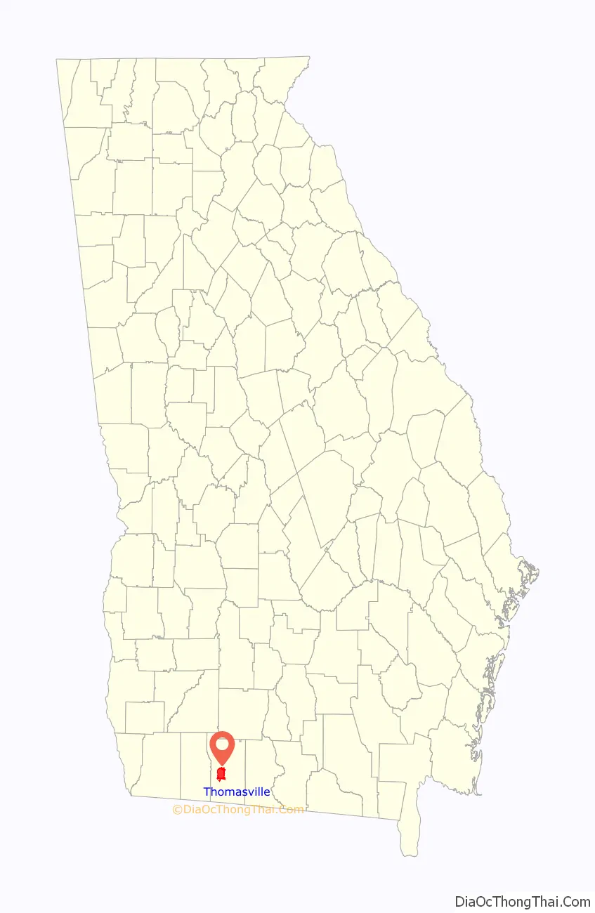
Thomasville is the county seat of Thomas County, Georgia, United States. The population was 18,413 at the 2010 United States Census, making it the second largest city in southwest Georgia after Albany.
The city deems itself the “City of Roses” and holds an annual Rose Festival. The city features plantations open to the public, a historic downtown, a large farmer’s market, and an oak tree from about 1680 at the corner of Monroe and Crawford streets.
| Name: | Thomasville city |
|---|---|
| LSAD Code: | 25 |
| LSAD Description: | city (suffix) |
| State: | Georgia |
| County: | Thomas County |
| Elevation: | 279 ft (85 m) |
| Land Area: | 15.01 sq mi (38.88 km²) |
| Water Area: | 0.13 sq mi (0.34 km²) |
| Population Density: | 1,257.64/sq mi (485.58/km²) |
| ZIP code: | 31792, 31799 |
| Area code: | 229 |
| FIPS code: | 1376224 |
| GNISfeature ID: | 0333216 |
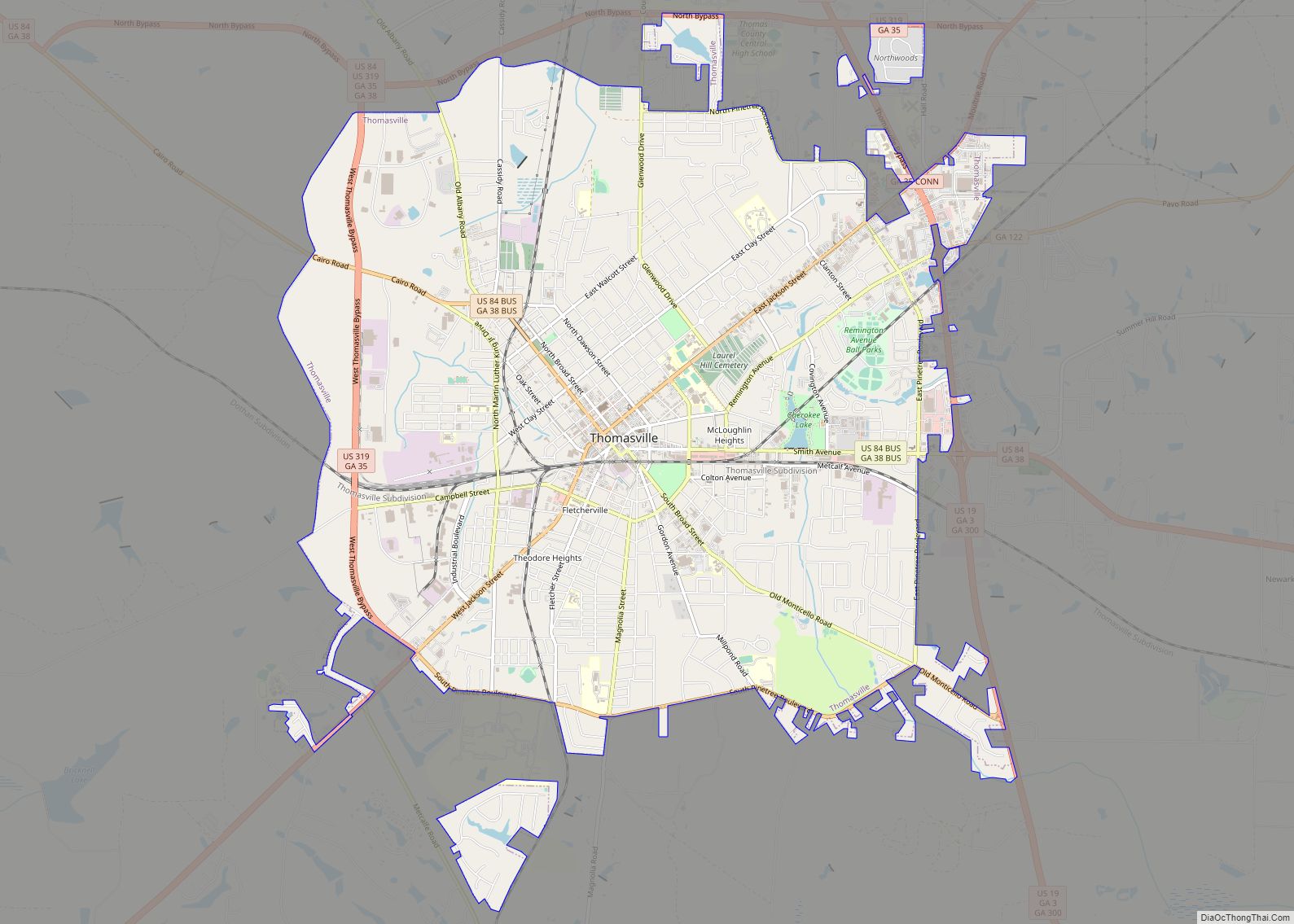
Online Interactive Map
Click on ![]() to view map in "full screen" mode.
to view map in "full screen" mode.
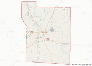
Thomasville location map. Where is Thomasville city?
History
Thomasville was founded in 1825 as seat of the newly formed Thomas County. It was incorporated as a town in 1831 and as a city in 1889. The community was named for Jett Thomas, a general in the War of 1812.
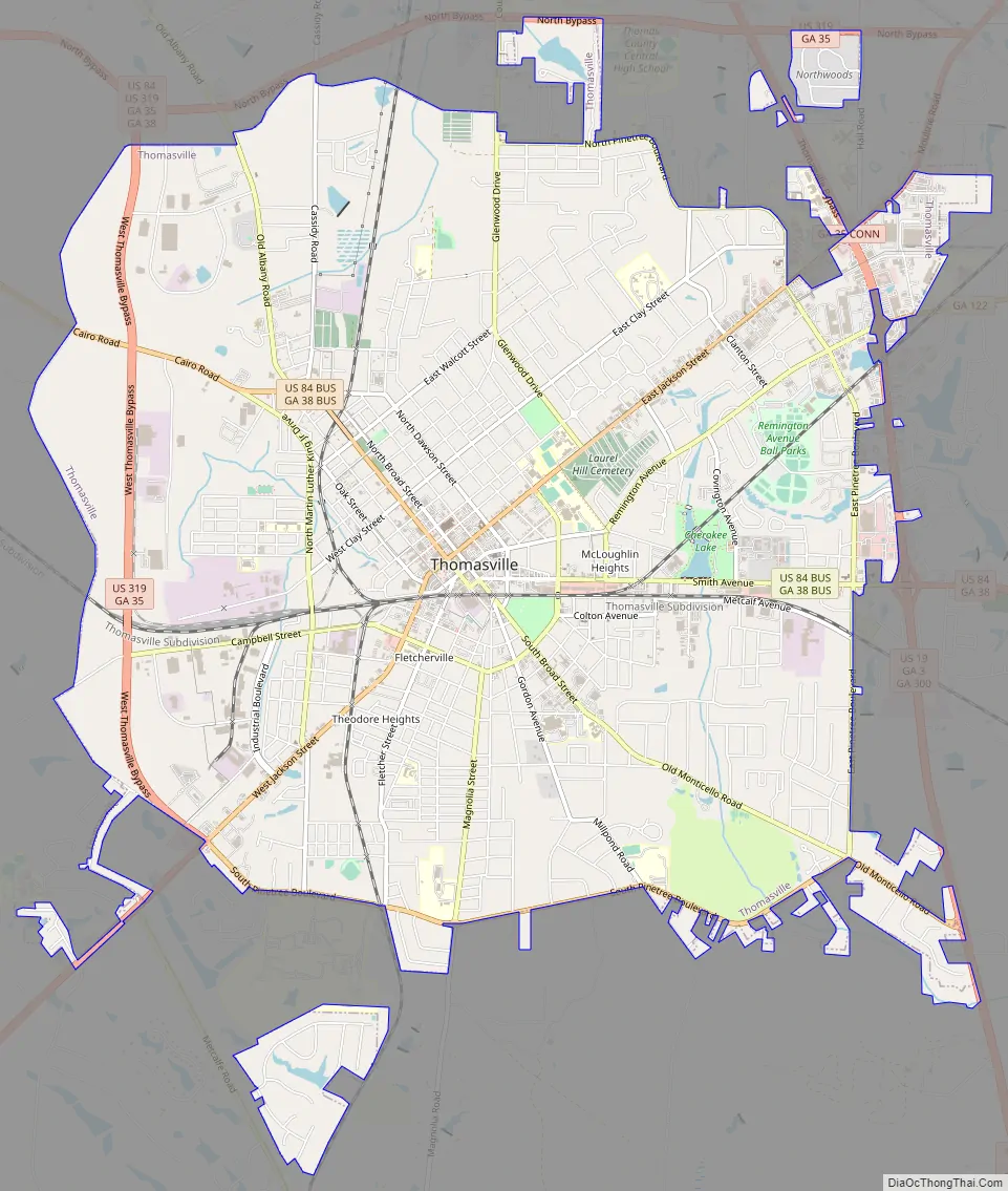
Thomasville Road Map
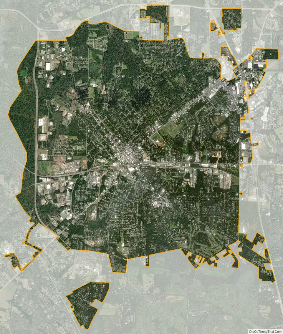
Thomasville city Satellite Map
Geography
According to the United States Census Bureau, the city has a total area of 14.9 square miles (39 km), of which 14.9 square miles (39 km) is land and 0.1 square miles (0.26 km) (0.40%) is water. It is the second largest city in Southwest Georgia after Albany. The city has three U.S. Routes: 19, 84 and 319. It is located 34 miles northeast of Tallahassee, Florida, 28 miles southwest of Moultrie, 43 miles west of Valdosta, 95 miles east of Dothan, Alabama, 59 miles south of Albany and 22 miles north of Monticello, Florida.
Climate
The climate in this area is characterized by hot, humid summers and generally mild to cool winters. According to the Köppen Climate Classification system, Thomasville has a humid subtropical climate, abbreviated “Cfa” on climate maps.
See also
Map of Georgia State and its subdivision:- Appling
- Atkinson
- Bacon
- Baker
- Baldwin
- Banks
- Barrow
- Bartow
- Ben Hill
- Berrien
- Bibb
- Bleckley
- Brantley
- Brooks
- Bryan
- Bulloch
- Burke
- Butts
- Calhoun
- Camden
- Candler
- Carroll
- Catoosa
- Charlton
- Chatham
- Chattahoochee
- Chattooga
- Cherokee
- Clarke
- Clay
- Clayton
- Clinch
- Cobb
- Coffee
- Colquitt
- Columbia
- Cook
- Coweta
- Crawford
- Crisp
- Dade
- Dawson
- Decatur
- DeKalb
- Dodge
- Dooly
- Dougherty
- Douglas
- Early
- Echols
- Effingham
- Elbert
- Emanuel
- Evans
- Fannin
- Fayette
- Floyd
- Forsyth
- Franklin
- Fulton
- Gilmer
- Glascock
- Glynn
- Gordon
- Grady
- Greene
- Gwinnett
- Habersham
- Hall
- Hancock
- Haralson
- Harris
- Hart
- Heard
- Henry
- Houston
- Irwin
- Jackson
- Jasper
- Jeff Davis
- Jefferson
- Jenkins
- Johnson
- Jones
- Lamar
- Lanier
- Laurens
- Lee
- Liberty
- Lincoln
- Long
- Lowndes
- Lumpkin
- Macon
- Madison
- Marion
- McDuffie
- McIntosh
- Meriwether
- Miller
- Mitchell
- Monroe
- Montgomery
- Morgan
- Murray
- Muscogee
- Newton
- Oconee
- Oglethorpe
- Paulding
- Peach
- Pickens
- Pierce
- Pike
- Polk
- Pulaski
- Putnam
- Quitman
- Rabun
- Randolph
- Richmond
- Rockdale
- Schley
- Screven
- Seminole
- Spalding
- Stephens
- Stewart
- Sumter
- Talbot
- Taliaferro
- Tattnall
- Taylor
- Telfair
- Terrell
- Thomas
- Tift
- Toombs
- Towns
- Treutlen
- Troup
- Turner
- Twiggs
- Union
- Upson
- Walker
- Walton
- Ware
- Warren
- Washington
- Wayne
- Webster
- Wheeler
- White
- Whitfield
- Wilcox
- Wilkes
- Wilkinson
- Worth
- Alabama
- Alaska
- Arizona
- Arkansas
- California
- Colorado
- Connecticut
- Delaware
- District of Columbia
- Florida
- Georgia
- Hawaii
- Idaho
- Illinois
- Indiana
- Iowa
- Kansas
- Kentucky
- Louisiana
- Maine
- Maryland
- Massachusetts
- Michigan
- Minnesota
- Mississippi
- Missouri
- Montana
- Nebraska
- Nevada
- New Hampshire
- New Jersey
- New Mexico
- New York
- North Carolina
- North Dakota
- Ohio
- Oklahoma
- Oregon
- Pennsylvania
- Rhode Island
- South Carolina
- South Dakota
- Tennessee
- Texas
- Utah
- Vermont
- Virginia
- Washington
- West Virginia
- Wisconsin
- Wyoming