Treutlen County is a county located in the east central portion of the U.S. state of Georgia. As of the 2020 census, the population was 6,406. The county seat is Soperton. It is host to the Million Pines Arts and Crafts Festival which occurs during the first weekend in November.
| Name: | Treutlen County |
|---|---|
| FIPS code: | 13-283 |
| State: | Georgia |
| Founded: | 1918 |
| Named for: | John A. Treutlen |
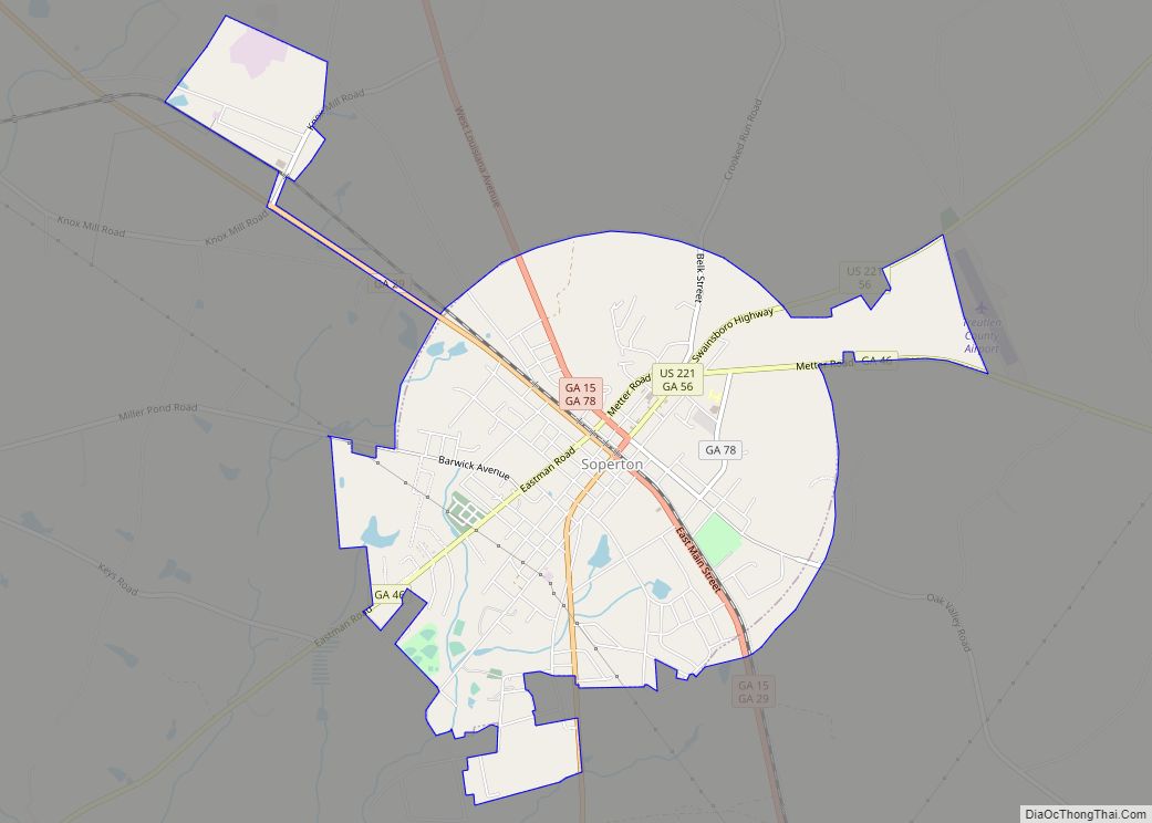
| Seat: | Soperton |
| Largest city: | Soperton |
| Total Area: | 202 sq mi (520 km²) |
| Land Area: | 199 sq mi (520 km²) |
| Total Population: | 6,406 |
| Population Density: | 32/sq mi (12/km²) |
| Time zone: | UTC−5 (Eastern) |
| Summer Time Zone (DST): | UTC−4 (EDT) |
| Website: | Treutlen County, Georgia |
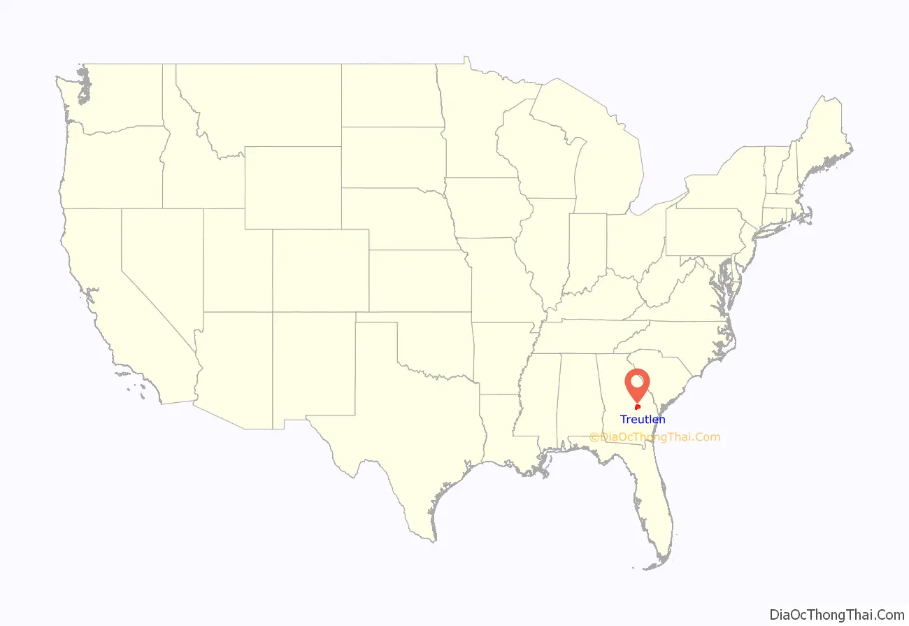
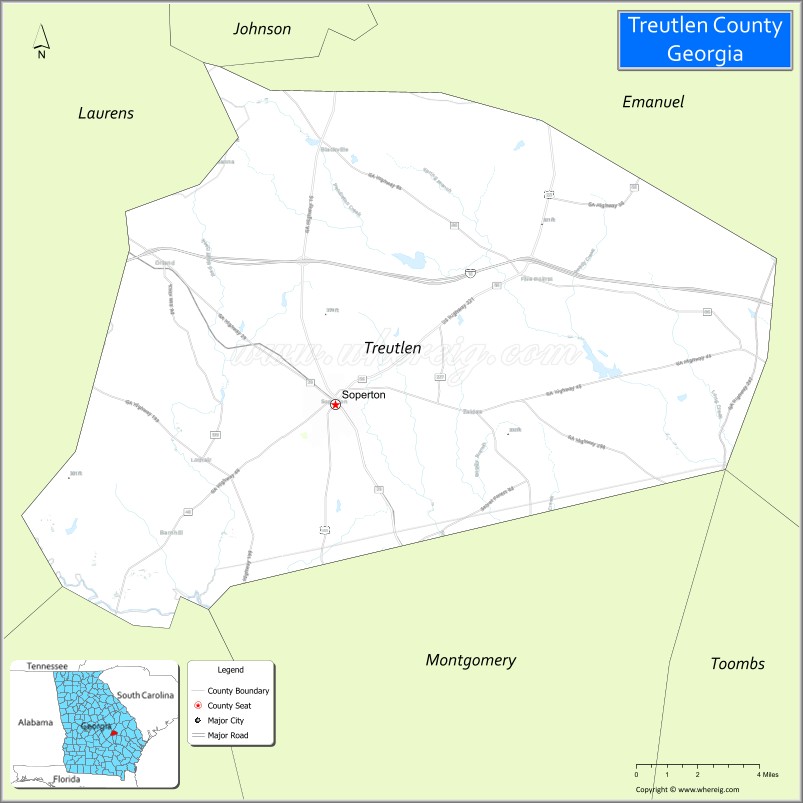
Treutlen County location map. Where is Treutlen County?
History
The state constitutional amendment to create the county was proposed by the Georgia General Assembly on August 21, 1917, and ratified November 5, 1918. The county is named for John A. Treutlen, Georgia’s first state governor following adoption of the state Constitution of 1777.
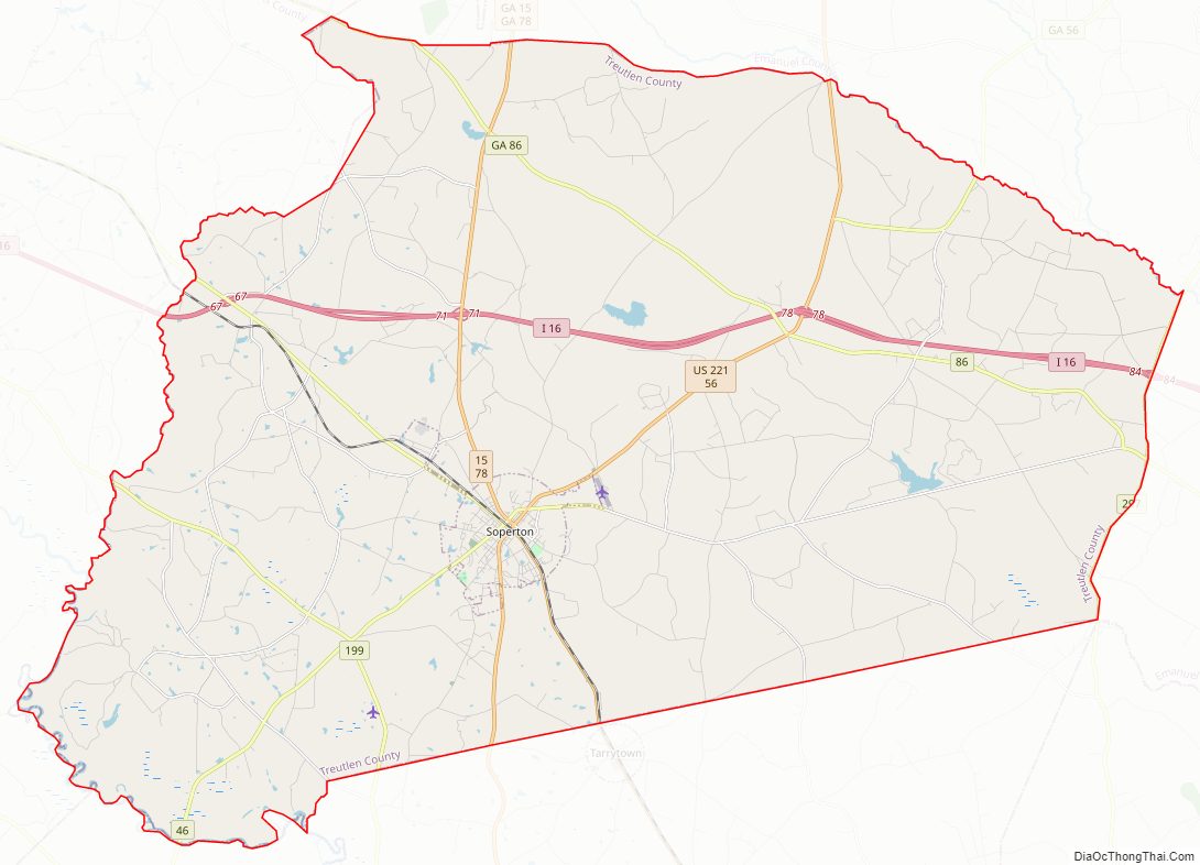
Treutlen County Road Map
Geography
According to the U.S. Census Bureau, the county has a total area of 202 square miles (520 km), of which 199 square miles (520 km) is land and 3.0 square miles (7.8 km) (1.5%) is water.
The western portion of Treutlen County, west of Soperton, is located in the Lower Oconee River sub-basin of the Altamaha River basin. The eastern portion of the county is located in the Ohoopee River sub-basin of the larger Altamaha River basin.
Major highways
- Interstate 16
- U.S. Route 221
- State Route 15
- State Route 29
- State Route 46
- State Route 56
- State Route 78
- State Route 86
- State Route 171
- State Route 199
- State Route 199 Spur
- State Route 227
- State Route 297
- State Route 298
- State Route 404 (unsigned designation for I-16)
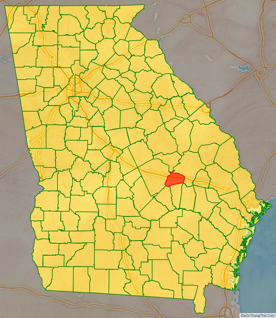
Adjacent counties
- Emanuel County (northeast)
- Montgomery County (southeast)
- Wheeler County (southwest)
- Laurens County (west)
- Johnson County (northwest)
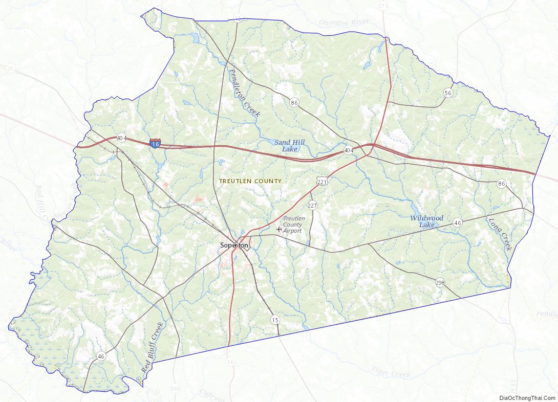
Treutlen County Topographic Map
Treutlen County Satellite Map

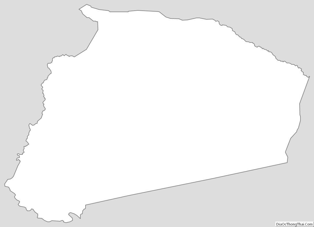
Treutlen County Outline Map