Montgomery County is a county located in the central portion of the U.S. state of Georgia. As of the 2020 census, the population was 8,610. The county seat is Mount Vernon.
Montgomery County is part of the Vidalia, GA Micropolitan Statistical Area.
| Name: | Montgomery County |
|---|---|
| FIPS code: | 13-209 |
| State: | Georgia |
| Founded: | 1793 |
| Named for: | Richard Montgomery |
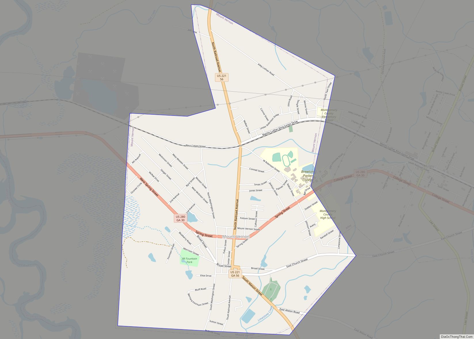
| Seat: | Mount Vernon |
| Largest city: | Mount Vernon |
| Total Area: | 245 sq mi (630 km²) |
| Land Area: | 240 sq mi (600 km²) |
| Total Population: | 8,610 |
| Population Density: | 36/sq mi (14/km²) |
| Time zone: | UTC−5 (Eastern) |
| Summer Time Zone (DST): | UTC−4 (EDT) |
| Website: | montgomerycountyga.gov |
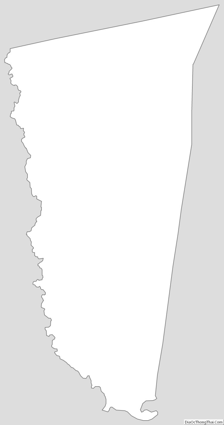
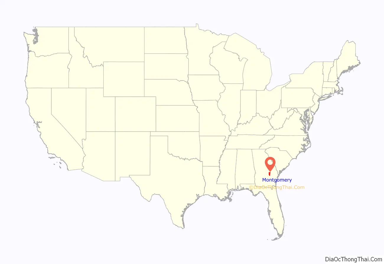
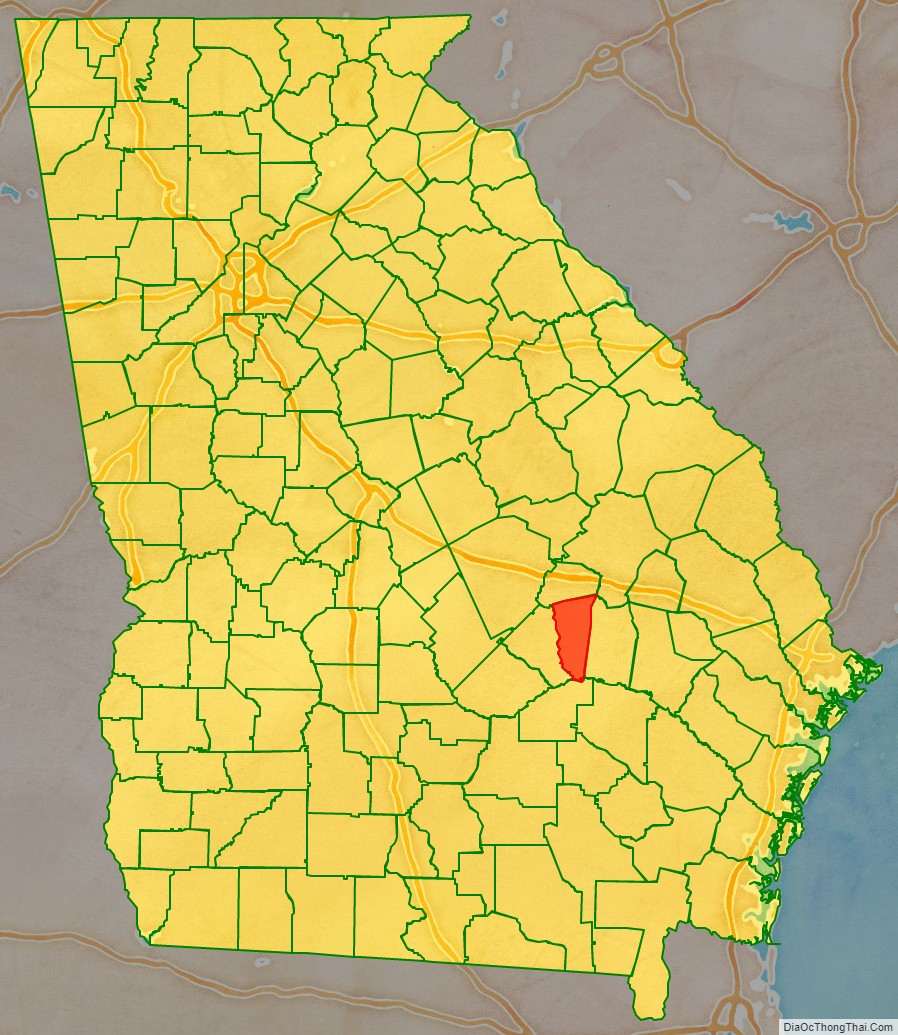
Montgomery County location map. Where is Montgomery County?
History
Montgomery County is named in honor of Richard Montgomery, an American Revolutionary War general killed in 1775 while attempting to capture Quebec City, Canada. It was created on December 19, 1793, from a southern portion of Washington County, Georgia.
Arthur Lott’s Plantation was designated the first county seat in 1797.
In 1801, Tattnall County, Georgia was formed from the southern part of Montgomery County. The dividing line between Tatnall and Montgomery ran from the mouth of Limestone Creek on the Oconee River, just below modern Mount Vernon, Georgia, to the mouth of Wolf Creek on the Canoochee River below Metter, Georgia.
The Great Revision
On December 11, 1811, the county lines between Washington County, Montgomery County, and Laurens County were adjusted by the Georgia General Assembly. The northern section of Montgomery between the Oconee River and the Ohoopee River was transferred to Laurens. On December 10, 1812, the county line of Montgomery was significantly adjusted as part of the creation of Emanuel County. Its new boundaries became from the then Laurens and Telfair county line on the Oconee River to the north prong of the Little Ocmulgee River (near present Chauncey, Dodge County, Georgia) down the Little Ocmulgee River as it meanders to its confluence with the Ocmulgee River then downstream as it meanders to the Oconee River, then North 30 degrees to Milligan’s Creek in Tatnall County, and then with it to the Montgomery County line. Pendleton Creek (in modern Treutlen and Toombs counties) was used as the border between Montgomery and Emanuel. Because of these transitions Montgomery regained part of the land it had lost in the creation of Tatnall County in 1801 (land along the lower Oconee River), but also lost land along the upper Oconee River to Laurens County.
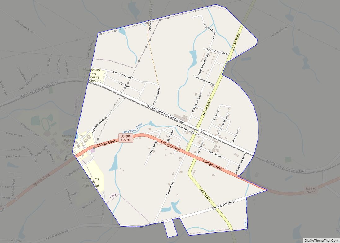
The creation of Emanuel County put the old county seat within Emanuel’s border. On December 12, the Georgia General Assembly appointed the justices of the inferior court of Montgomery county to a commission to designate a new county seat and called for county business to be held until then at the home of James Alston. In 1813, the General Assembly recognized Mount Vernon as the new county seat.
The county line between Telfair County and Montgomery was adjusted once again in 1820 by the Georgia Genera Assembly. The new line differed in the upstream portion of the Little Ocmulgee River and better defined the line and gave Montgomery a small border with Pulaski County, Georgia and Telfair County some land on the northeast side of the Little Ocmulgee River. The line was to go upstream to its fork then to Browning’s mill, a straight line to the mouth of Joiner’s Creek (Near modern McRae, Georgia) at the second fork of the Little Ocmulgee River, and then up the second prong to Pulaski County Line.
The land gained by Telfair County from Montgomery County on the northeast side of the Little Ocmulgee River was reversed by the Georgia General Assembly on December 18, 1833.
American Civil War
At the time of the 1850 United States Census, Montgomery had 1,541 whites, 613 slaves. By the 1860 census, there were 2,014 whites, 977 slaves, and 6 Free people of color. The pine barrens and soil quality outside of the river lands made the area unsuitable for slave-heavy cotton producing plantation culture. Montgomery’s status as a majority white county led the region developing different attitudes about secession from other areas of Georgia.
On January 22, 1861, Montgomery County representatives, Thomas M. McRae and Solon Homer Latimer, were among the 89 delegates who voted no to Georgia’s immediate secession from the Union at the state secession convention. In addition, McRae and Latimer were among the 6 delegates who voiced their protest by against the Ordinance of Secession in the published document.
In the interior of the county around Gum Swamp (Modern Chauncey, Georgia) near the Pulaski County, Telfair County, and Montgomery County lines a deserter gang fought against Confederate forces.
Additional counties created
On August 18, 1905, Montgomery County gained and lost some territory during the creation of Toombs County. On August 14, 1912, the parts of Montgomery County between the Little Ocmulgee River and the Oconee River became Wheeler County. On August 21, 1917, Montgomery lost additional territory during the creation of Treutlen County, Georgia.
Modern
More recently, the county was noted for its practice of organizing segregated proms, a practice that had continued since integration of its schools in the 1970s. Following publicity about this practice, Montgomery County students took the initiative to integrate the prom in 2010.
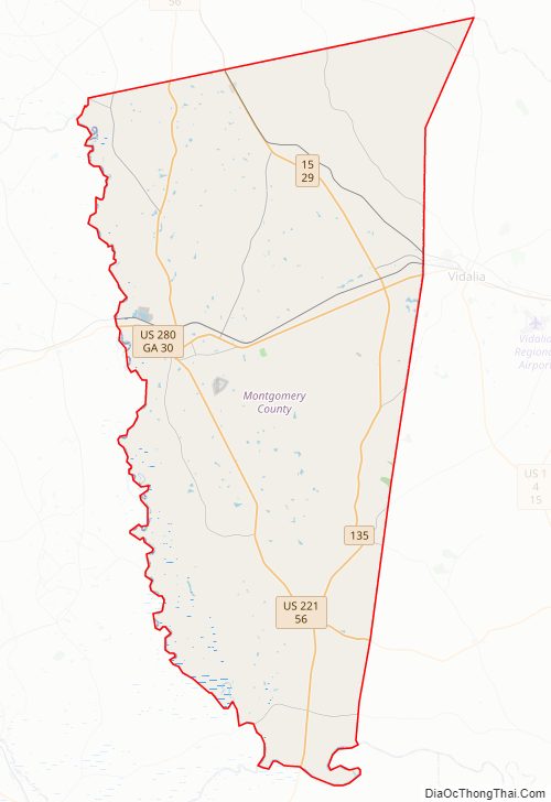
Montgomery County Road Map
Geography
According to the U.S. Census Bureau, the county has a total area of 245 square miles (630 km), of which 240 square miles (620 km) is land and 5.2 square miles (13 km) (2.1%) is water.
The southeastern quarter of Montgomery County is located in the Altamaha River sub-basin of the larger river basin by the same name. The western half of the county, from Tarrytown south, is located in the Lower Oconee River sub-basin of the Altamaha River basin. The northeastern quarter of Montgomery County, northeast of a line from Tarrytown to Higgston, is located in the Ohoopee River sub-basin of the same Altamaha River basin.
Major highways
- U.S. Route 221
- U.S. Route 280
- State Route 15
- State Route 29
- State Route 30
- State Route 56
- State Route 130
- State Route 135
- State Route 199
- State Route 292
- State Route 298
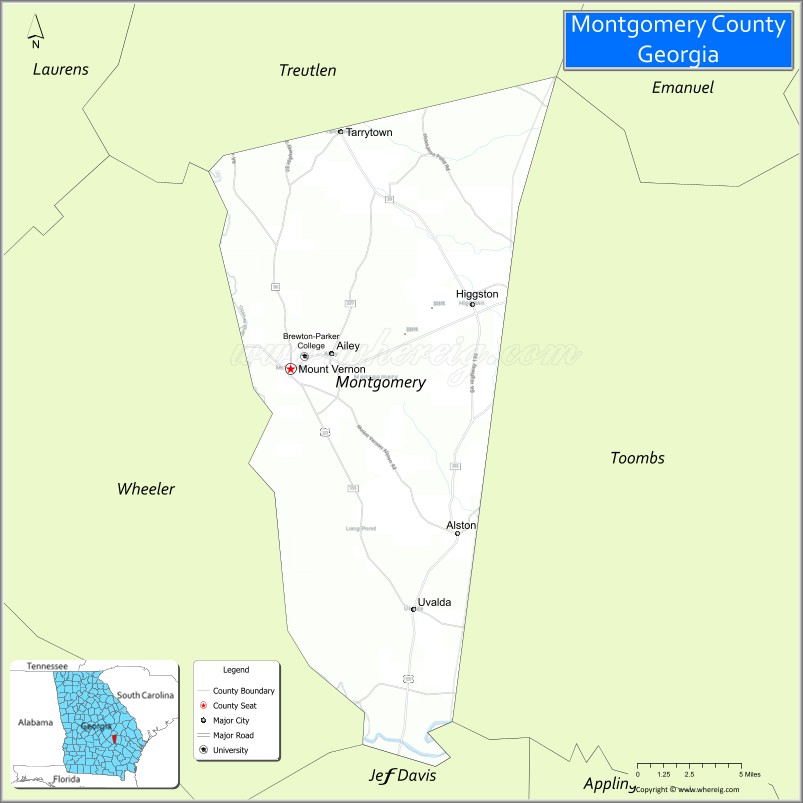
Adjacent counties
- Treutlen County (north)
- Toombs County (east)
- Jeff Davis County (south)
- Wheeler County (west)
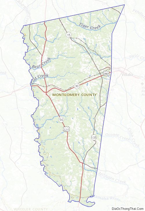
Montgomery County Topographic Map
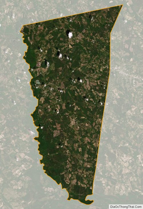
Montgomery County Satellite Map
Montgomery County Outline Map