Johnson County is a county located in the U.S. state of Georgia. As of the 2020 census, the population was 9,189. The county seat is Wrightsville. Johnson County is part of the Dublin, Georgia, Micropolitan Statistical Area.
| Name: | Johnson County |
|---|---|
| FIPS code: | 13-167 |
| State: | Georgia |
| Founded: | 1858 |
| Named for: | Herschel Vespasian Johnson |
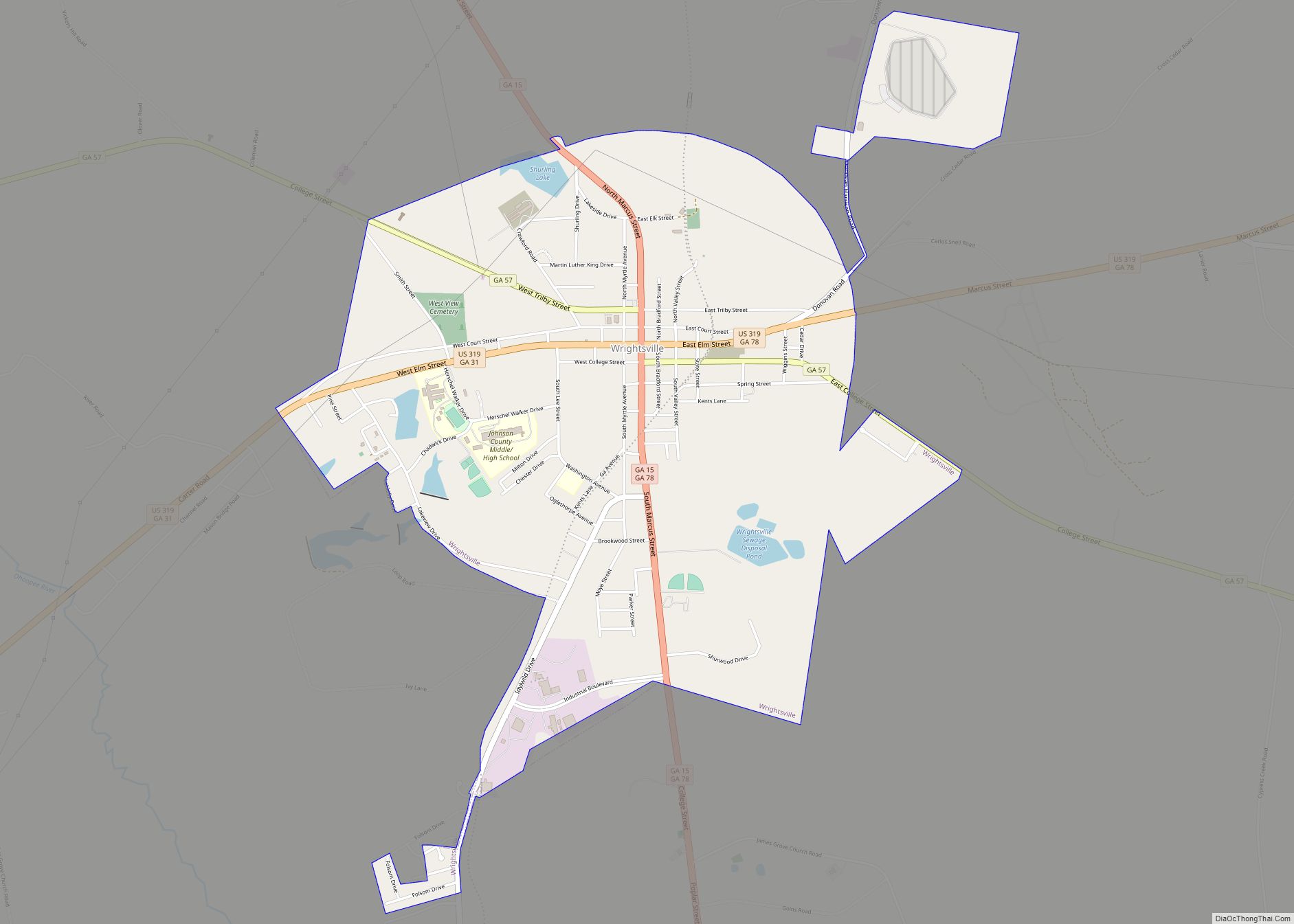
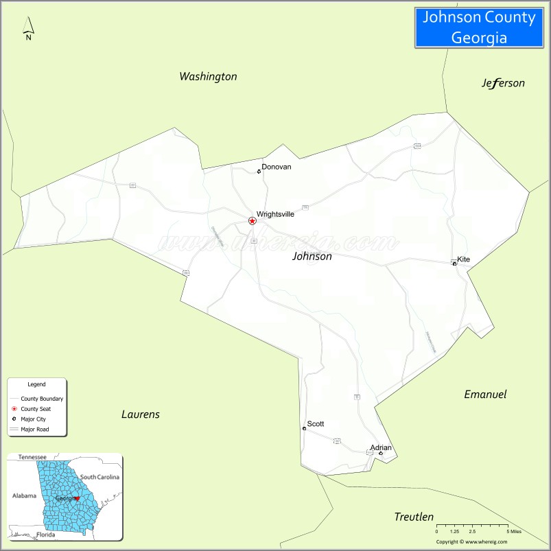
| Seat: | Wrightsville |
| Largest city: | Wrightsville |
| Total Area: | 307 sq mi (800 km²) |
| Land Area: | 303 sq mi (780 km²) |
| Total Population: | 9,189 |
| Population Density: | 30/sq mi (10/km²) |
| Time zone: | UTC−5 (Eastern) |
| Summer Time Zone (DST): | UTC−4 (EDT) |
| Website: | www.johnsonco.org |
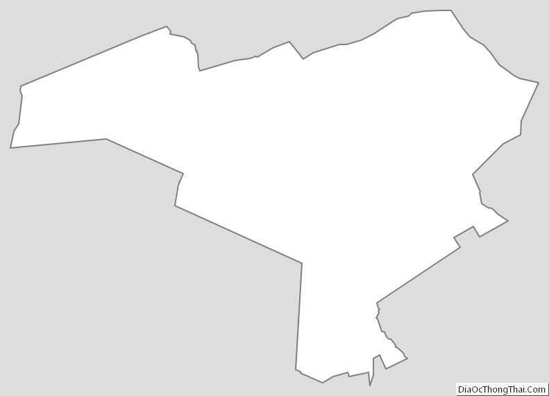
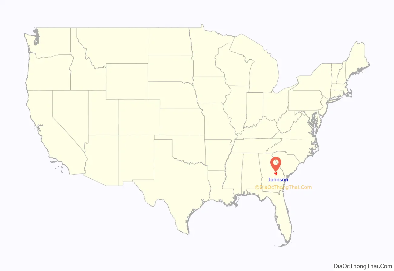
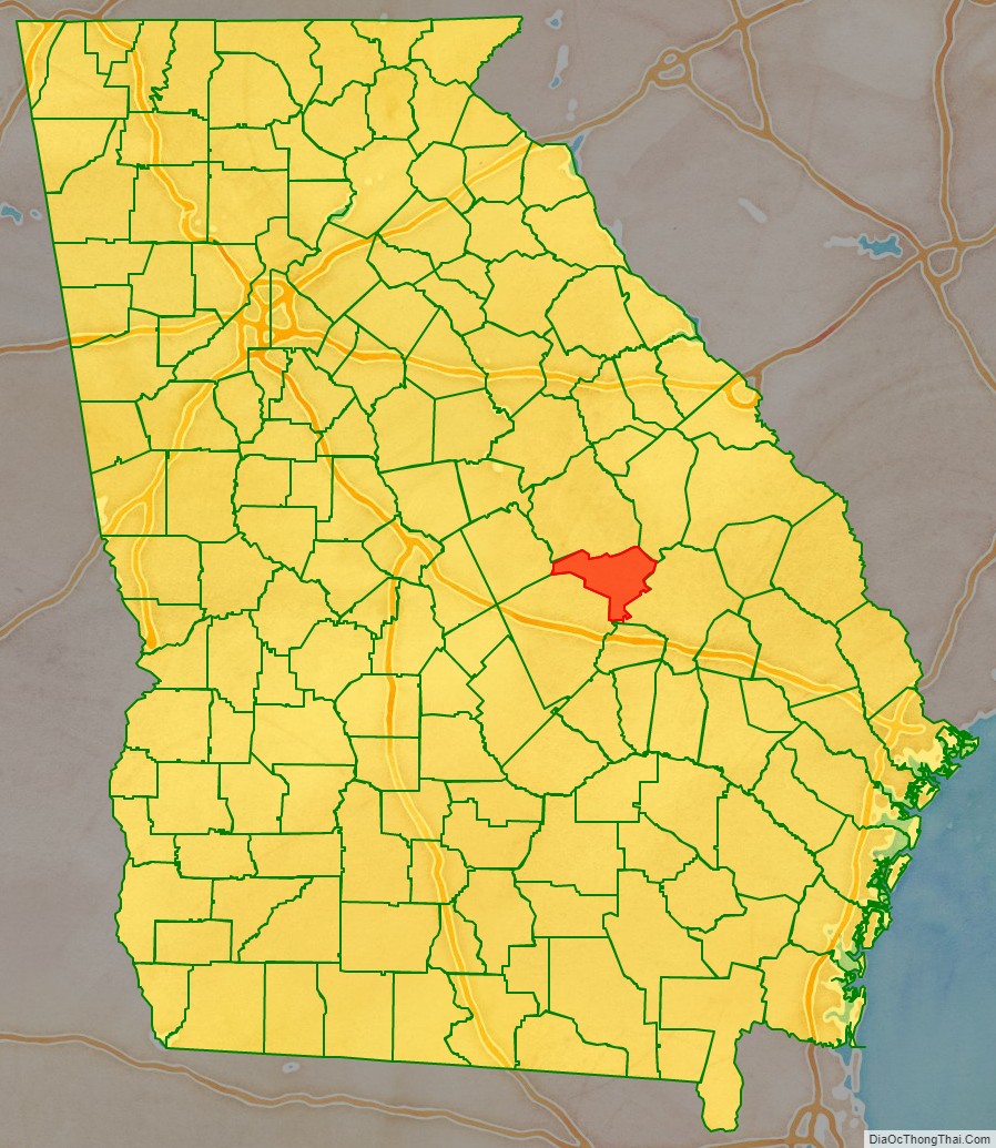
Johnson County location map. Where is Johnson County?
History
Johnson county was created by the Georgia legislature December 11, 1858, from parts of Emanuel, Laurens, and Washington counties. Johnson County was named for Georgia governor, senator, and U.S. vice-presidential candidate Herschel Vespasian Johnson.
In 1919, a deputy driving Jim Waters, a black prisoner accused of rape, out of the county was stopped by a group of 150 men at a bridge over the Ohoopee River. The men tied Waters to a tree and shot him numerous times. The case was closed without any investigation.
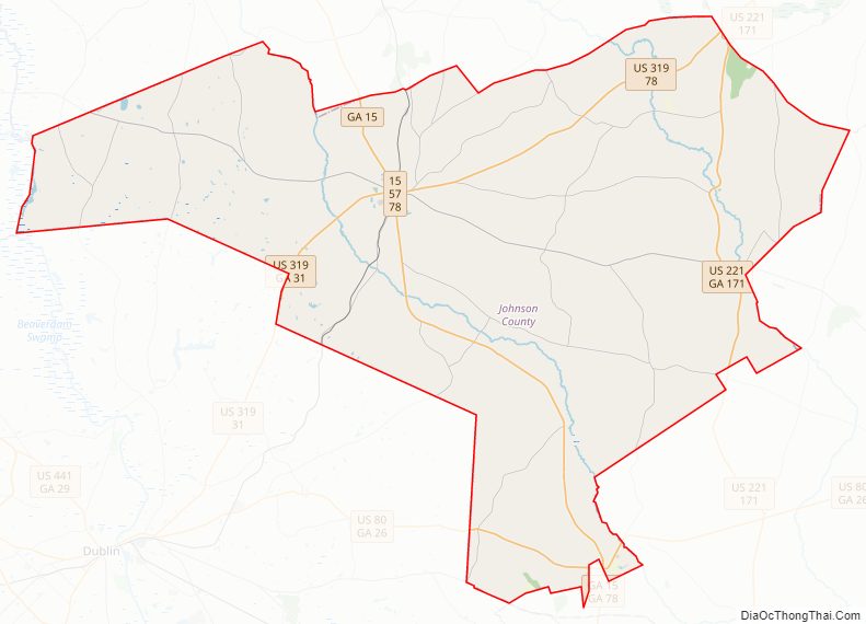
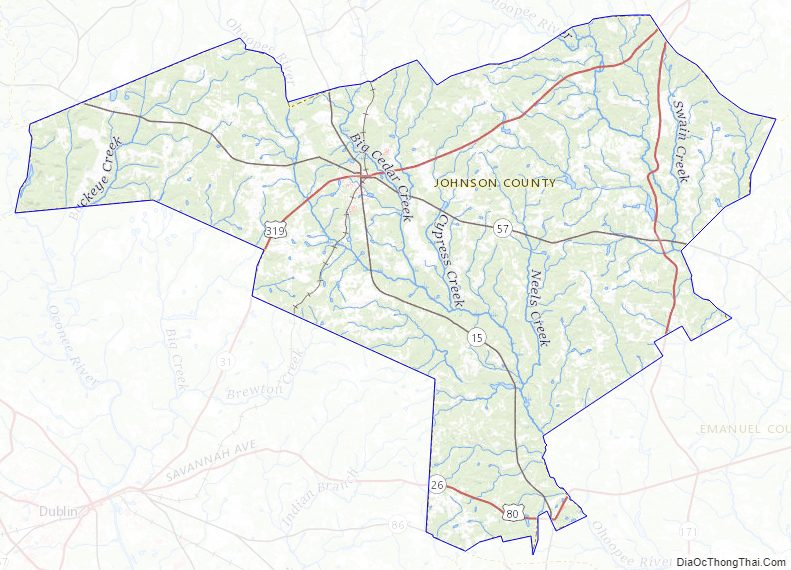
Johnson County Road Map
Geography
According to the U.S. Census Bureau, the county has a total area of 307 square miles (800 km), of which 303 square miles (780 km) is land and 3.6 square miles (9.3 km) (1.2%) is water.
The vast majority of Johnson County is located in the Ohoopee River sub-basin of the Altamaha River basin. Tiny portions of the northeastern borders of the county are located in the Upper Ogeechee River sub-basin of the Ogeechee River basin, while the western corner of Johnson County is located in the Lower Oconee River sub-basin of the Altamaha River basin.
Major highways
- U.S. Route 80
- U.S. Route 221
- U.S. Route 319
- State Route 15
- State Route 26
- State Route 31
- State Route 57
- State Route 78
- State Route 86
- State Route 171
Adjacent counties
- Washington County – north
- Jefferson County – northeast
- Emanuel County – east
- Treutlen County – south
- Laurens County – southwest
- Wilkinson County – west
Johnson County Topographic Map
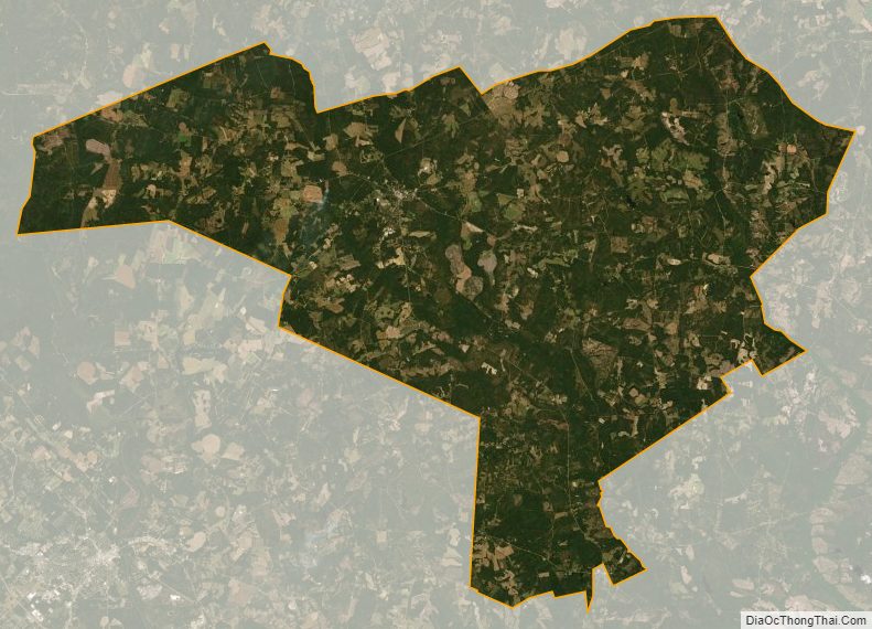
Johnson County Satellite Map
Johnson County Outline Map