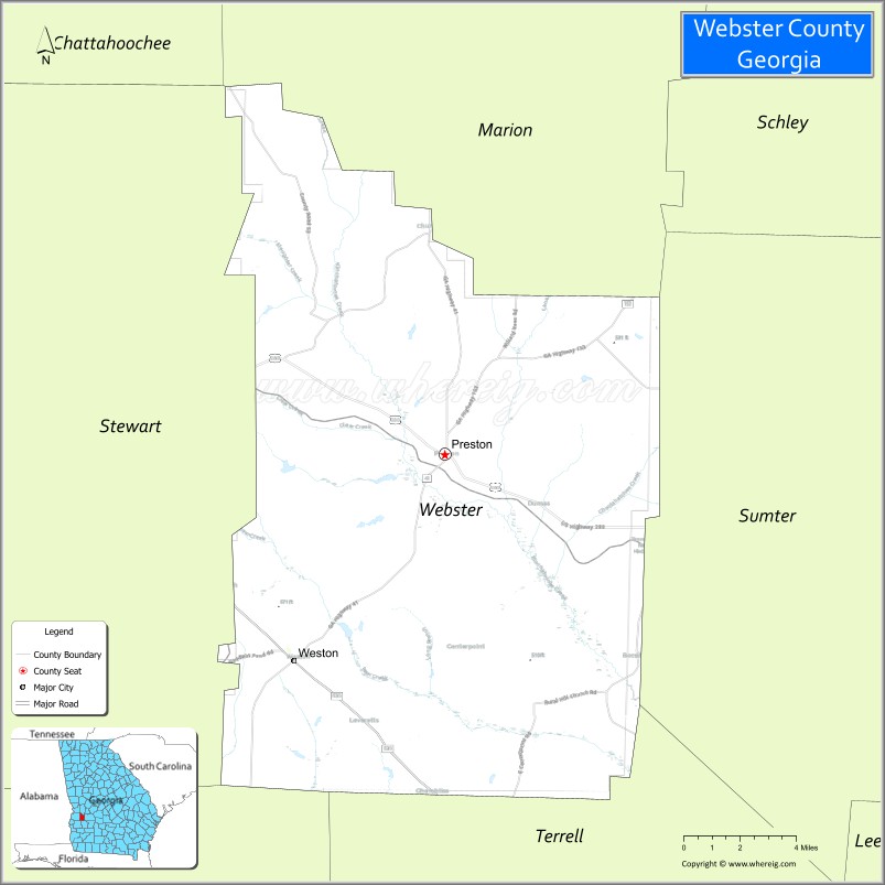
Webster County is a county located in the west central portion of the U.S. state of Georgia. As of the 2020 Census reflected a population of 2,348, making it the third-least populous county in Georgia. The county seat is Preston.
| Name: | Webster County |
|---|---|
| FIPS code: | 13-307 |
| State: | Georgia |
| Founded: | 1853 |
| Named for: | Daniel Webster |
| Seat: | Preston |
| Total Area: | 210 sq mi (500 km²) |
| Land Area: | 209 sq mi (540 km²) |
| Total Population: | 2,348 |
| Population Density: | 11/sq mi (4/km²) |
| Time zone: | UTC−5 (Eastern) |
| Summer Time Zone (DST): | UTC−4 (EDT) |
| Website: | www.webstercountyga.org |
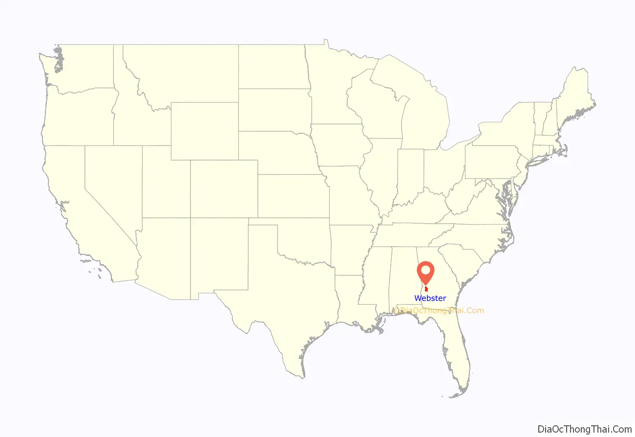
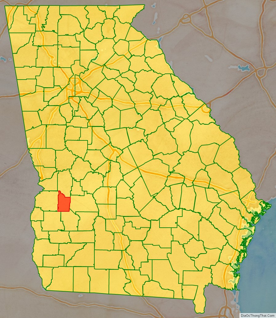
Webster County location map. Where is Webster County?
History
Webster County was created by an act of the Georgia General Assembly on December 16, 1853, as Kinchafoonee County. A subsequent legislative act on February 21, 1856, changed the name to Webster. The land for the county came from eastern portions of Stewart County.
The county is named for Daniel Webster, U.S. representative of New Hampshire and U.S. representative and U.S. senator of Massachusetts. Webster County’s original name of Kinchafoonee came from the Kinchafoonee Creek which runs through the county.
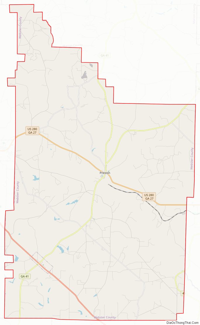
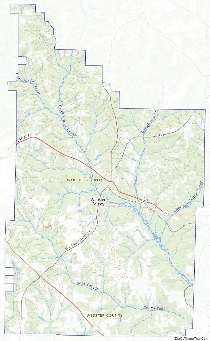
Webster County Road Map
Geography
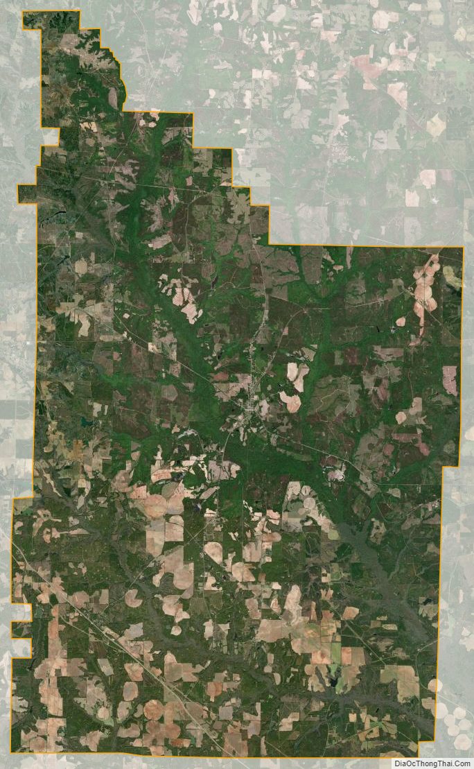
According to the U.S. Census Bureau, the county has a total area of 210 square miles (540 km), of which 209 square miles (540 km) is land and 1.1 square miles (2.8 km) (0.5%) is water.
The majority of Webster County, bordered to the southwest by State Route 520, is located in the Kinchafoonee-Muckalee sub-basin of the ACF River Basin (Apalachicola-Chattahoochee-Flint River Basin). The southwestern corner of the county is located in the Ichawaynochaway Creek sub-basin of the same ACF River Basin. A tiny edge of the southwestern border, just south of State Route 520, is located in the Middle Chattahoochee River-Walter F. George Lake sub-basin of the same ACF River Basin.
Major highways
- U.S. Route 280
- State Route 27
- State Route 41
- State Route 45
- State Route 153
- State Route 520
Adjacent counties
- Marion County – north
- Sumter County – east
- Terrell County – south
- Randolph County – southwest
- Stewart County – west
Webster County Topographic Map
Webster County Satellite Map
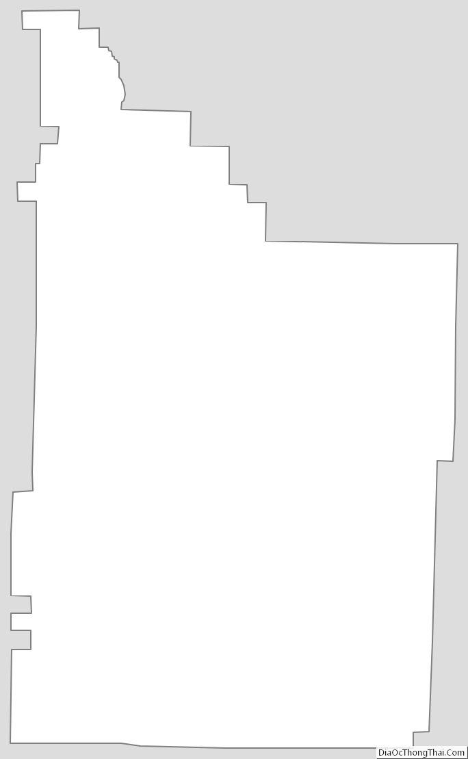
Webster County Outline Map