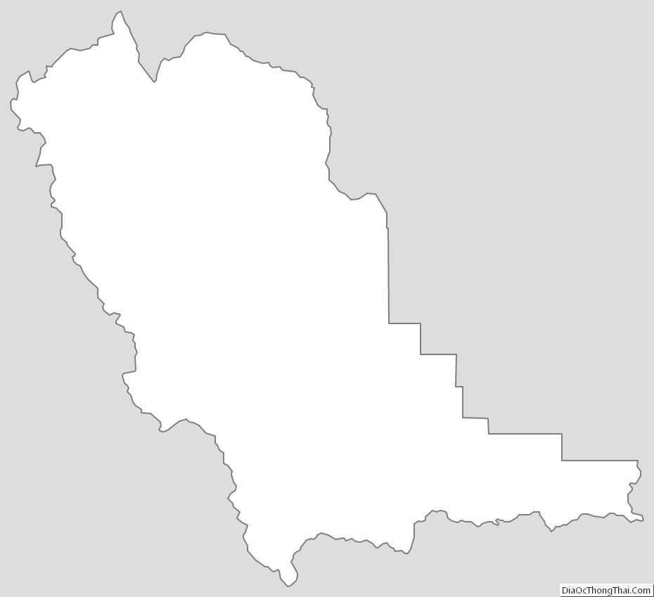
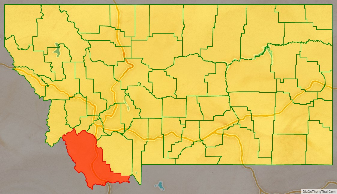
Beaverhead County is the largest county by area in the U.S. state of Montana. As of the 2020 census, the population was 9,371. Its county seat is Dillon. The county was founded in 1865.
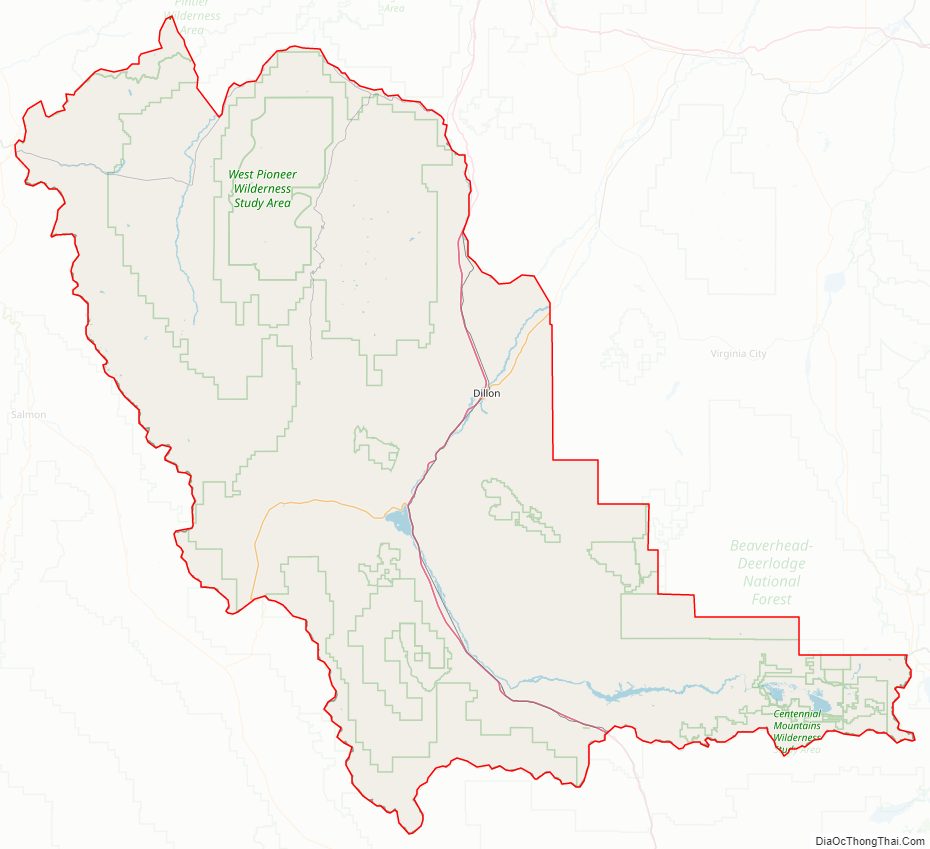
Much of the perimeter of the county is the Continental Divide, including its entire border with the state of Idaho. The divide heads east into Montana at the county border with Ravalli County, between Lost Trail Pass and Chief Joseph Pass.
| Name: | Beaverhead County |
|---|---|
| FIPS code: | 30-001 |
| State: | Montana |
| Founded: | 1865 |
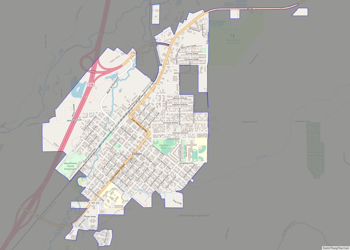
| Seat: | Dillon |
| Largest city: | Dillon |
| Total Area: | 5,572 sq mi (14,430 km²) |
| Land Area: | 5,542 sq mi (14,350 km²) |
| Total Population: | 9,371 |
| Population Density: | 1.7/sq mi (0.65/km²) |
| Time zone: | UTC−7 (Mountain) |
| Summer Time Zone (DST): | UTC−6 (MDT) |
| Website: | www.beaverheadcounty.org |
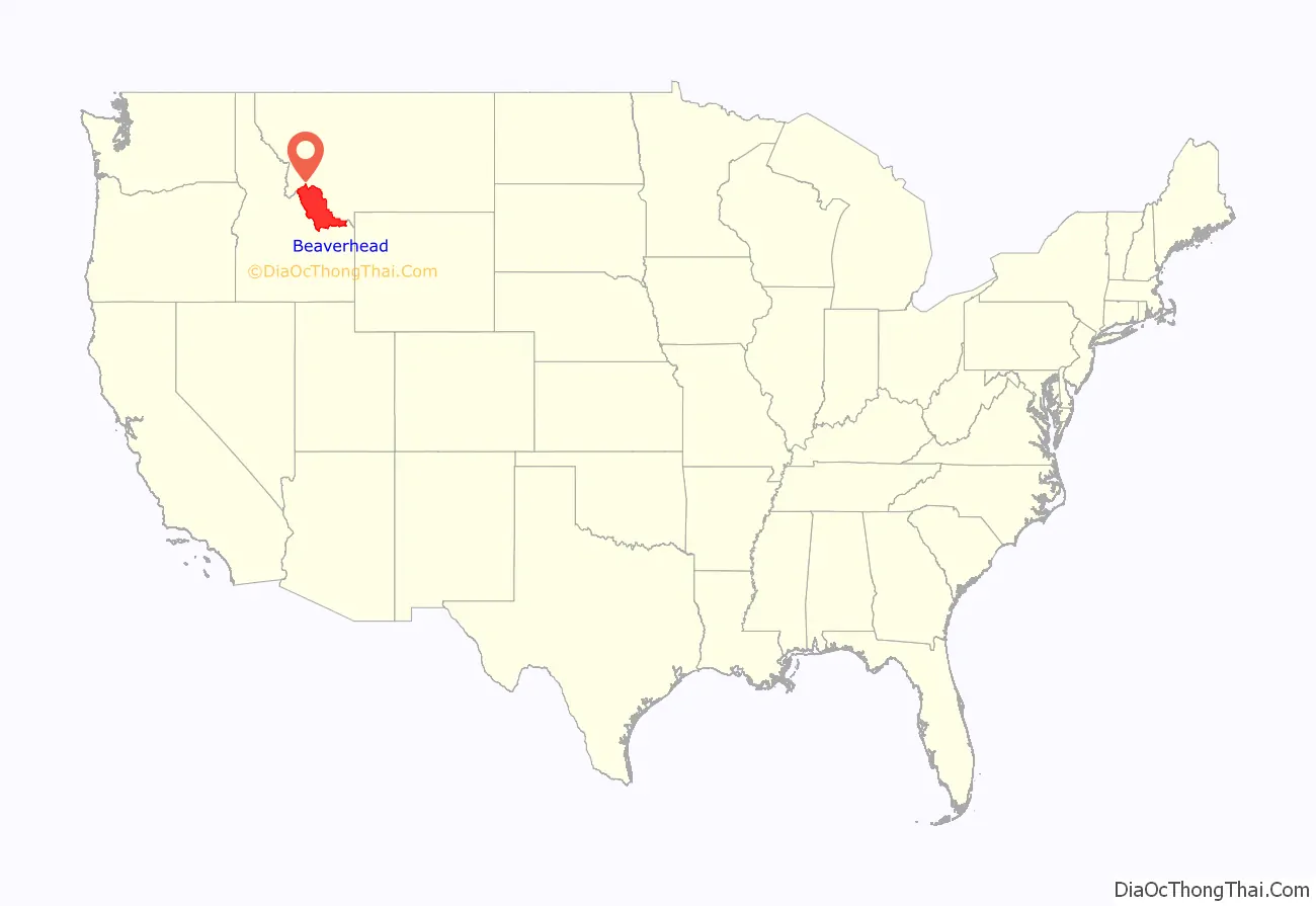
Beaverhead County location map. Where is Beaverhead County?
History
The county name is derived from a rock formation, which the Shoshone described as being shaped like a beaver’s head.
The original county seat was the gold-mining town of Bannack. In 1881 it was moved to Dillon.
Beaverhead County Road Map
Geography
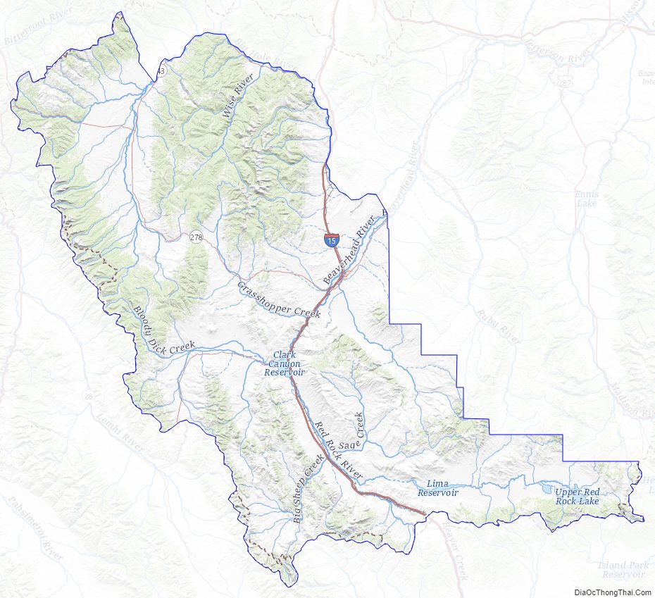
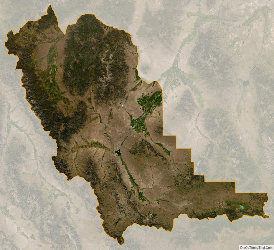
According to the United States Census Bureau, the county has a total area of 5,572 square miles (14,430 km), of which 5,542 square miles (14,350 km) is land and 30 square miles (78 km) (0.3%) is water. It is the largest county in Montana by area. Beaverhead impact structure is in the area. The Big Hole River (formerly called Wisdom River) runs through the county.
Adjacent counties
- Ravalli County – northwest
- Deer Lodge County – north
- Silver Bow County – north
- Madison County – east
- Fremont County, Idaho – southeast
- Clark County, Idaho – south
- Lemhi County, Idaho – west
Major highways
- I-15 / US 91
- I-15 BL
- MT 41
- MT 43
- S-278
- S-324
National protected areas
- Beaverhead National Forest (part)
- Big Hole National Battlefield
- Nez Perce National Historical Park (part)
- Red Rock Lakes National Wildlife Refuge
Beaverhead County Topographic Map
Beaverhead County Satellite Map
Beaverhead County Outline Map