Bibb County is located in the U.S. state of Georgia. As of the 2020 census, its population was 157,346. Bibb County is geographically located in the Central Georgia (Middle Georgia) region, and is the largest county in the Macon metropolitan area (metropolitan statistical area).
Bibb County has a consolidated city-county government following a merger of the county with its county seat and largest city, Macon, in 2014. They were later joined in this consolidated government in 2015 by the county’s only other municipality, Payne City.
| Name: | Bibb County |
|---|---|
| FIPS code: | 13-021 |
| State: | Georgia |
| Founded: | 1822 |
| Named for: | William Wyatt Bibb |
| Seat: | Macon |
| Largest city: | Macon |
| Total Area: | 255 sq mi (660 km²) |
| Land Area: | 250 sq mi (600 km²) |
| Total Population: | 157,346 |
| Population Density: | 629/sq mi (243/km²) |
| Time zone: | UTC−5 (Eastern) |
| Summer Time Zone (DST): | UTC−4 (EDT) |
| Website: | www.co.bibb.ga.us |
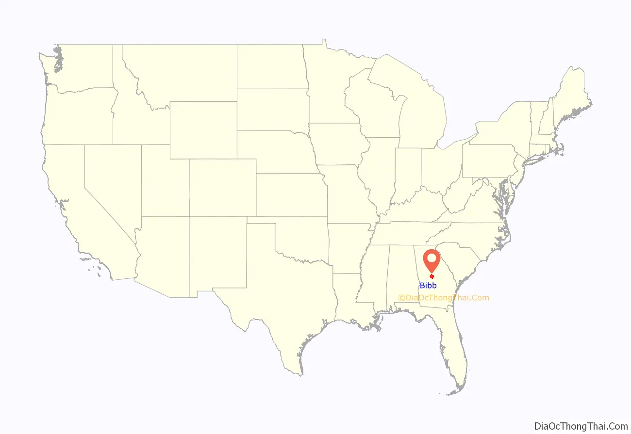
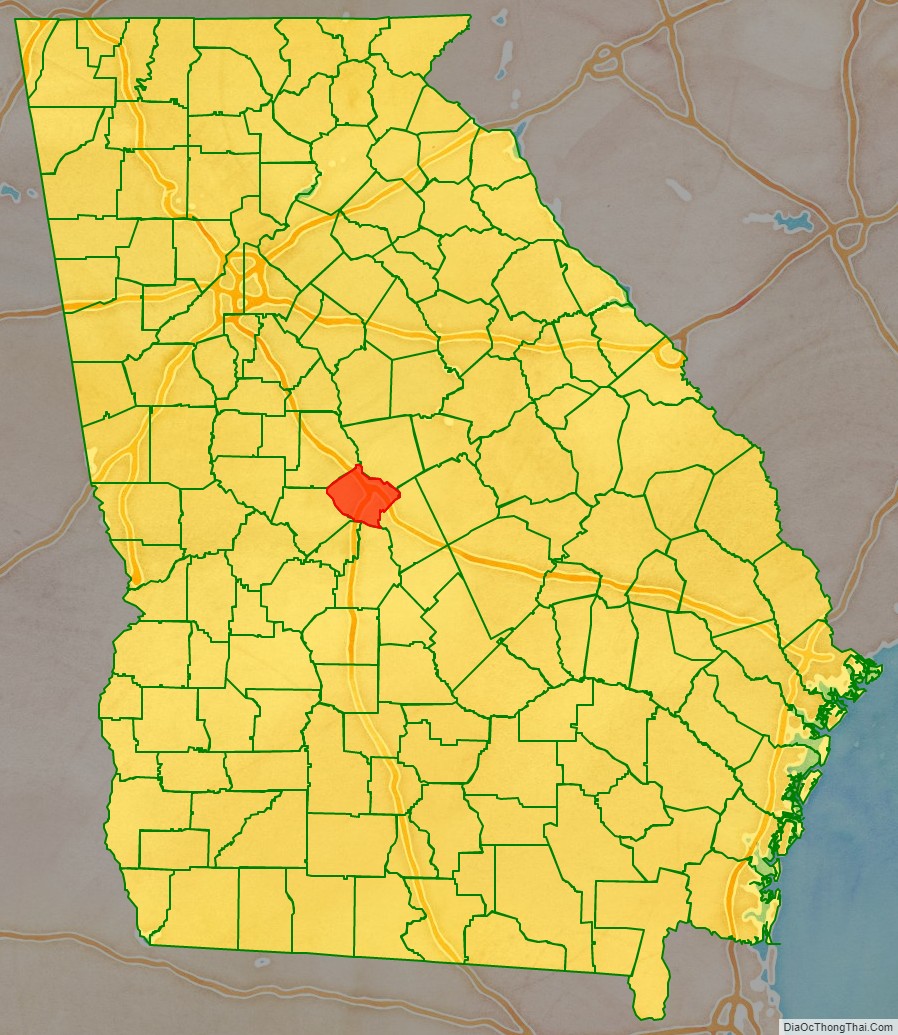
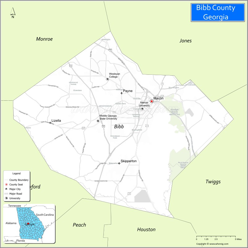
Bibb County location map. Where is Bibb County?
History
This area was inhabited for thousands of years by successive indigenous peoples. The Ocmulgee National Monument is a national park and historic site incorporating two major mound and town complexes: Lamar Mounds and Village Site and Ocmulgee Mound Site, both located along the Ocmulgee River. They were built by indigenous peoples during the Mississippian culture era. The detailed chronicles of the Hernando de Soto expedition recorded visiting Ichisi, a major village, in 1539. Historians and archeologists have theorized it may have been located at the Lamar Mounds complex.
For centuries, the historic Native Americans Muscogee tribe, descendants of this culture, was the predominant one in a large area of Georgia, including that later organized as Bibb County. During the colonial period, Anglo colonists carried on a brisk trade with them and allied with them in certain wars in the Southeast. With European-American land hunger to extend cotton cultivation in the Georgia uplands, the Muscogee and other four Civilized Tribes of the Southeast were forcibly relocated to Indian Territory west of the Mississippi River, in the Indian Removal of the 1830s, during the administration of President Andrew Jackson. The Indian tribes affected refer to their journey is as the “Trail of Tears”, since many died during the march west.
In the late 18th century, the cotton gin was invented, making profitable the processing of short-staple cotton. This could be grown across the uplands of the South, in contrast to the long-staple cotton of the Low Country. Bibb is considered one of the counties of the “Black Belt”, which originally referred to the fertile dark soil in these uplands. The area was developed by European-American planters, who used enslaved African Americans as workers to clear land and develop large cotton plantations during the antebellum years. Cotton generated high profits, since it was in demand in the textile mills of the northern states and England. By the 1860 census, shortly before the American Civil War, more than a million enslaved African Americans lived in Georgia, and they constituted a majority of the population in much of the Black Belt.
Bibb County was created by act of the Georgia Legislature on December 9, 1822, with Macon to be incorporated as a town/city in December 1823; designated the county seat. It was carved from the earlier territories of the counties of Jones, Monroe, Houston, and Twiggs Counties. The county seat has not been changed since, and no other subsequent county in the state has ever been created (“erected”) out of land from Bibb County.
The county was named for Dr. William Wyatt Bibb, a physician from Elbert County, who served in the U.S. House of Representatives and United States Senate from Georgia. After he moved to the new Alabama Territory, he was later elected as the first governor of the new State of Alabama upon its admission.
Civil War to present
During the Civil War, an estimated 10% of the white males in the county lost their lives while serving in the Confederate States Army. The war gained the emancipation of slaves across the South. Georgia had been a battleground, and Atlanta and many other areas were left in ruins.
Well into the 20th century, the county depended on cotton and other agriculture as its economic base. It was subject to related vagaries of weather, financial markets, and the devastation of the invasive boll weevil in the early 20th century, which destroyed cotton crops across the South.
After the Civil War and during the 20th century, the county seat of Macon continued to serve as the county’s principal population center, site of the most significant landmarks, and the location of major historical events.
On July 31, 2012, voters in the City of Macon (57.8% approval) and Bibb County (56.7% approval) passed a referendum to merge the governments of the city and the county, based on the authorization of House Bill 1171 passed by the Georgia General Assembly earlier in the year. Four previous consolidation attempts (in 1933, 1960, 1972, and 1976) had failed. The consolidation took effect on January 1, 2014, along with the deannexation from the city of a small portion of land in Jones County.
In addition to Macon, Bibb County contained one other municipality, Payne City (or Payne), an enclave of around 200 people that was surrounded entirely by the preconsolidation City of Macon. In the 2012 referendum, Payne City voters rejected consolidation by a vote of 9 to 7, so it was not merged into the consolidated government. In early 2015, at the request of the small city’s government, the Georgia General Assembly passed a bill dissolving Payne City, merging it with the rest of Macon-Bibb County.
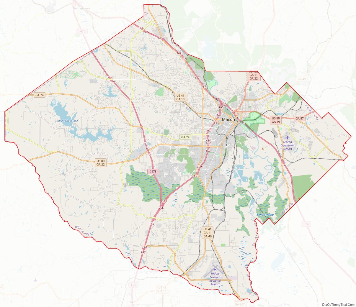
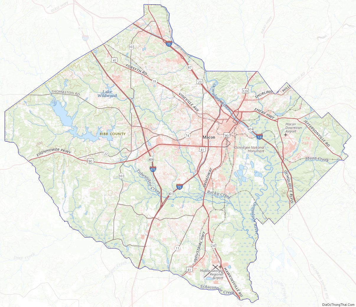
Bibb County Road Map
Geography
According to the U.S. Census Bureau, the county has a total area of 255 square miles (660 km), of which 250 square miles (650 km) is land and 5.6 square miles (15 km) (2.2%) is water. The entirety of Bibb County is located in the Upper Ocmulgee River sub-basin of the Altamaha River basin.
Adjacent counties
- Jones County – northeast
- Twiggs County – east
- Houston County – south
- Peach County – south-southwest
- Crawford County – southwest
- Monroe County – northwest
National protected areas
- Bond Swamp National Wildlife Refuge (part)
- Ocmulgee National Monument
Bibb County Topographic Map
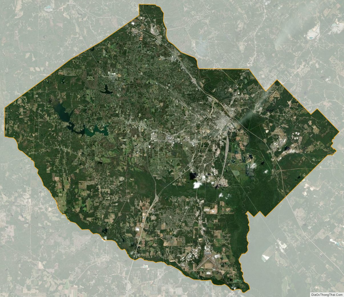
Bibb County Satellite Map
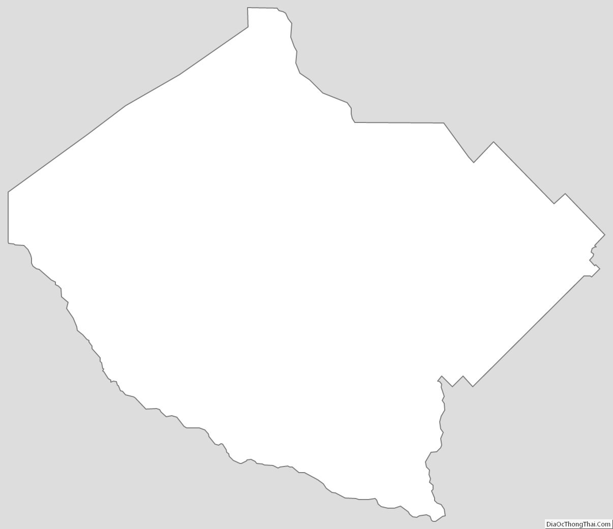
Bibb County Outline Map