Bowman County is a county in the U.S. state of North Dakota. As of the 2020 census, the population was 2,993. Its county seat is Bowman.
| Name: | Bowman County |
|---|---|
| FIPS code: | 38-011 |
| State: | North Dakota |
| Founded: | 1883 |
| Named for: | Edward M. Bowman |
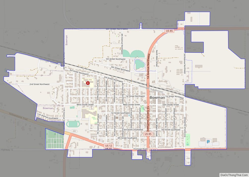
| Seat: | Bowman |
| Largest city: | Bowman |
| Total Area: | 1,167 sq mi (3,020 km²) |
| Land Area: | 1,162 sq mi (3,010 km²) |
| Total Population: | 2,993 |
| Population Density: | 2.6/sq mi (0.99/km²) |
| Time zone: | UTC−7 (Mountain) |
| Summer Time Zone (DST): | UTC−6 (MDT) |
| Website: | www.bowmannd.com |
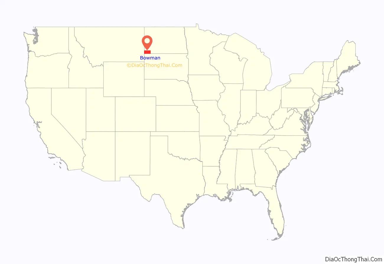
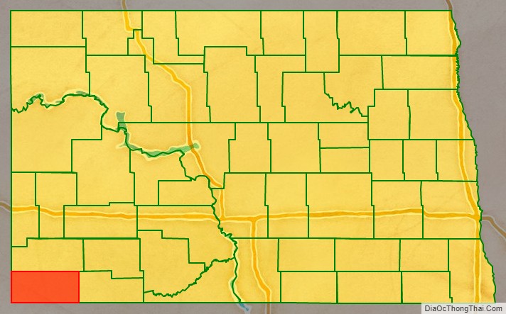
Bowman County location map. Where is Bowman County?
History
The legislature of the Dakota Territory designated Bowman (named for Edward M. Bowman, a member of the territorial House of Representatives during the 1883 session) as a separate county on March 8, 1883, although it was not organized at that time. In 1885, its boundaries were altered to cede territory to Billings and Villard Counties (Villard itself was eliminated in 1887). In 1891, and again in 1896, the South Dakota legislature eliminated the not-yet-organized Bowman County, due to scant settlement in the area, but these actions either were not put into effect (the 1891 vote) or were overturned in judicial appeal (the 1896 vote).
A decision by the North Dakota supreme court on May 24, 1901, resurrected Bowman County. That decision also caused the county’s area to slightly increase; its former boundary descriptions were replaced by descriptions based on the boundary lines of adjacent jurisdictions, which added a strip along its south border and another strip along its east border.
Since the scantily-populated county was still unorganized, in March 1903 the legislature attached the area to Stark County for judicial purposes. This state of affairs continued until November 1904, when the legislature again dissolved the county and assigned its territory to Billings County. However, on June 10, 1907, ND Governor John Burke issued a proclamation which re-created Bowman County. This proclamation did not attach the area to any other area for judicial purposes, so on July 5, 1907, the new county’s organization was set up, and Bowman was confirmed as the county seat.
The US Navy ship USS Bowman County (LST-391), a tank landing ship in World War II, was named for this county.
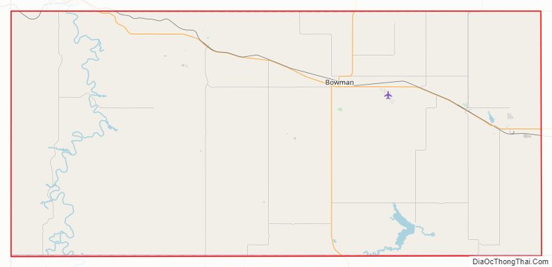
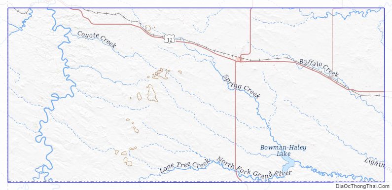
Bowman County Road Map
Geography
Bowman County lies at the southwestern corner of North Dakota; its south boundary line abuts the north boundary line of the state of South Dakota, and its west boundary line abuts the east boundary line of the state of Montana. The Little Missouri River flows northward through the west part of the county; the North Fork of the Grand River flows easterly through the lower part of the county, filling Bowman-Haley Lake in the process. Spring Creek flows south-southeasterly through the central part of the county, discharging into Bowman-Haley Lake.
Bowman County’s terrain consists of semi-arid high hills running north–south through the west-central part of the county, with lower hills in the remaining territory. The area is partially used for agriculture. The western part slopes to the north and west; the eastern part slopes to the east and south. Its highest point is on the south boundary line, toward its southwestern corner, at 3,228′ (984m) ASL. The county has a total area of 1,167 square miles (3,020 km), of which 1,162 square miles (3,010 km) is land and 5.2 square miles (13 km) (0.4%) is water.
Major highways
- U.S. Highway 12
- U.S. Highway 85
- North Dakota Highway 67
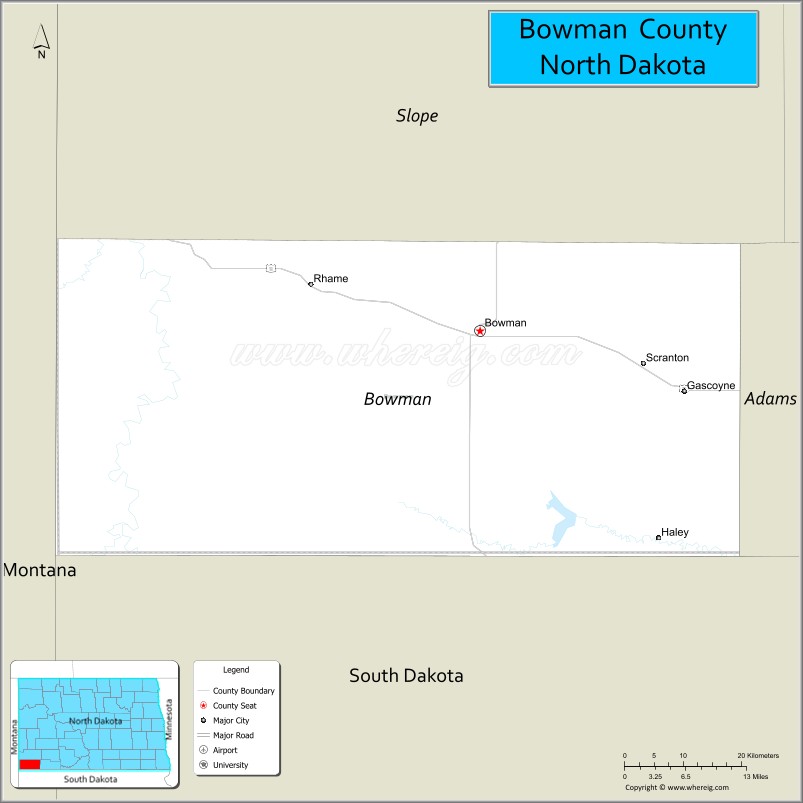
Adjacent counties
- Slope County – north
- Adams County – east
- Harding County, South Dakota – south
- Fallon County, Montana – west
Lakes
- Bowman-Haley Lake
- Gascoyne Lake
Bowman County Topographic Map
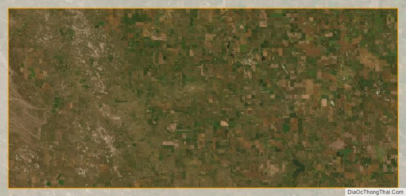
Bowman County Satellite Map
Bowman County Outline Map