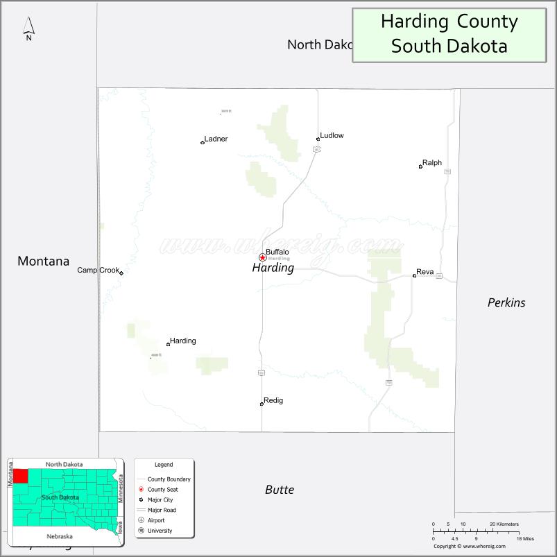
Harding County is a county in the U.S. state of South Dakota. As of the 2020 census, the population was 1,311, making it the third-least populous county in South Dakota. Its county seat is Buffalo.
Harding County was established as a county in the Dakota Territory on 5 March 1881, but was not organized at that time. Its name recognized J. A. Harding, who had been Speaker of the House of Dakota Territory. Its boundaries were altered in 1883, in 1889, and in 1894. On 8 November 1898, Harding County was dissolved and its territory assigned to Butte County. However, on 3 November 1908, it was again created (with altered boundaries) from Butte County’s area, and on 17 February 1909 its governing organization was completed.
Custer National Forest has its South Dakota portion in Harding County, and South Dakota State University operates the Antelope Range and Livestock Research Station about 14 miles (23 km) east of Buffalo.
| Name: | Harding County |
|---|---|
| FIPS code: | 46-063 |
| State: | South Dakota |
| Founded: | 1909 |
| Named for: | J. A. Harding |
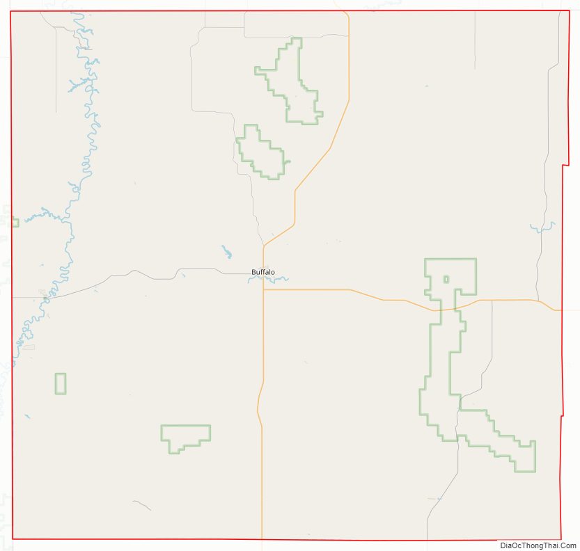
| Seat: | Buffalo |
| Largest town: | Buffalo |
| Total Area: | 2,678 sq mi (6,940 km²) |
| Land Area: | 2,671 sq mi (6,920 km²) |
| Total Population: | 1,311 |
| Population Density: | 0.49/sq mi (0.19/km²) |
| Time zone: | UTC−7 (Mountain) |
| Summer Time Zone (DST): | UTC−6 (MDT) |
| Website: | www.hardingcountysd.com |
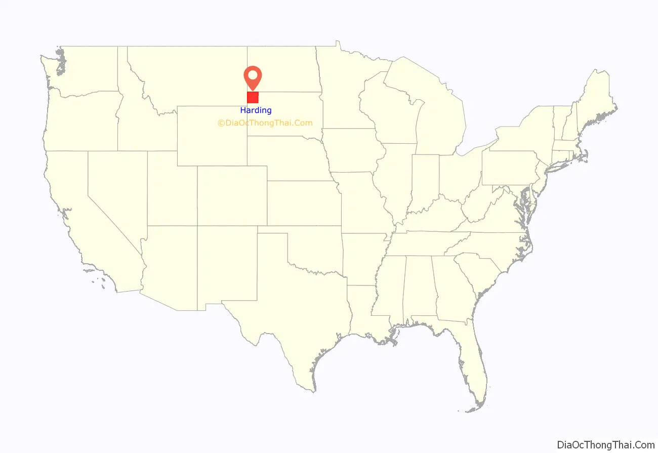
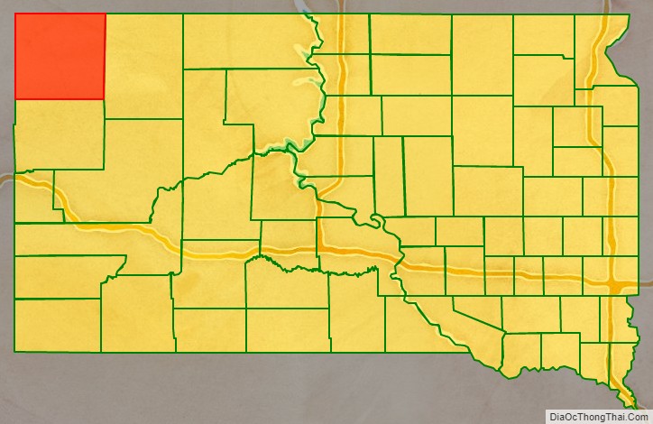
Harding County location map. Where is Harding County?
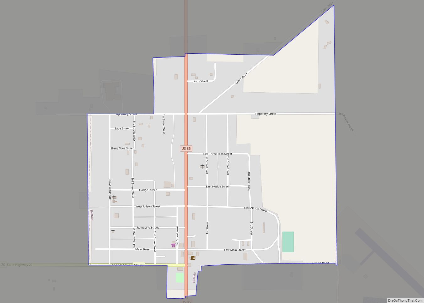
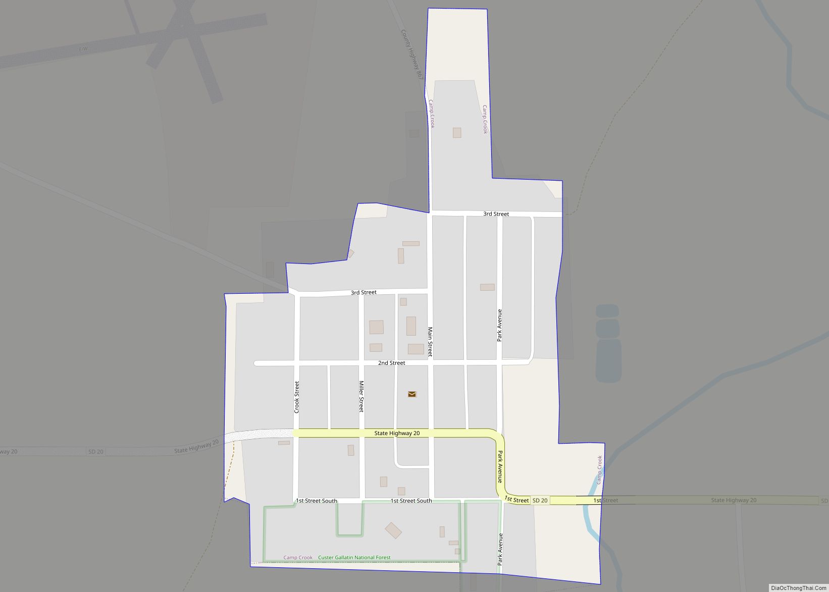
Harding County Road Map
Geography
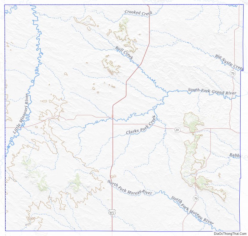
Harding County lies at the northwest corner of South Dakota. Its western boundary line abuts the east boundary line of the state of Montana, and its north boundary line abuts the south boundary line of the state of North Dakota. Its terrain consists of high hills, generally sloping to the east. Its highest point is a ridge that runs northwest to southeast near the county’s southwest corner, at 3,366′ (1026m) ASL.
Harding County has a total area of 2,678 square miles (6,940 km), of which 2,671 square miles (6,920 km) is land and 6.5 square miles (17 km) (0.2%) is water. It is the fourth-largest county in South Dakota by area.
Major highways
- U.S. Highway 85
- South Dakota Highway 20
- South Dakota Highway 79
Adjacent counties
- Bowman County, North Dakota – north
- Adams County, North Dakota – northeast
- Perkins County – east
- Butte County – south
- Carter County, Montana – west
- Fallon County, Montana – northwest
Protected areas
- Custer National Forest (partial)
- Gardner Lake State Game Production Area
- Mallula State Game Production Area
- State Experiment Farm and Antelope Reserve
Lakes
- Lake Gardner – it is 203 acres in surface area and is approximately 14 feet deep at its deepest point. Channel Catfish, Largemouth Bass, Walleye, Yellow Bullhead, and Yellow Perch inhabit the lake.
- Leger Dam
- Rabbit Creek Dam – this lake has a surface area of 17 acres and is inhabited by a variety of warm water fish including Largemouth Bass.
- Vessey Dam – Eight acres in size, this lake is stocked with rainbow trout.
Harding County Topographic Map
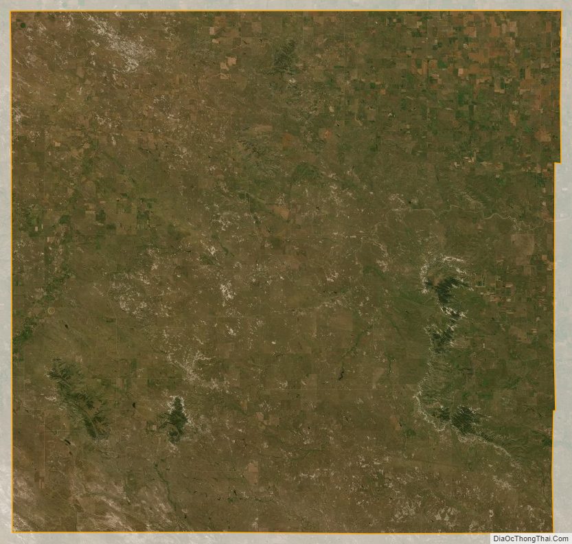
Harding County Satellite Map
Harding County Outline Map