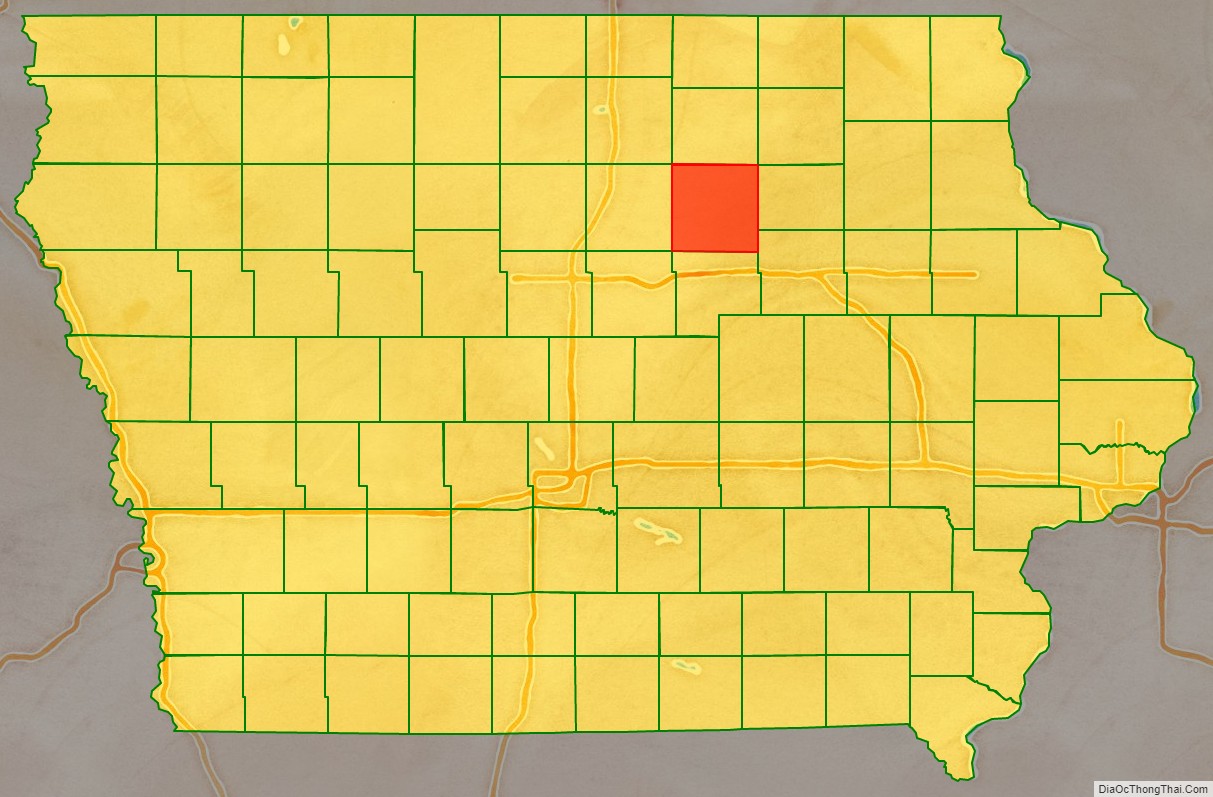
Butler County is a county located in the U.S. state of Iowa. As of the 2020 census, the population was 14,334. Its county seat is Allison. The county was organized in 1854 and named for General William O. Butler.
| Name: | Butler County |
|---|---|
| FIPS code: | 19-023 |
| State: | Iowa |
| Founded: | 1851 |
| Named for: | William Orlando Butler |
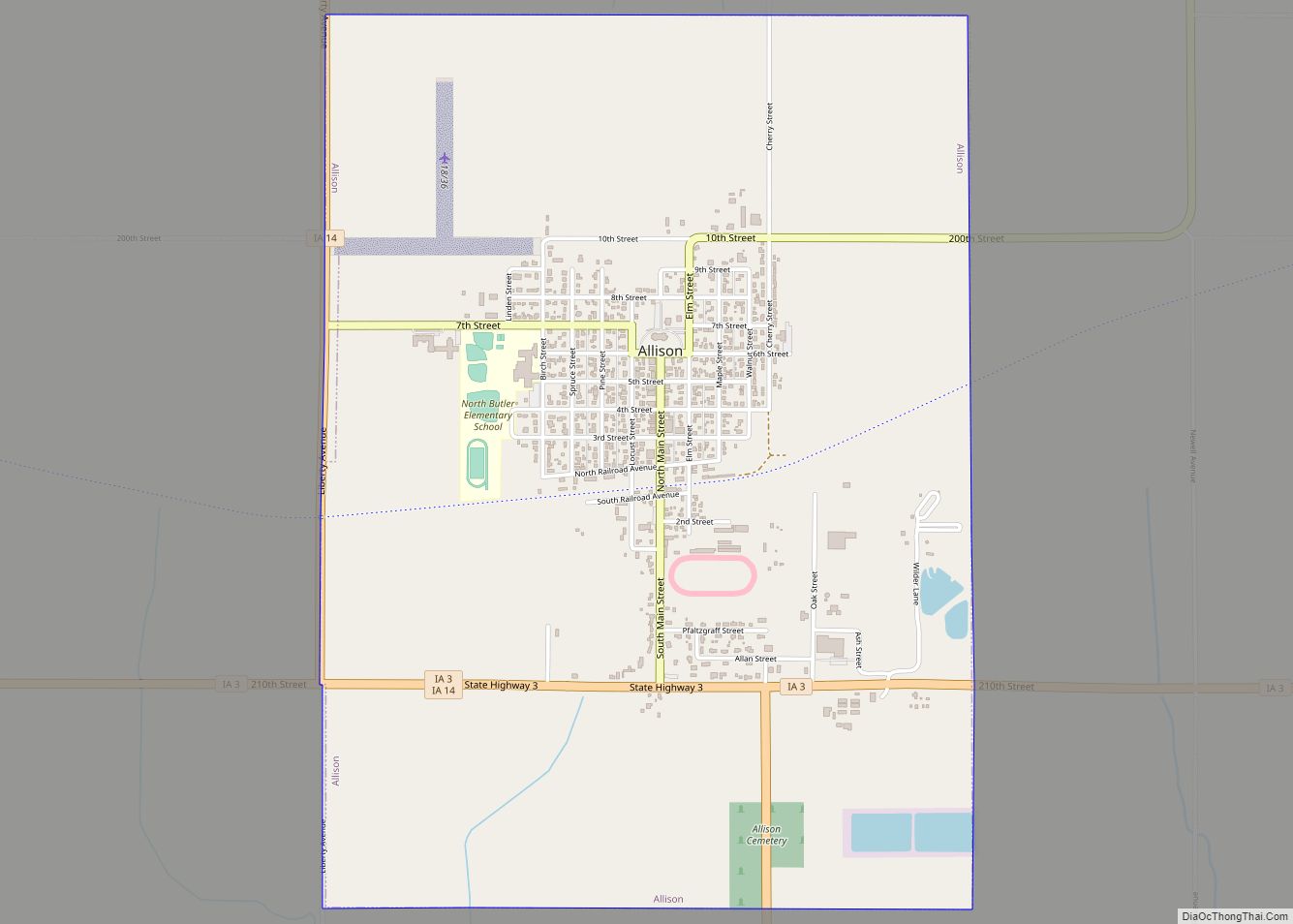
| Seat: | Allison |
| Largest city: | Parkersburg |
| Total Area: | 582 sq mi (1,510 km²) |
| Land Area: | 580 sq mi (1,500 km²) |
| Total Population: | 14,334 |
| Population Density: | 25/sq mi (9.5/km²) |
| Time zone: | UTC−6 (Central) |
| Summer Time Zone (DST): | UTC−5 (CDT) |
| Website: | butlercounty.iowa.gov |
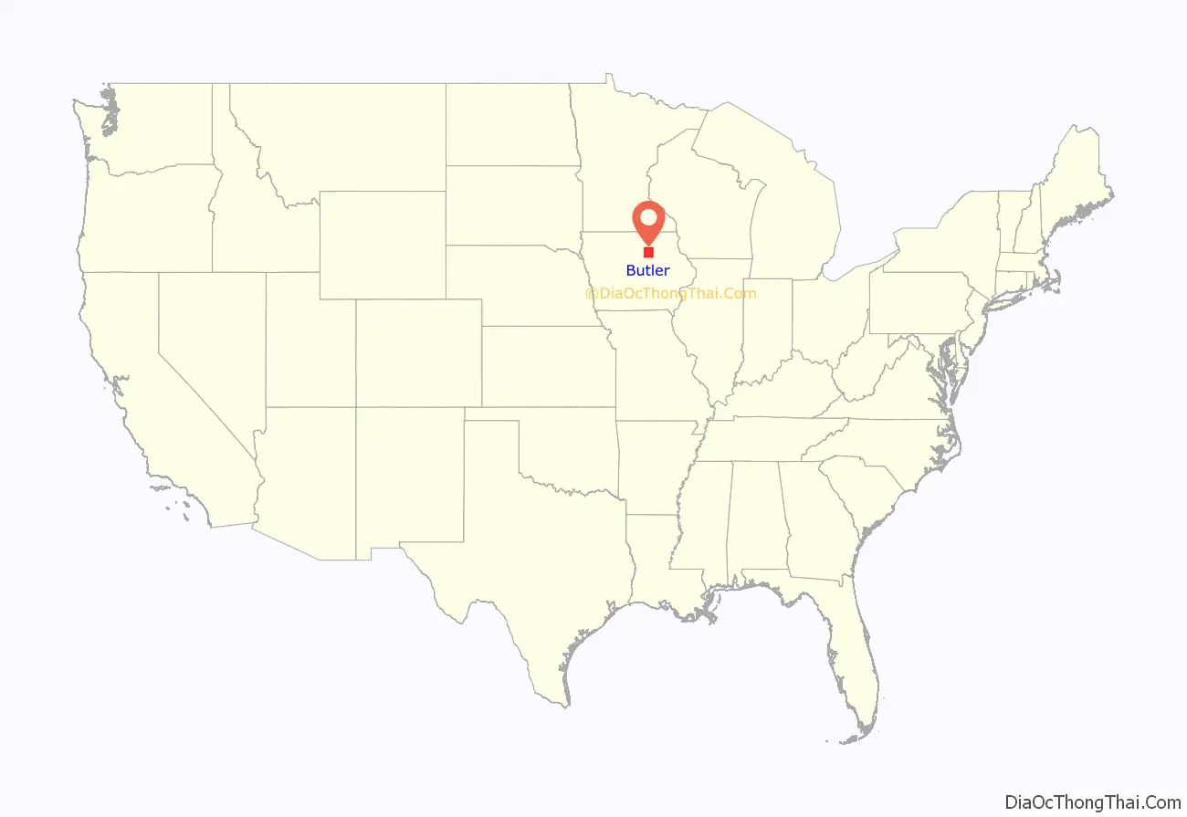
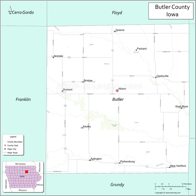
Butler County location map. Where is Butler County?
History
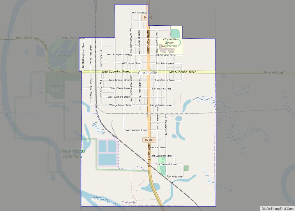
Butler County was formed on January 15, 1851, from open land. It was named after Kentucky native William Orlando Butler, a general and hero of the Mexican–American War, who ran as Vice President of the United States in 1848. Until 1854, the county was governed by other counties. Only at this time did it have enough inhabitants to establish its own local government. The first court proceedings were conducted in a small log cabin of a settler. In 1858, the first courthouse was completed in Clarksville. After it was sold shortly thereafter to the local school district, it was used as a schoolhouse from 1863 until 1903.
Clarksville was the first county seat, from 1854 to 1860, after which Butler Center became the seat. Because locals became disenchanted with Butler Center (partially because of its inaccessibility during the winter), Allison was made the county seat on January 10, 1881, after the tracks of the Dubuque and Dakota Railroad had been laid there.
Butler County is the only county in Iowa that does not have any stop lights, four-lane roads (US Highway or interstate), a hospital, or a movie theatre. There are also no national fast-food chains in Butler county.
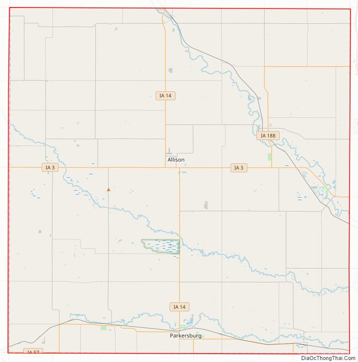
Butler County Road Map
Geography
According to the U.S. Census Bureau, the county has a total area of 582 square miles (1,510 km), of which 580 square miles (1,500 km) is land and 1.6 square miles (4.1 km) (0.3%) is water.
Major highways
- Iowa Highway 3
- Iowa Highway 14
- Iowa Highway 57
- Iowa Highway 188
Adjacent counties
- Floyd County (north)
- Bremer County (east)
- Black Hawk County (southeast)
- Grundy County (south)
- Franklin County (west)
- Chickasaw County (northeast)
- Cerro Gordo County (northwest)
- Hardin County (southwest)
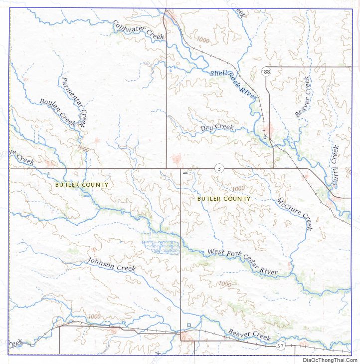
Butler County Topographic Map
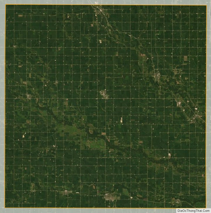
Butler County Satellite Map
Butler County Outline Map