Kentucky (US: /kənˈtʌki/ (listen) kən-TUK-ee, UK: /kɛn-/ ken-), officially the Commonwealth of Kentucky, is a state in the Southeastern region of the United States and one of the states of the Upper South. It borders Illinois, Indiana, and Ohio to the north, West Virginia to the northeast, Virginia to the east, Tennessee to the south, and Missouri to the west. Its northern border is defined by the Ohio River. Its capital is Frankfort, and its two largest cities are Louisville and Lexington. Its population was approximately 4.5 million in 2020.
Kentucky was admitted into the Union as the 15th state on June 1, 1792, splitting from Virginia in the process. It is known as the “Bluegrass State”, a nickname based on Kentucky bluegrass, a species of green grass introduced by European settlers for the purpose of grazing in pastures, which has supported the thoroughbred horse industry in the center of the state. Historically, it was known for excellent farming conditions for this reason and the development of large tobacco plantations akin to those in Virginia and North Carolina in the central and western parts of the state with the use of enslaved labor during the Antebellum South and Civil War period. Kentucky ranks 5th nationally in goat farming, 8th in beef cattle production, and 14th in corn production. Kentucky has also been a long-standing major center of the tobacco industry. Today, Kentucky’s economy has expanded to importance in non-agricuIturaI sectors, including auto manufacturing, energy fuel production, and medical facilities. The state ranks 4th among US states in the number of automobiles and trucks assembled.
The state is home to the world’s longest cave system in Mammoth Cave National Park, as well as the greatest length of navigable waterways and streams in the contiguous United States, and the two largest man-made lakes east of the Mississippi River. Kentucky is also known for its culture, which includes horse racing, bourbon, moonshine, coal, My Old Kentucky Home State Park, automobile manufacturing, tobacco, bluegrass music, college basketball, Louisville Slugger baseball bats, Kentucky Fried Chicken, and the Kentucky colonel.
| Before statehood: | Part of Virginia (District of Kentucky) |
|---|---|
| Admitted to the Union: | June 1, 1792 (15th) |
| Capital: | Frankfort |
| Largest city: | Louisville |
| Largest metro and urban areas: | Louisville |
| Elevation: | 750 ft (230 m) |
| Total Area: | 40,408 sq mi (104,656 km) |
| Area Rank: | 37th |
| Total Population: | 4,509,342 |
| Population Rank: | 26th |
| Population Density: | 114/sq mi (44/km) |
| Population Density Rank: | 23rd |
| Median Household Income: | $52,295 |
| Income Rank: | 44th |
| Demonym(s): | Kentuckian |
| USPS abbreviation: | KY |
| ISO 3166 code: | US-KY |
| Website: | kentucky.gov |
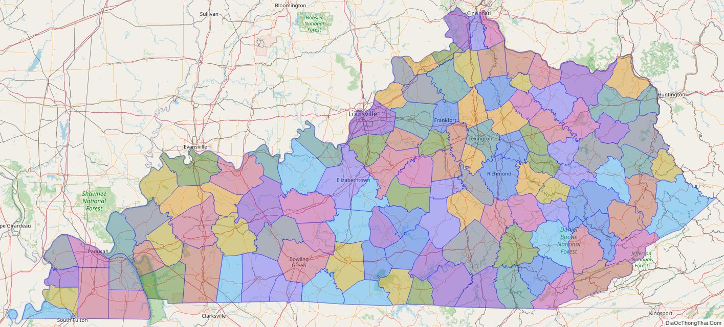
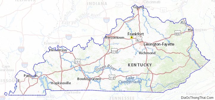
Online Interactive Map
Click on ![]() to view map in "full screen" mode.
to view map in "full screen" mode.
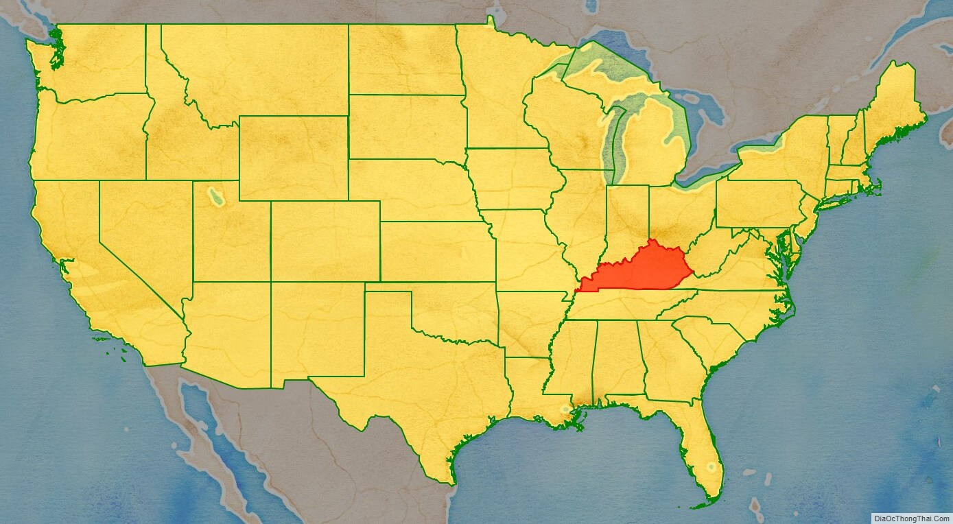
Kentucky location map. Where is Kentucky state?
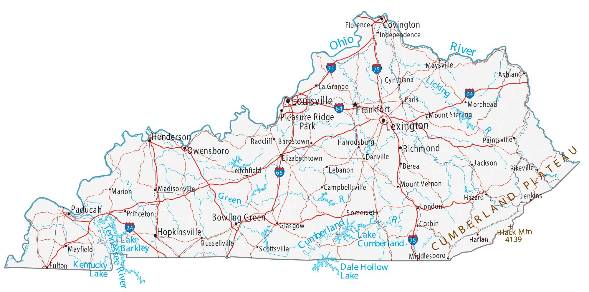
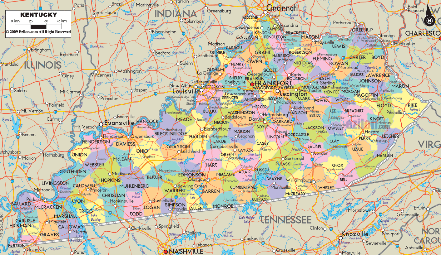
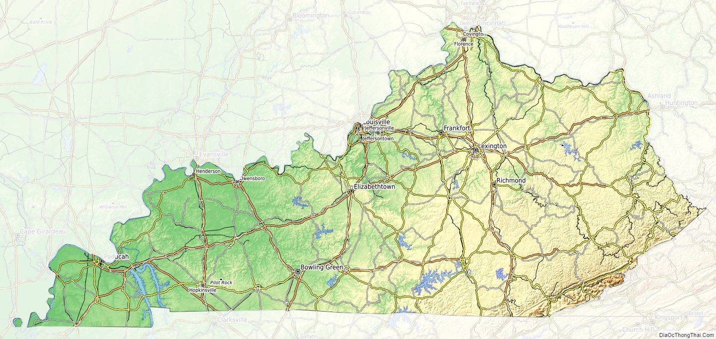
Kentucky Road Map
Kentucky Map – Roads & Cities
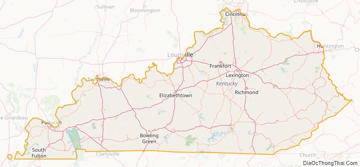
Kentucky Street Map
History
Native American settlement
It is not known exactly when the first humans arrived in what is now Kentucky. Based on the evidence in other regions, humans were likely living in Kentucky prior to 10,000 BCE, but “archaeological evidence of their occupation has yet to be documented”. Around 1800 BCE, a gradual transition began from a hunter-gatherer economy to agriculturalism. Around 900 CE, a Mississippian culture took root in western and central Kentucky; by contrast, a Fort Ancient culture appeared in eastern Kentucky. While the two had many similarities, the distinctive ceremonial earthwork mounds constructed in the former’s centers were not part of the culture of the latter. Fort Ancient settlements depended largely on corn, beans, and squash, and practiced a system of agriculture that prevented ecological degradation by rotating crops, burning sections of forest to create ideal habitat for wild game, relocating villages every 10-30 years, and continually shifting the location of fields to maintain plots of land in various stages of ecological succession.
In about the 10th century, the Kentucky native people’s variety of corn became highly productive, supplanting the Eastern Agricultural Complex, and replaced it with a maize-based agriculture in the Mississippian era. French explorers in the 17th century documented numerous tribes living in Kentucky until the Beaver Wars in the 1670s; however, by the time that European colonial explorers and settlers began entering Kentucky in greater numbers in the mid-18th century, there were no major Native American settlements in the region.
As of the 16th century, what became Kentucky was home to tribes from diverse linguistic groups. The Kispoko, an Algonquian-speaking tribe controlled much of the interior of the state.
The Chickasaw had territory up to the confluence of Mississippi and Ohio rivers. During a period known as the Beaver Wars (1640–1680), another Algonquian tribe called the Maumee, or Mascouten was chased out of southern Michigan. The vast majority of them moved to Kentucky, pushing the Kispoko east and war broke out with the Tutelo of North Carolina and Virginia that pushed them further north and east. The Maumee were closely related to the Miami from Indiana. Later, the Kispoko merged with the Shawnee, who migrated from the east and the Ohio River valley.
The Shawnee settled Lower Shawnee Town at the Scioto and Ohio rivers in 1734 to 1738.
While the Cherokee did not settle in Kentucky, they hunted there. They relinquished their hunting rights there in the Treaty of Sycamore Shoals in 1775.
European settlement
In 1774 James Harrod founded the first permanent European settlement in Kentucky at the site of present-day Harrodsburg.
County of Kentucky and statehood
On December 31, 1776, by an act of the Virginia General Assembly, the portion of Fincastle County west of the Appalachians extending to the Mississippi River, previously known as Kentucky (or Kentucke) territory, was split off into its own county of Kentucky. Harrod’s Town (Oldtown as it was known at the time) was named the county seat. The county was subdivided into Jefferson, Lincoln and Fayette Counties in 1780, but continued to be administered as the District of Kentucky even as new counties were split off.
On several occasions the region’s residents petitioned the General Assembly and the Confederation Congress for separation from Virginia and statehood. Ten constitutional conventions were held in Danville between 1784 and 1792. One petition, which had Virginia’s assent, came before the Confederation Congress in early July 1788. Unfortunately, its consideration came up a day after word of New Hampshire‘s all-important ninth ratification of the proposed Constitution, thus establishing it as the new framework of governance for the United States. In light of this development, Congress thought that it would be “unadvisable” to admit Kentucky into the Union, as it could do so “under the Articles of Confederation” only, but not “under the Constitution”, and so declined to take action.
On December 18, 1789, Virginia again gave its consent to Kentucky statehood. The United States Congress gave its approval on February 4, 1791. (This occurred two weeks before Congress approved Vermont‘s petition for statehood.) Kentucky officially became the fifteenth state in the Union on June 1, 1792. Isaac Shelby, a military veteran from Virginia, was elected its first Governor.
Native Americans and European colonists
A 1790 U.S. government report states that 1,500 Kentucky settlers had been killed by Native Americans since the end of the Revolutionary War. As more settlers entered the area, warfare broke out with the Native Americans over their traditional hunting grounds. Historian Susan Sleeper-Smith documents the role of Kentucky settlers in displacing Native American communities living in the northern Ohio River Valley during the late 18th century.
19th century
Central Kentucky, the bluegrass region, as well as Western Kentucky, were the areas of the state with the most slave owners. Planters cultivated tobacco and hemp (see Hemp in Kentucky) on plantations with the use of enslaved labor, and were noted for their quality livestock. During the 19th century, Kentucky slaveholders began to sell unneeded slaves to the Deep South, with Louisville becoming a major slave market and departure port for slaves being transported downriver.
Kentucky was one of the border states during the American Civil War, and it remained neutral within the Union. Despite this, representatives from 68 of 110 counties met at Russellville calling themselves the “Convention of the People of Kentucky” and passed an Ordinance of Secession on November 20, 1861. They established a Confederate government of Kentucky with its capital in Bowling Green. The Confederate shadow government was never popularly elected statewide, though 116 delegates were sent representing 68 Kentucky counties which at the time made up a little over half the territory of the Commonwealth to the Russellville Convention in 1861, and were occupied and governed by the Confederacy at some point in the duration of the war, and Kentucky had full representation within the Confederate Government. Although Confederate forces briefly controlled Frankfort, they were expelled by Union forces before a Confederate government could be installed in the state capital. After the expulsion of Confederate forces after the Battle of Perryville, this government operated in-exile. Though it existed throughout the war, Kentucky’s provisional government only had governing authority in areas of Kentucky under direct Confederate control and had very little effect on the events in the Commonwealth or in the war once they were driven out of the state.
Kentucky remained officially “neutral” throughout the war due to the Southern Unionists sympathies of a majority of the Commonwealth’s citizens who were split between the struggle of Kentucky’s sister Southern States fully in the Confederate States of America and a continued loyalty to the Unionist cause that was also prevalent in other areas of the South such as in East Tennessee, West Virginia, Western North Carolina, and others. Despite this, some 21st-century Kentuckians observe Confederate Memorial Day on Confederate leader Jefferson Davis’ birthday, June 3, and participate in Confederate battle re-enactments. Both Davis and U.S. president Abraham Lincoln were born in Kentucky. John C. Breckinridge, the 14th and youngest-ever Vice President was born in Lexington, Kentucky at Cabell’s Dale Farm. Breckenridge was expelled from the U. S. Senate for his support of the Confederacy.
On January 30, 1900, Governor William Goebel, flanked by two bodyguards, was mortally wounded by an assassin while walking to the State Capitol in downtown Frankfort. Goebel was contesting the Kentucky gubernatorial election of 1899, which William S. Taylor was initially believed to have won. For several months, J. C. W. Beckham, Goebel’s running mate, and Taylor fought over who was the legal governor until the Supreme Court of the United States ruled in May in favor of Beckham. After fleeing to Indiana, Taylor was indicted as a co-conspirator in Goebel’s assassination. Goebel is the only governor of a U.S. state to have been assassinated while in office.
20th century
The Black Patch Tobacco Wars, a vigilante action, occurred in Western Kentucky in the early 20th century. As a result of the tobacco industry monopoly, tobacco farmers in the area were forced to sell their crops at prices that were too low. Many local farmers and activists united in a refusal to sell their crops to the major tobacco companies.
An Association meeting occurred in downtown Guthrie, where a vigilante wing of “Night Riders”, formed. The riders terrorized farmers who sold their tobacco at the low prices demanded by the tobacco corporations. They burned several tobacco warehouses throughout the area, stretching as far west as Hopkinsville to Princeton. In the later period of their operation, they were known to physically assault farmers who broke the boycott. Governor Augustus E. Willson declared martial law and deployed the Kentucky National Guard to end the wars.
On October 15, 1959, a B-52 carrying two nuclear weapons collided in midair with a KC-135 tanker near Hardinsburg, Kentucky. One of the nuclear bombs was damaged by fire but both weapons were recovered.
Kentucky State Map – Places and Landmarks
Kentucky Political Map
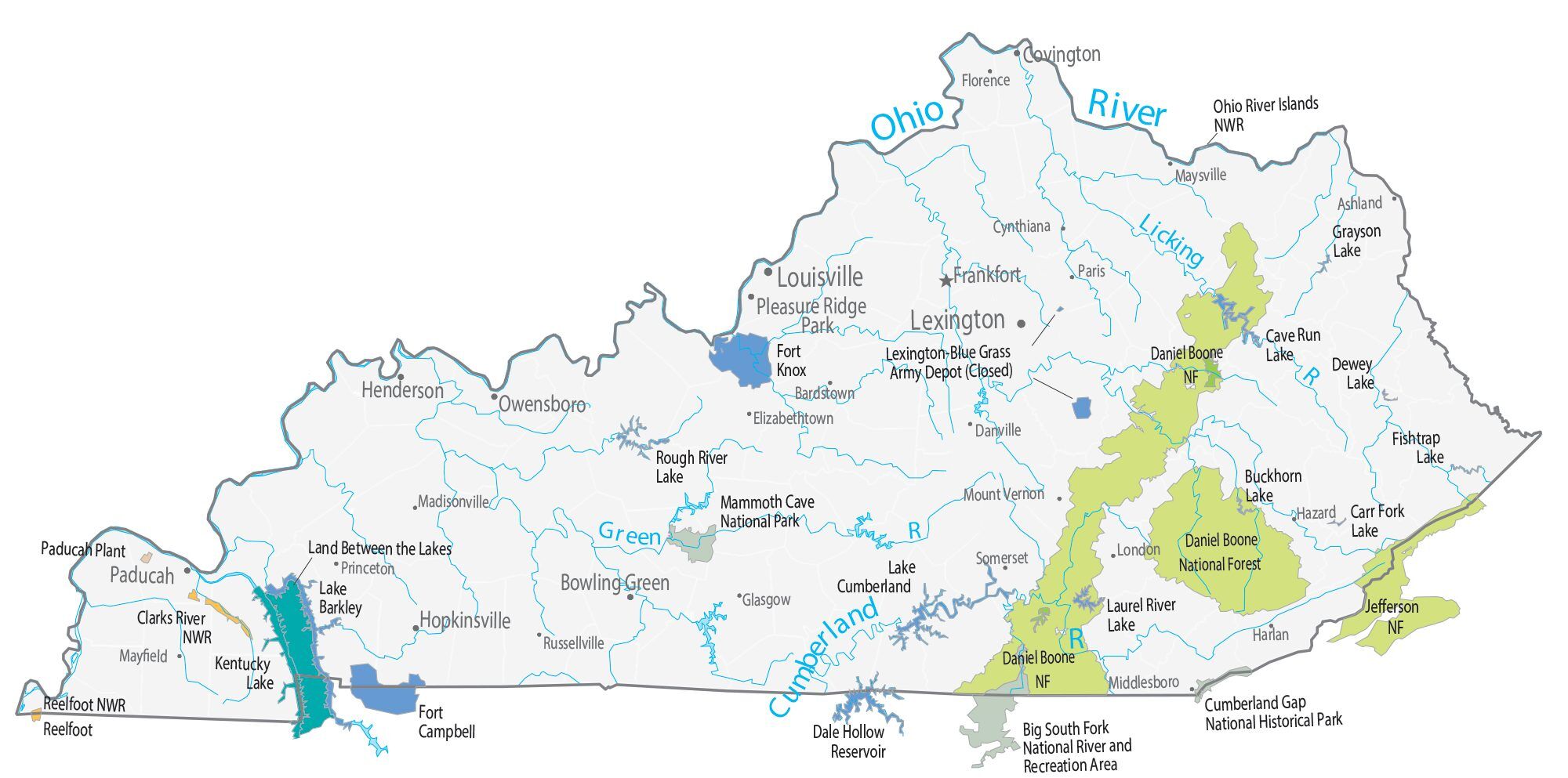
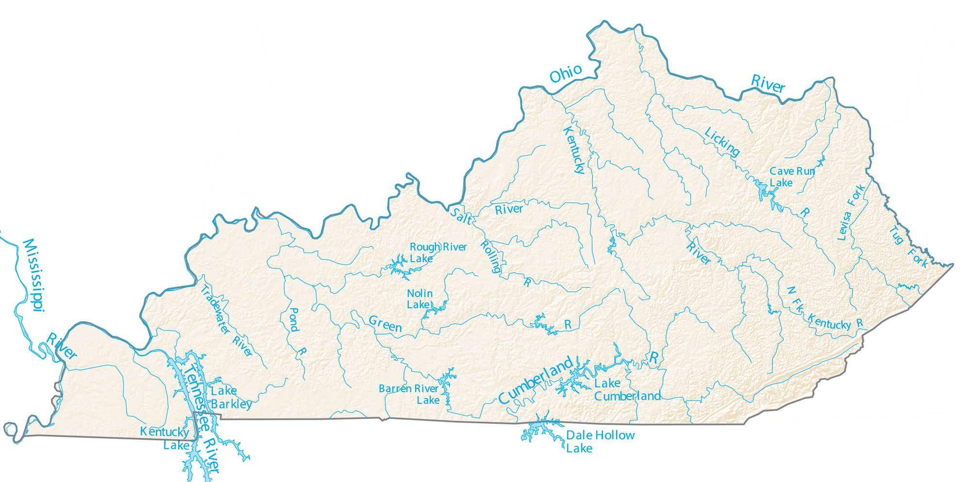
Kentucky Lakes and Rivers Map
Kentucky Physical Map
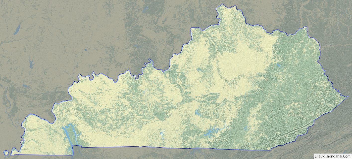

Kentucky Topographic Map
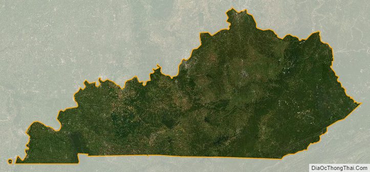
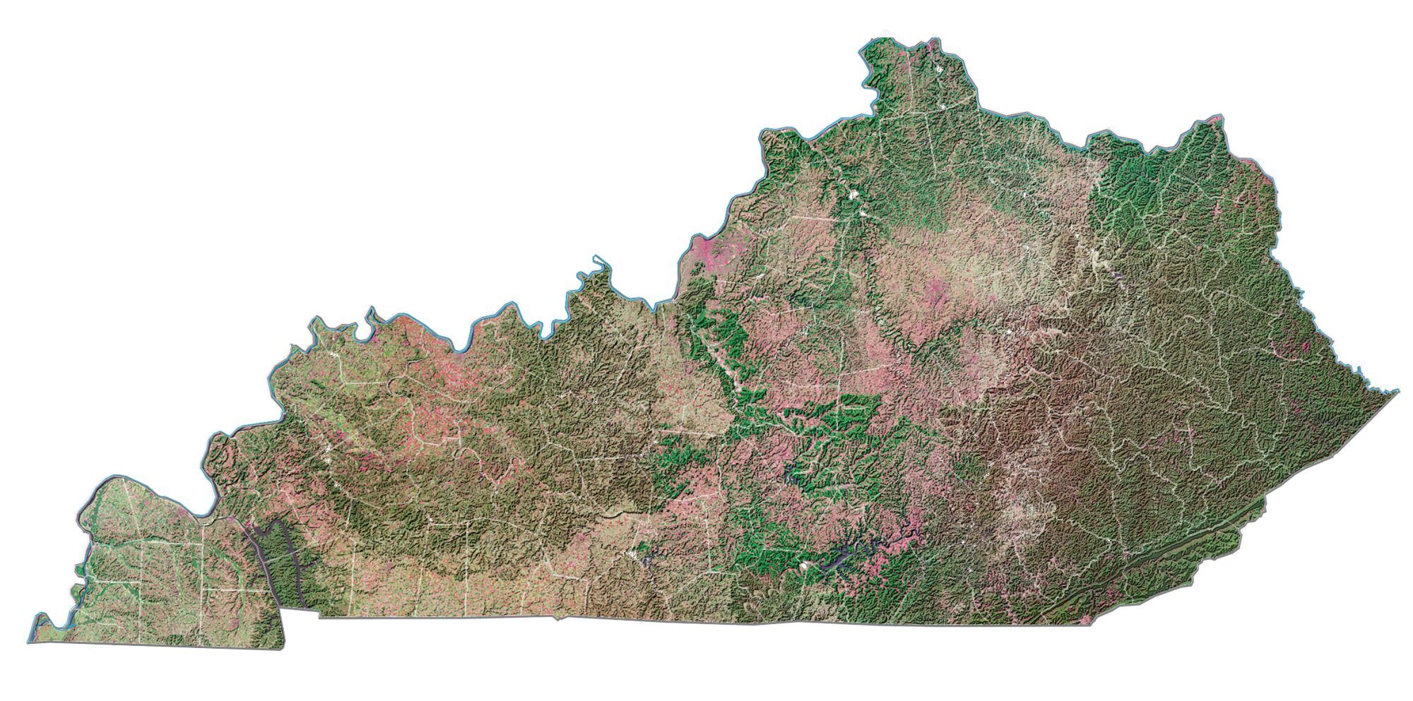
Kentucky Satellite Map
Others printable maps
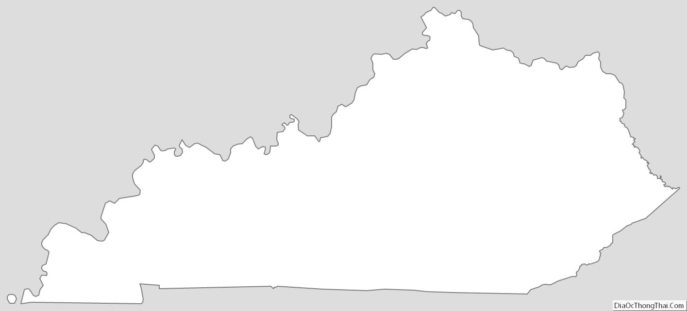
Kentucky Outline Map
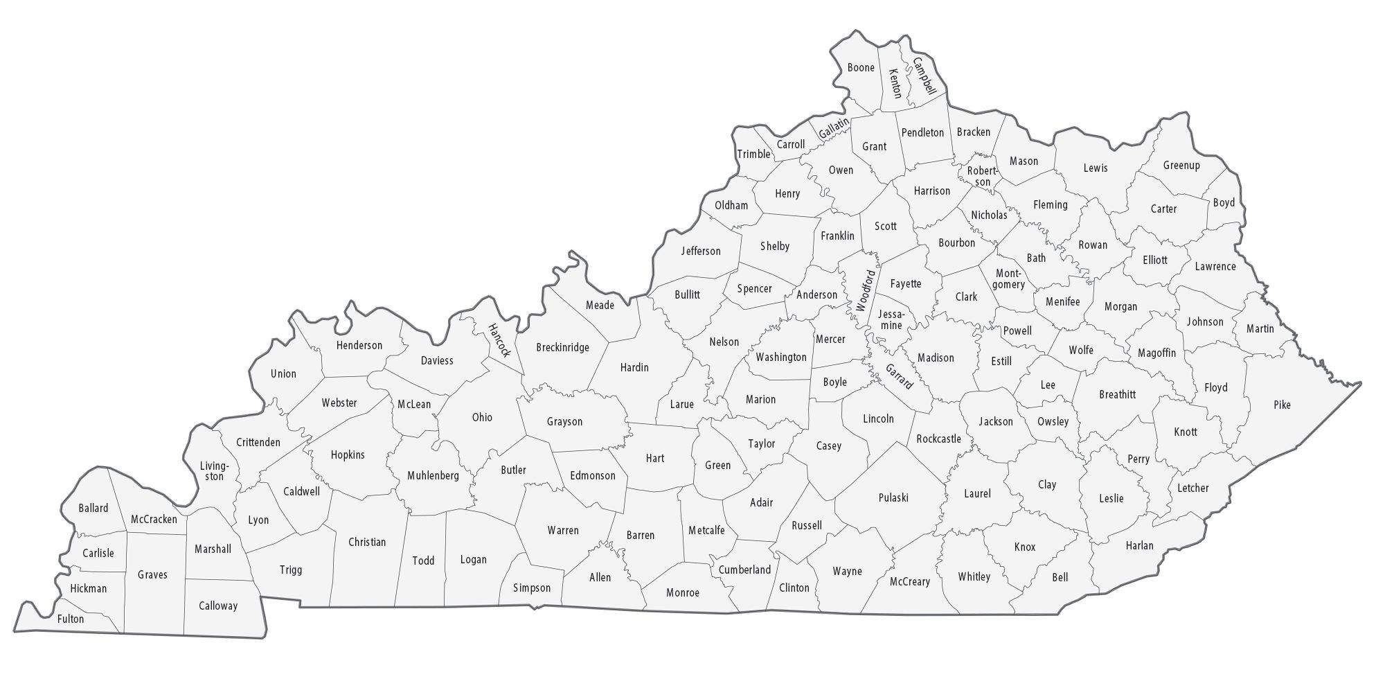
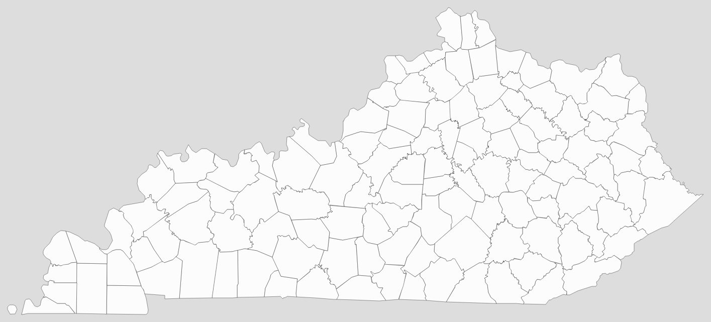
Blank Kentucky County Map
See also
Map of Kentucky State and its subdivision:- Adair
- Allen
- Anderson
- Ballard
- Barren
- Bath
- Bell
- Boone
- Bourbon
- Boyd
- Boyle
- Bracken
- Breathitt
- Breckinridge
- Bullitt
- Butler
- Caldwell
- Calloway
- Campbell
- Carlisle
- Carroll
- Carter
- Casey
- Christian
- Clark
- Clay
- Clinton
- Crittenden
- Cumberland
- Daviess
- Edmonson
- Elliott
- Estill
- Fayette
- Fleming
- Floyd
- Franklin
- Fulton
- Gallatin
- Garrard
- Grant
- Graves
- Grayson
- Green
- Greenup
- Hancock
- Hardin
- Harlan
- Harrison
- Hart
- Henderson
- Henry
- Hickman
- Hopkins
- Jackson
- Jefferson
- Jessamine
- Johnson
- Kenton
- Knott
- Knox
- Larue
- Laurel
- Lawrence
- Lee
- Leslie
- Letcher
- Lewis
- Lincoln
- Livingston
- Logan
- Lyon
- Madison
- Magoffin
- Marion
- Marshall
- Martin
- Mason
- McCracken
- McCreary
- McLean
- Meade
- Menifee
- Mercer
- Metcalfe
- Monroe
- Montgomery
- Morgan
- Muhlenberg
- Nelson
- Nicholas
- Ohio
- Oldham
- Owen
- Owsley
- Pendleton
- Perry
- Pike
- Powell
- Pulaski
- Robertson
- Rockcastle
- Rowan
- Russell
- Scott
- Shelby
- Simpson
- Spencer
- Taylor
- Todd
- Trigg
- Trimble
- Union
- Warren
- Washington
- Wayne
- Webster
- Whitley
- Wolfe
- Woodford
- Alabama
- Alaska
- Arizona
- Arkansas
- California
- Colorado
- Connecticut
- Delaware
- District of Columbia
- Florida
- Georgia
- Hawaii
- Idaho
- Illinois
- Indiana
- Iowa
- Kansas
- Kentucky
- Louisiana
- Maine
- Maryland
- Massachusetts
- Michigan
- Minnesota
- Mississippi
- Missouri
- Montana
- Nebraska
- Nevada
- New Hampshire
- New Jersey
- New Mexico
- New York
- North Carolina
- North Dakota
- Ohio
- Oklahoma
- Oregon
- Pennsylvania
- Rhode Island
- South Carolina
- South Dakota
- Tennessee
- Texas
- Utah
- Vermont
- Virginia
- Washington
- West Virginia
- Wisconsin
- Wyoming


