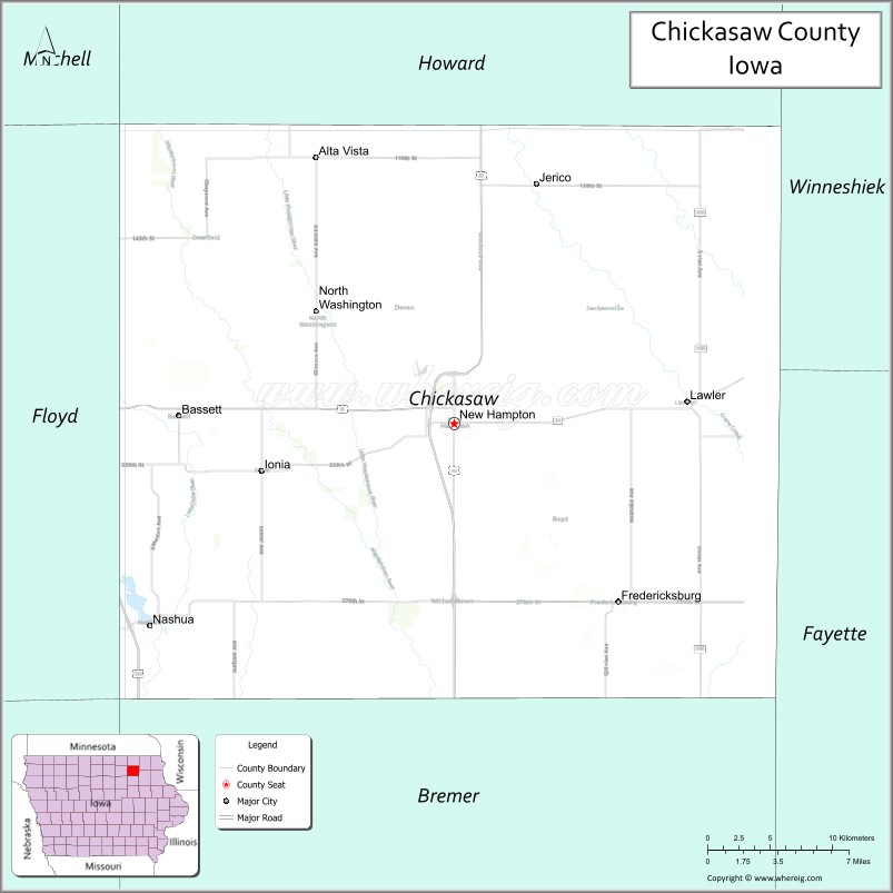
Chickasaw County is a county located in the U.S. state of Iowa. As of the 2020 census, the population was 12,012. Its county seat is New Hampton. The county was named for the southern Indian Nation whose chief was Bradford.
| Name: | Chickasaw County |
|---|---|
| FIPS code: | 19-037 |
| State: | Iowa |
| Founded: | January 15, 1851 |
| Named for: | Chickasaw people |
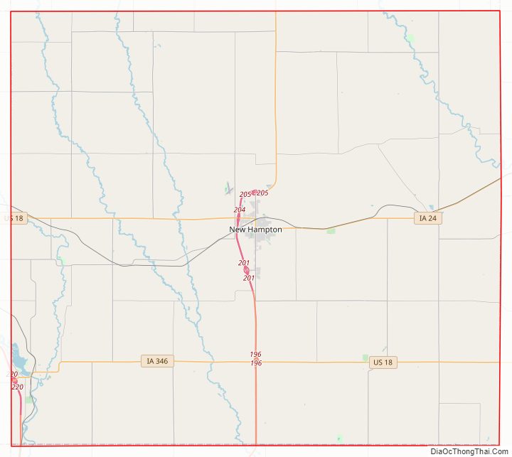
| Seat: | New Hampton |
| Largest city: | New Hampton |
| Total Area: | 506 sq mi (1,310 km²) |
| Land Area: | 504 sq mi (1,310 km²) |
| Total Population: | 12,012 |
| Population Density: | 24/sq mi (9.2/km²) |
| Time zone: | UTC−6 (Central) |
| Summer Time Zone (DST): | UTC−5 (CDT) |
| Website: | chickasawcounty.iowa.gov |
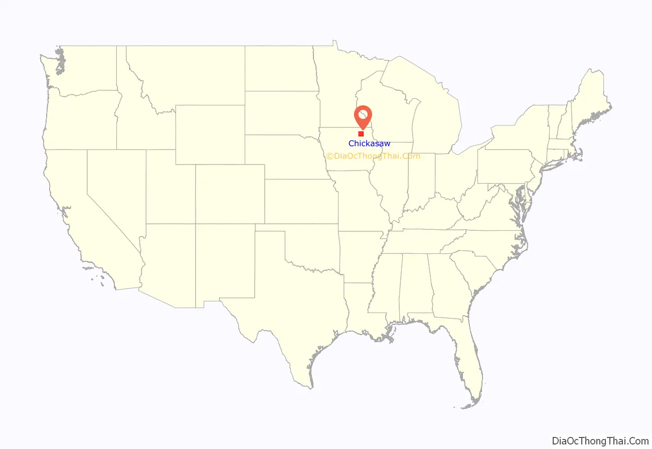
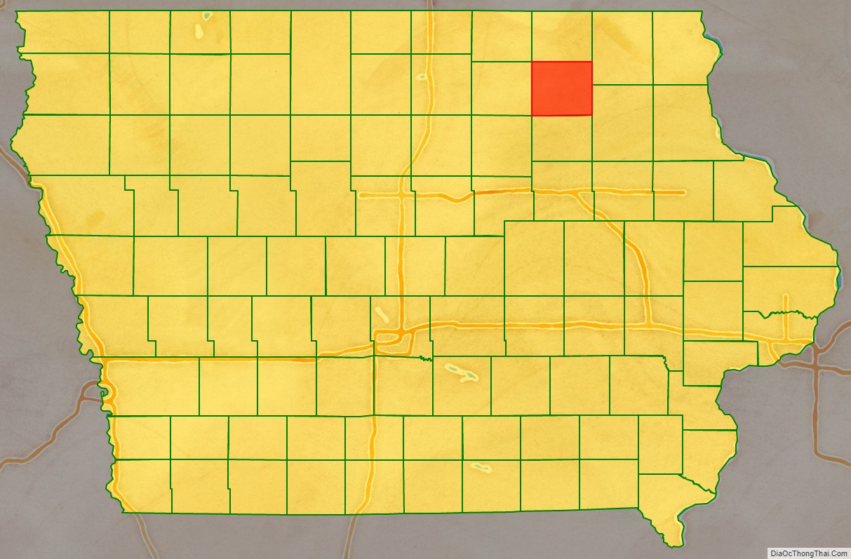
Chickasaw County location map. Where is Chickasaw County?
History
Chickasaw County was founded in January 1851. It was named after the Chickasaw tribe, which lived in the Southern United States at the time.
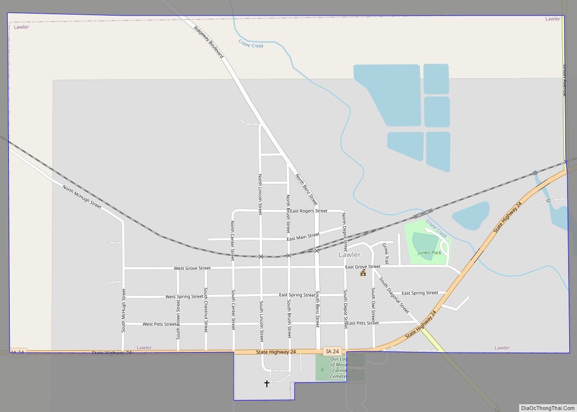
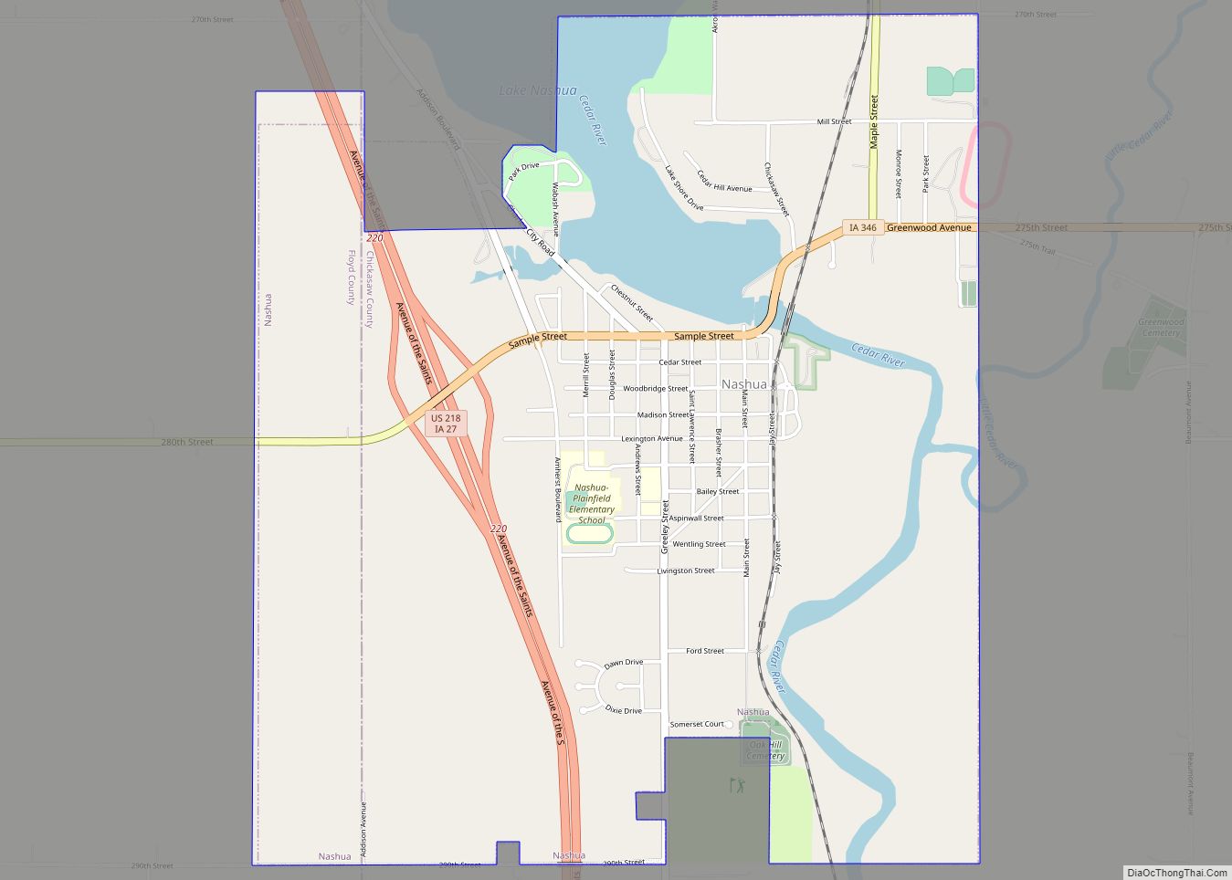
The first nonindigenous settlers arrived in 1848 and the first county seat was from 1854 in Bradford, in the southwestern corner of the county. In the spring of 1857, the seat was moved to New Hampton, located near the geographic center, and was then called Chickasaw Center. The first county offices were housed in private houses and in the school building. The first courthouse, a wood-frame building, was erected in 1865. That building was enlarged in 1876, but a fire on March 26, 1880, destroyed it (townspeople managed to save the records). A brick/stone replacement structure was completed in 1881, and included a soaring clock tower. This building was enlarged in 1905 and again in 1906, but by the twenties it again was too small. The present structure, featuring Bedford stone, was built in 1929 and put into use in 1930.
Chickasaw County Road Map
Geography
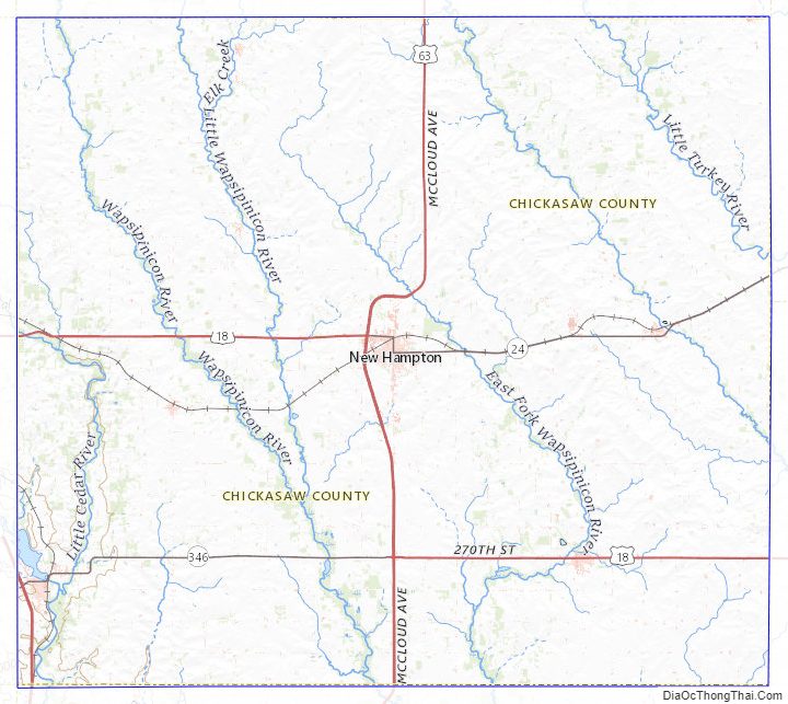
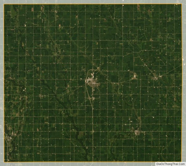
According to the US Census Bureau, the county has a total area of 506 square miles (1,310 km), of which 504 square miles (1,310 km) is land and 1.3 square miles (3.4 km) (0.3%) is water.
Adjacent counties
- Bremer County (south)
- Butler County (southwest)
- Fayette County (southeast)
- Floyd County (west)
- Howard County (north)
- Mitchell County (northwest)
- Winneshiek County (northeast)
Highways
- U.S. Highway 18
- U.S. Highway 63
- U.S. Highway 218
- Iowa Highway 24
- Iowa Highway 27
- Iowa Highway 346
Chickasaw County Topographic Map
Chickasaw County Satellite Map
Chickasaw County Outline Map