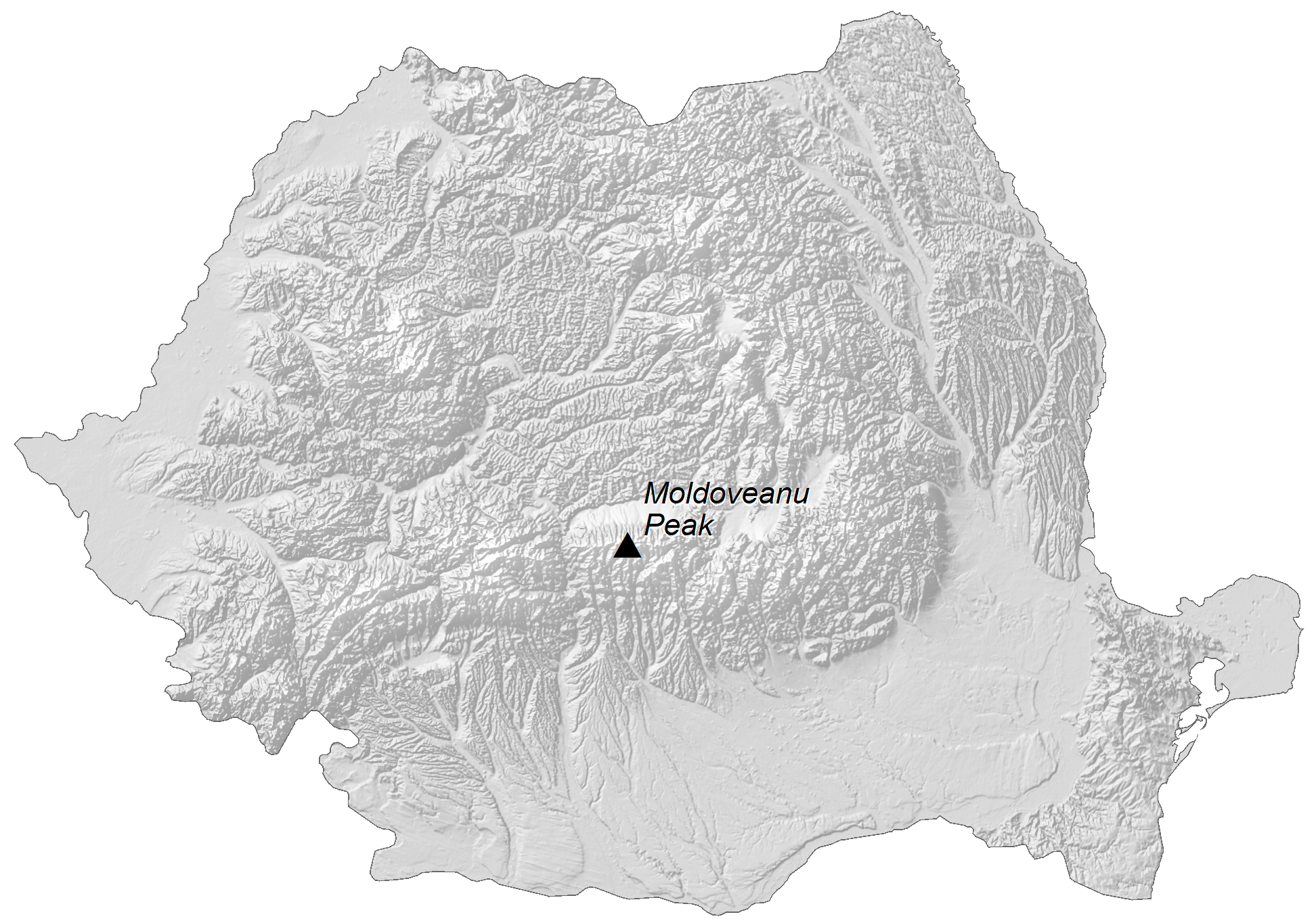
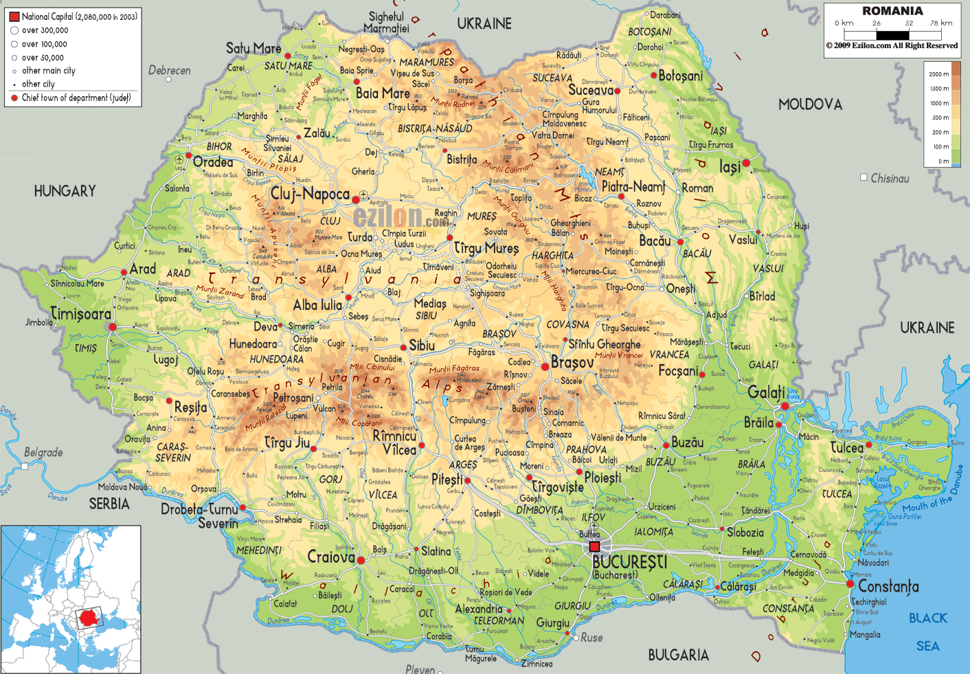
Romania is a European nation occupying an area of 238,397 sq. km. As can be observed on the physical map of Romania, the country’s landscape is almost evenly divided among mountains, hills, and plains.
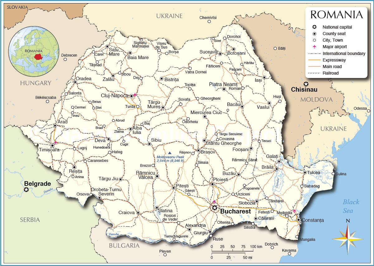
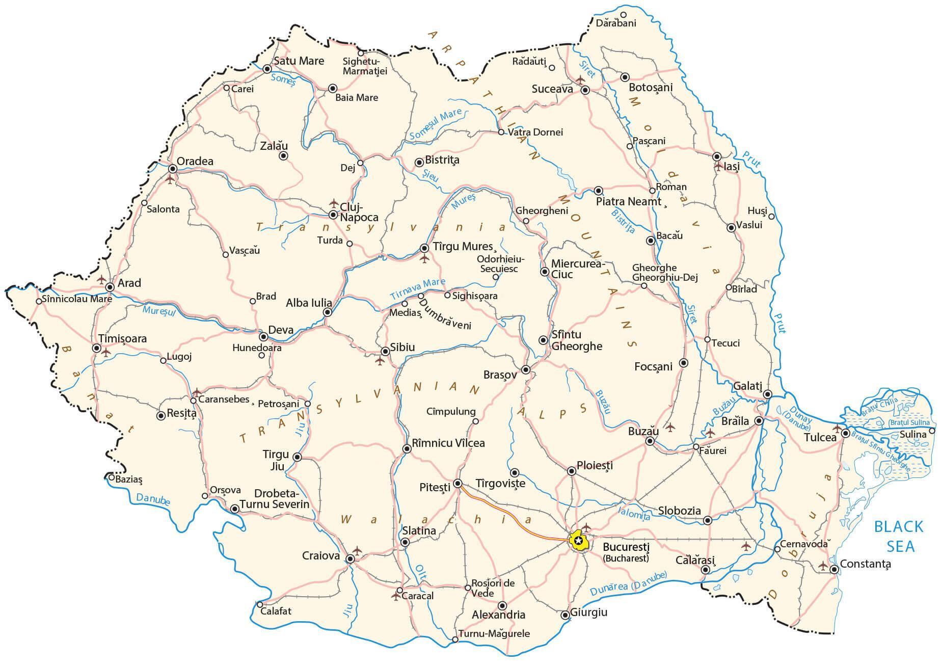
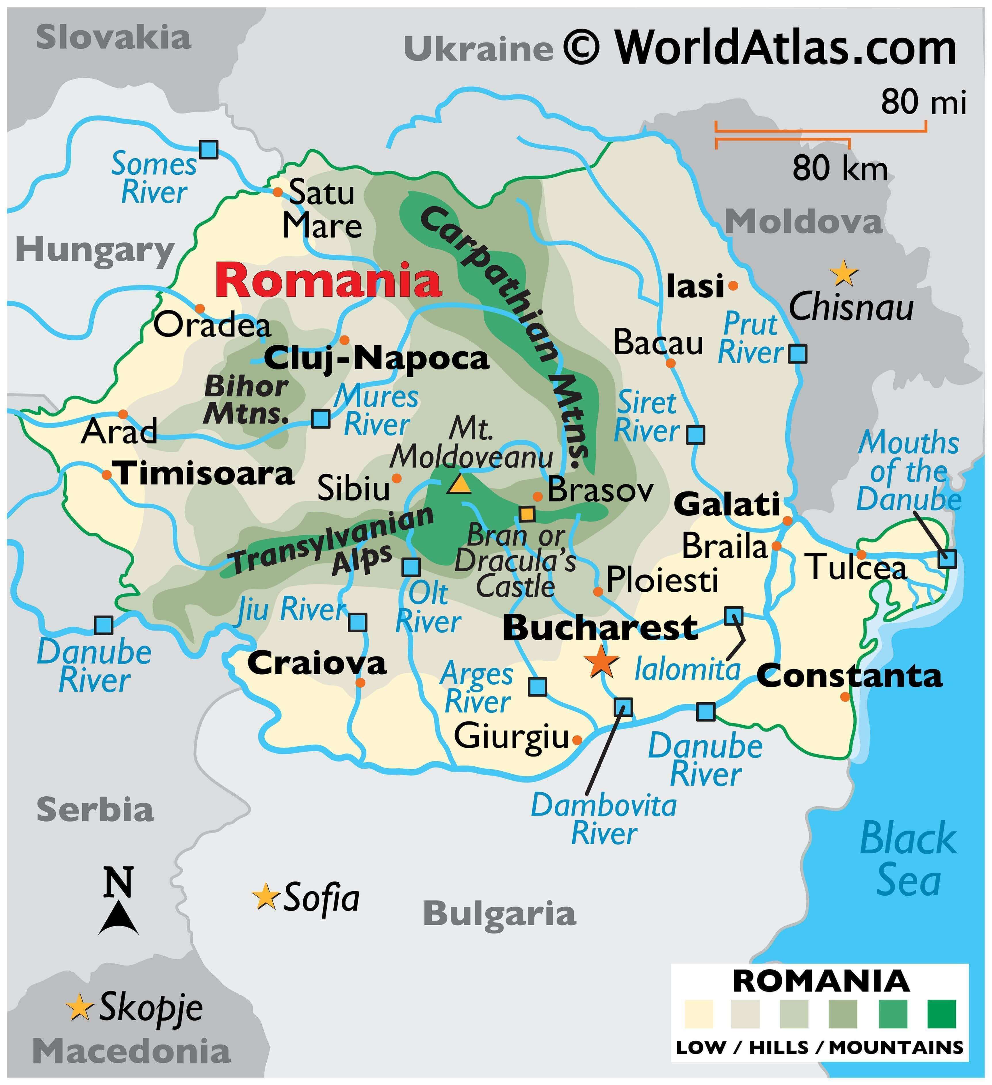
As for mountains, the medium-sized Carpathians extend through the center of the country in a wide arc, and they are the source of several rivers. Also visible on the map above is the Transylvanian Alps, a range of the Carpathians that divide central and southern Romania. The country’s highest point, Mt. Moldoveanu, is located there. It stands at 2,544 m (8,346 ft). A yellow upright triangle marks its position on the map.
Beyond the Carpathian foothills, the land slopes down into rolling hills and plains. The low-lying Romanian Plain, to the south of Craiova, extends east to the Black Sea.The country’s lowest land is found along the Danube Delta, an area of marshes, floating reed islands, and sandbanks.
The Danube River travels some 1,075 km through or along Romanian territory, forming much of the southern borders with Serbia and Bulgaria.
The Danube itself is Europe’s second-longest river after the Volga. It rises in the Black Forest in Germany, then flows southeastward for a distance of some 2850 km (1771 miles).
Other rivers of note include the Arges, Dambovita, Ialomita, Jiu, Mures, Olt, Prut, Siret and Somes.
Numerous small lakes occur throughout the country. There are also a dozen, or so, reservoirs of size.The Prut River forms its eastern border with Moldova, and the Danube River forms its southern border with Bulgaria, then flowing north and east into the Black Sea.
| Flag: |  |
|---|---|
| Legal Name: | Romania |
| Capital Value: | Bucharest |
| Official languages: | Romanian |
| Demonym(s): | Romanian |
| Government: | Unitary semi-presidential republic |
| Legislature: | Parliament |
| Total Area: | 238,391 km² |
| Land Area: | 229,891 km² |
| Water Area: | 8,500 km² |
| Population: | 19,356,544 |
| Density: | 79.9/km (206.9/sq mi) (136th) |
| GDP: | $250.08 Billion |
| GDP Per Capita: | $12,919.53 |
| Currency Value: | Lei (RON) |
| Driving side: | right |
| Calling code: | +40 |
| Internet TLD: | .ro |
Explore Romania with this interactive map! Discover the Transylvania Region, Carpathian Mountains, and the Wallachian Plain. From cities and roads to water and satellite imagery, this map of Romania has it all. Plus, you can get an idea of the terrain with its elevation feature.
Online Interactive Political Map
Click on ![]() to view map in "full screen" mode.
to view map in "full screen" mode.
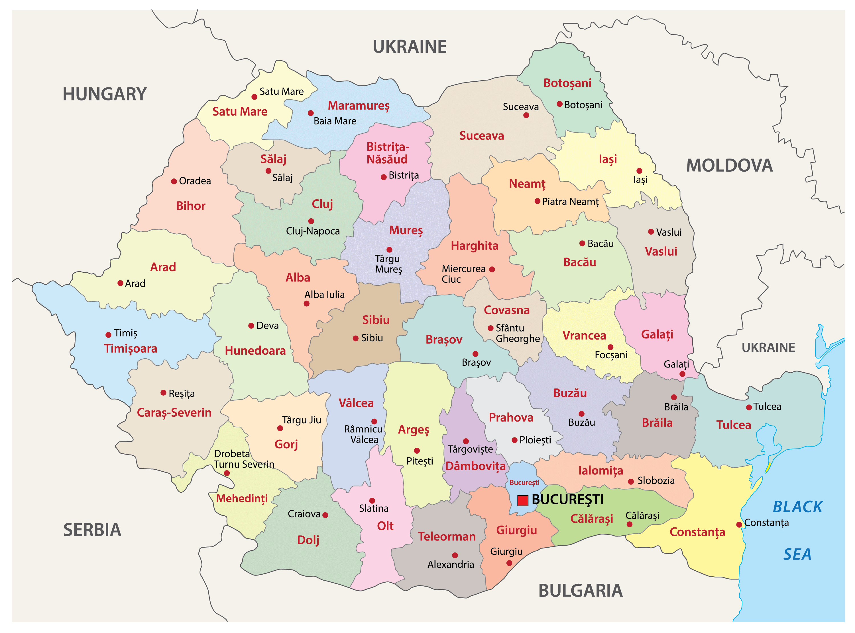
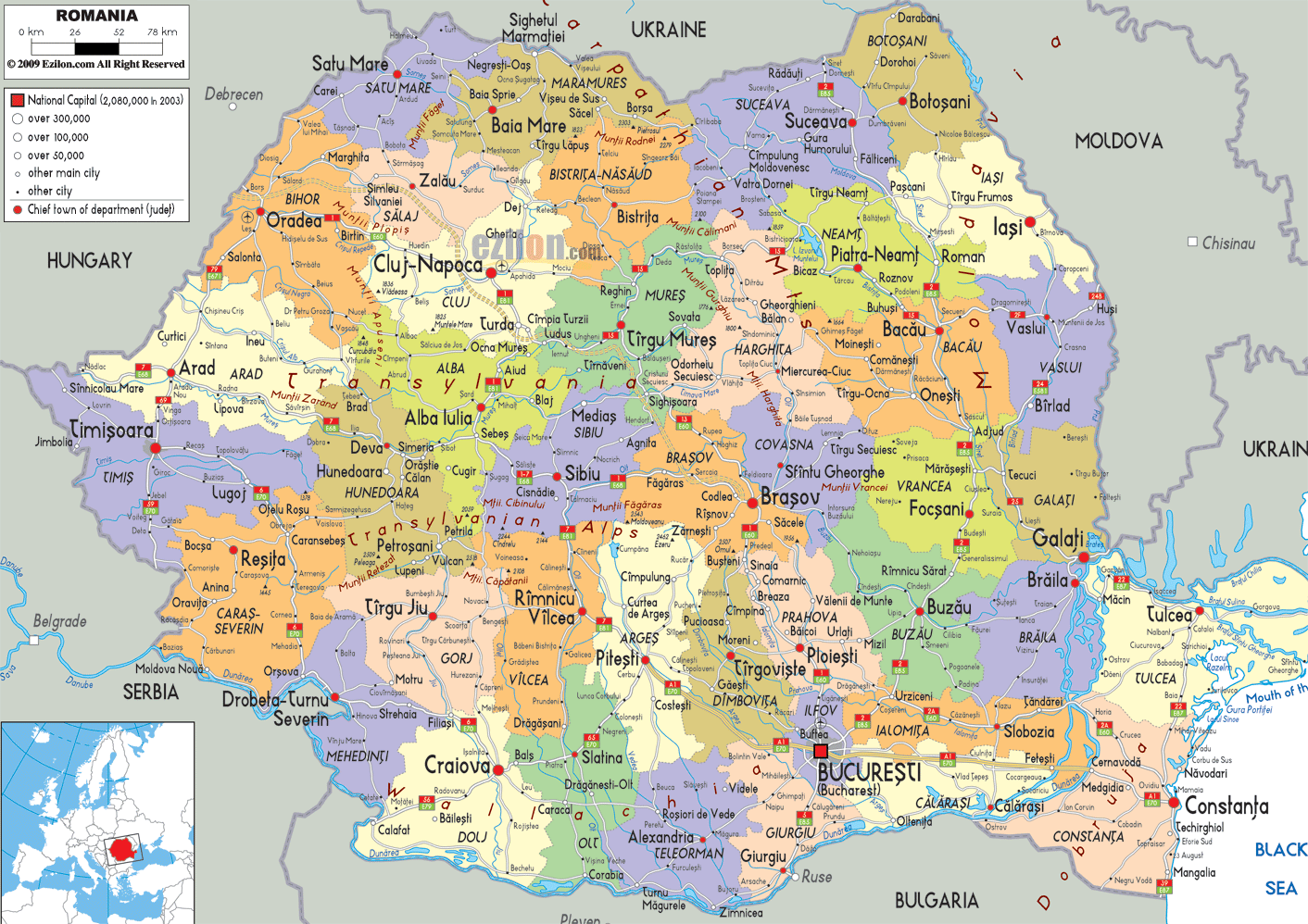
Romania is divided into 41 counties (judete, sing. judet) and 1 municipality (municipiu). In alphabetical order, the counties are: Alba, Arad, Arges, Bacau, Bihor, Bistrita-Nasaud, Botosani, Braila, Brasov, Buzau, Calarasi, Caras-Severin, Cluj, Constanta, Covasna, Dambovita, Dolj, Galati, Gorj, Giurgiu, Harghita, Hunedoara, Ialomita, Iasi, Ilfov, Maramures, Mehedinti, Mures, Neamt, Olt, Prahova, Salaj, SatuMare, Sibiu, Suceava, Teleorman, Timis, Tulcea, Vaslui, Valcea, and Vrancea. Bucuresti (Bucharest) is the municipality.
With an area of 238,397 sq. km, Romania is the 12th largest country in Europe. With a population of over 20 million people, Romania is the 7th most populous country of EU. Located in the south eastern part of the country is Bucharest – the capital and the largest city of Romania. It is also the cultural, administrative and economic center of Romania. Bucharest is the most prosperous city in the country and the 6th largest city in EU.
Location Maps
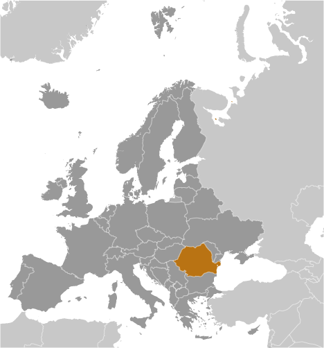
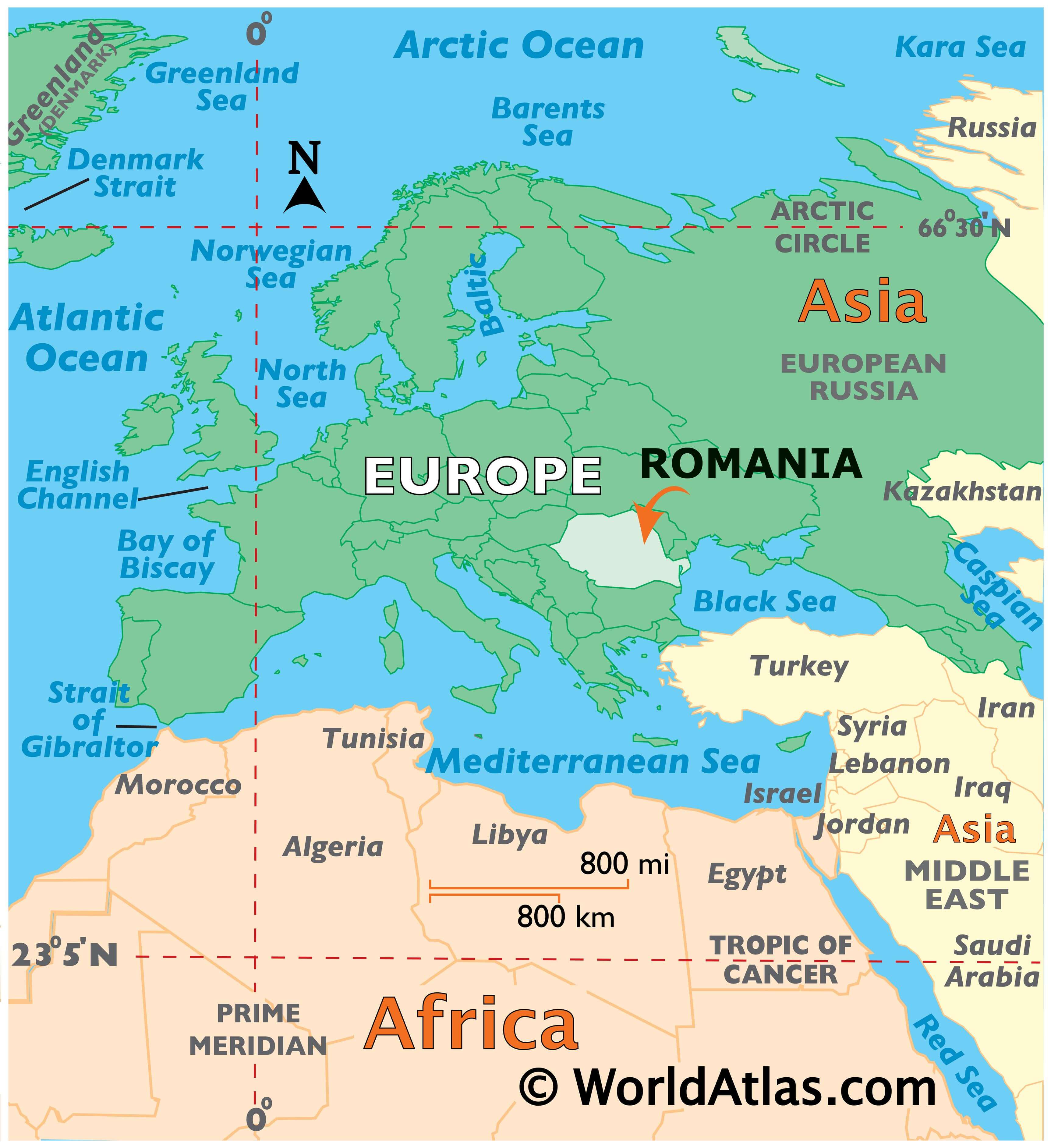
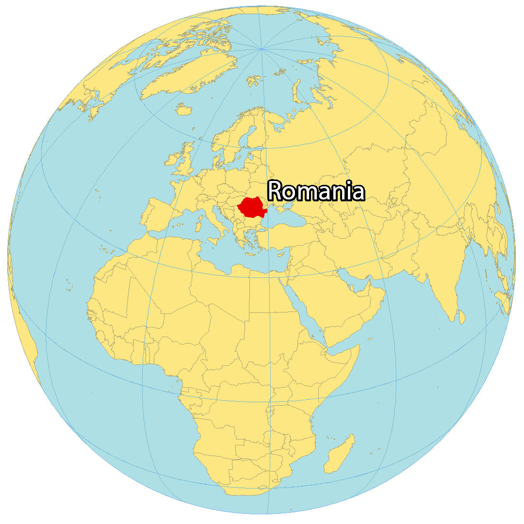
Where is Romania?
Romania is located in southeastern Europe, bordering Moldova to the east, Ukraine to the north, Hungary to the northwest, Serbia to the southwest, and Bulgaria to the southeast. It is known for its forested Transylvania region and the Carpathian Mountains. Famous for its medieval towns and castles, such as the clifftop Bran Castle and the legend of Dracula, Romania is the home of the capital and largest city, Bucharest. Other major cities include Cluj-Napoca, Timișoara and Constanta.
High Definition Political Map of Romania
Physical Map of Romania
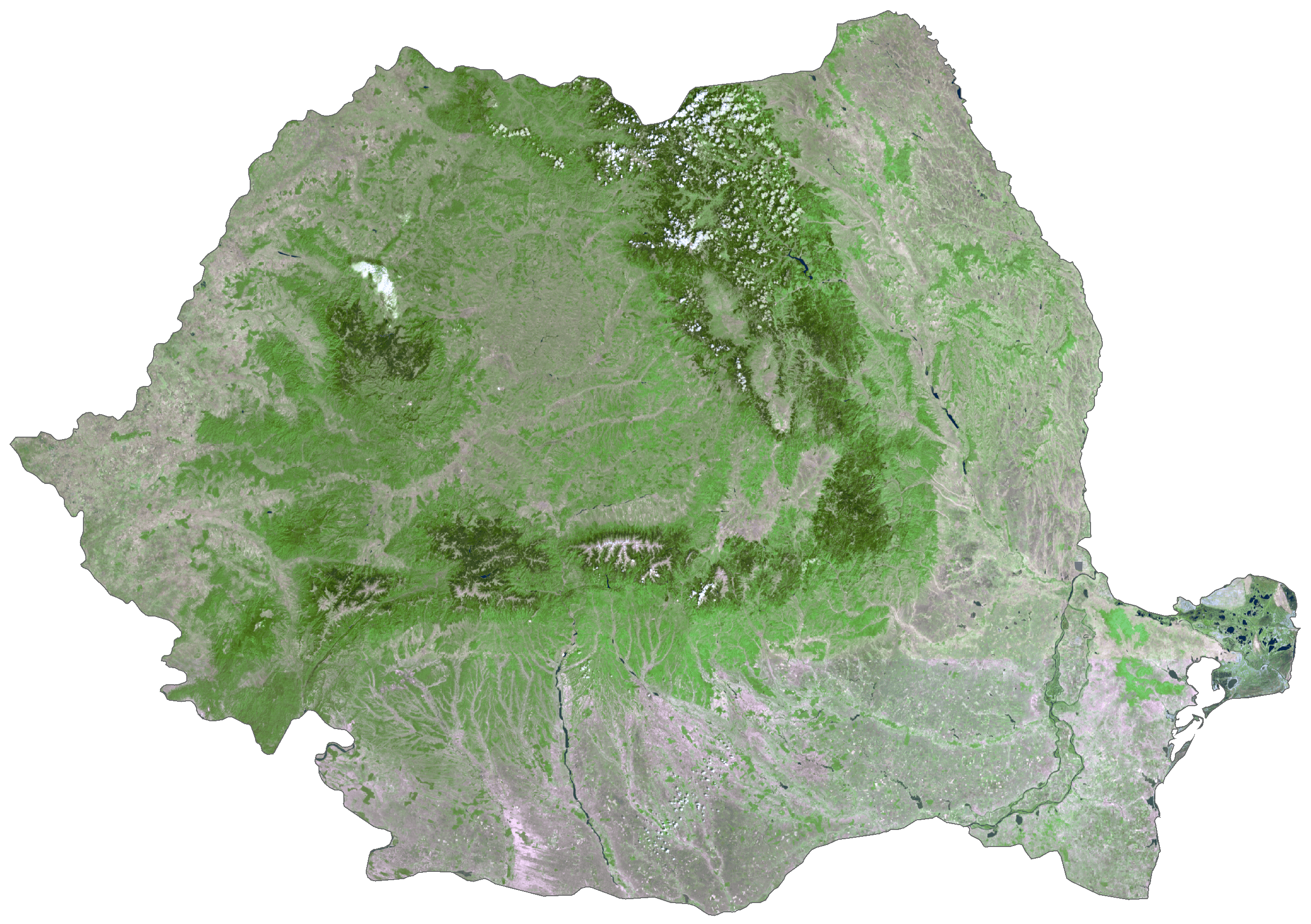
Romania Satellite Map
Elevation Map